
TRIP REPORT - Keith's Hut - 1/20 through 1/22
We had three days off and the avalanche danger kept stacking up in Washington. Marc and I had been planning on heading up to the North Cascades, but the hut we wanted to use required skinning up an avalanche chute, which seemed like a bad idea with the forecast. We spent a few days frantically researching alternatives before calling our friend Katrina, who sorted us out. New objective: Keith's Hut in BC. She even gave us a guidebook.
Keith's hut has it all - big objectives (Vantage Peak, Joffre Peak and Matier Mountain) for good conditions, and solid low-angle tree skiing (lower Vantage trees, Joffre Arm, east bowl of Chief Pascal) for bad. If you're planning a trip up here, I included a .kmz file at the end with our tracks and beta.
Depending on the source, there's room in the hut for 10 to 20 people. We were worried there wouldn't be room, so we woke up at midnight and left at 2 am from Seattle. 6 hours (and one Tim Horton's breakfast stop in Squamish) later, we were at the trailhead, watching the sun come up.
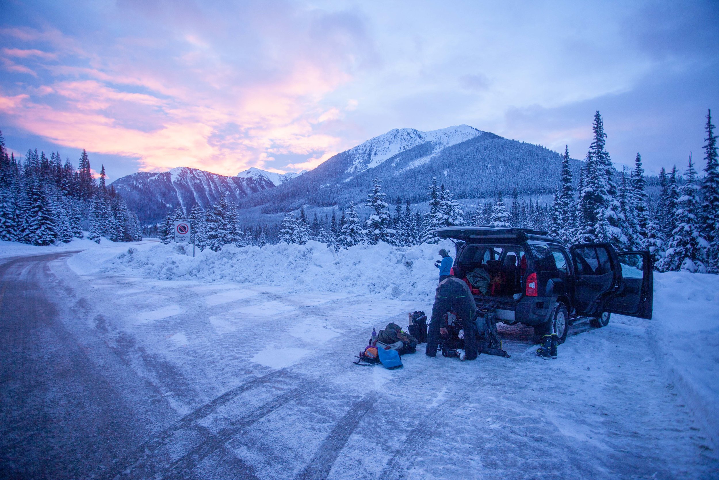
We brought tents in case there wasn't room in the hut, but decided not to bring them when we only saw a few cars parked at the trailhead.
Marc wishing he'd gotten less sleep
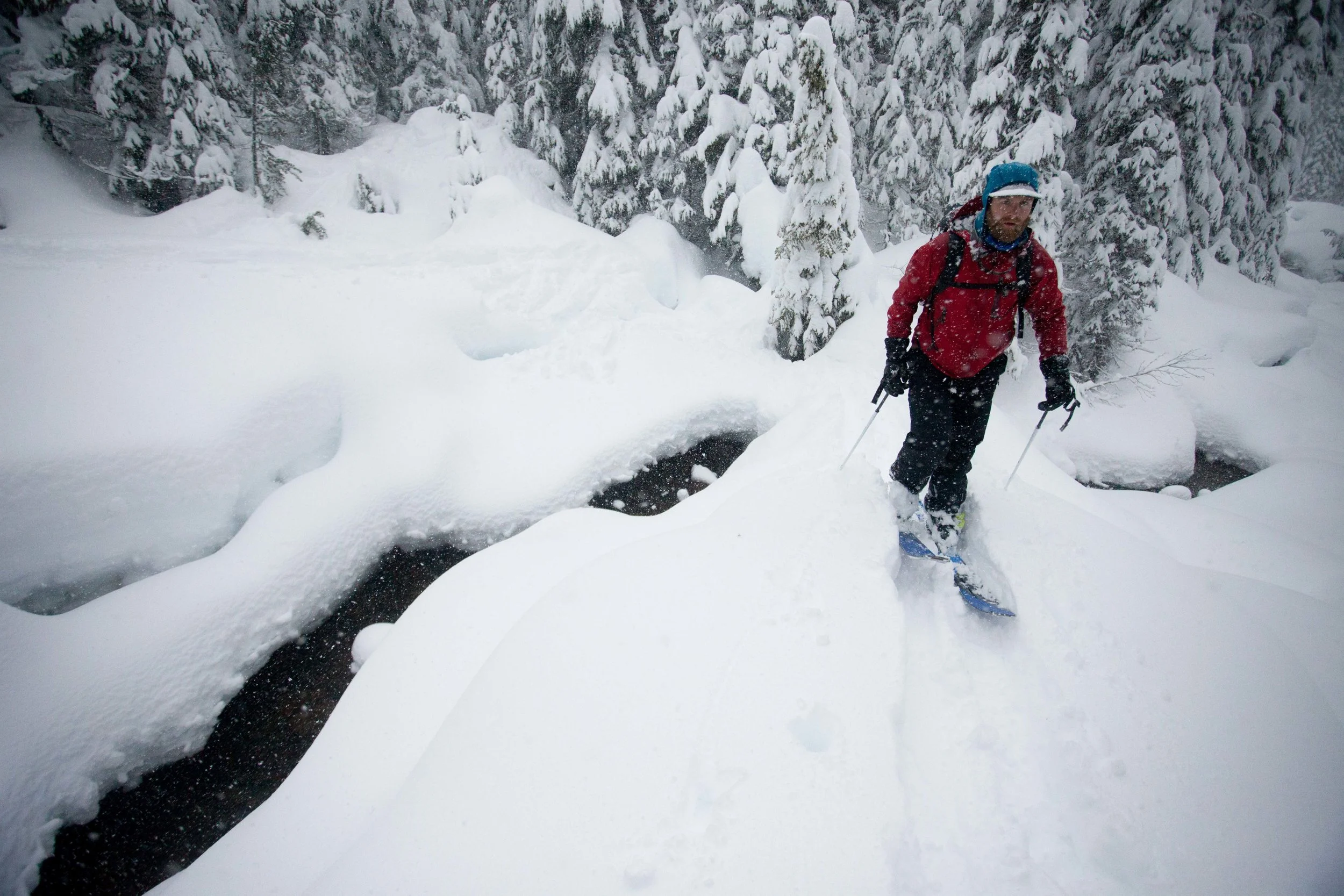
The skin up to the hut starts with a spicy creek crossing across a log. It's not as bad as it looks...
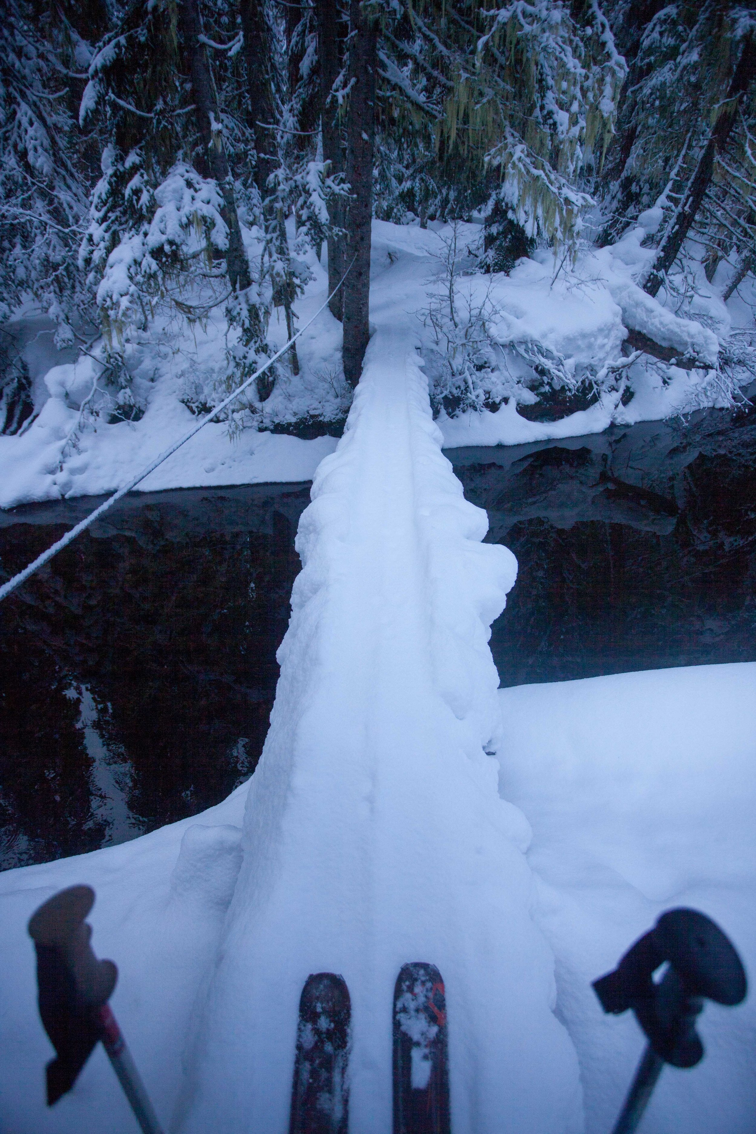
Once we were across the log, it was only 3.5 miles up to the hut. The track changes depending on avy and snow conditions, but it's well-traveled enough to be pretty obvious. If it's totally gone, break your own trail - I've included our gpx track below. It's a casual skin up, and ends up being pretty safe in high avalanche danger. A few miles in, you'll cross the bottom of huge slide path off Vantage Ridge but it wasn't fully filled in when we passed through.
Overview from above the trailhead, looking south
Near the top of the valley (once we saw the terminal and lateral moraines) we swung right and contoured along the terminal moraine, gained the ridge, and reached the hut.
There were 11 sleeping bags upstairs when we arrived, and it was pretty close quarters after we'd added our 3. After lunch and a taste of whiskey, we headed out to ski Joffre Arm, which stretches north from Joffre Peak. It's a quick 20 minute skin to a knob on Joffre Arm, from which there are a lot of options.
View from above the hut, looking NE
You can either head back down to the hut (which is 300 vertical feet through low-angle trees) or drop off the backside (~1,200 ft of skiing) which offers open skiing for good avy conditions and nicely spaced trees when it's dangerous. We skied two laps off the hut-side and then headed back to the hut.

Marc on top of Joffre Arm
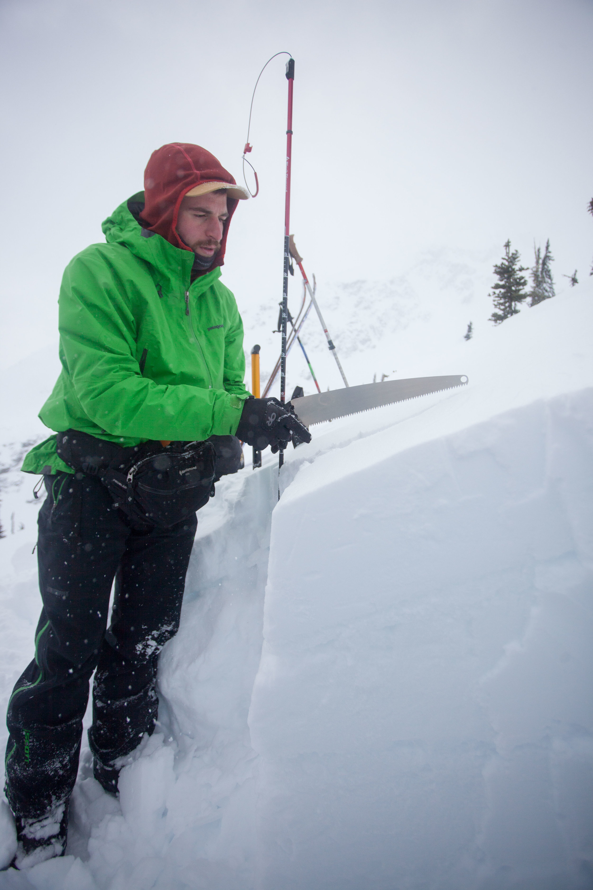
Toby cutting a column test - if you look closely you can see the two rain/warm weather crusts, with over a foot of storm slab on top...
Toby shredding down the low angle trees off Joffre Arm (hut-side)
Depending on who's in the hut, things can get pretty rowdy. I definitely drank more than I'd expected to, but it was a Saturday night, so...

The aftermath (midway through the cleanup, and without most of the empties)...
It'd been dumping all night and we woke to however many inches of new snow (at least a foot, and it showed no signs of stopping). Everyone headed their separate ways, with most people skiing different parts of Joffre Arm (though lower Vantage Peak apparently offered some good options). Toby, Marc, and I decided to head off the backside of Joffre Arm and tried to stick to the trees. Almost immediately, we remote-triggered a small avalanche on a slightly open slope, so we chose even tighter trees for the rest of the run (which kept things interesting with the tree wells). Once at the bottom of the run, we had some trouble getting back to the hut skin track, as Cerise Creek is just wide enough to make crossing difficult. After following some stray skin tracks (one of which turned out to have been the faster way back up to the hut - marked in the gpx) we found a snow bridge.
Crossing Cerise Creek could get pretty frustrating
We got back on the hut skin track and the wind and snow had almost entirely obscured our tracks from the day before.

You can just see Toby through the blowing snow

Marc gesturing at something
Once back at the hut, we ate a quick lunch before heading up for two more conservative laps off the hut-side of Joffre Arm. The snow was piling up, and another snowpit showed that things were looking pretty delicate.
Digging a late afternoon snowpit
Let's keep it low-angle for the rest of the day...
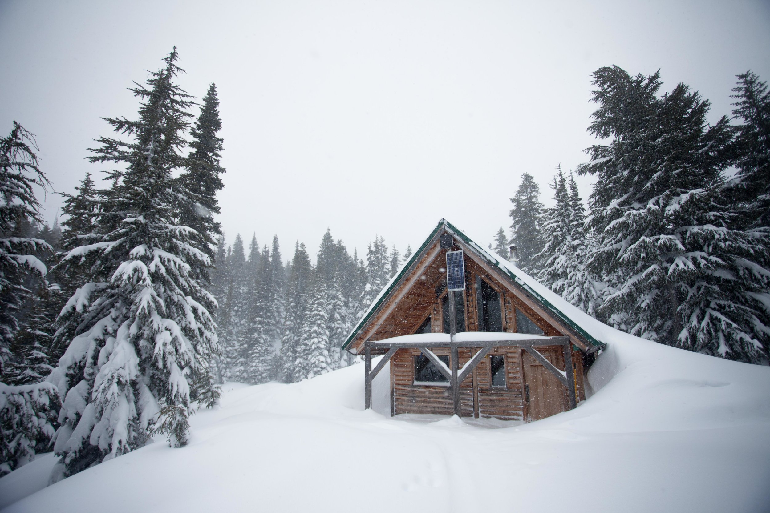
Everyone else left, so the three of us settled into the cabin for a night of sobriety and casual cards. The next day, we woke up to even more snow.

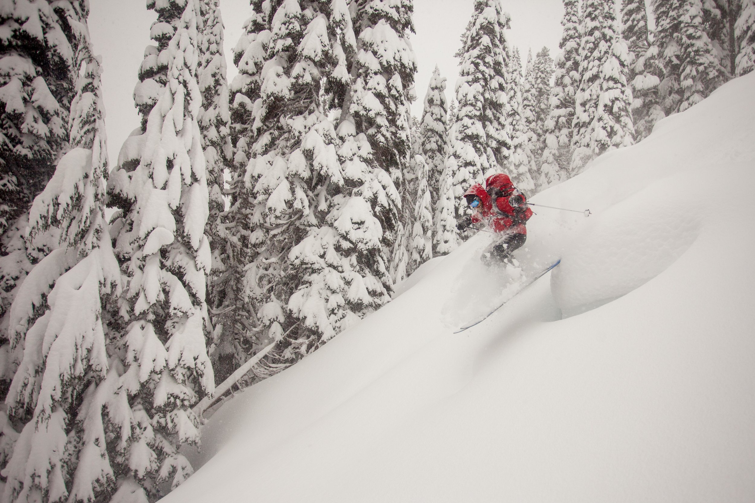
We packed up and again headed off the backside of Joffre Arm, this time starting lower to avoid where we'd had the slide (the day before). The lower trees were perfectly spaced, and we found our best turns of the trip there.


Once we were down, we headed towards the east side of Chief Pascal, where there was supposed to be some more tree skiing (it's also on the way out). We pretty quickly found ourselves traversing some pretty unpleasant slopes. Don't try to skin up the south eastern part of the ridge.

Marc does not like my skintrack (which to be fair involved some balancing on logs)
After we found the proper way to skin up, we battled through feet of powder through old growth forest (and Toby's skins failed).

Skin failure isn't a big deal when you've got 10 ski straps
NW View of low angle Chief Pascal skiing
But once we finally gained some elevation, we found some pretty sweet lines - still in the trees and low angle enough to feel good about.

By the time we finally got back to the car, we had just enough energy to dig the car out before heading home.

Toby is way too excited to be shoveling
All in all, it was a perfect trip, though we're already planning to head back when there's clearer skies and safer avalanche conditions.