
TRIP REPORT - Hex Mountain - 1/29/18
It's always worth it to get out, even if the forecast looks gross
"The Bottom Line: Travel in avalanche terrain is not recommended as very large and destructive avalanches are expected. Rain falling on previously dry snow will lead to dangerous conditions on Monday. Identify and avoid traveling through areas with avalanche paths overhead." - NWAC, the night before
With NWAC forecasting high avalanche danger for all of Washington, heavy rainfall predicted for the entire state, and generally sloppy conditions expected, Becky and I did our now-familiar Sunday night scramble: "Where exactly are we going?"
We wanted to avoid the rain (as much as possible), avoid avalanche terrain, and stand on top of something (if at all possible). Hex Mountain looked perfect (and it was).
Hex Mountain
Trail stats - 8.2 miles and 2775' of elevation
- great option for a first snowshoeing peak or in high avalanche danger
The yellow, red, and purple shading show the slope angle (and specifically avalanche terrain). GPX available at the bottom of the report
We drove through the Seattle morning traffic, crossed Snoqualmie Pass through low-hanging clouds and dropped down to Cle Elum lake and the trailhead (which is across the road from the fire station and unmarked).
Getting geared up at the road
We walked alongside the road for a few hundred feet before coming to the turnoff and putting our snowshoes on. The snow was so wet and heavy (and the trail was relatively well packed) that we didn't necessarily need them, but they definitely helped with traction and we were happy to have them on the whole time.
We began in the fog and clouds, but slowly the sun began to shine through, and we had a few hours of unexpected sunshine and views, even as we could see the storm hanging over the Cascade Crest.
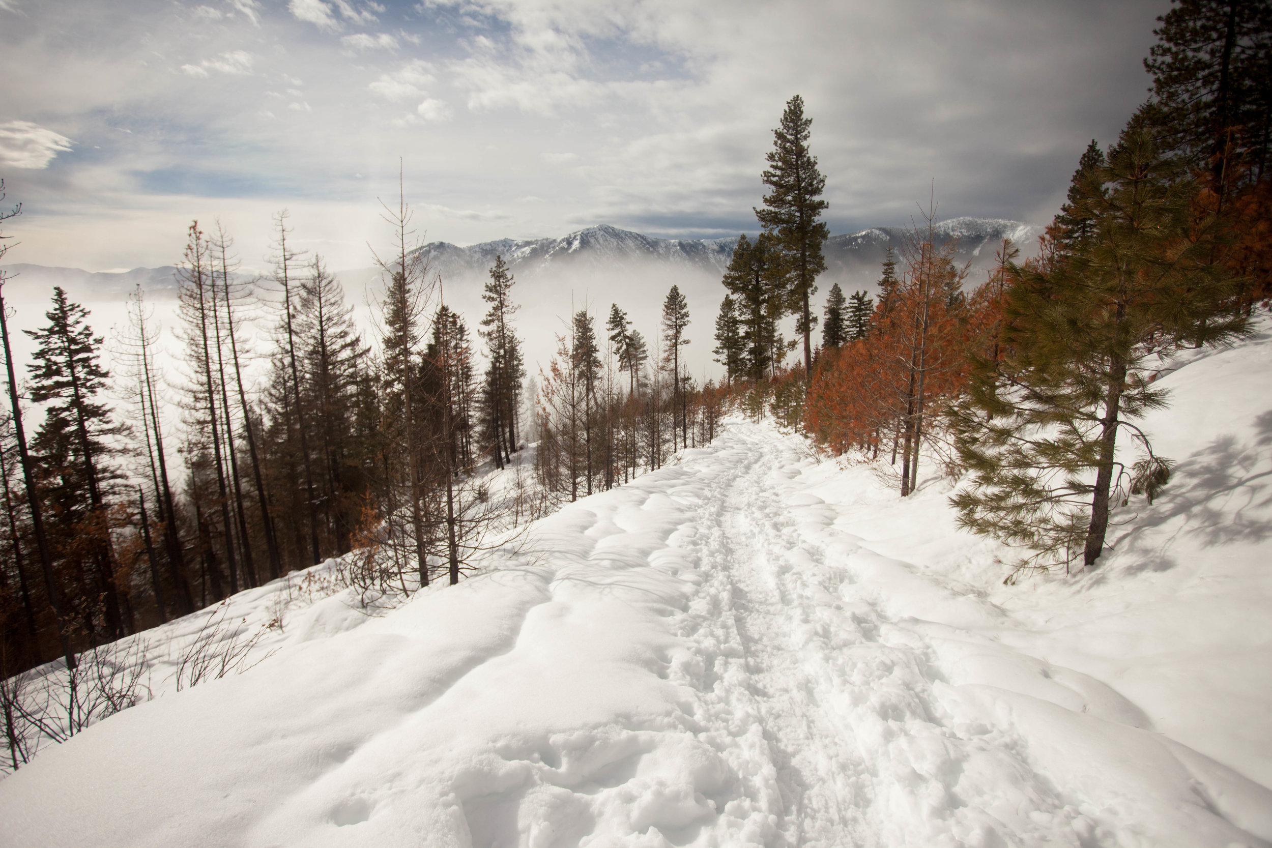
The joys of being east of the crest (look at that dark cloud on the right)
Much of the trail goes through a burn zone, which was eerie in the quiet as the ash stained the snow beneath our snowshoes.
Burnt trees tower over the final slope to the summit
After winding our way along forest service roads (which were totally snowed over), we followed the corniced ridge to the summit, where we could just see Stuart and the Enchantments peeking through the clouds. No views of Rainier, but we hadn't expected any views.
Stoked on the summit!
Just after leaving the summit, it began to rain. I dug a snowpit to check on the snowpack, and the rain gradually picked up.
Compression test!
The way down ended up being pretty uncomfortable, as the rain gradually turned into a deluge. The snow underfoot turned into sloppy concrete, and we tripped and slipped our way back down.
Smiling through the pouring rain
On our way back down the ridge, we passed a slide, where it looked like the cornice had fallen and triggered a wet slab. We were happy not to be on any avy terrain.
Wet slide
We got back to the car soaking wet and huddled in the car before driving home slowly back through the storm. It was a great day out, and the few hours of sun and views were an unexpected bonus!
GPX track + waypoints