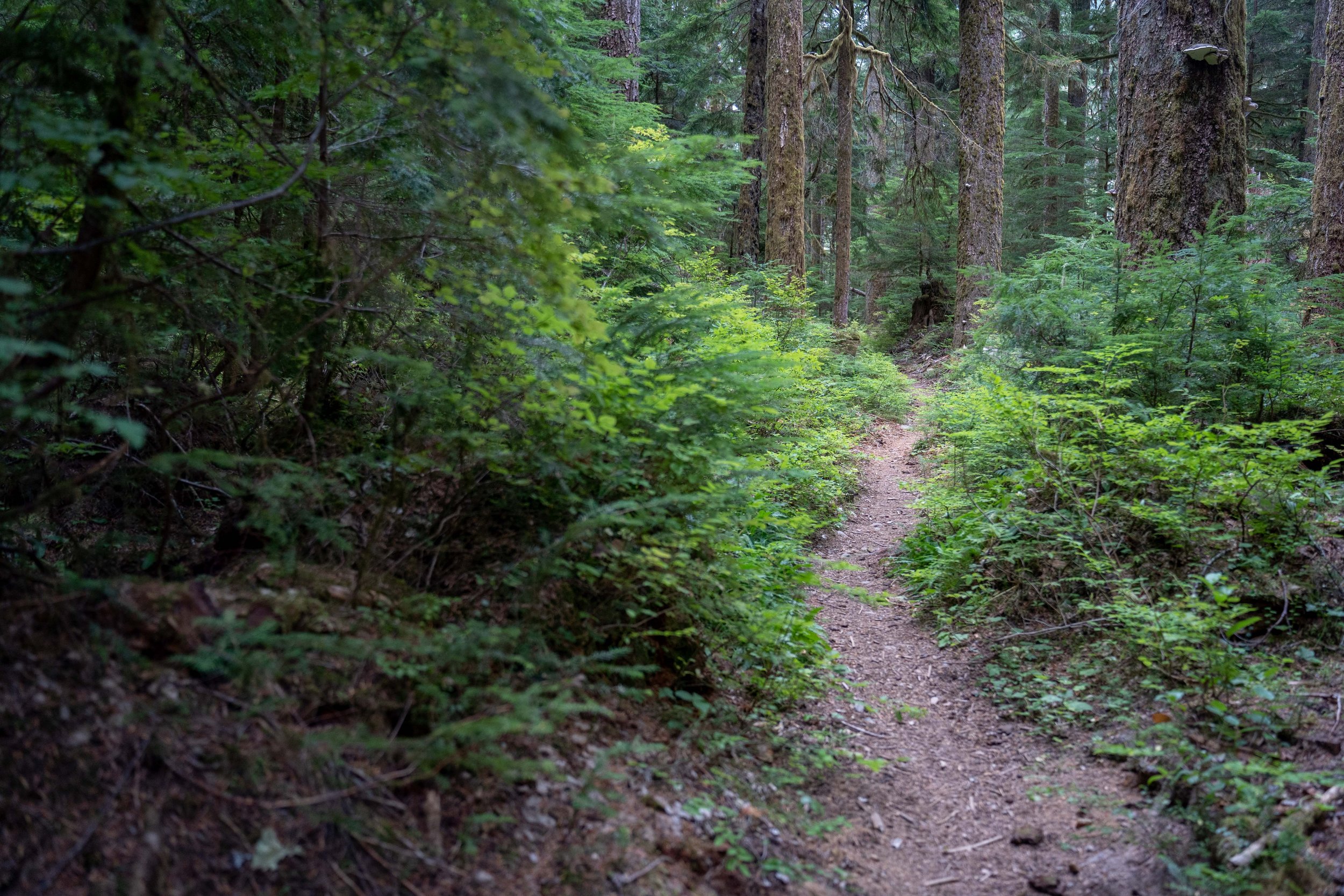
Trip Log
Index
-
2024
- Jan 2, 2024 The Lessons of 2023: On Goals, Bucketlist Lines, Failures and Overuse Injuries Jan 2, 2024
-
2023
- Oct 31, 2023 Trip Report - Guiding in Olympic National Park in WA - 9/5/23 - 9/22/23 Oct 31, 2023
- Jul 14, 2023 Trip Report - Guiding in Gates of the Arctic National Park in AK - 6/29/23 - 7/9/23 Jul 14, 2023
-
2022
- Oct 6, 2022 Trip Report - Granite Peak, MT - 8/26-28/22 Oct 6, 2022
- Aug 2, 2022 Trip Report - Guiding 6 days on the Southern Yosemite High Route with Andrew Skurka Adventures Aug 2, 2022
- Jul 6, 2022 Trip Report - Complete Exum Ridge on Grand Teton - 7/2-4/22 Jul 6, 2022
- Jul 1, 2022 Trip Report - El Capitan of the Bitterroot - 6/30/22 Jul 1, 2022
- Jun 26, 2022 Trip Report - North Ridge of Canyon Peak (MT) - 6/26/22 Jun 26, 2022
-
2021
- Jun 30, 2021 Trip Report - Royal Basin Ski Trip - 5/29/21 - 6/1/21 Jun 30, 2021
- Jan 28, 2021 Reflecting on my 2020 Elevation Goals Jan 28, 2021
-
2020
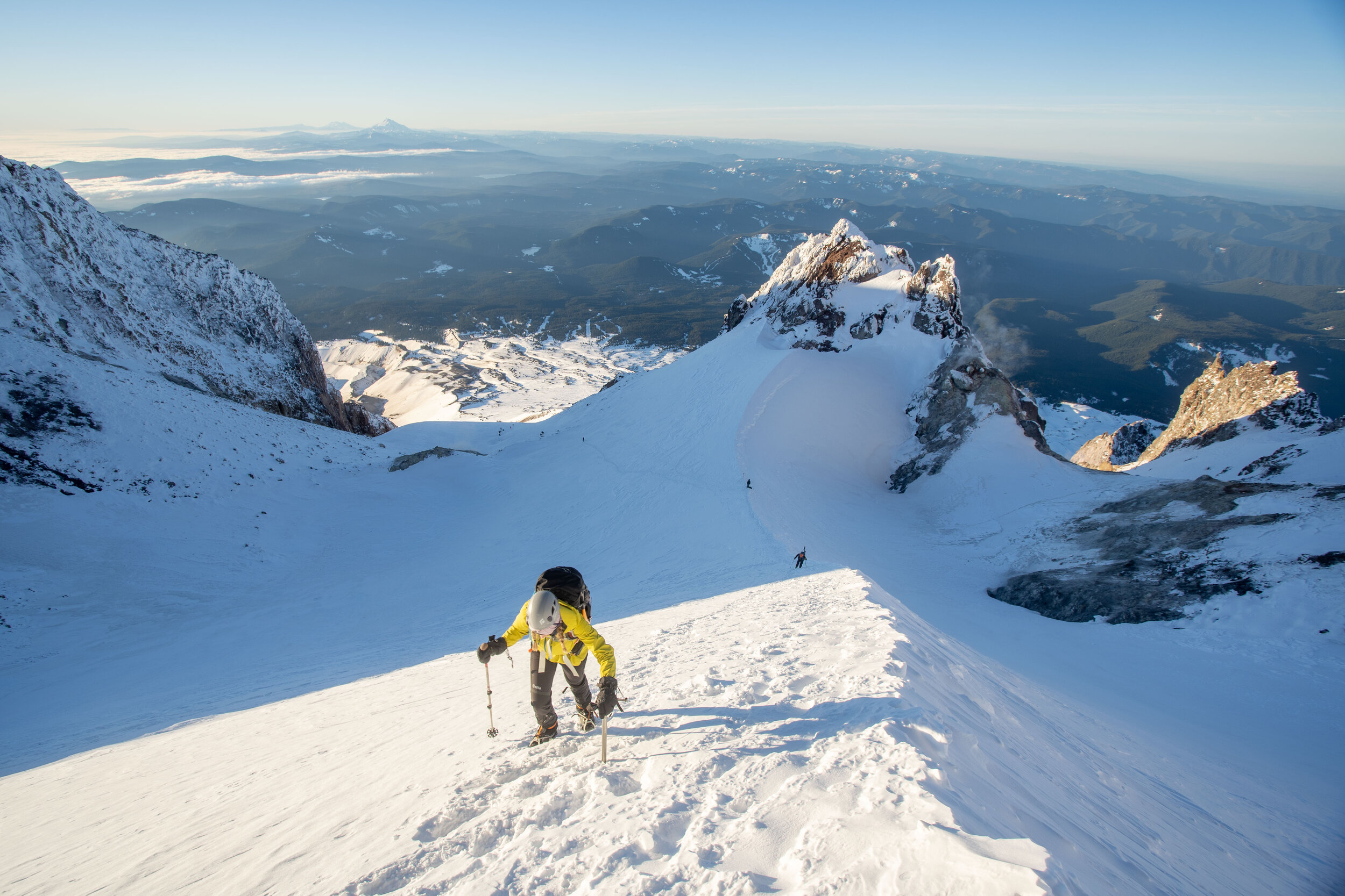
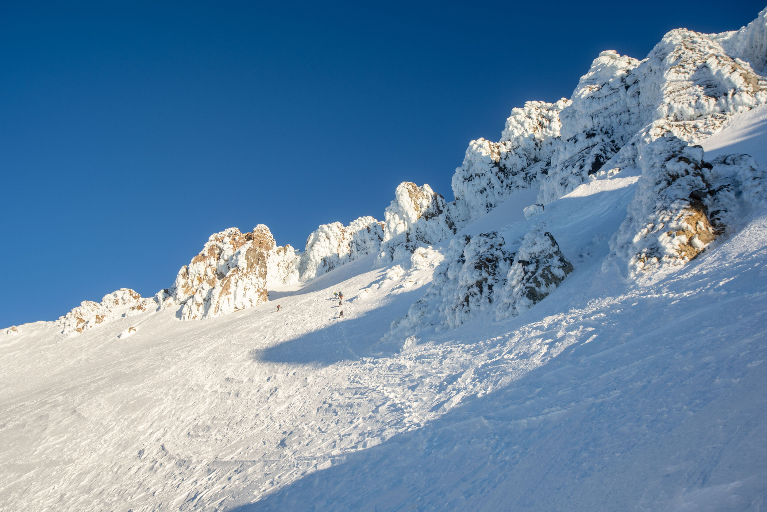
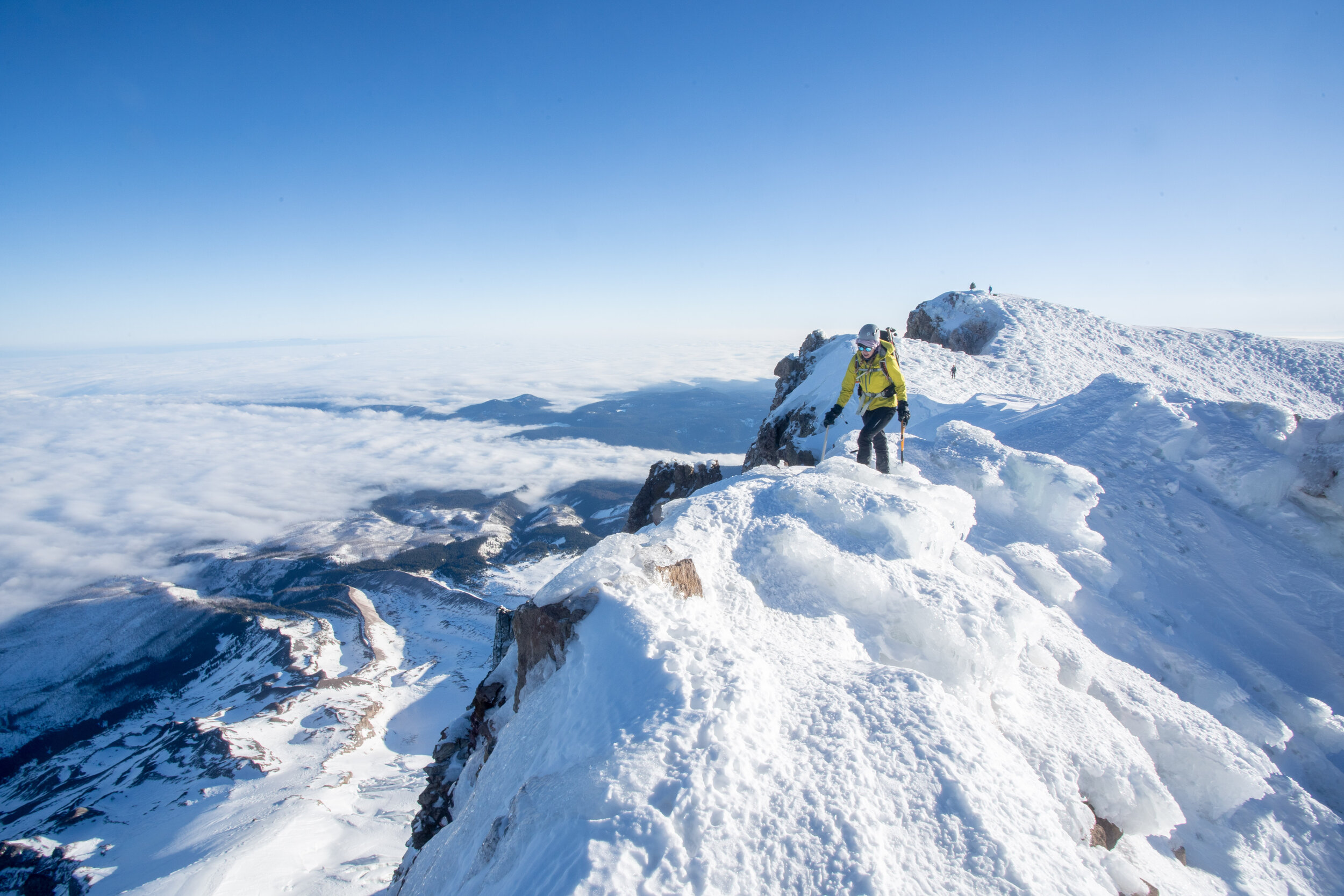
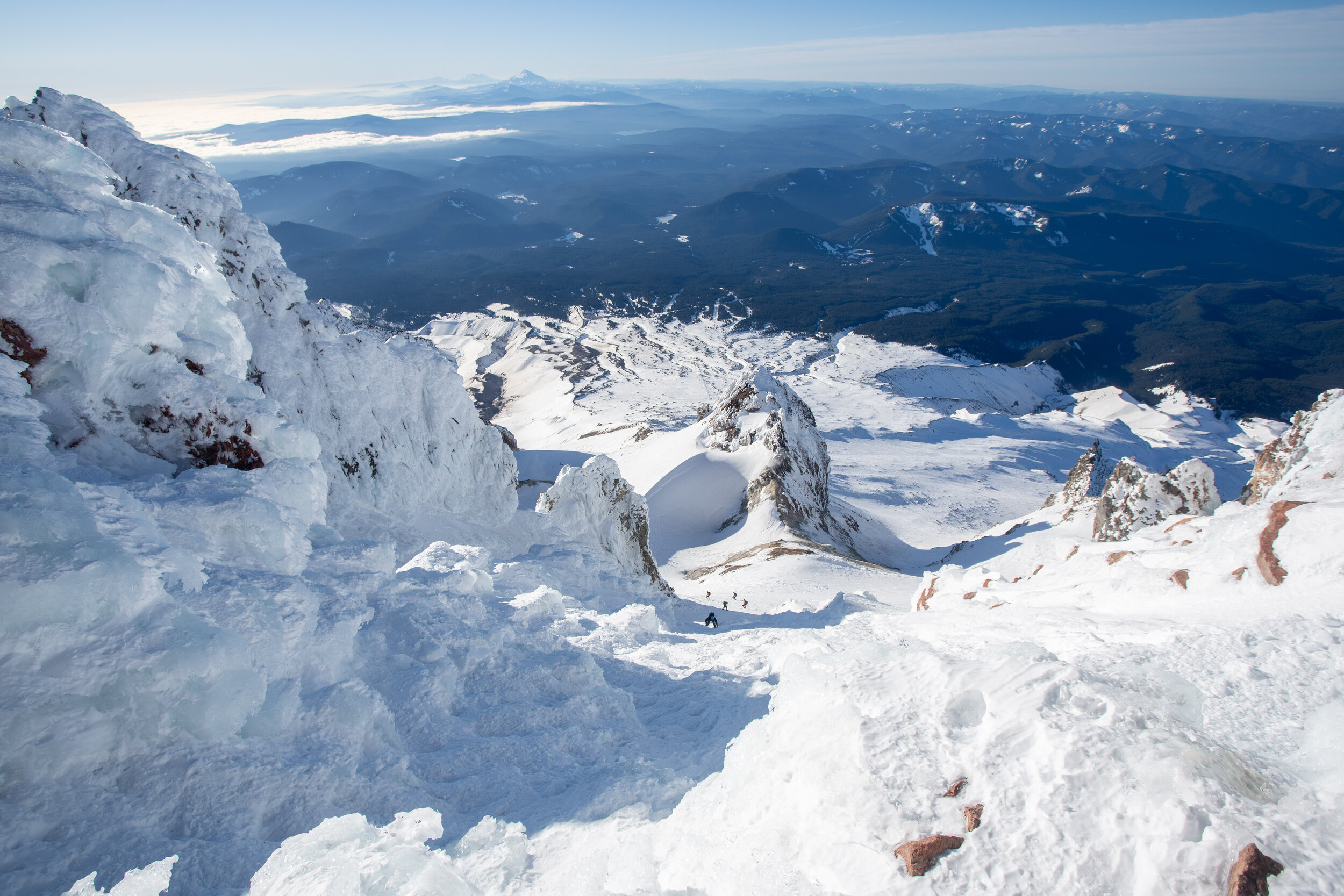
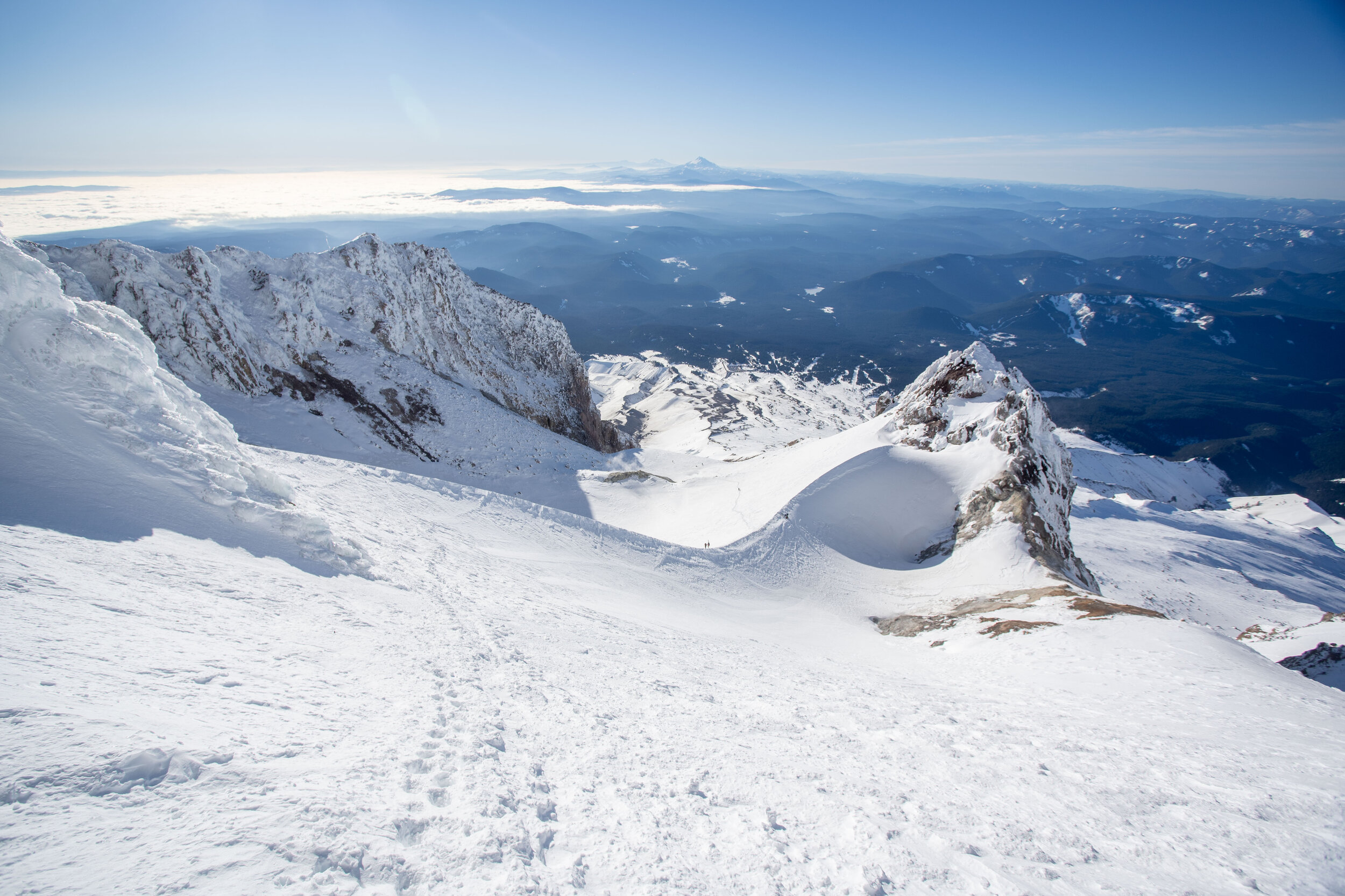
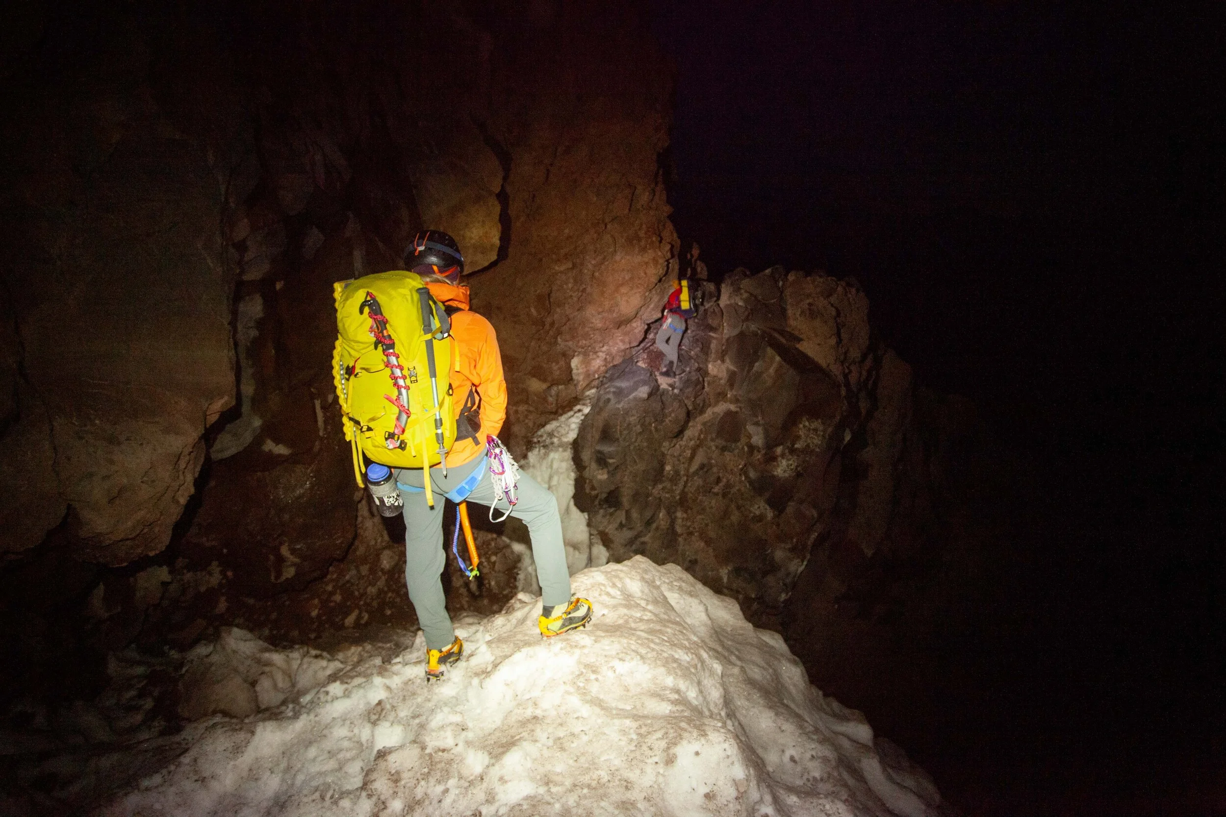
- Dec 6, 2020 Trip Report - Mt Hood via Old Chute - 12/5/20 Dec 6, 2020
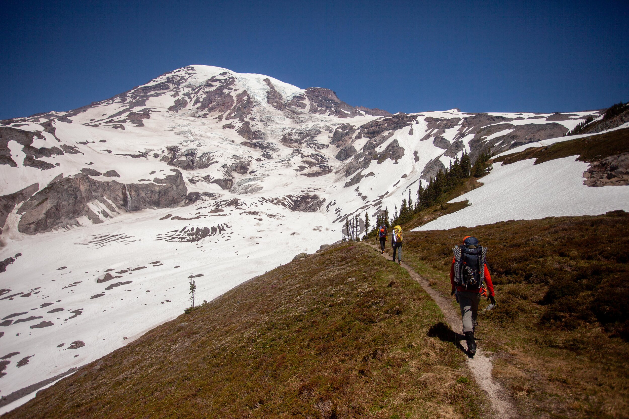
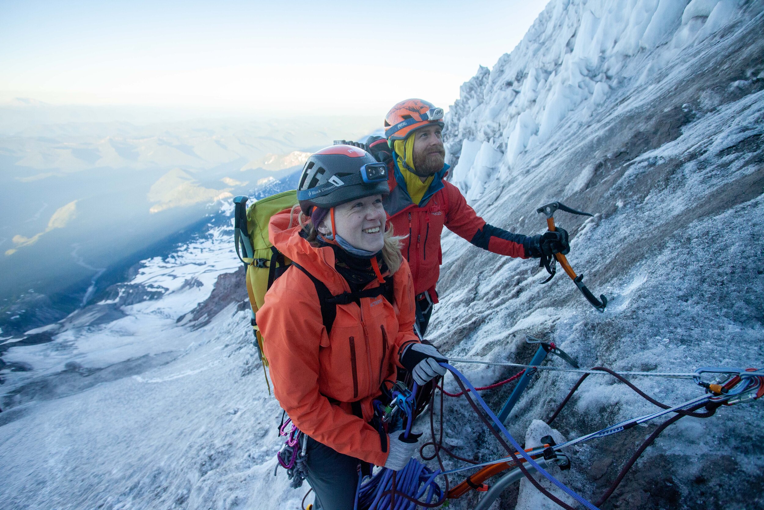
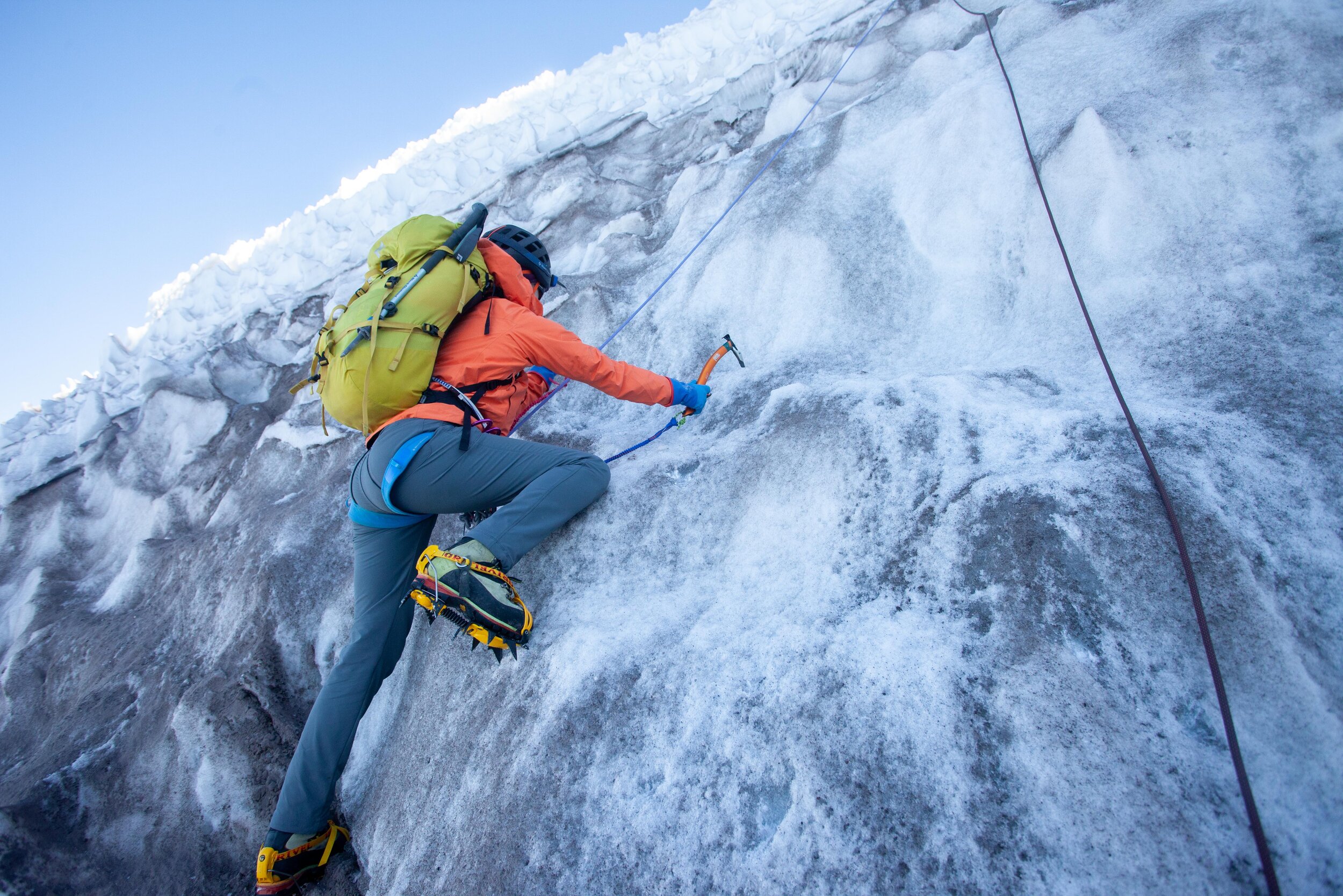
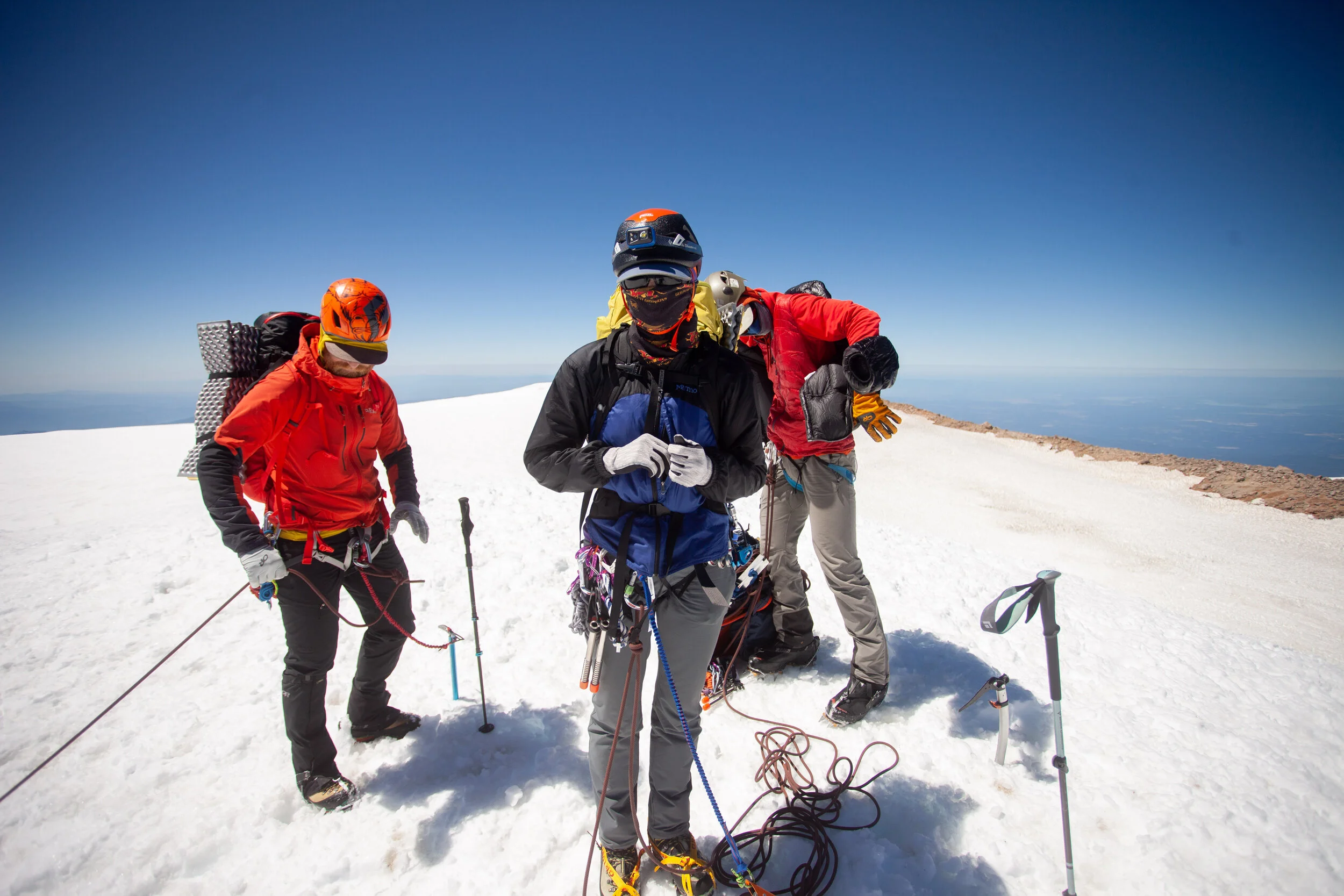
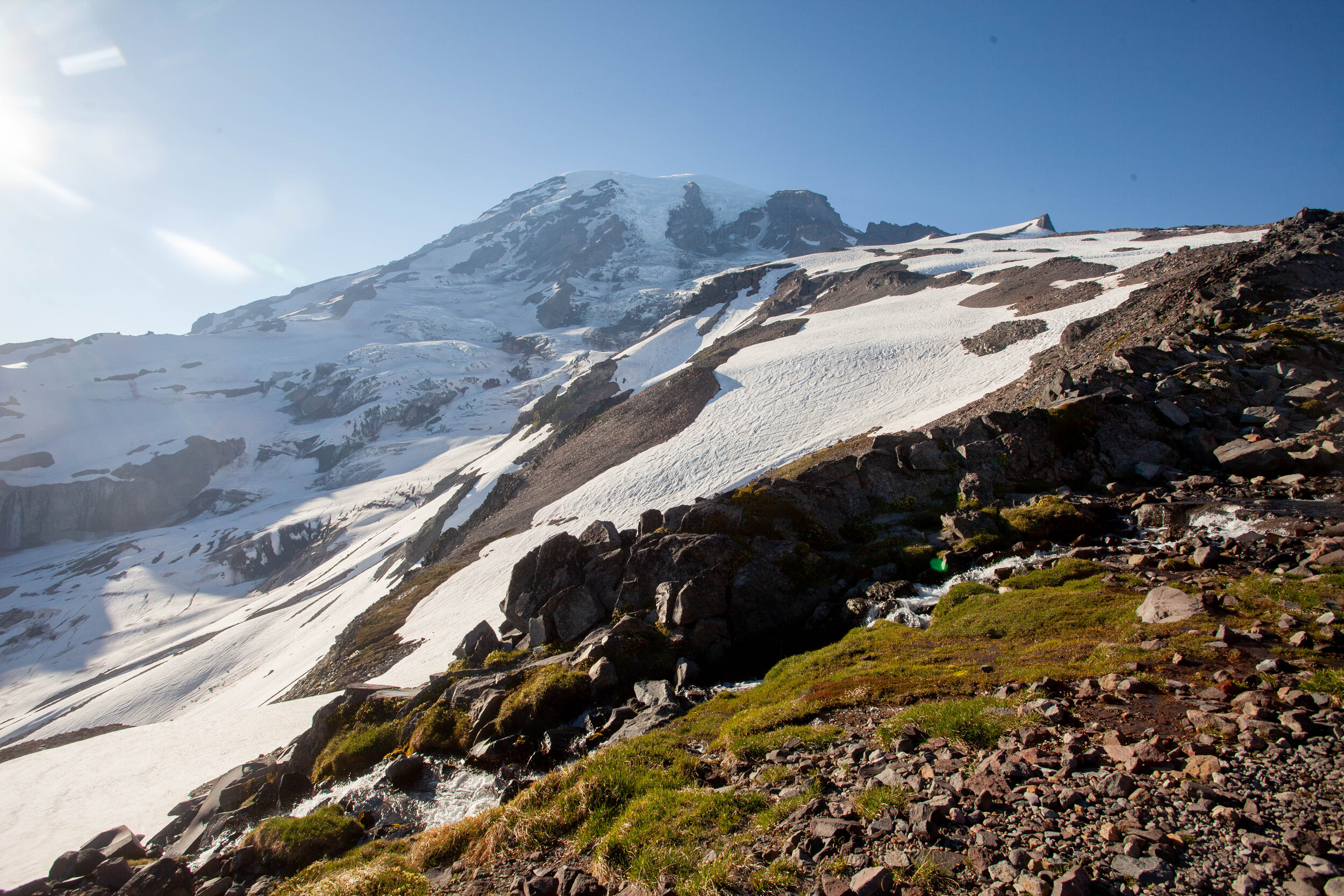
- Aug 3, 2020 Trip Report - Mount Rainier via Emmons - August 1st - 3rd 2020 Aug 3, 2020
- Jul 23, 2020 Trip Report - Mount Rainier Carryover - up the Kautz and down the DC - June 18th through 20th 2020 Jul 23, 2020
- Jul 6, 2020 Trip Report - Waptus Lake + Second Half of Alpine Lakes Crest Traverse (Hinman to Daniel) - July 3rd through 5th, 2020 Jul 6, 2020
- Jun 30, 2020 Trip Report - Ptarmigan Traverse - June 25th through 28th, 2020 Jun 30, 2020
-
2019
- Aug 14, 2019 Trip Report - 8/10-12/19 - Backpacking Tapto Lakes & Copper Ridge Aug 14, 2019
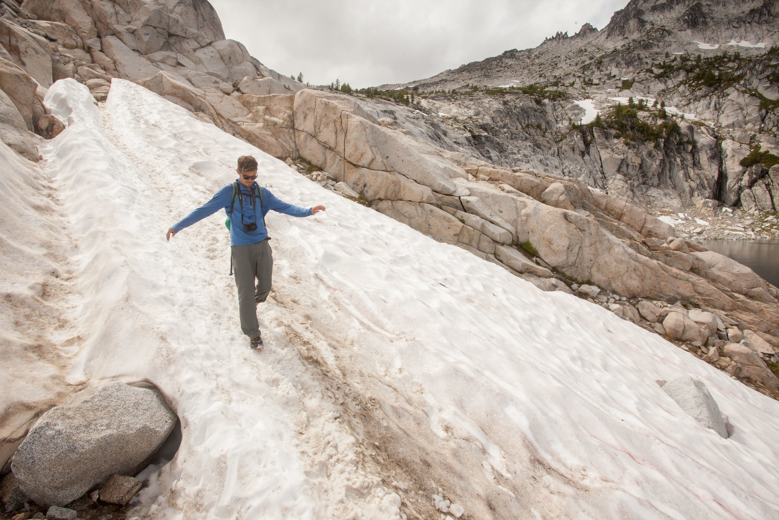
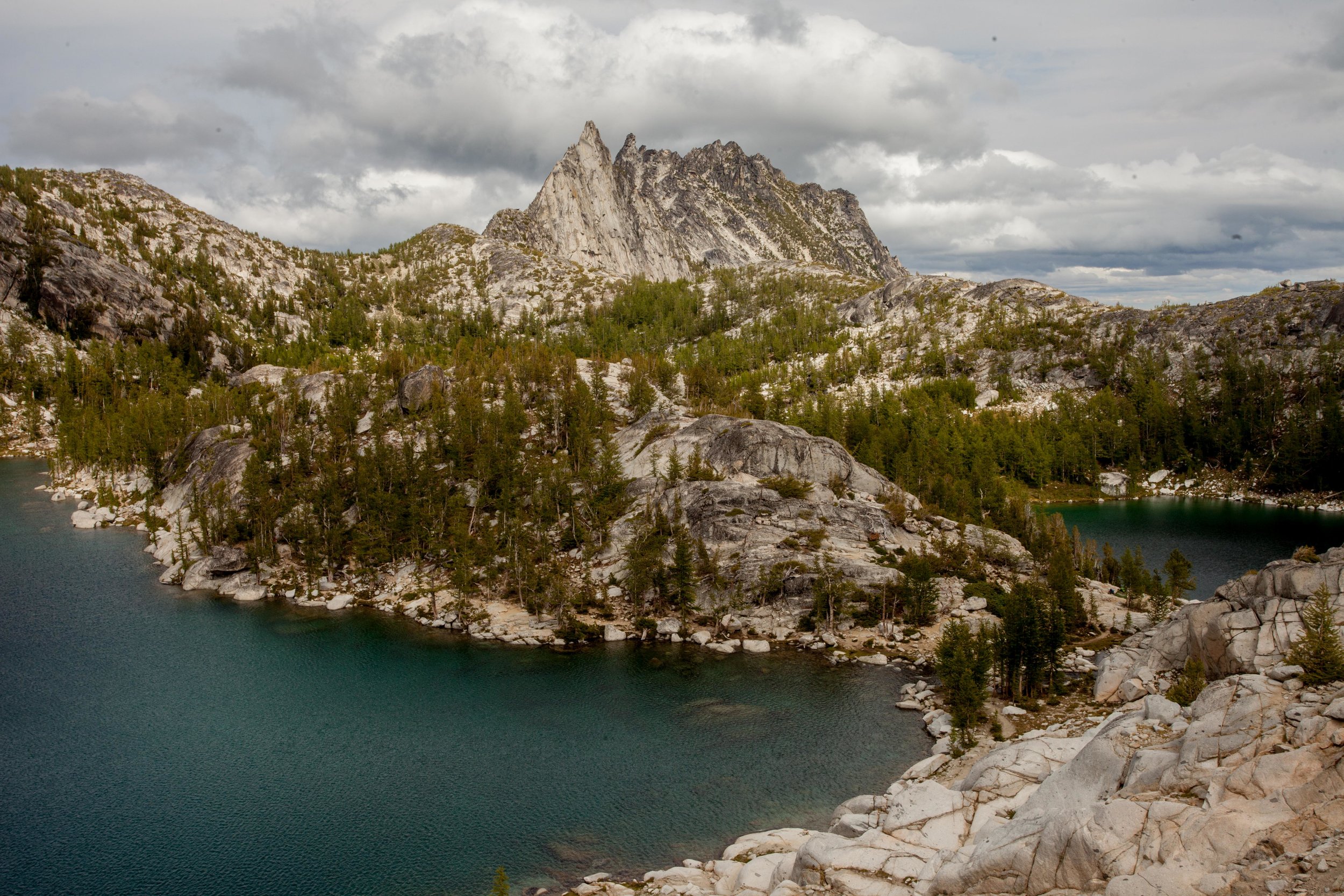
- Aug 5, 2019 Trip Report - Dragontail Peak via Colchuck Glacier + Pandora's Box, then through the Enchantments Aug 5, 2019
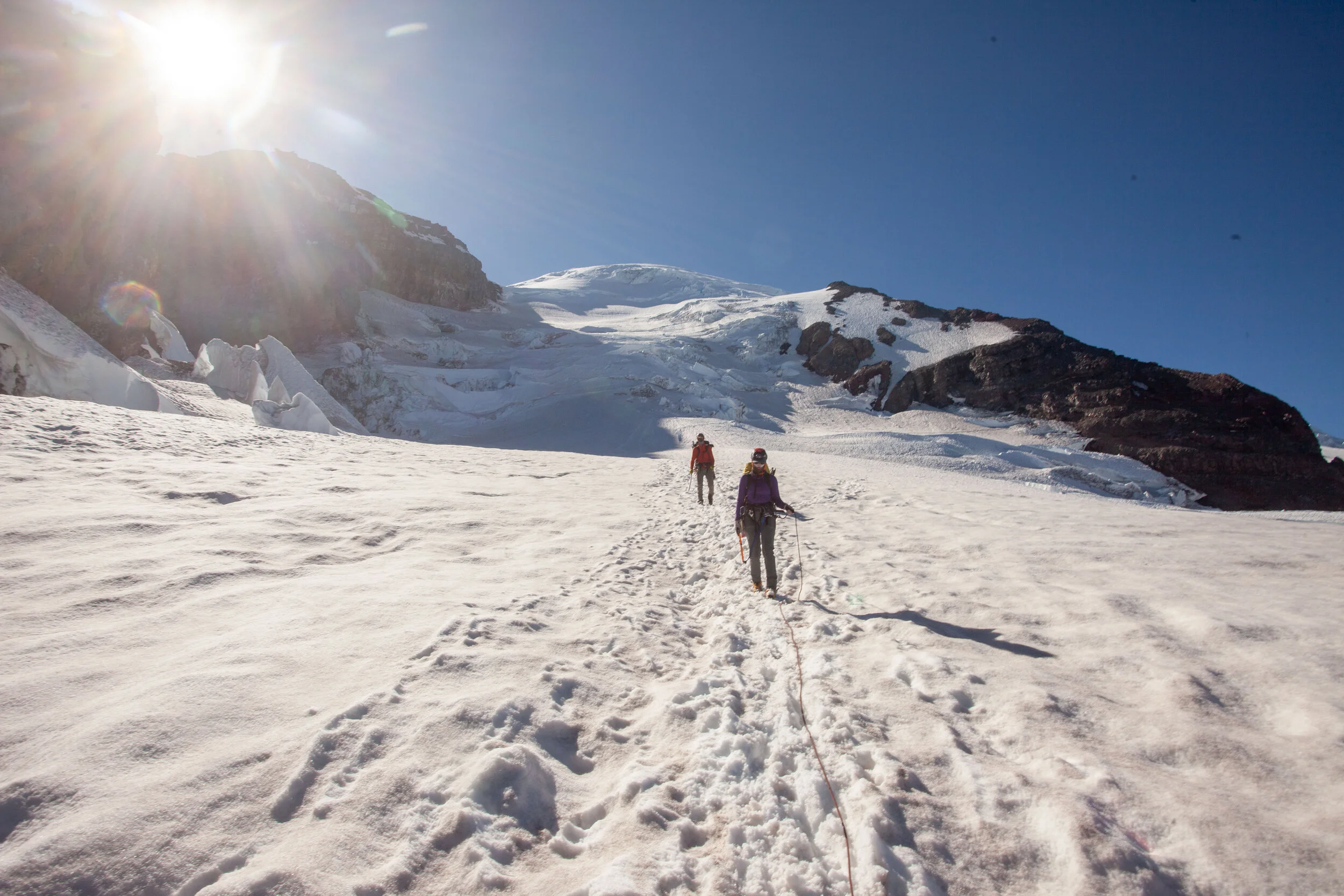
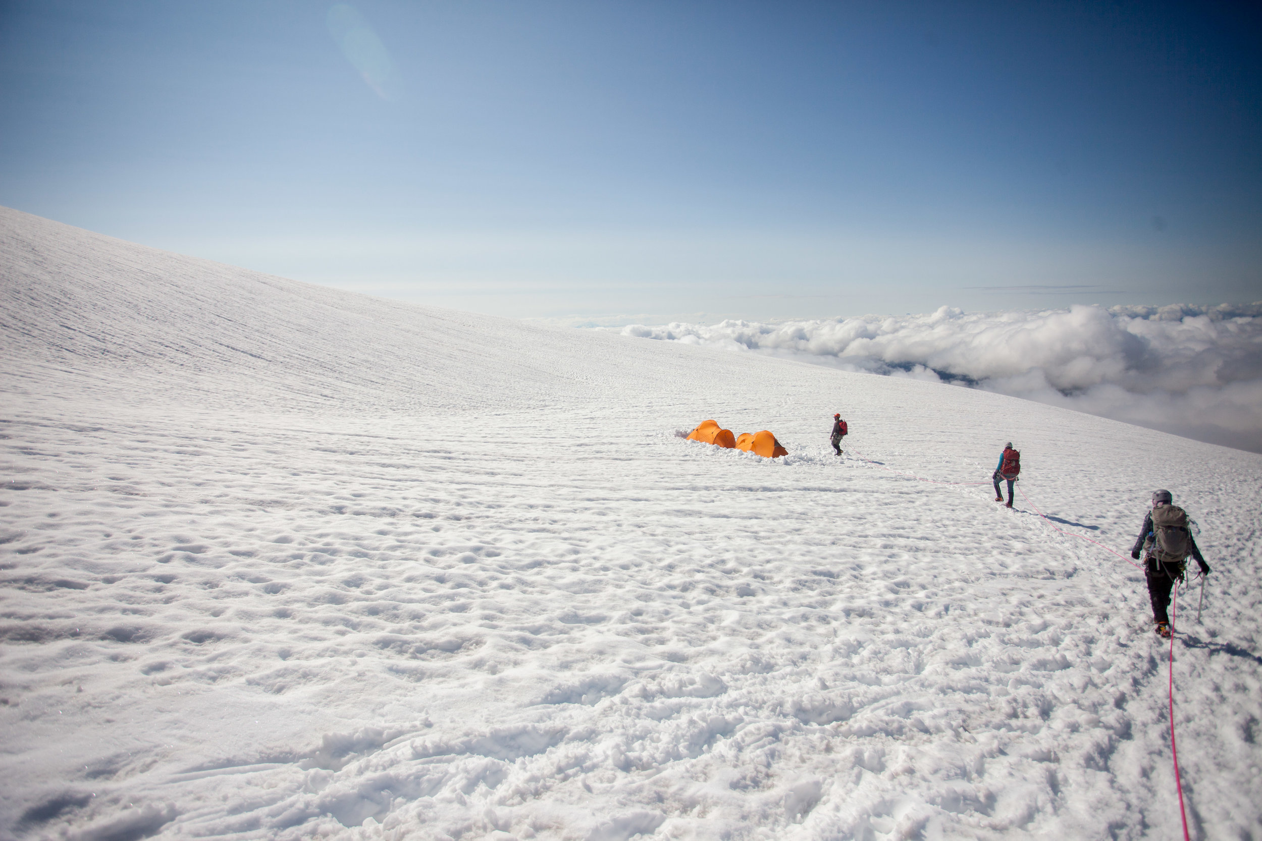
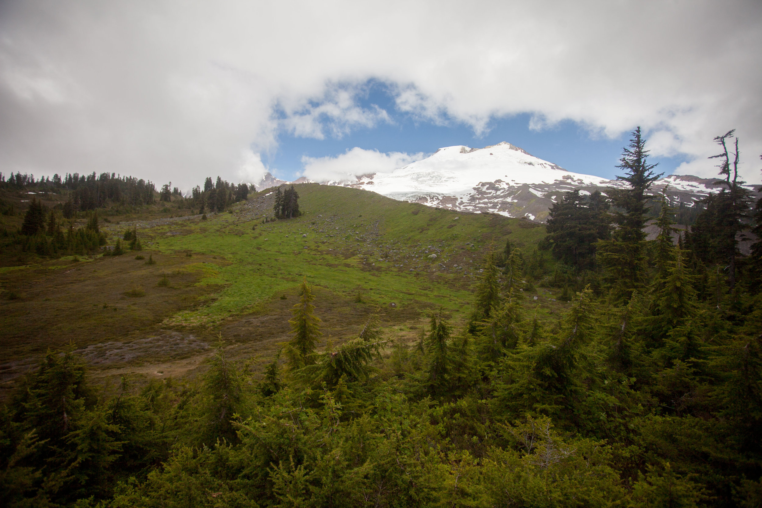
- Jul 13, 2019 Trip Report - Mt. Baker (Easton Route) - 7/7-8/19 Jul 13, 2019
- Jun 3, 2019 Trip Report - Trapper's Peak - 6/1/19 Jun 3, 2019
- May 6, 2019 Photo Essay - 27 Days Rafting the Grand Canyon - February + March 2019 May 6, 2019
-
2018
- Aug 28, 2018 TR - Twin Sisters Traverse - 8/27/18 Aug 28, 2018
- Mar 11, 2018 TRIP REPORT - Mount St. Helens - 3/11/18 Mar 11, 2018
- Mar 3, 2018 TRIP REPORT - Tye Peak Attempt - 3/3/18 Mar 3, 2018
- Feb 13, 2018 TRIP REPORT - West Granite Mountain (and attempted traverse) - 2/12/18 Feb 13, 2018
- Feb 2, 2018 TRIP REPORT - Hyak Mountain Dawn Patrol - 2/1/18 Feb 2, 2018
- Jan 31, 2018 TRIP REPORT - Hex Mountain - 1/29/18 Jan 31, 2018
- Jan 25, 2018 TRIP REPORT - Keith's Hut - 1/20 through 1/22 Jan 25, 2018
-
2017
- Dec 24, 2017 TRIP REPORT - Skiing Great Scott Bowl - Snoqualmie Pass Dec 24, 2017
- Dec 12, 2017 TRIP REPORT - Snowshoeing Camp Muir Dec 12, 2017
- Jul 24, 2017 TRIP REPORT - Pasayten Wilderness - 50 miles Jul 24, 2017
- Mar 16, 2017 Too Few Days in Red Rocks Mar 16, 2017
- Mar 5, 2017 The Warren G Hardings! Mar 5, 2017
- Mar 3, 2017 Settling Down? Mar 3, 2017
- Mar 1, 2017 Only a few days away from a stable life? Mar 1, 2017
- Feb 14, 2017 Life on the Road Feb 14, 2017
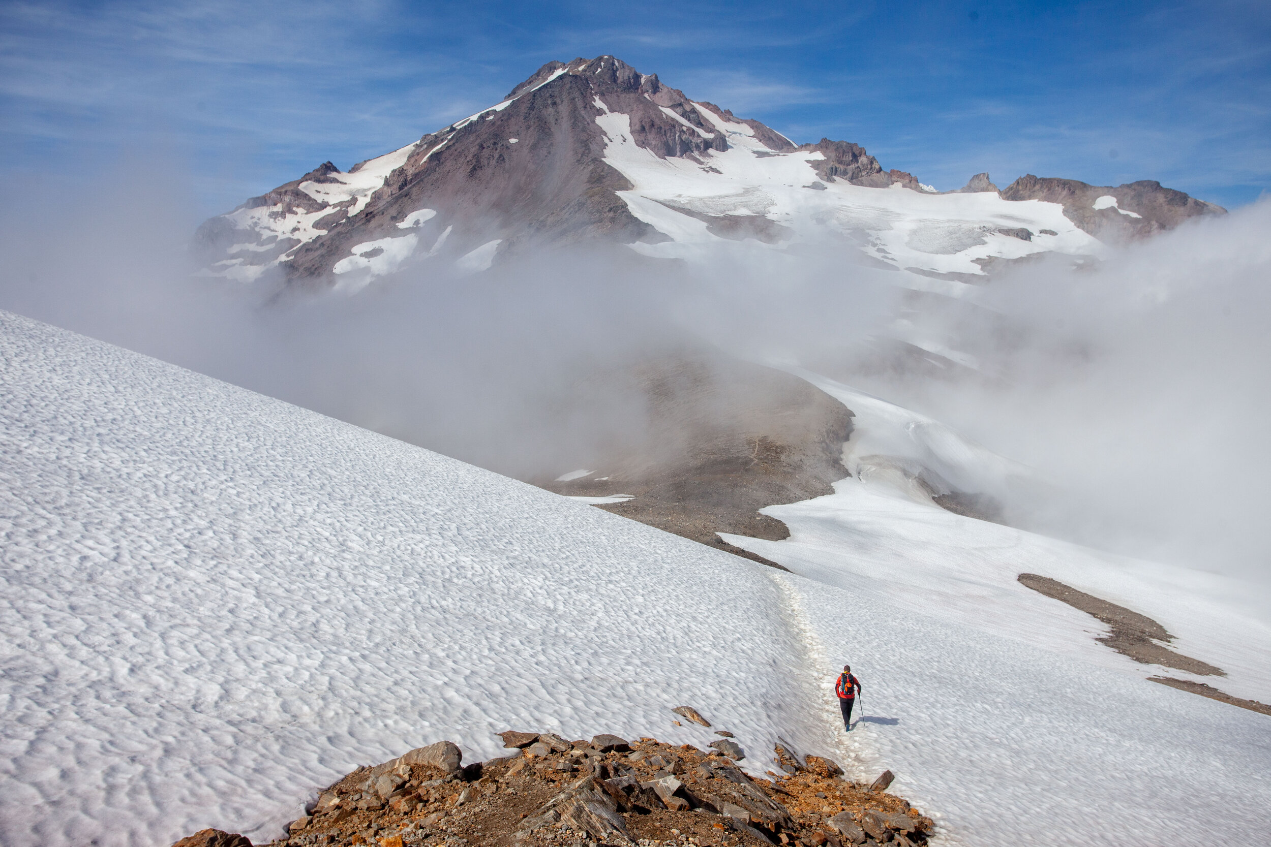
The Lessons of 2023: On Goals, Bucketlist Lines, Failures and Overuse Injuries

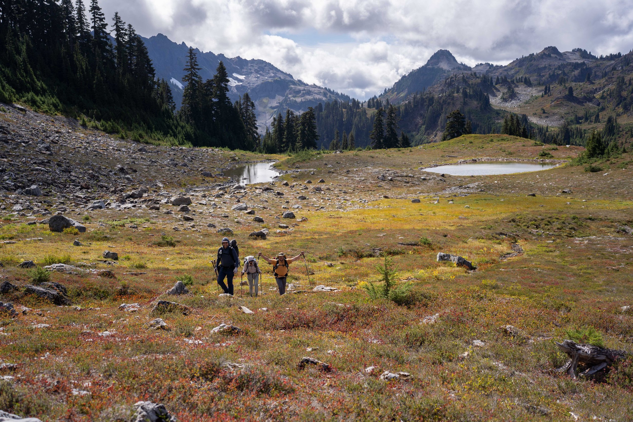
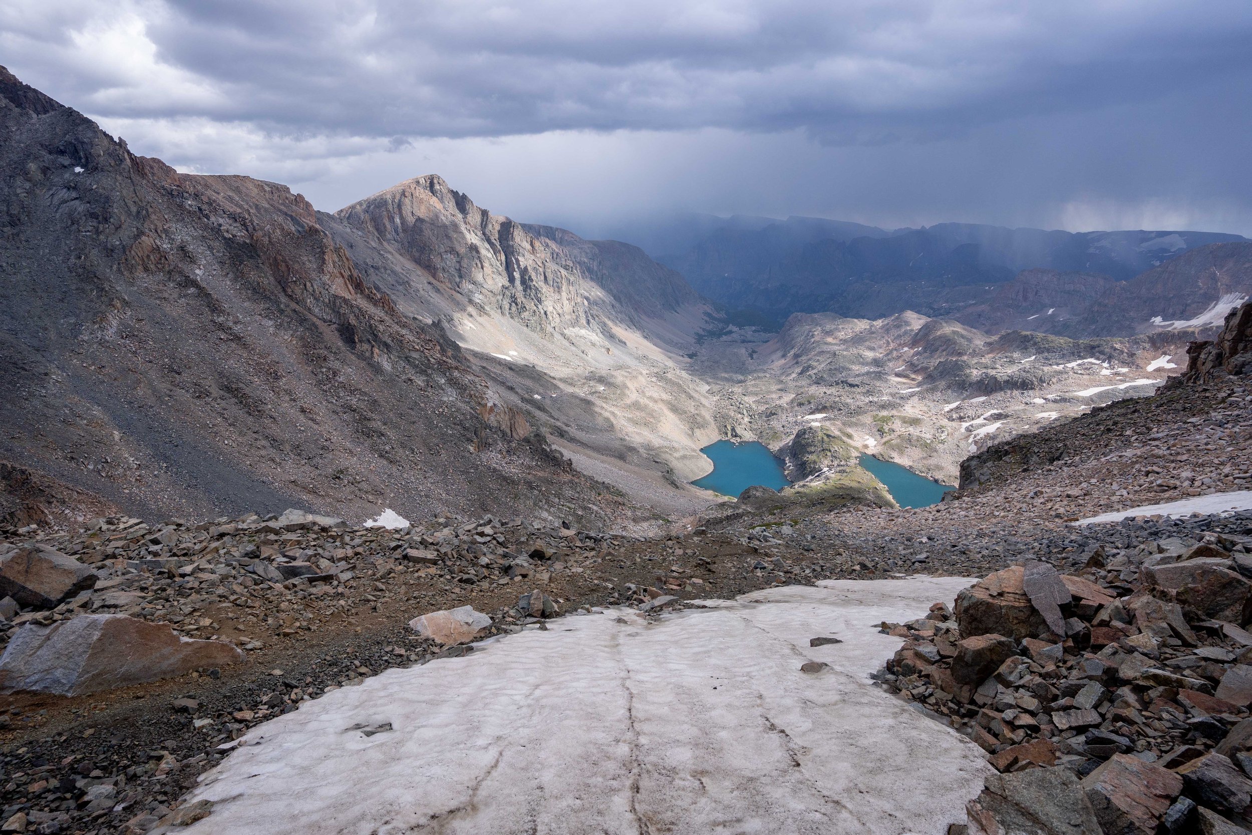
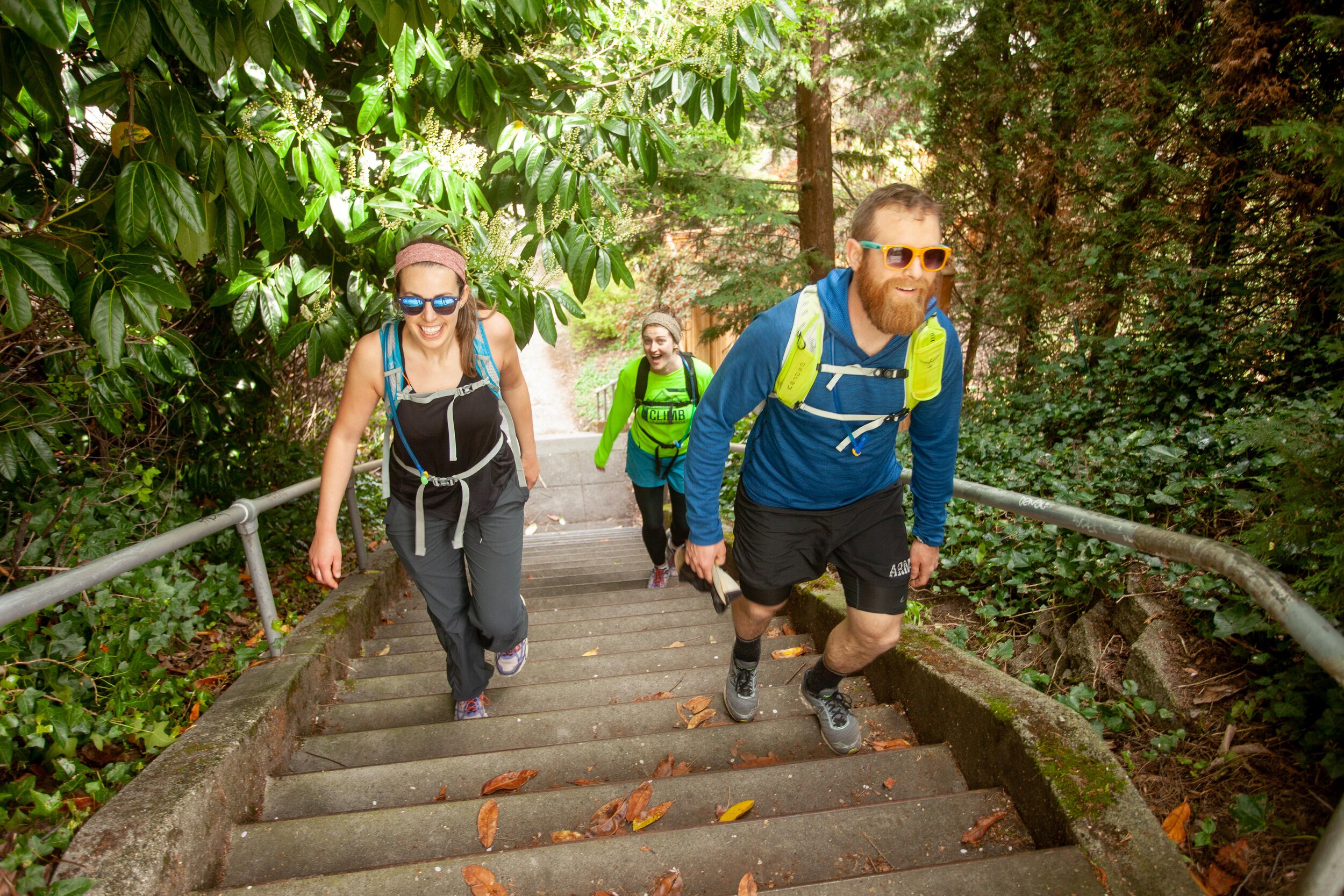
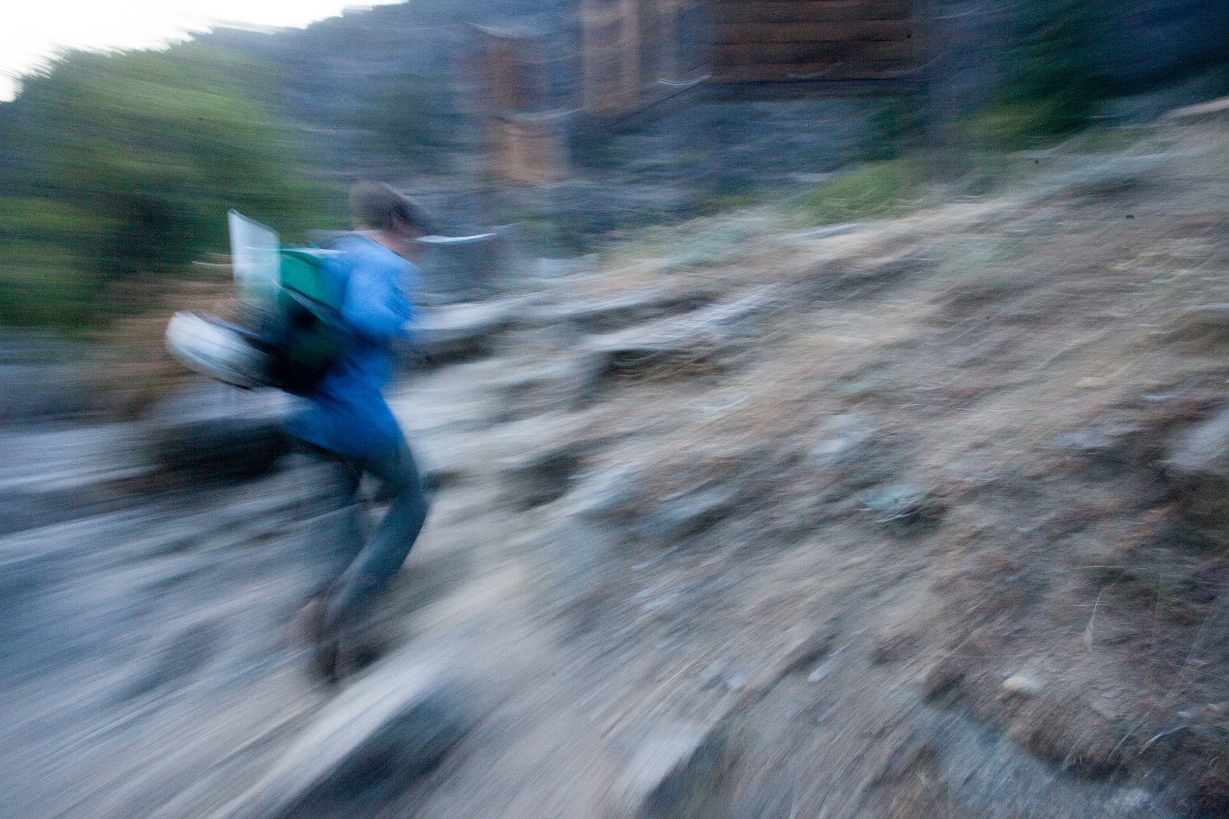
I can’t add a caption to the photo above, but there’s a reason it’s the cover shot - this day out is the epitome of what I’m trying to find in the mountains. My dear friends Nomi and Zac climbed an obscure peak with me in the middle of nowhere Montana. There’s no trail, so we thrashed our way through miles of dense brush to reach a beautiful lake, then fought our way past cliffbands to reach huge slabs of rock that brought us to the summit. We reached the summit only a few hours before sunset, then finagled our way out in the dark, ultimately getting stuck in a swamp at 10pm, where I laughed so hard I cried. We got back to the car after 17.5 hrs, 20 miles, and 6,500’ of vert. This is what I’m looking for in the mountains - endless conversation, laughter, and remote adventure.
Backstory
Back in 2020, I set myself a goal of climbing 1,000’ a day - 365,000’ for the year - by any human-powered means. You can read about that year here. While it got a bit close at the end, I pulled it off, ultimately climbing up 380,000’. Because it had been fun and inspiring, I set the same goal for 2021.
2021 - I was on pace until November 7th, when I ran into the brick wall of an overuse injury combined my first semester of grad school. I basically did nothing after November 7th and finished the year with 332k’.
2022 - When 2022 rolled around, I set the same goal again. I wanted to balance my work/outside life a bit better and hoped the goal would help. But I ended up getting sick three different times - bronchitis and COVID twice - each for a month, all of which affected my lungs pretty badly. I managed to get 318k’ but it was pretty scrappy.
After failing twice, I thought about writing a blog post on failing at big goals but didn’t get past the first draft. An excerpt:
What is the point of making goals if you keep missing them?
I believe that there may be people out there who don’t need the motivation of goals, who can simply live in accordance with how they want to without setting long-term commitments to themselves about how they want to be in the future. I don’t work like that. I need clear-cut goals to help steer me toward who I want to be. And I also need practice at failing. So setting goals, driving earnestly toward them, and then failing, it’s all good. At the end of the day, I just want to have tried to change. If that makes me a loser, so it goes, I’m happy like this.
That brings us to 2023. Obviously, I set the same goal again, even though I knew I’d be wrapped up in my last semester of grad school and had no idea what came next. Somehow, it all worked out.
2023 Year End Totals
374k’ climbed | 1,315 miles | 490 hrs exercising

Elevate for Strava - amazing app. If you look closely you can see that I tend to plateau in September or October due to overuse injuries I’ve racked up through the summer. At least I’m consistent?
But the numbers don’t tell anywhere near the whole story. This was a year of wildly surprising successes mixed up with overuse injuries from dreaming and pushing too hard. And I’m still trying to understand exactly what I did wrong and how I could have done better.
Some caveats
I’m not holding my stats up for any reason other than to share something that I’ve put an absurd amount of time and energy into, and I’m definitely not suggesting my numbers make me better or worse than anyone else. Many people are much stronger than me, and I’m constantly inspired by them! I also realize this is all excruciatingly navel-gazey, but what else are year-end reflections for?
While I’m caveating: I know I’m enormously privileged to experience such a generally healthy body, and I’m sorry that I did not recognize this privilege earlier. Before 2022, I had never been sick for a month before in my life. In 2022, I was sick for three months and became friends with two people who have experienced chronic illness for most of their lives. I wish I’d been able to be more compassionate to those experiencing chronic illness without my own illnesses, but I wasn’t. Even now, I cannot fathom my friends’ experiences, in large part because my life has been built on how my body works. But I can try to treat my body with more grace and care and to try and use some of the methods that they have been kind enough to share with me. To honor them.

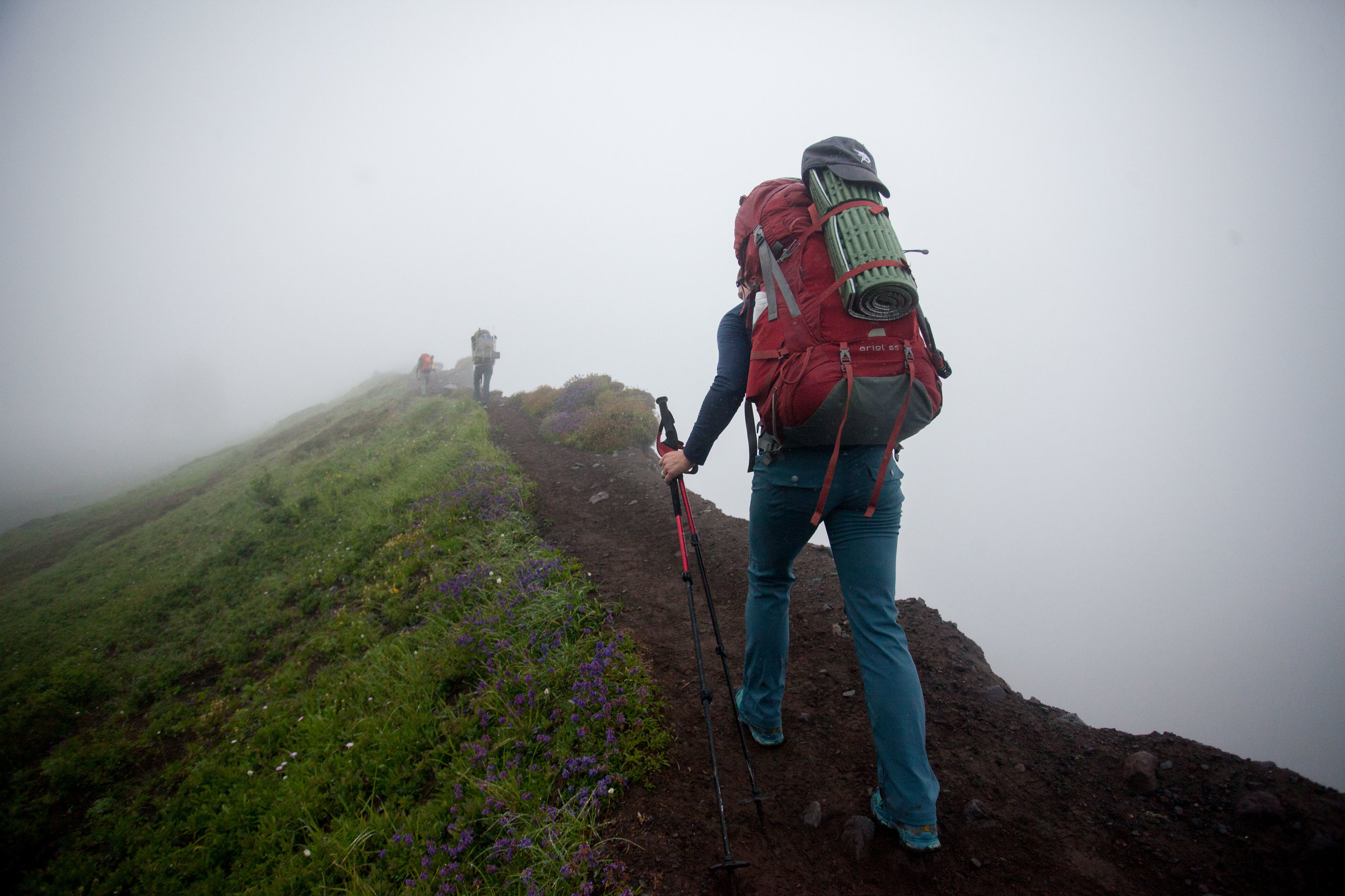
End of Winter 2023 into Spring
I was trying to wrap up my master’s work while also skiing my face off. I toured 50 days in the winter of 2022/23, and tagged some lines I’d been dreaming of for years - Red Mountain (WA) and Sky Pilot (MT).

Red Mountain!

Sky Pilot!

Rainier!
Then I graduated and celebrated by skiing Rainier in a day via the Fuhrer Finger with Solomon. This was a big deal for me, I’d never even allowed myself to dream about this line because I thought it was too gnarly for my skillset. But after 40+ days on skis that season, it went smoothly!
And then a few days later, I successfully skied the Isolation Traverse with Robby after two previous attempts the two previous years. And it was as incredible as I’d imagined.

Isolation Traverse!
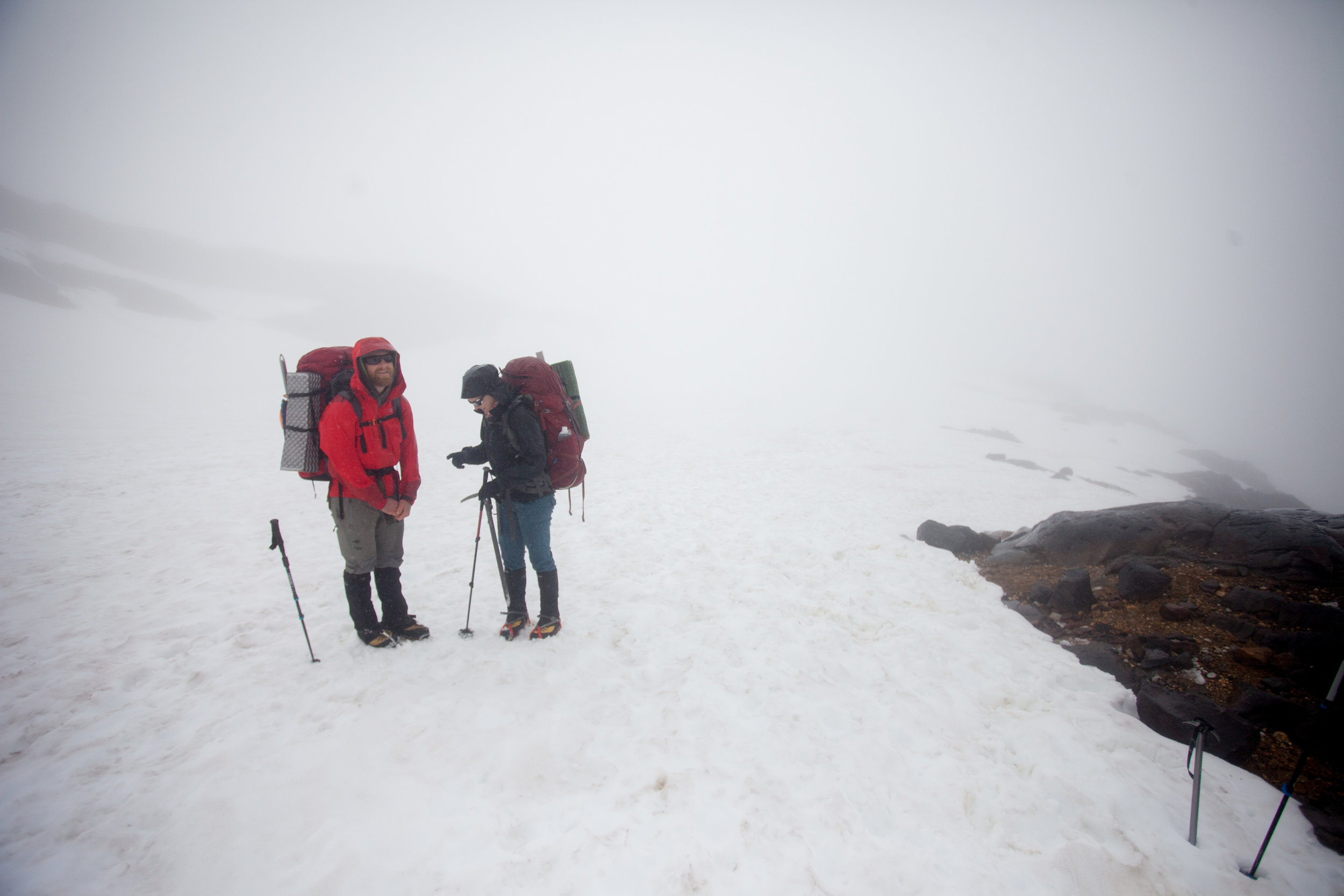
Summer
I kicked off the summer by reporting on the Held v Montana trial for three weeks. It was an incredible opportunity, but I spent three-plus weeks sitting and writing. Then, suddenly, a guide got sick and I got flown up to the Gates of the Arctic National Park to guide for 11 days. I’d always dreamed of going to Alaska, and this trip exceeded all my wildest dreams.

All the black dots are mosquitoes attacking
I got back and was feeling strong. And I think this is where I started to make some mistakes. I had barely been running all year, but when Keith invited me to run the Teton Crest Trail, I jumped at the chance. And while it was a spectacular and fun day, my knees blew up after mile 30.

The duality of man: mile 30 - before my knees blew up. This is the best day ever.

The duality of man: mile 40 - I want to go home but my knees won’t bend anymore.

Jonathan getting sendy on the Glacier Project and my knee destruction happening out of frame.

More glacier project, more knee destruction.
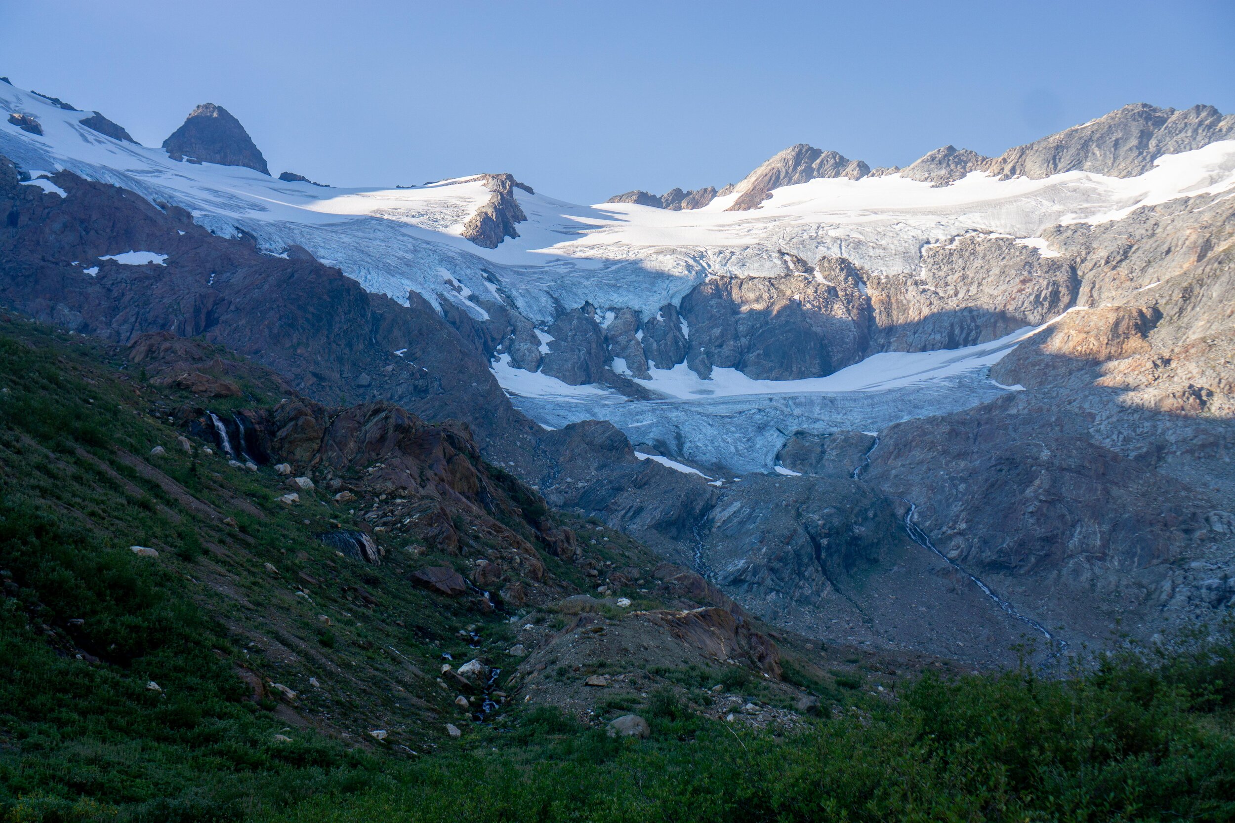
I took two weeks rest and then started visiting glaciers in Glacier National Park for my glacier project. And while I enjoyed a couple gorgeous trips, two with Jonathan and one with Mica, my knees blew up again. I limped my way out of the park and rested for another two weeks, praying my knees wouldn’t ruin my September guiding. Thanks to everyone who supported me through this time, I was rattled and upset.
Fall
Somehow, I managed to do 17 days of offtrail guiding back-to-back (with something like 45k’ vert) in the Olympic National Park without my knees blowing up, though they felt tweaky almost every day.

Guiding in the Olympics!

Oh, the Cascades

Nothing wrong with pow and wet feet in early October
After wrapping up the guiding, I went on a wild solo offtrail trail-running journey into the Cascades, summiting and circumnavigating Buck Mountain. I did 31 miles and almost 11k’ gain. And I felt great (minus the last few miles which were a 10pm death slog). I figured I was in the clear!
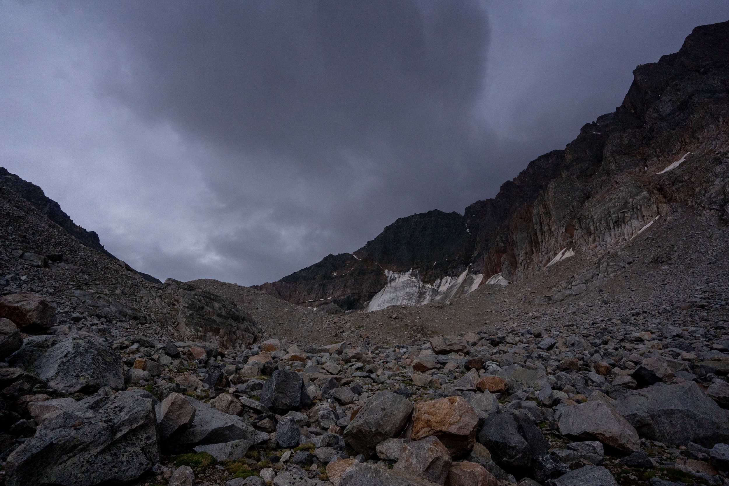
I headed back to Montana and had two more big romps - one in the Mission Range with Zac and Nomi and one more glacier visit with Barron - before my left knee finally told me I had done too much. I spent a month resting and having trouble walking.

Scrambly nonsense on a perfect fall day out

Alpine rambling with glaciers!
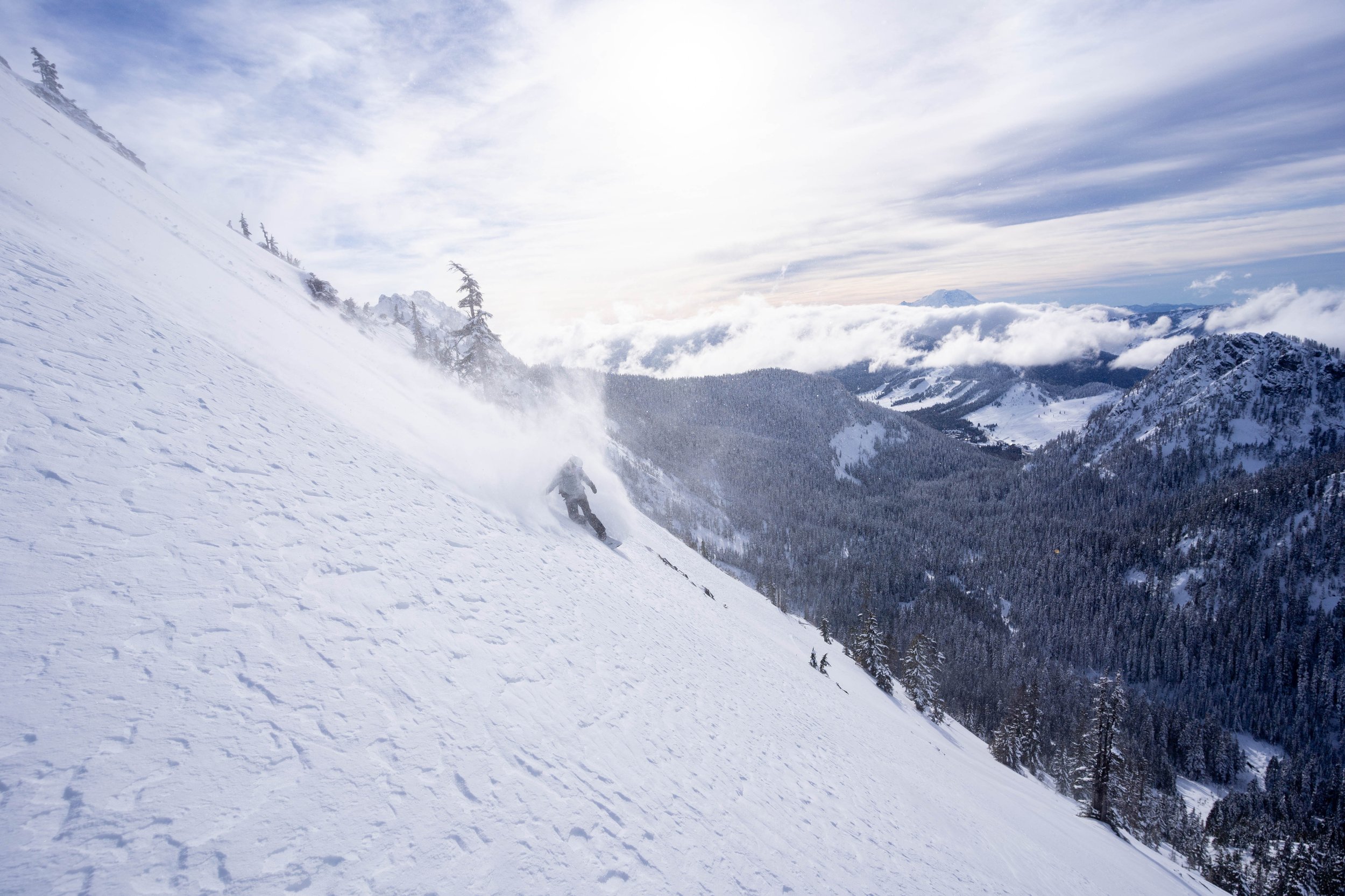
Winter?
As we all know, there’s so little snow that it doesn’t really feel like winter has started. I’ve spent the winter resting for the most part. When I thought my knee was finally better, I went on a few ill-advised runs at home in Missoula - one of which got me over 365,000’ for the year! - before my back blew up and forced me into another rest period.
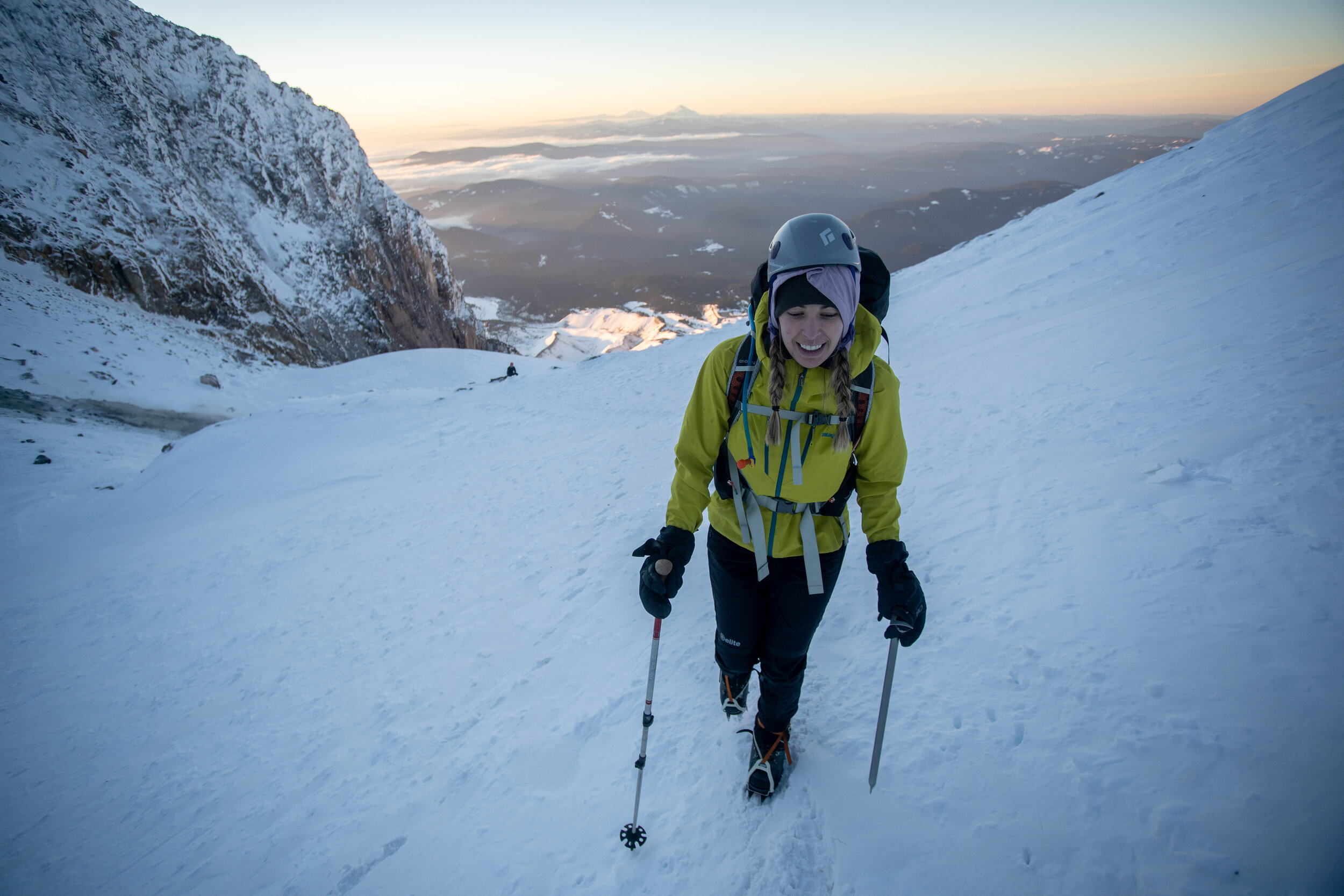
In the last two weeks, I finally got out ski touring a few times in Washington with my brother Owen and Marc, but I mainly tried to rest my poor back and knees. But I did manage to finish the year with a small triumph: Robby and I skied the Nisqually Chute on Rainier a few days ago, a line I’d always looked up at and never attempted.


Lessons
Now that 2023 is done, I’m trying to understand what I need to improve at. On the one hand, everything I pulled off this year, from finishing grad school, publishing some major pieces, and starting a new job, all the way to skiing Rainier and the Isolation Traverse, is thanks to the combination of my capacity to dream combined with my extreme stubbornness. And yet, these big dreams coupled with stubbornness are also responsible for all my injuries this year. I spent over two months trying to recover from overuse injuries this year. And that has felt like shit. Even as I write this, I’ve got a sore back and a tweaky knee.
What do I need to learn? Probably something about balance and about building strength preemptively. And that skiing/hiking fitness does not mean anything when it comes to running fitness (pretty sure my mixup here led to this whole mess).
But I’m also going to take it easy on myself. I saw a wonderful physical therapist when my knees were blowing up and he told me:
“Look, you’re using your body in the way it was meant to be used. Just slow it down a bit, stretch, and build up a bit more strength. But don’t be mean to yourself about this, your body can hear you. Tell it you’re going to try taking better care of it in the future. That’s it.”
That’s what I’m going to try to do. Right after I do some more resting.
And if you’re struggling with injuries or chronic illness, please be easy with yourself and ask your friends for help. They’ll step up. You’re not defined by your absurd activities, you’re defined by the way you show up for your community. And part of that means asking for help when you need it.

Part of my glacier project. A glacier that could use some more community.
Outdoor Goals for Next Year
1) I want to keep integrating my creative life with my community-building life with my outdoor life. I feel like I’ve been heading that way for a while, but I want to keep going. Subgoals:
I want to keep building my outdoor community with folks who are also balancing these three threads.
I want to keep mentoring folks who are trying to get into the sports I know how to do, both formally, as a guide, and informally.
I want to keep creating work about others who are loving and stewarding the environment even as that becomes increasingly upsetting to do.
2) I’ve already got a long list of ski-touring/trailrunning/packrafting linkups in the works for this year, but I’m not going to write those down, because that’s not the real goal. I want to keep getting into the deep backcountry with partners who are joyful and supportive and with a body that is properly prepared for the situation I’m in. The specific objectives will figure themselves out.
3) And as always, I want to do 365,000’ of vert again. Or maybe 421,000’, if I can pull that off, I’ll have averaged 1k’ vert/day for five years :) which is a stupid enough goal to motivate me!

Gratitude
I spent a lot less time this year on solo trips thanks to my lovely and ever-growing network of backcountry partners! Thank you to everyone who spent time with me in the backcountry! I specifically want to thank Marc, Solomon, Robby, Barron, Zac, Nomi, Jonathan, Keith, Sam, Mica, Greg, my brother Owen, and my mother Deborah for all the inspiration, support, and companionship they’ve given me.

Two great partners on a beautiful day out in WA
I want to thank the landscapes where I spent time this year. I explored Western Montana (mainly the Bitterroot range, the Missoula area, and Glacier National Park), the Cascades (WA), the Olympic Range (WA), the Chiricahua Range (AZ), and the Brooks Range (AK). I can’t express how thankful I am to be able to spend so much time in these landscapes, or how much they’ve taught me. But I hope my writing and photography are a start!
I am also increasingly reckoning with the fact that these landscapes have complex histories of ownership, control, and stewardship. I am deeply grateful for all those who have helped these areas become what they are and am committed to helping build capacity toward equitable and collaborative relationships with the land through my journalism, my guiding, and my work at the University of Montana’s Center for Natural Resources and Environmental Policy.
Thanks for reading!

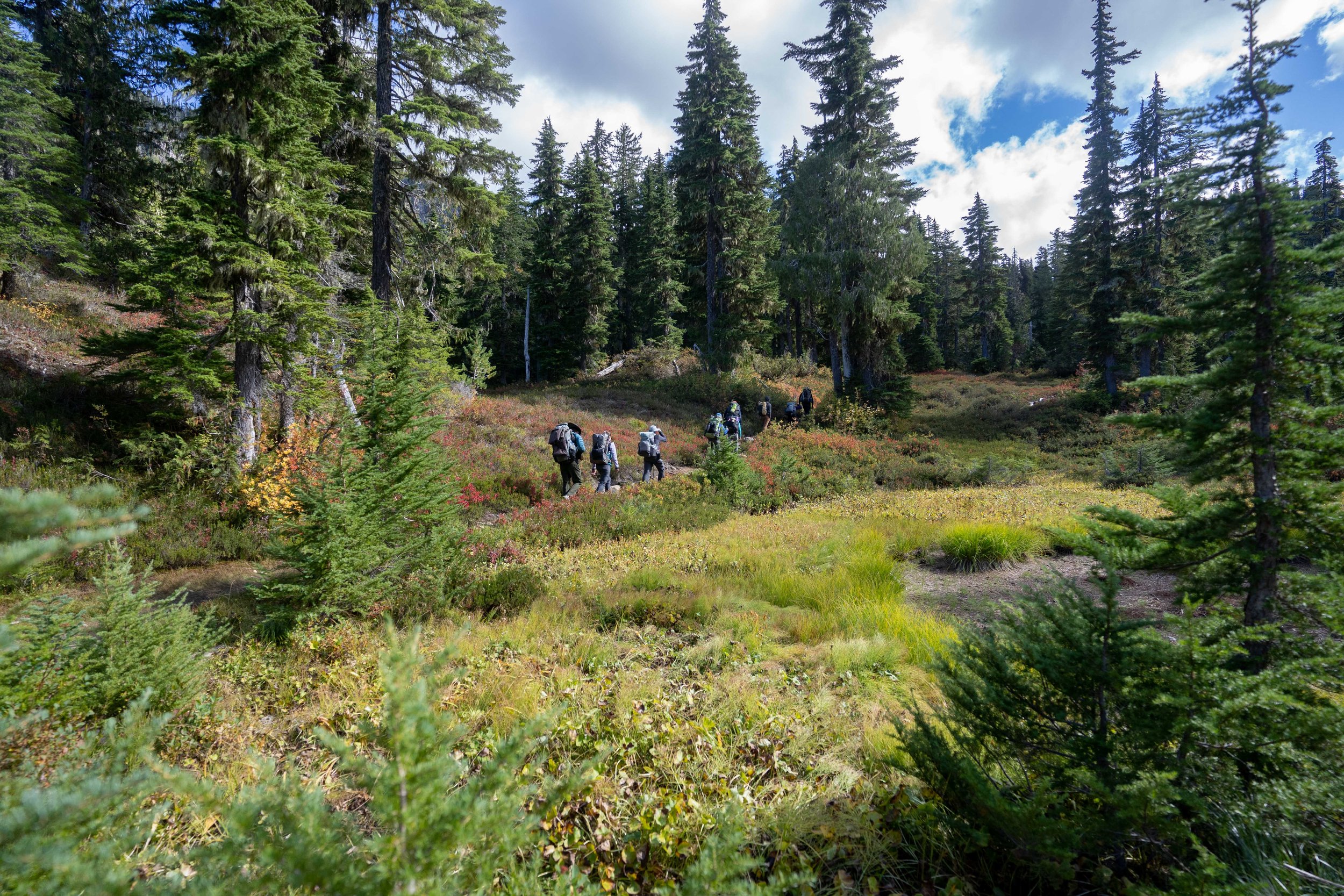
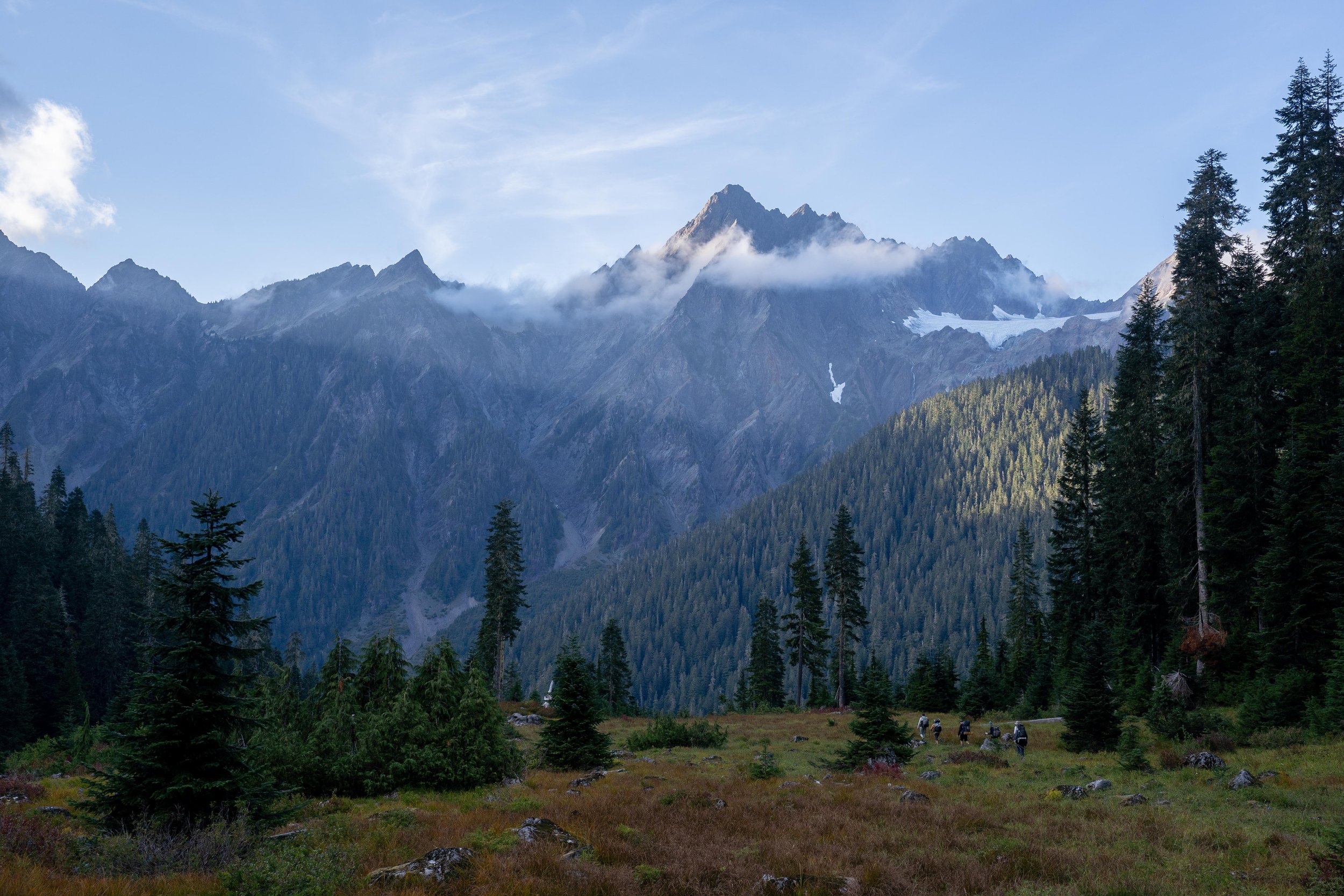
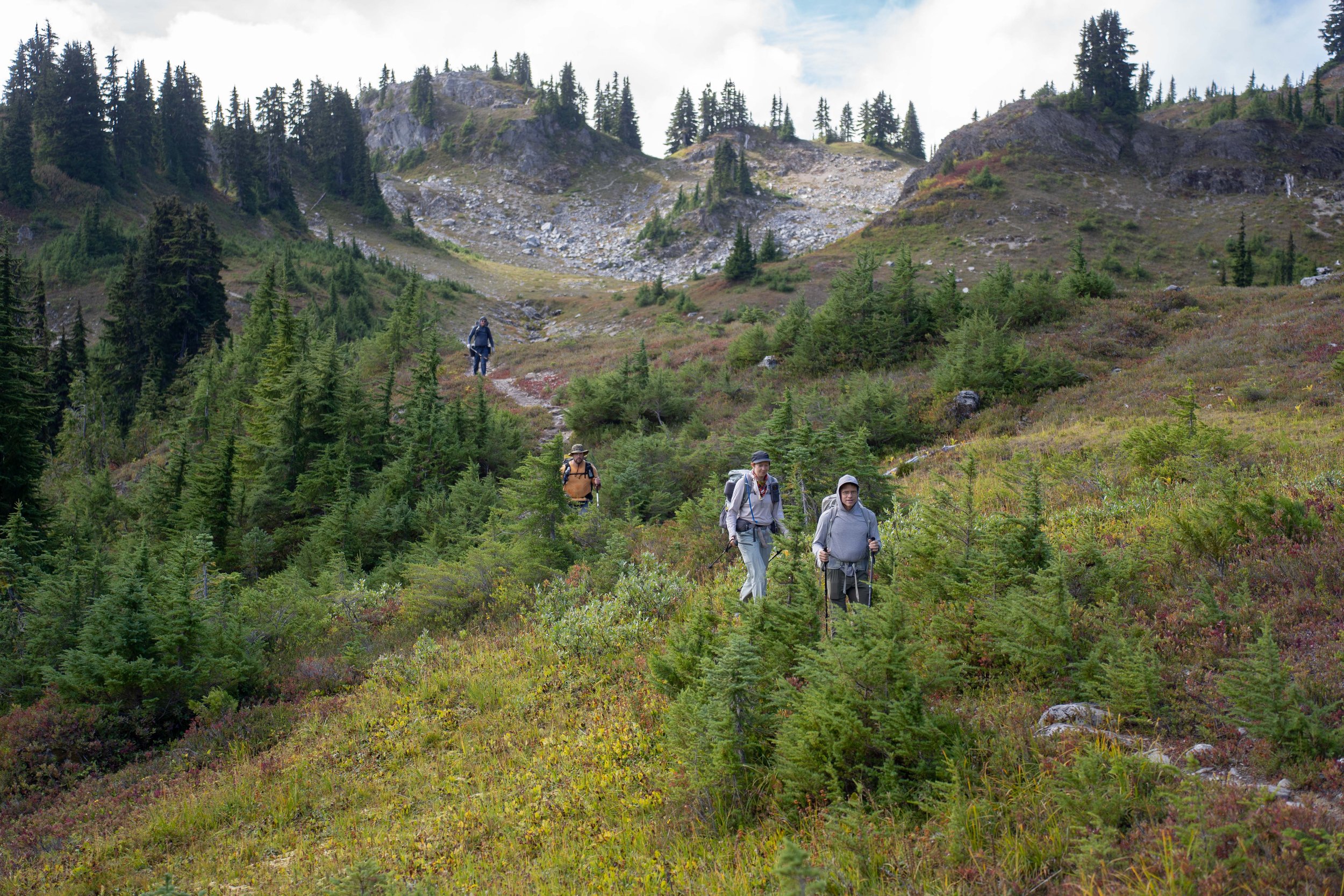
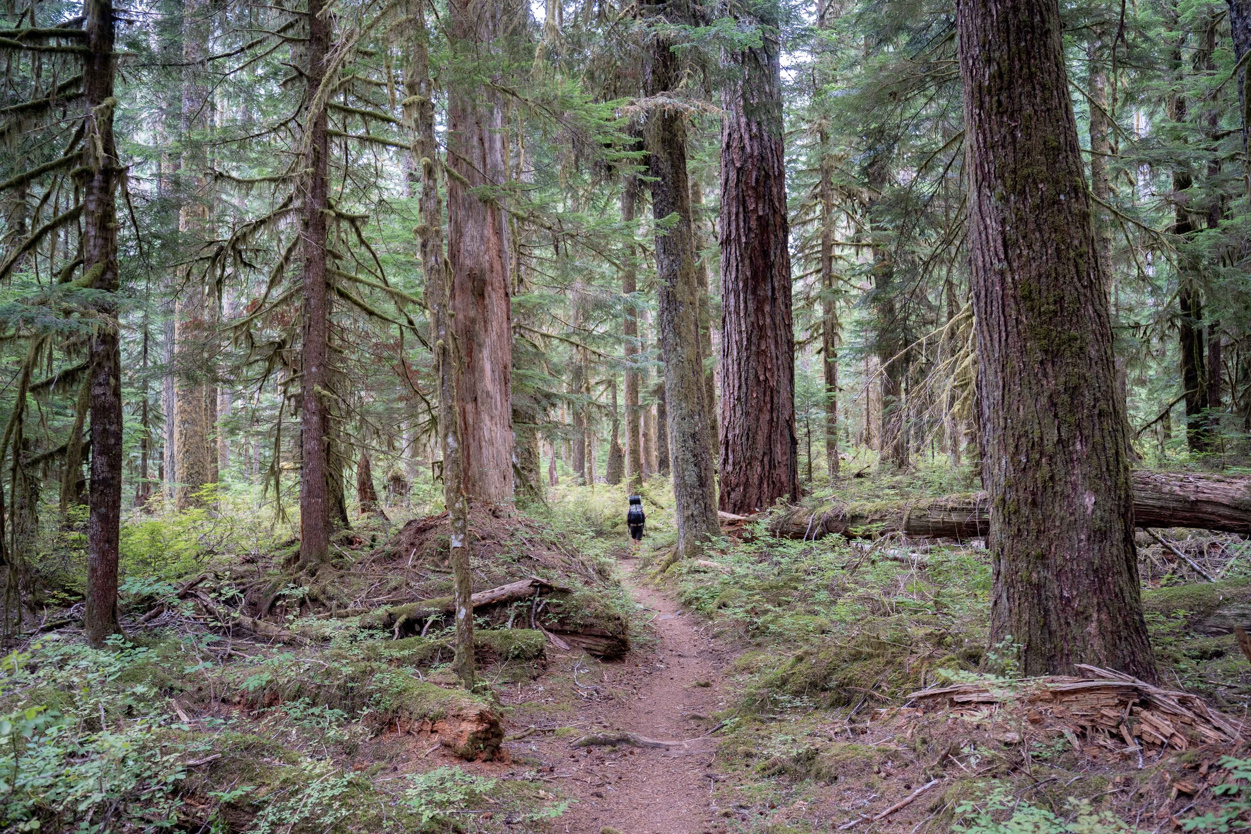
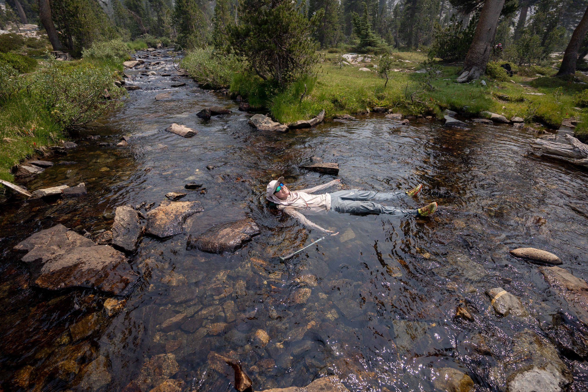
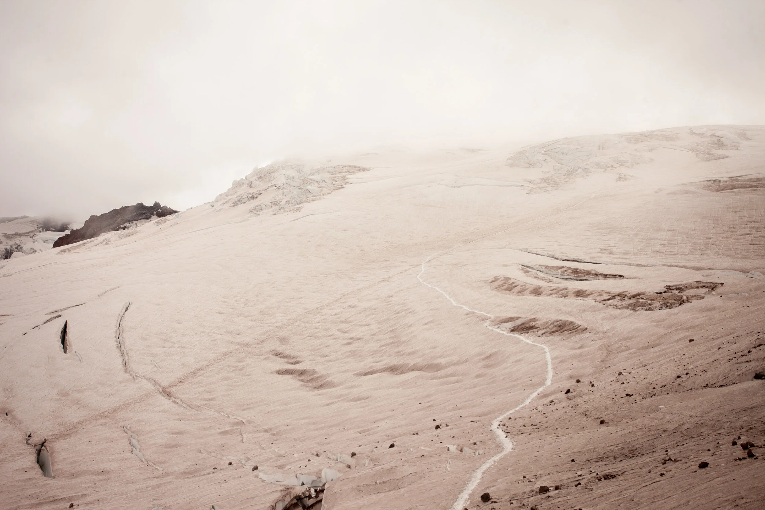
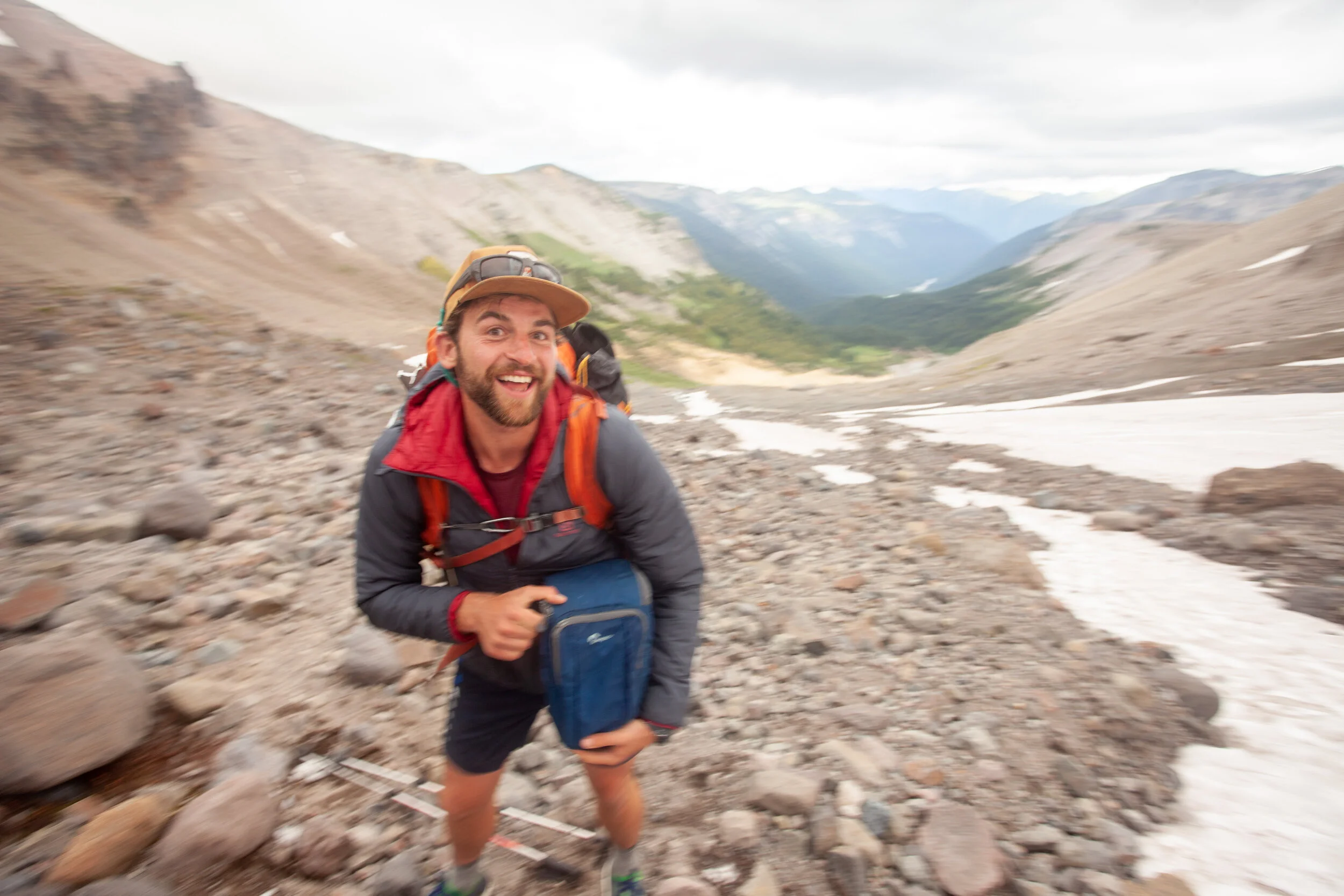
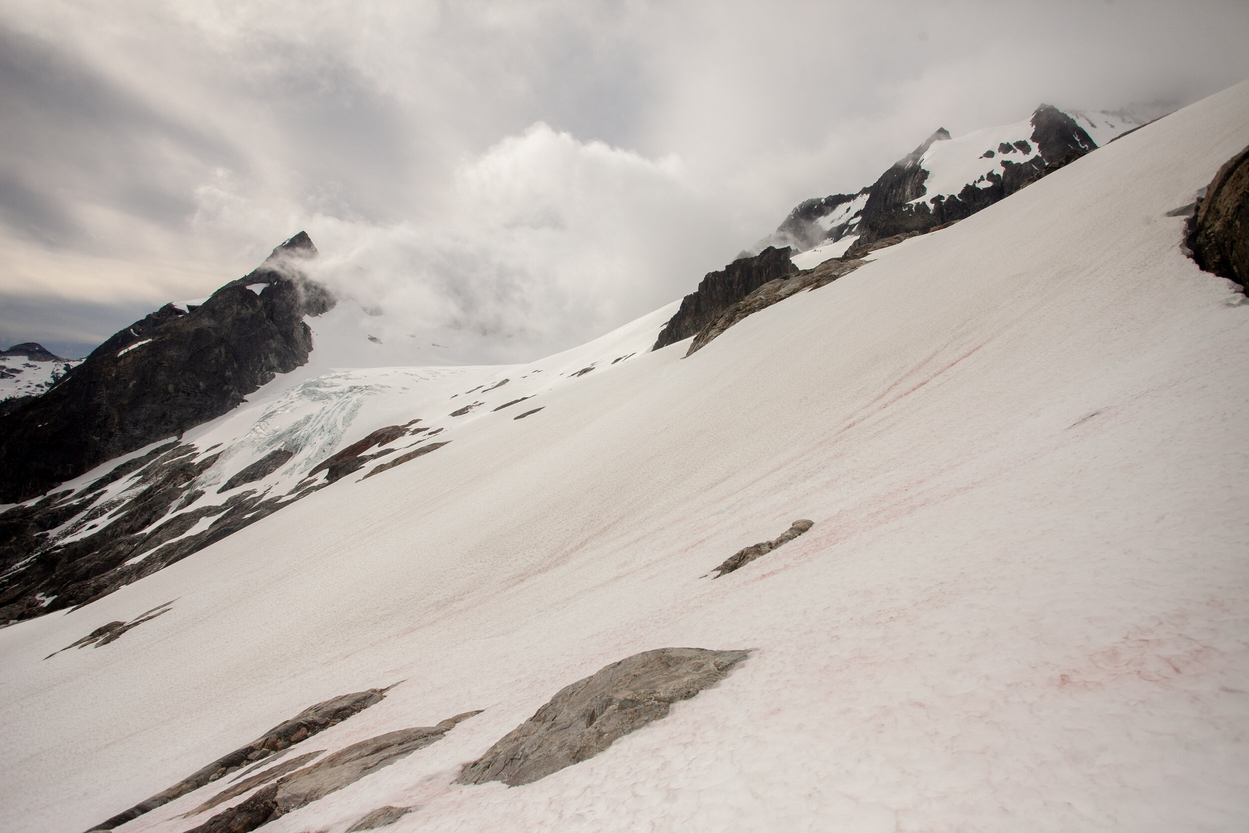
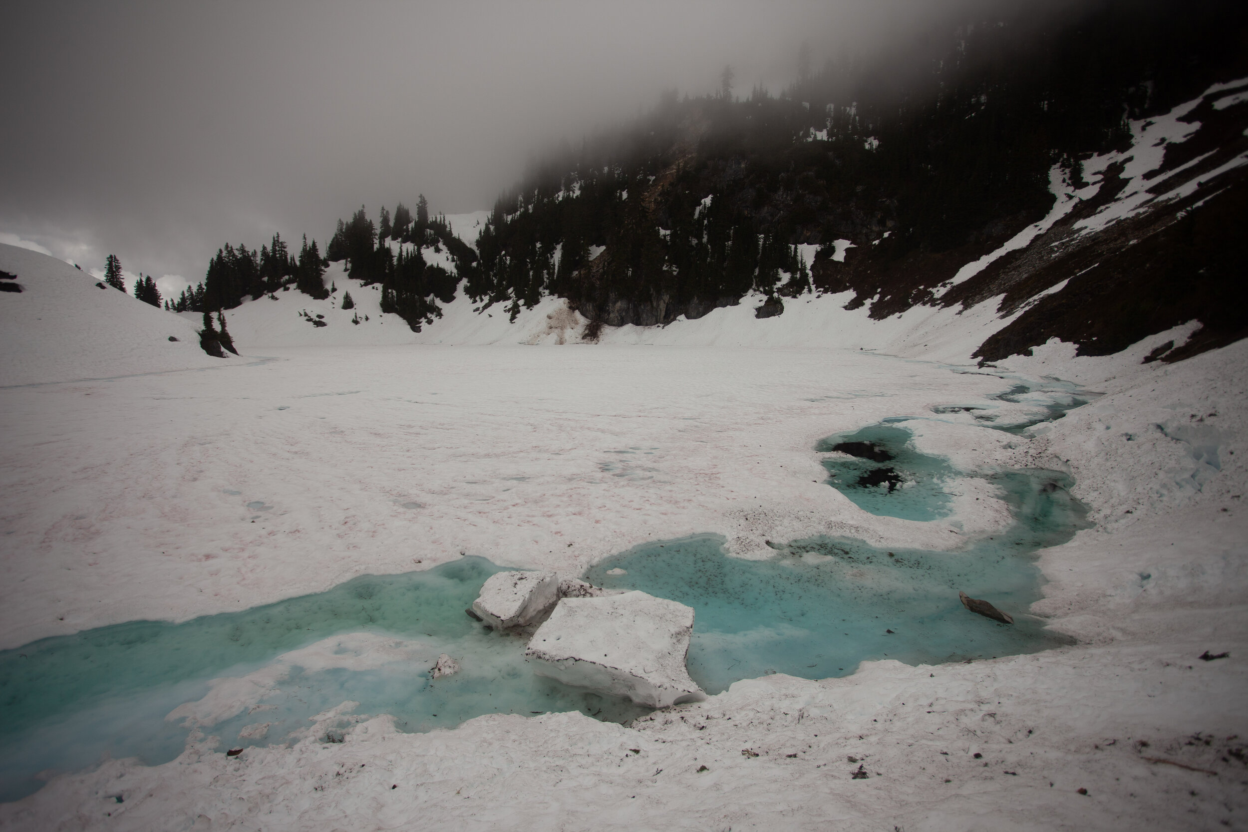
Trip Report - Guiding in Olympic National Park in WA - 9/5/23 - 9/22/23
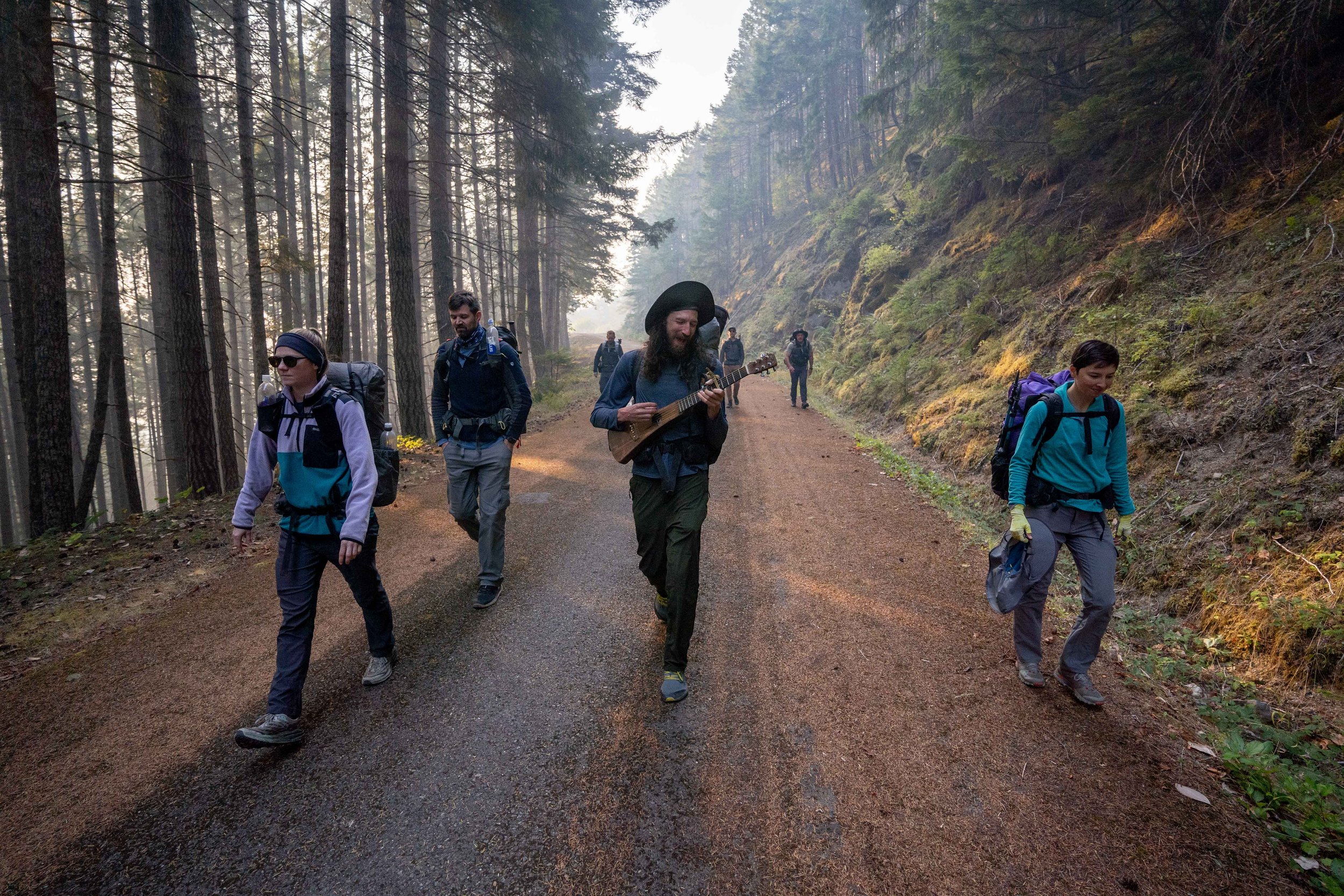
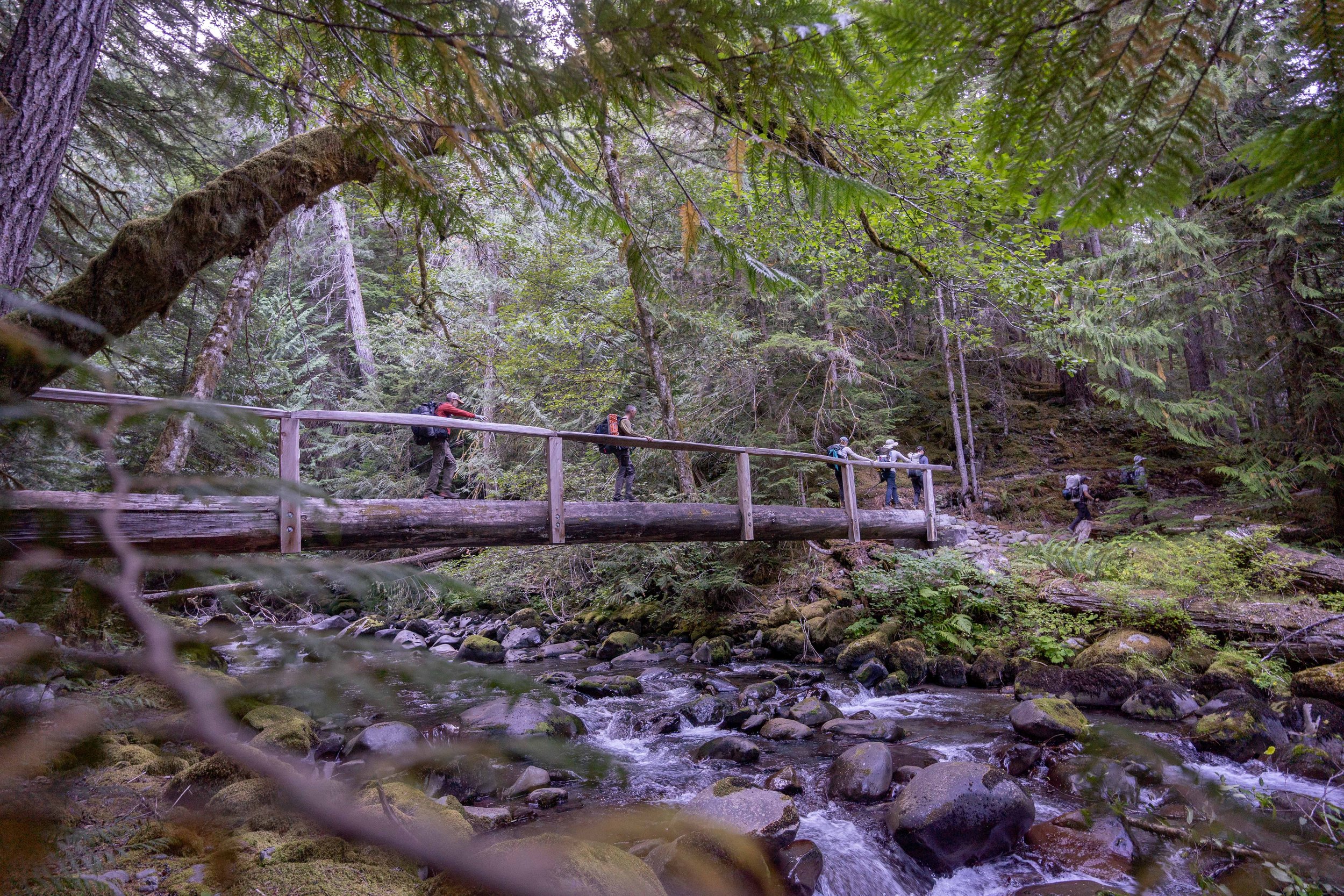
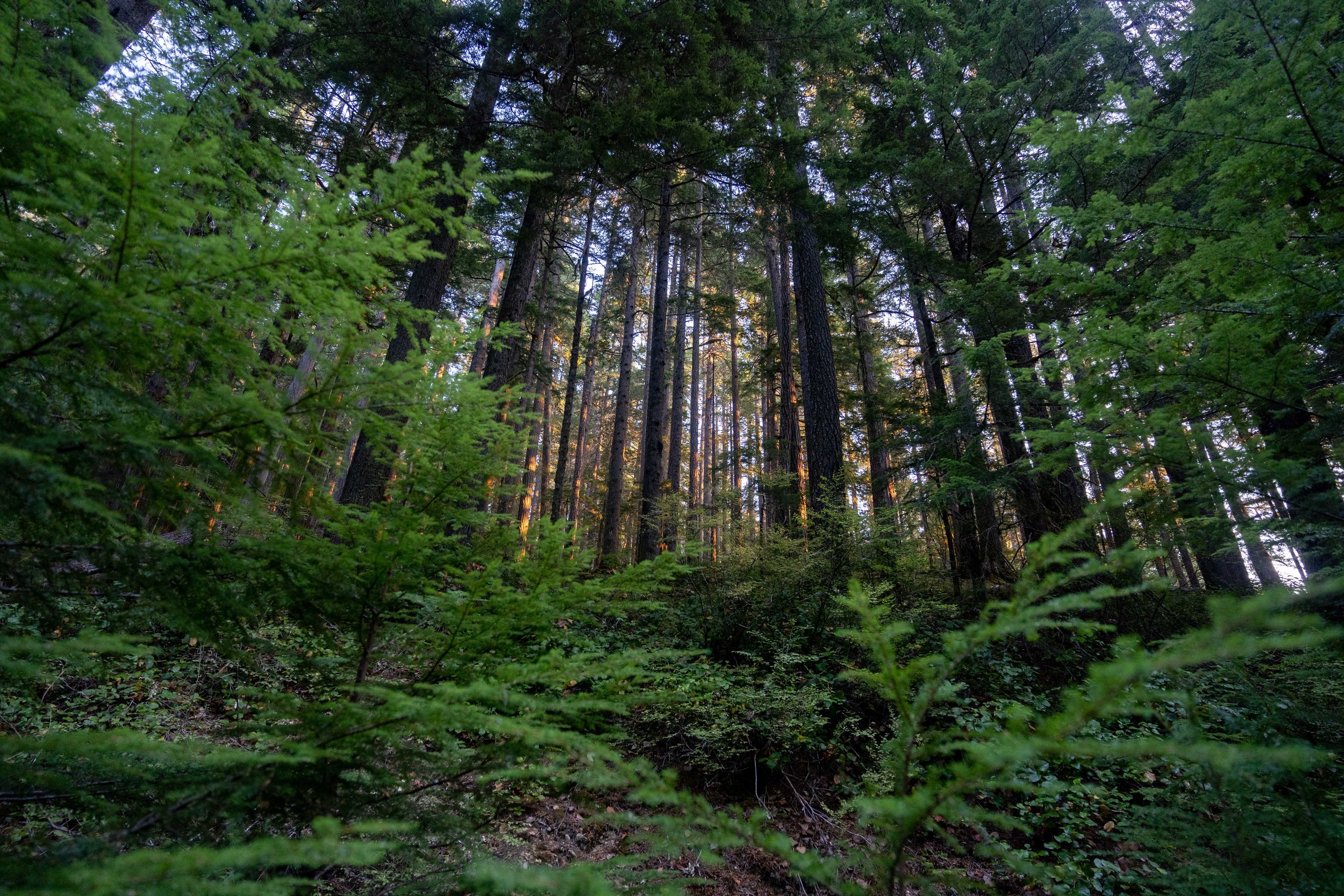
This September, I spent 17 days guiding a series of offtrail trips in Washington with Andrew Skurka Adventures. After spending the last two falls cooped up inside doing grad work, it was a joy to be out in the landscape watching Washington transition toward winter. My clients were wonderful, curious and resilient despite some gnarly conditions, and I’m thankful to have gotten to spend so much time with them all! Here are some photos of what we found:
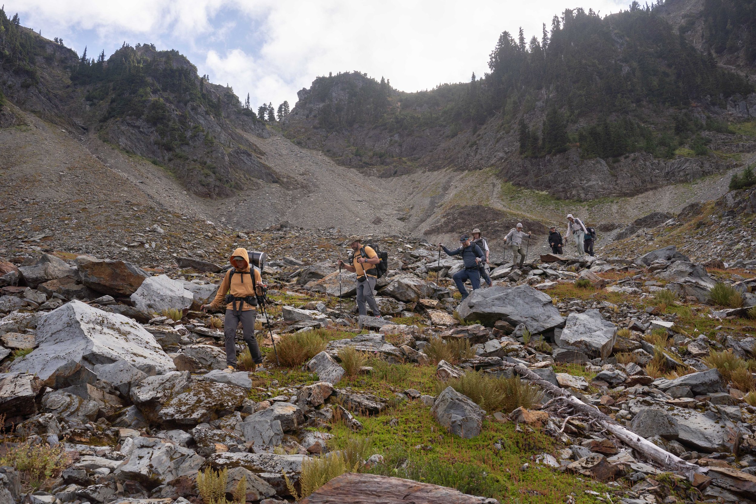
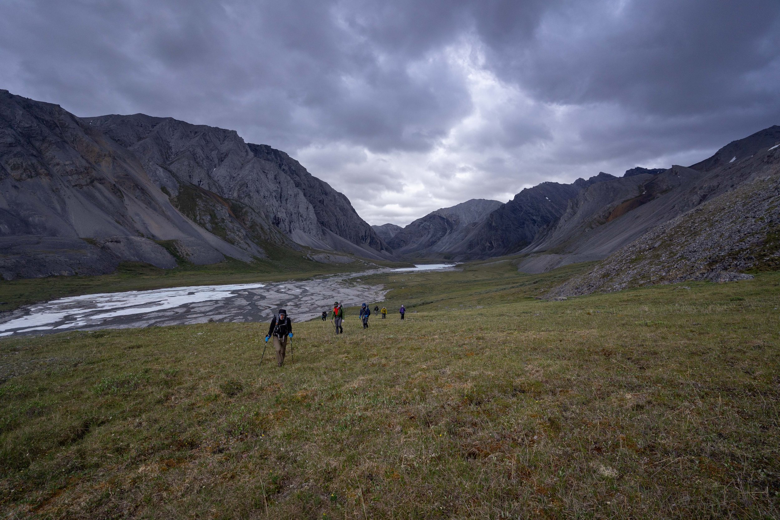
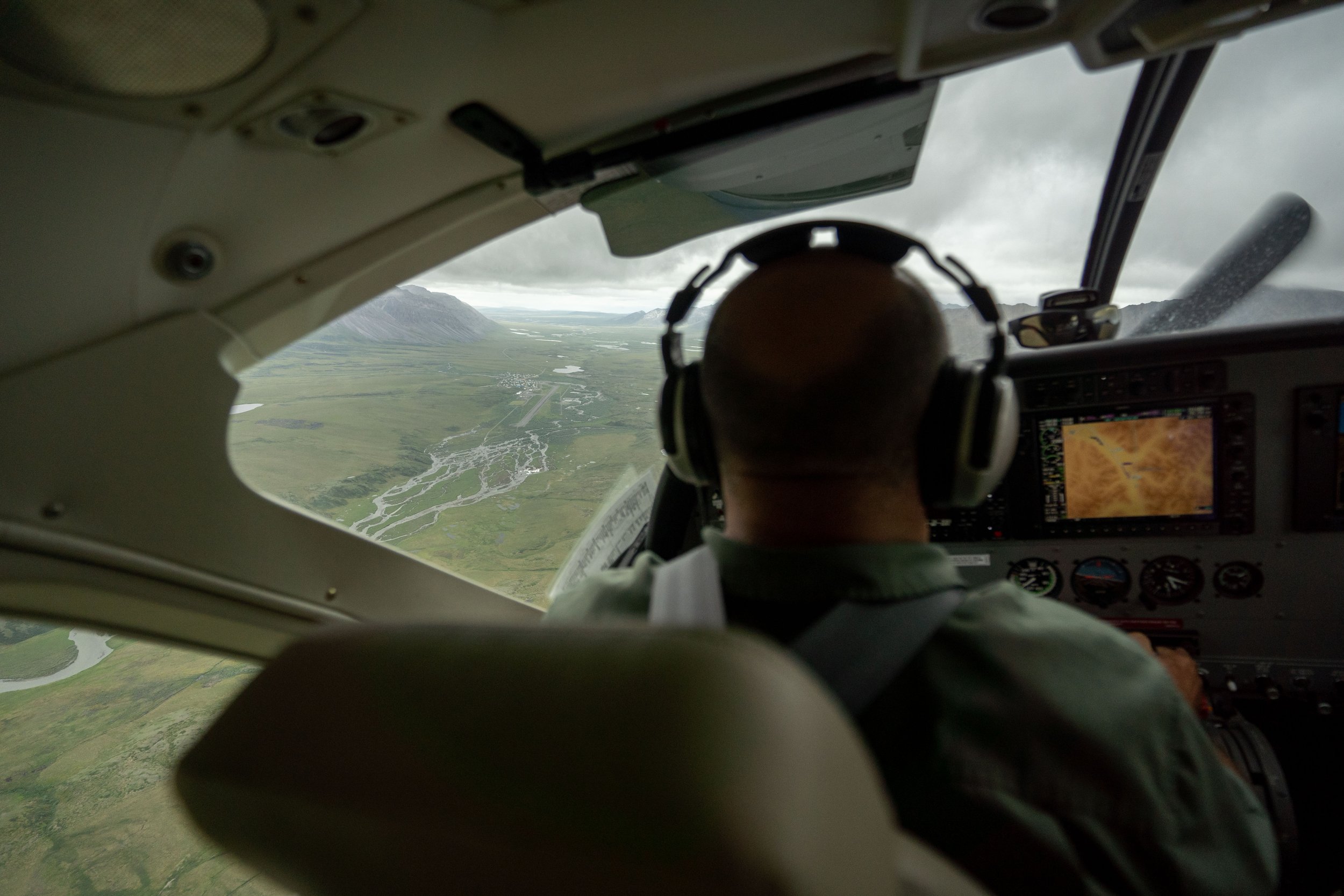
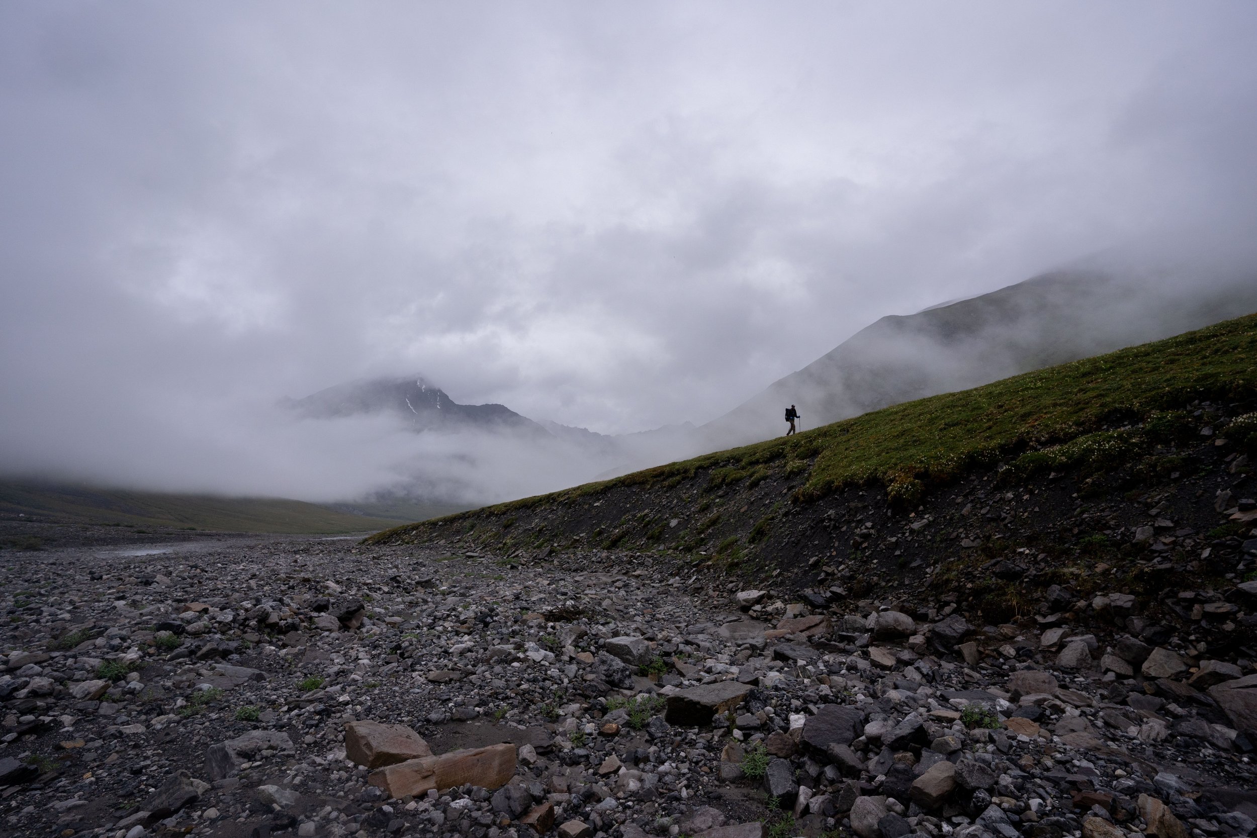
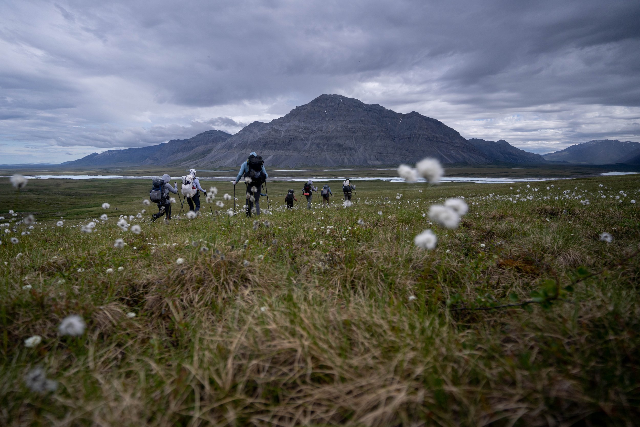
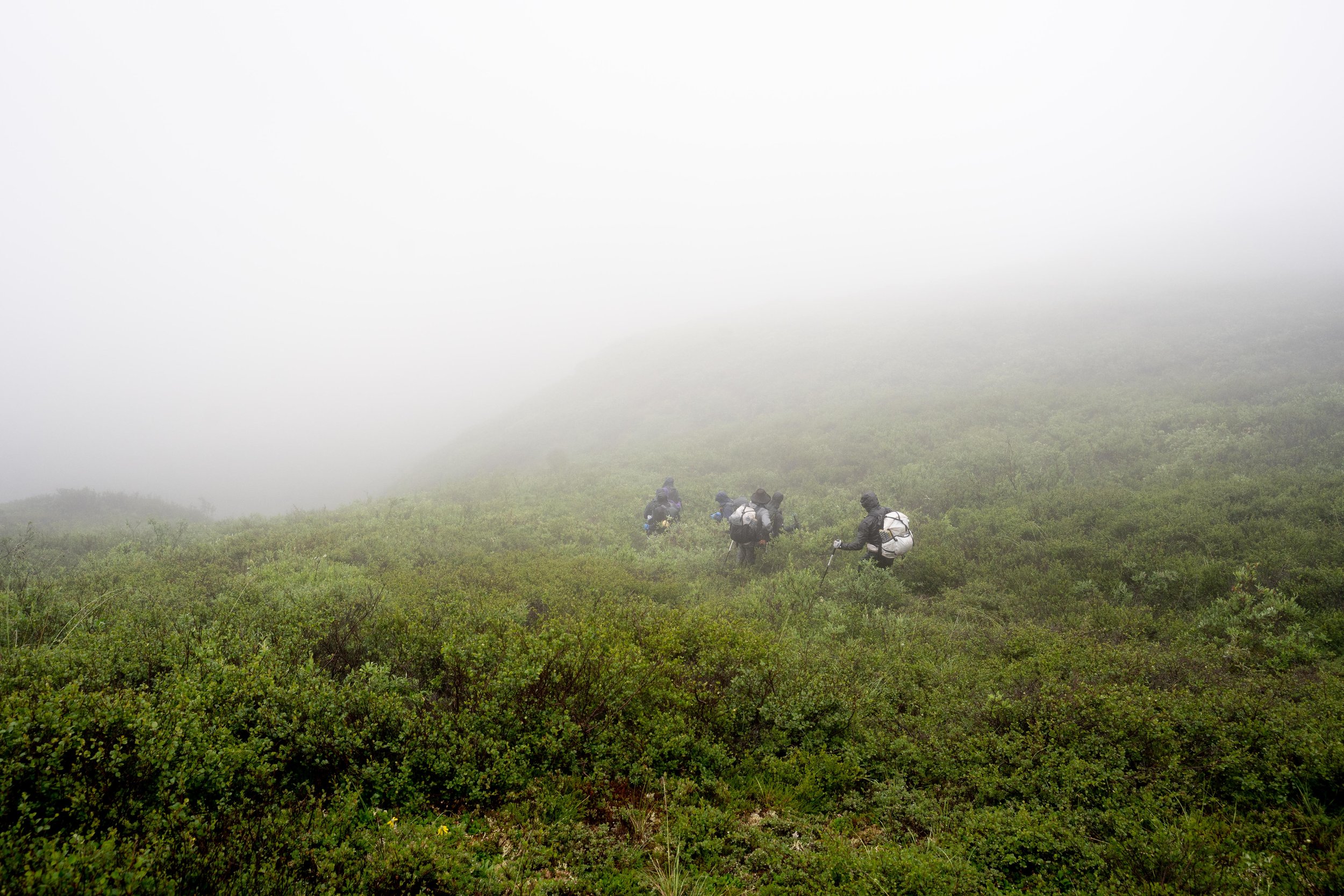
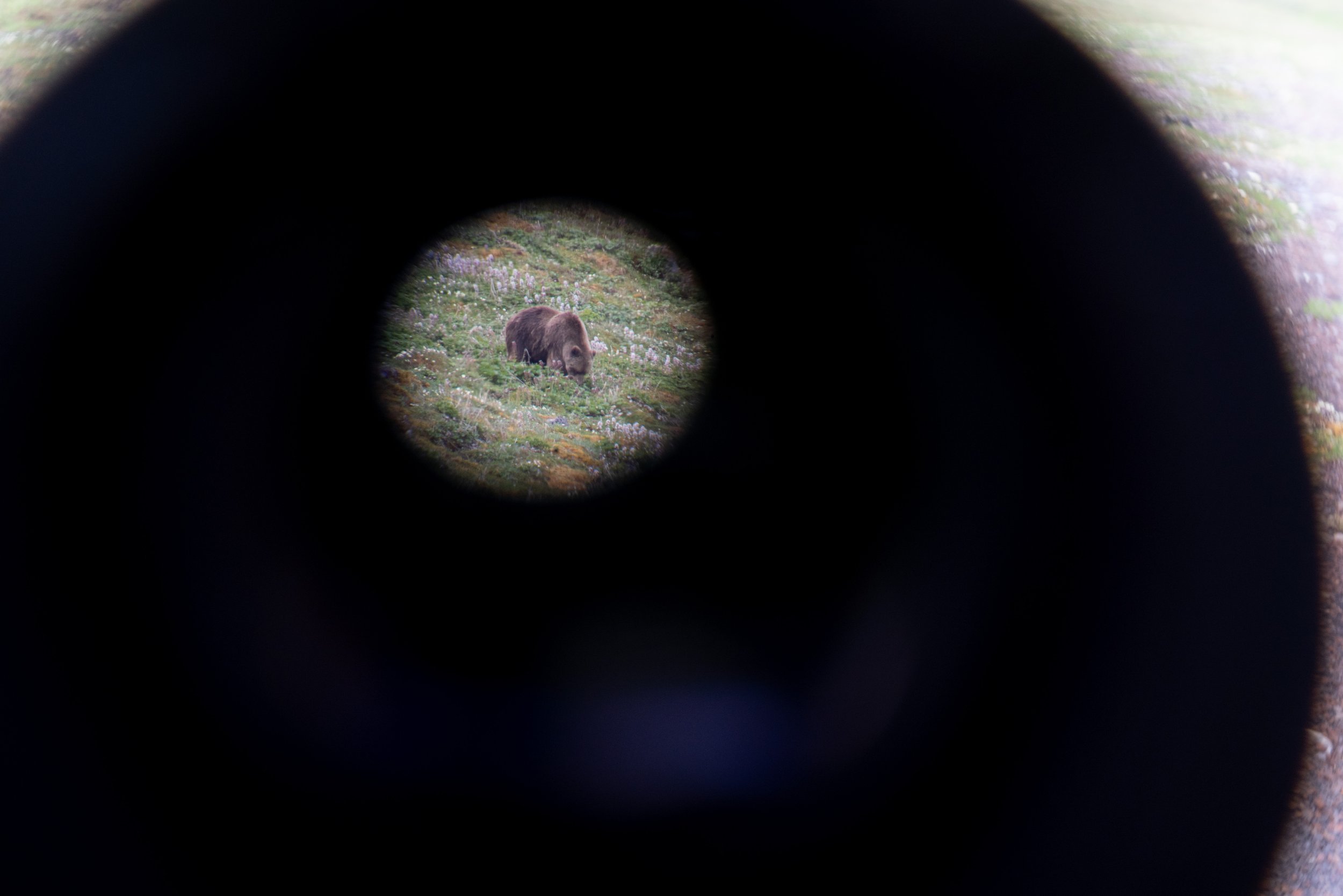
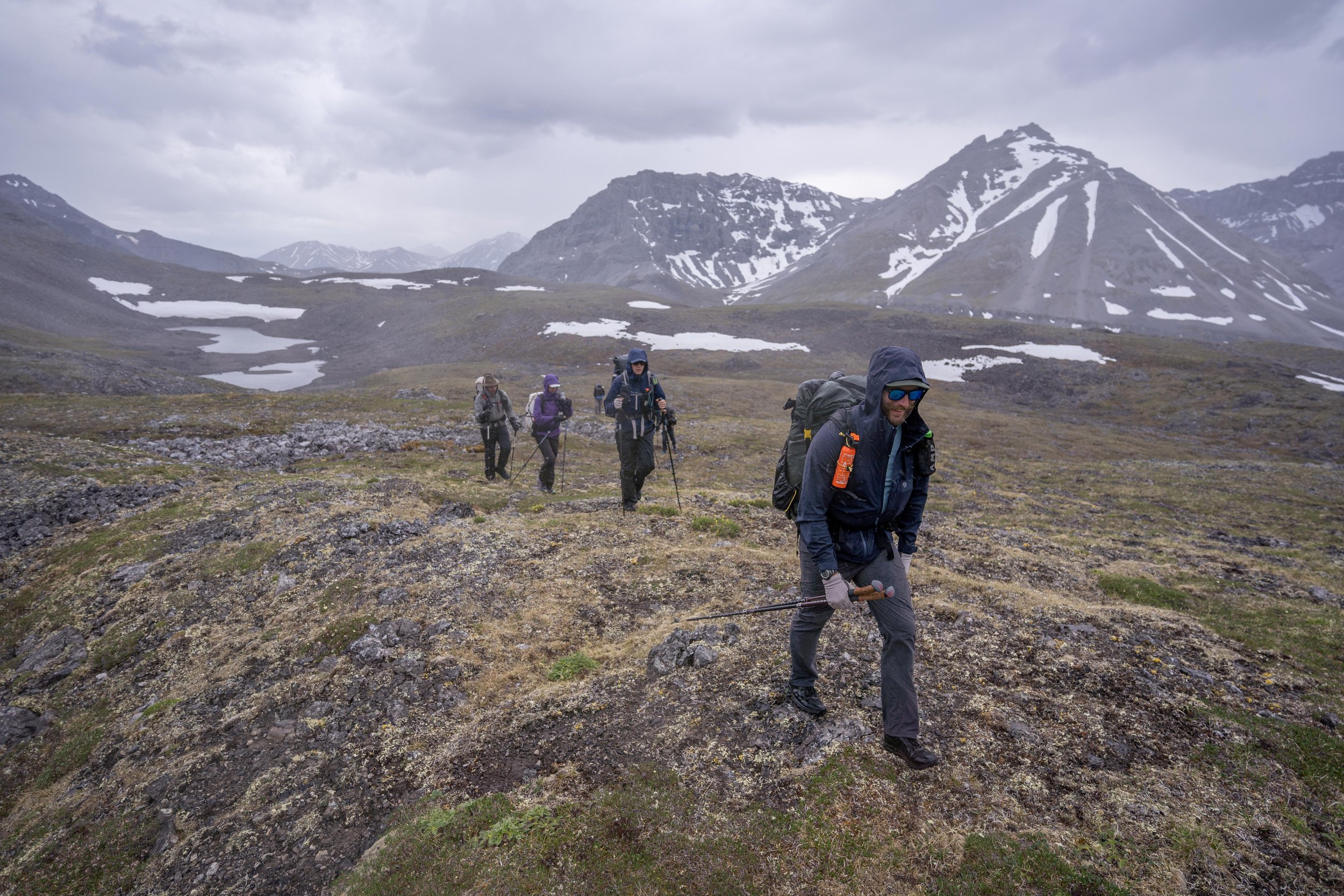
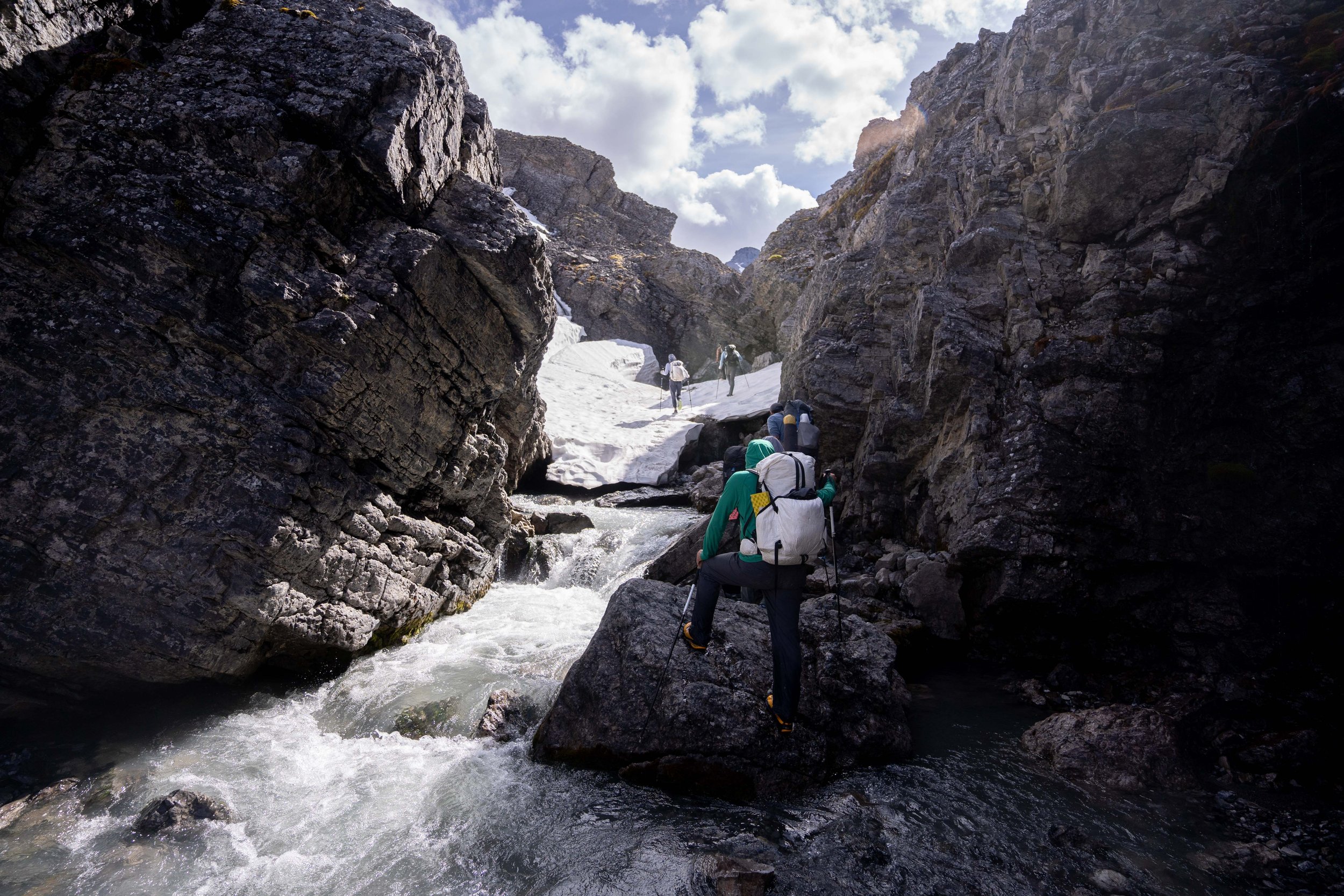
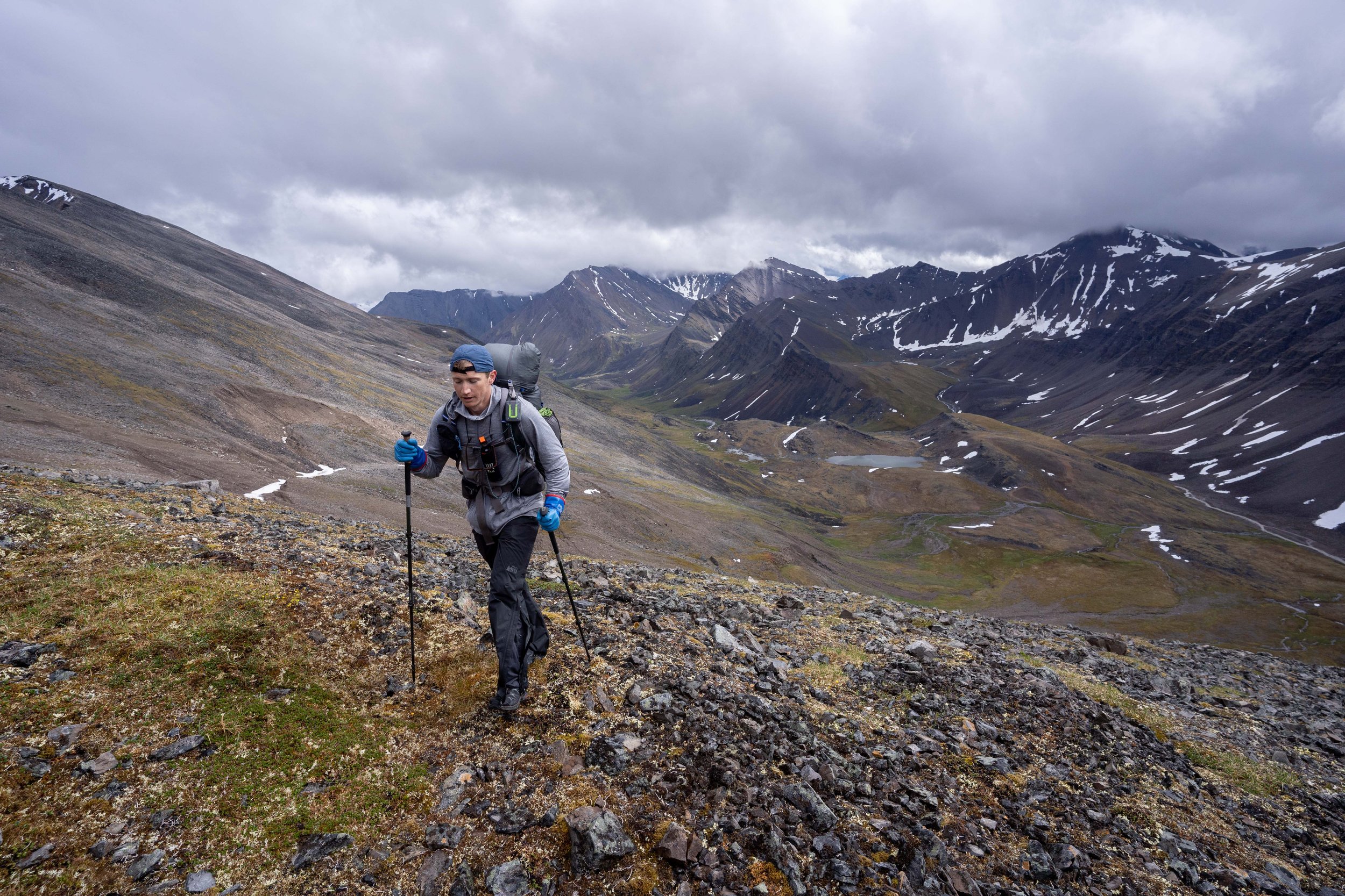
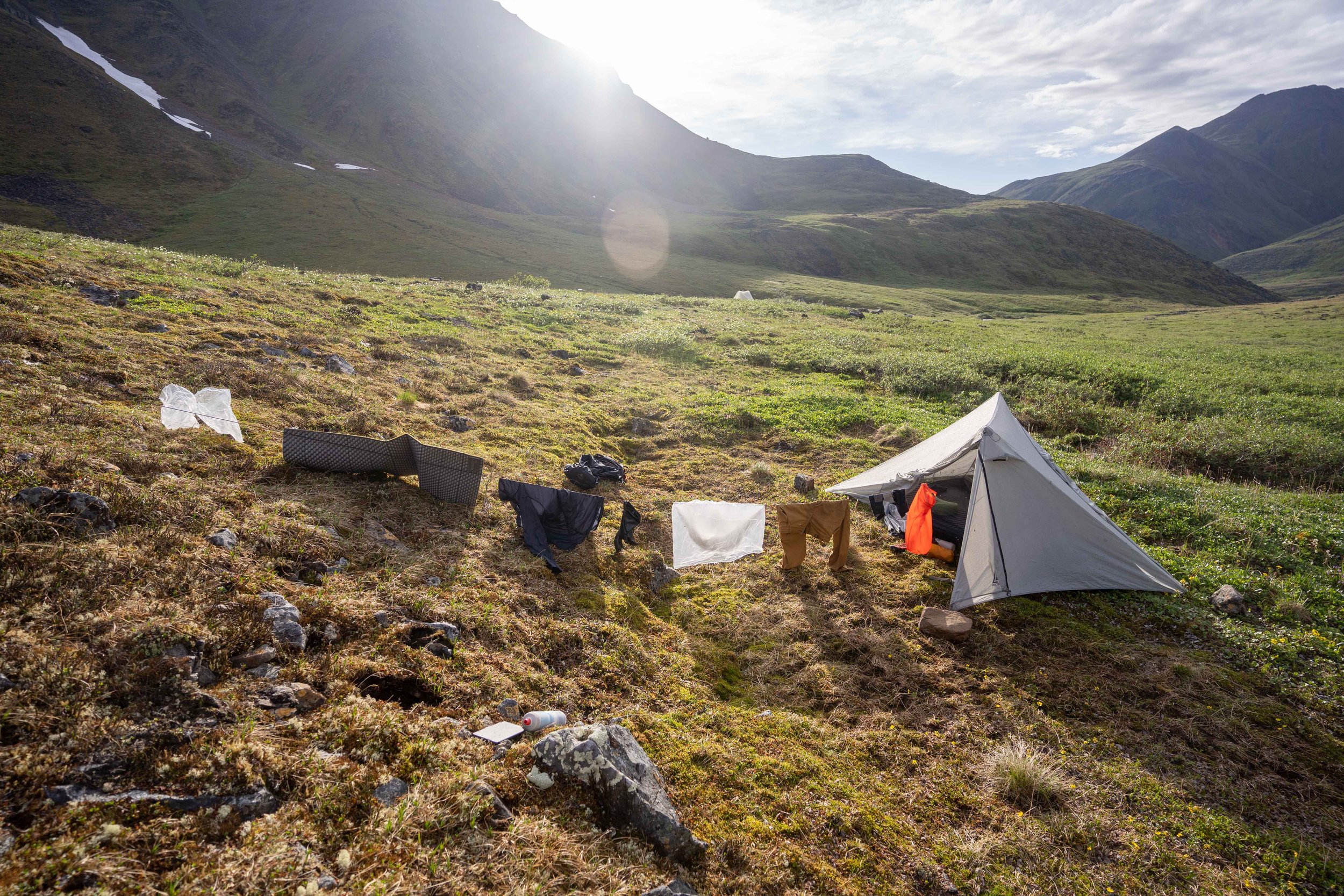
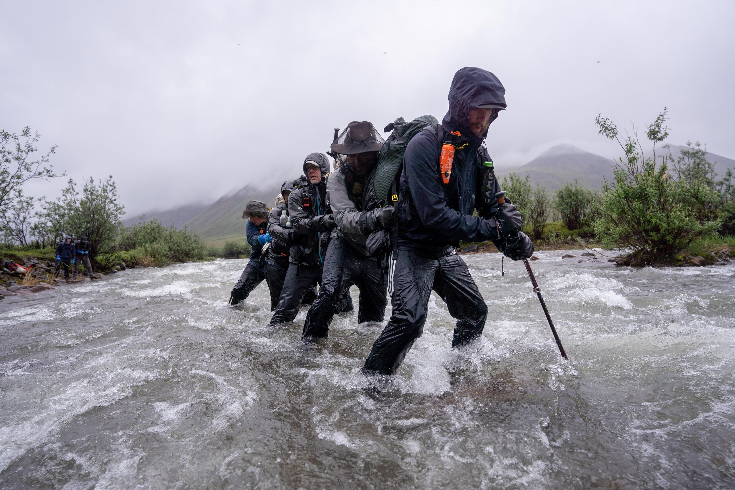
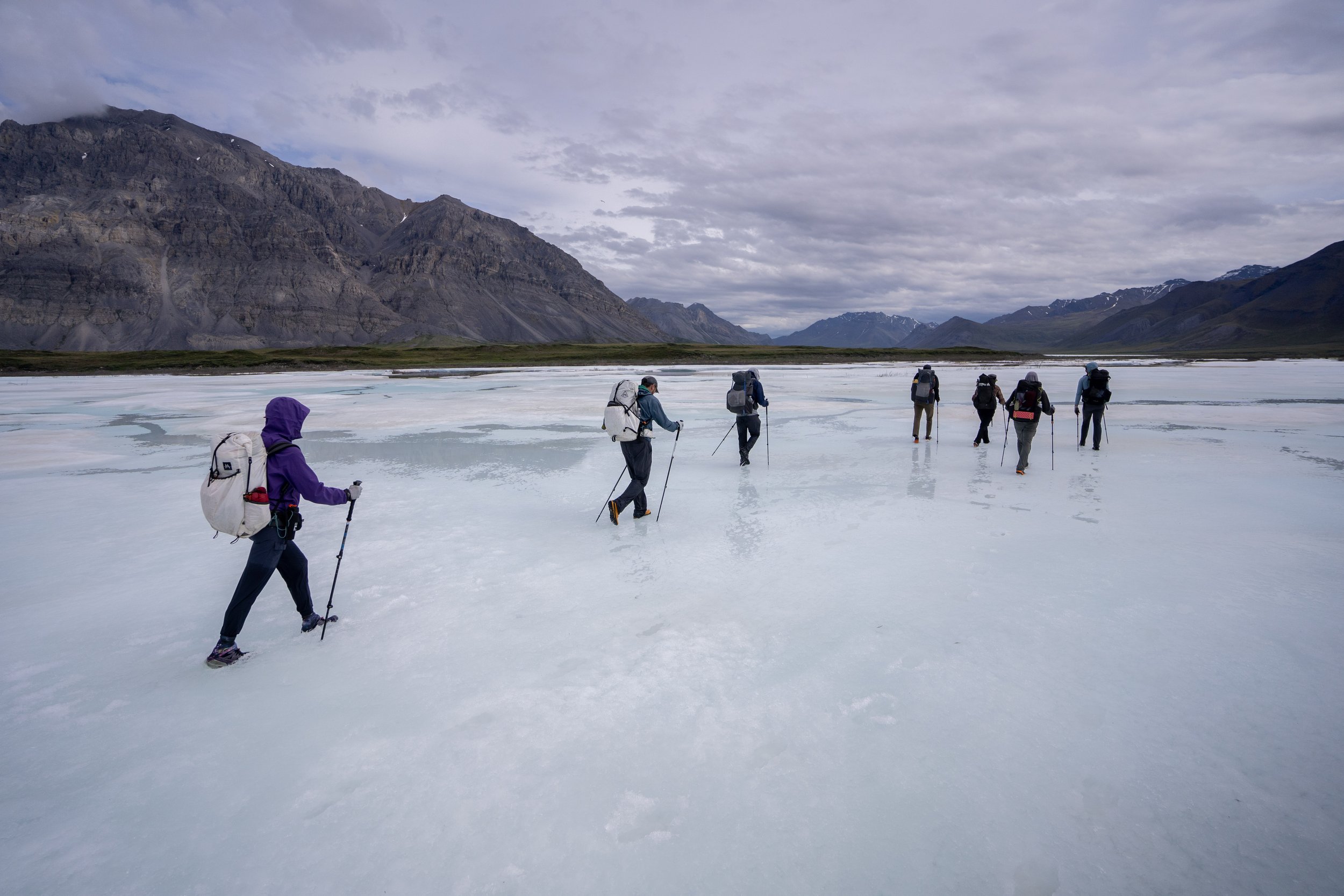
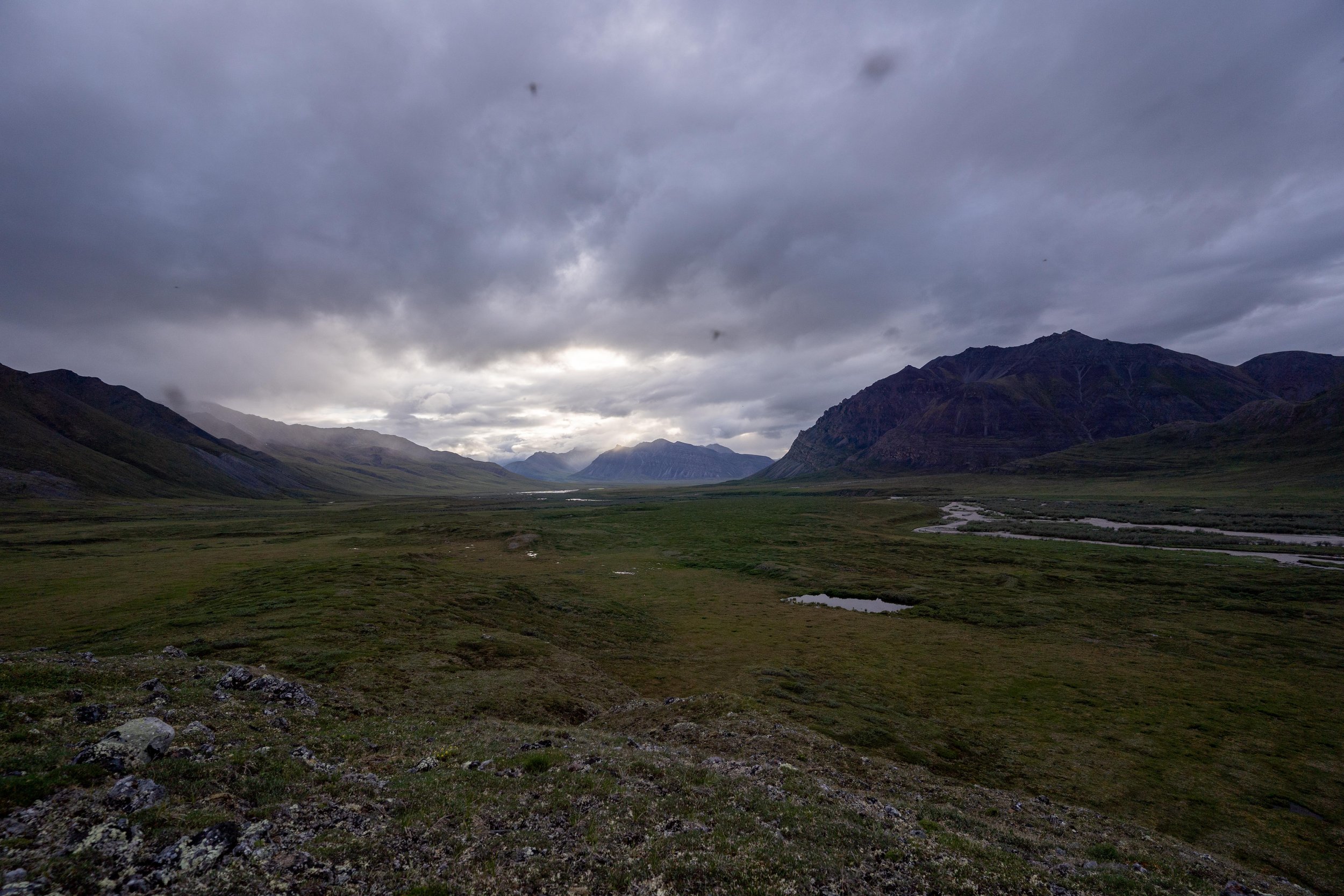
Trip Report - Guiding in Gates of the Arctic National Park in AK - 6/29/23 - 7/9/23
Just finished up with an 11-day guiding for Andrew Skurka Adventures up in Gates of the Arctic National Park. Had a wonderful time despite the cold temps and semi-constant drizzle/storms, and my clients were troopers. Saw a grizzly, caribou, Dall sheep and wolverine and wolf tracks, got to cross some rowdy rivers, and got chomped on by many many mosquitoes. Looking forward to getting back up there! Here are a few photos:
Trip Report - Granite Peak, MT - 8/26-28/22
The last weekend before my second year of grad school, I headed out to climb Granite Peak with Zac and Kate. Due to some weather in the forecast, we climbed via the Huckleberry approach, which required a fair amount more talus but provided a much more sheltered camp. We were thankful for that call when we got walloped by a huge series of storms on summit day and ended up hiding underneath a series of boulders to avoid getting too wrecked! All in all, Granite’s a phenomenal peak and ended up being a great way to kick off a new year of school.
I’m not writing up a full trip report - there’s enough beta out there on this peak - but here are some photos!
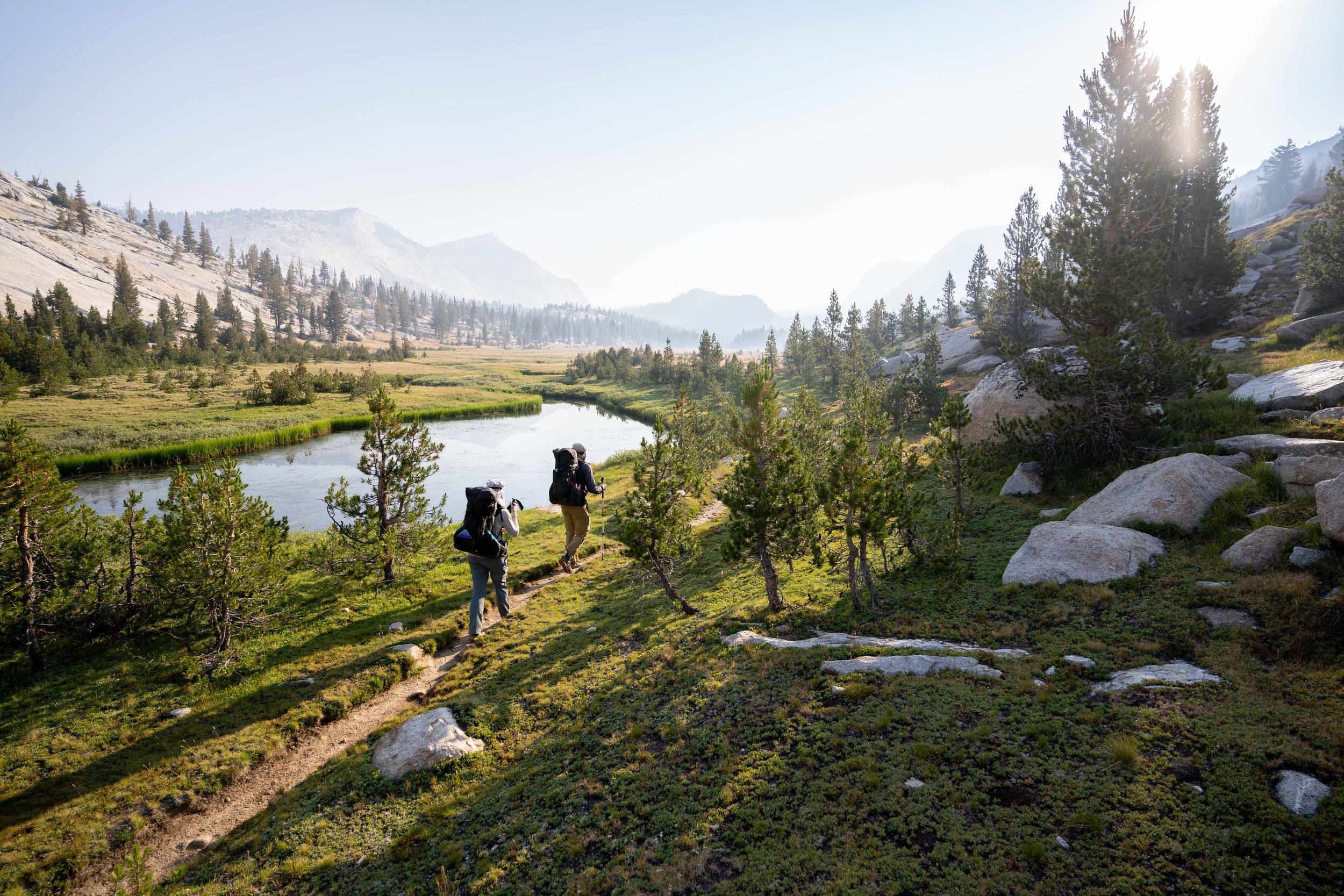
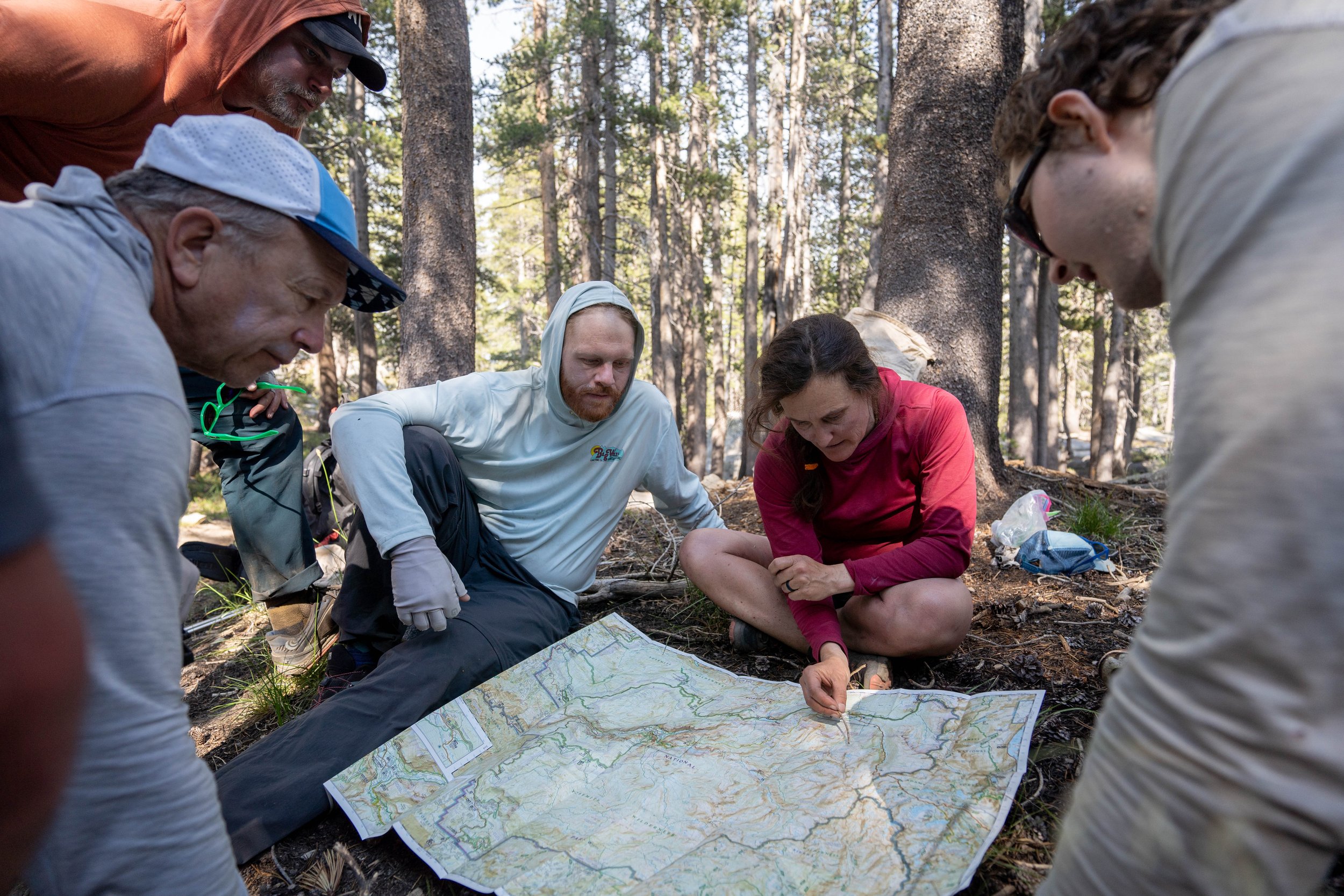
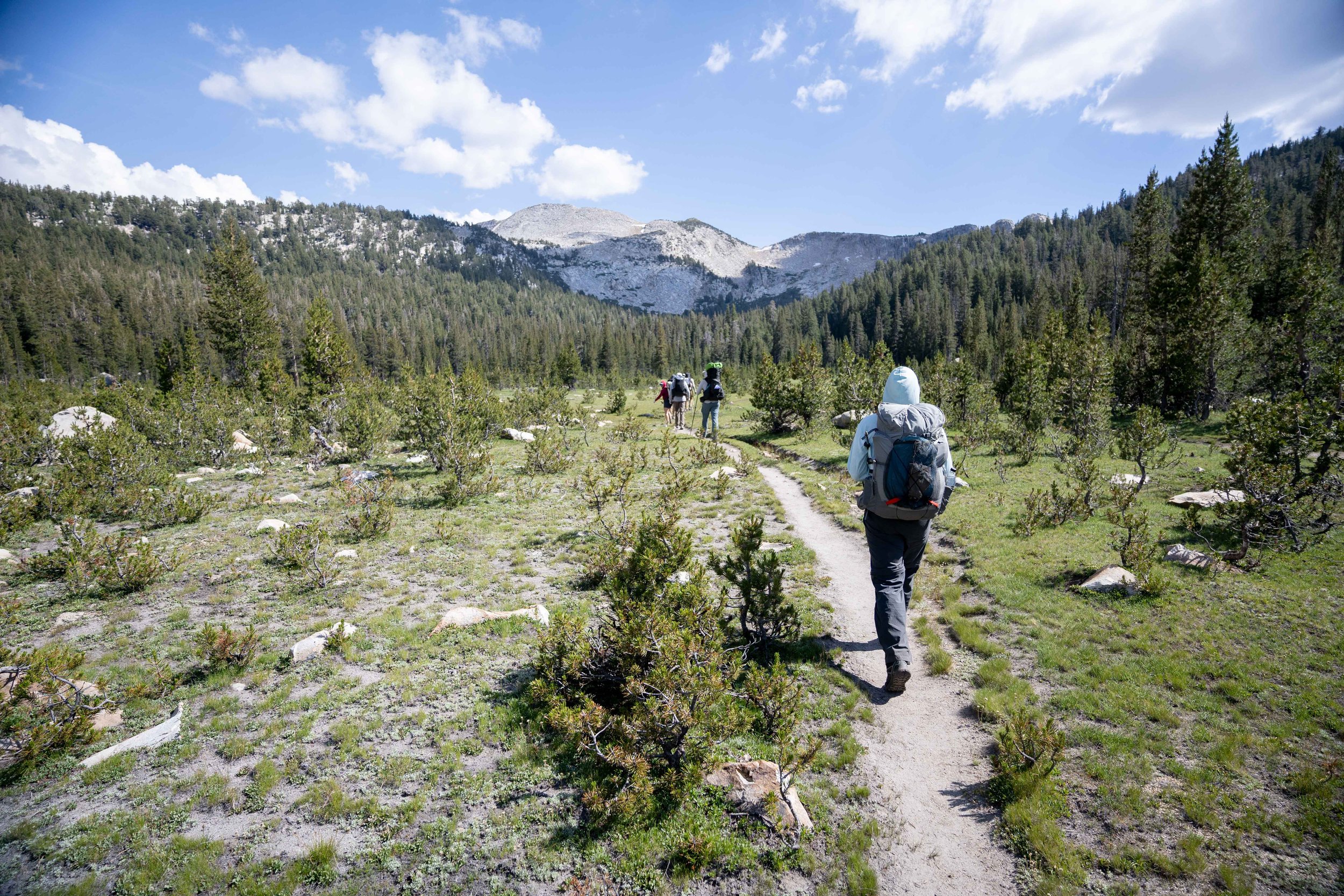
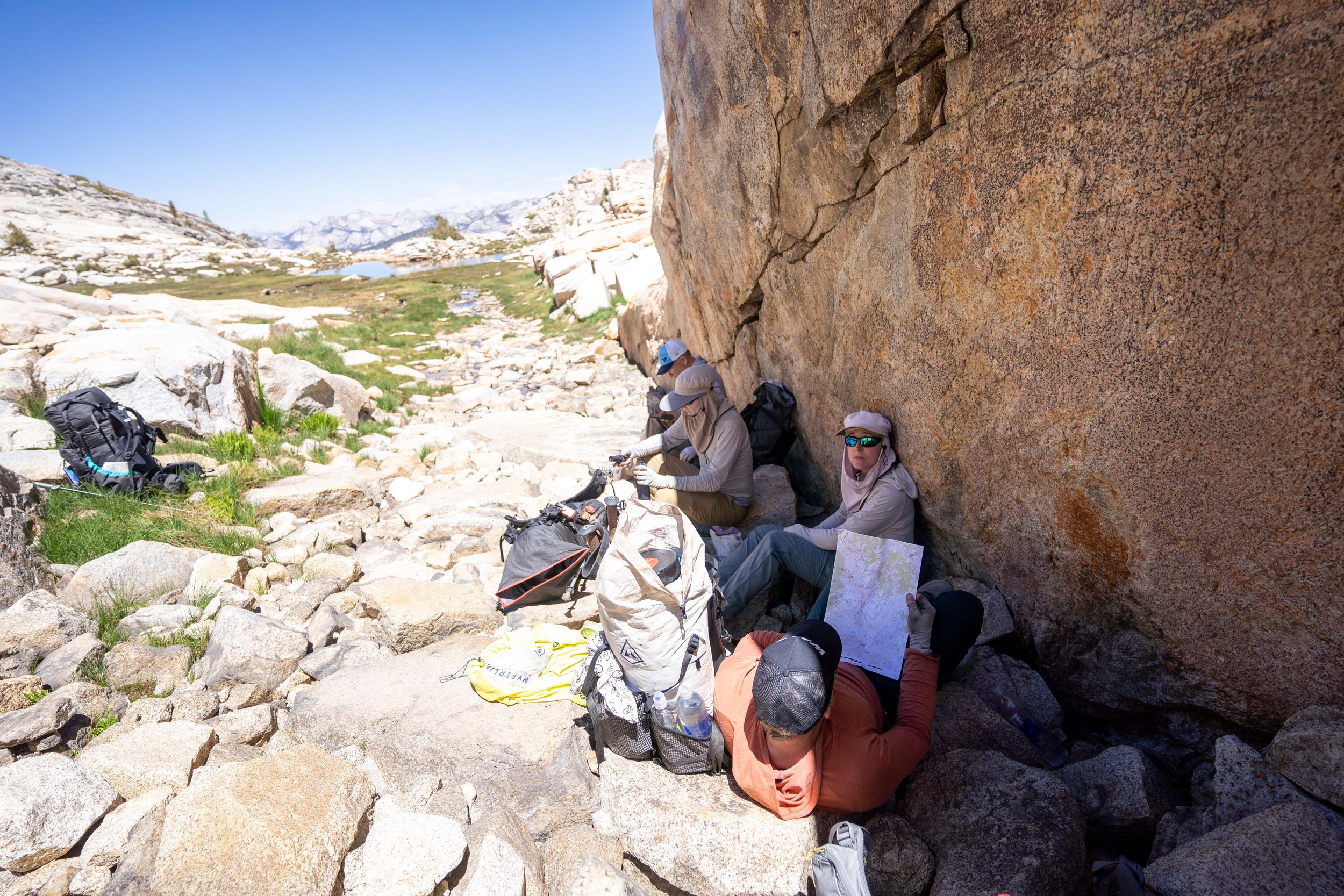
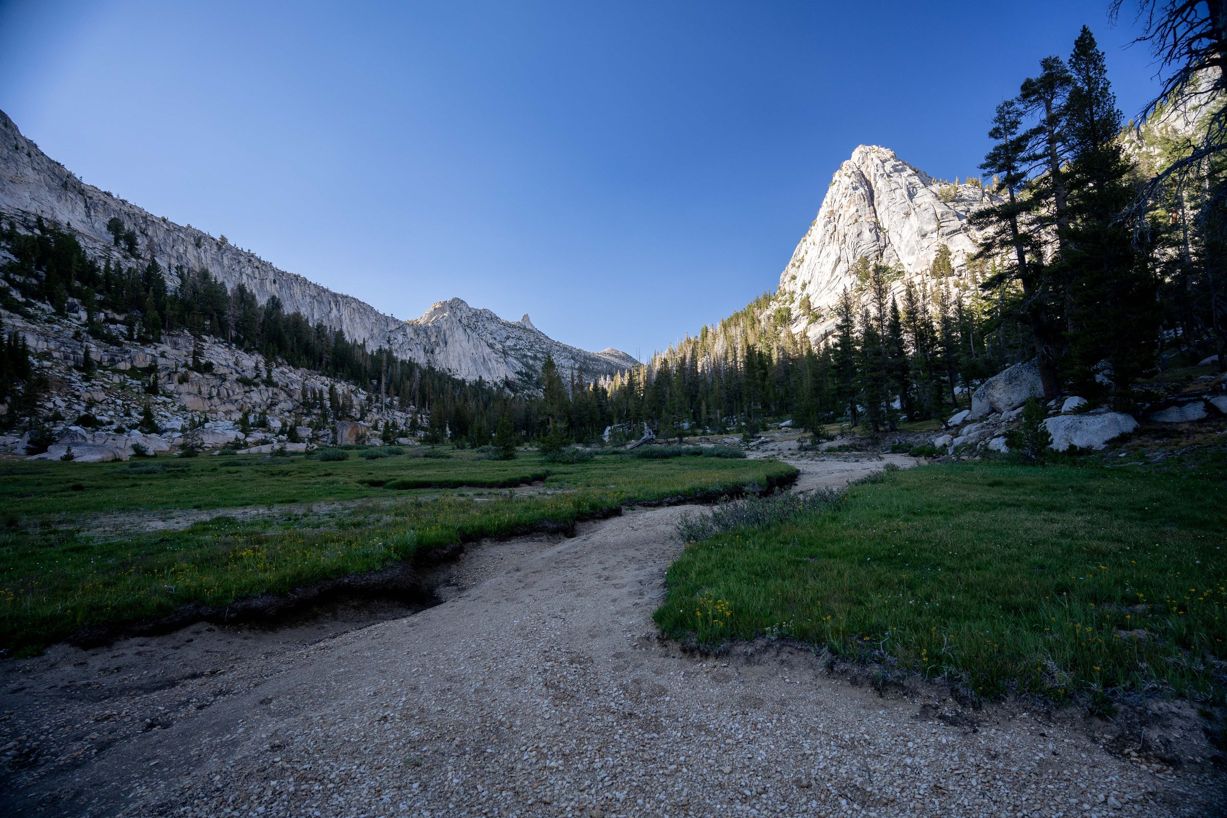
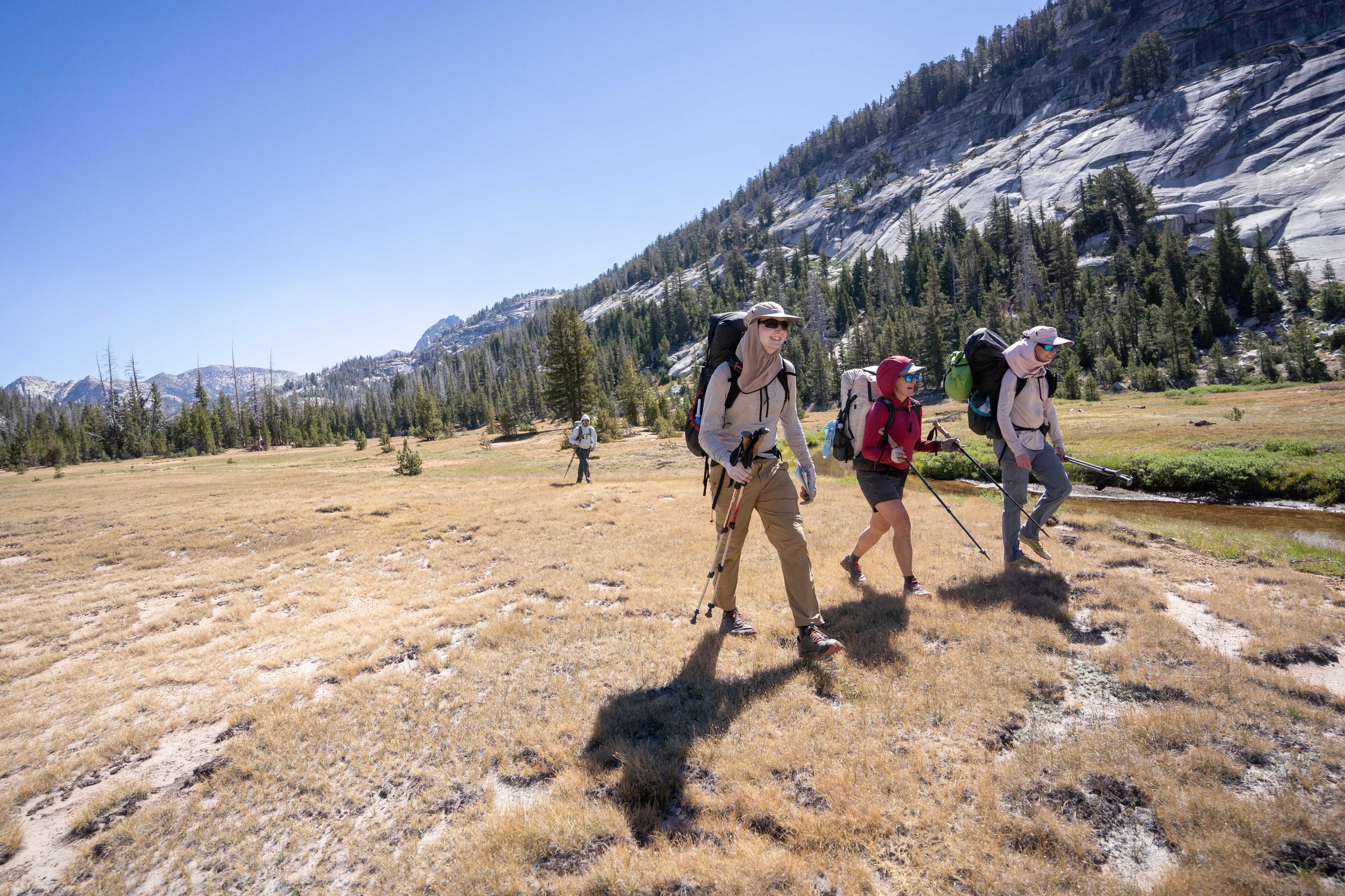
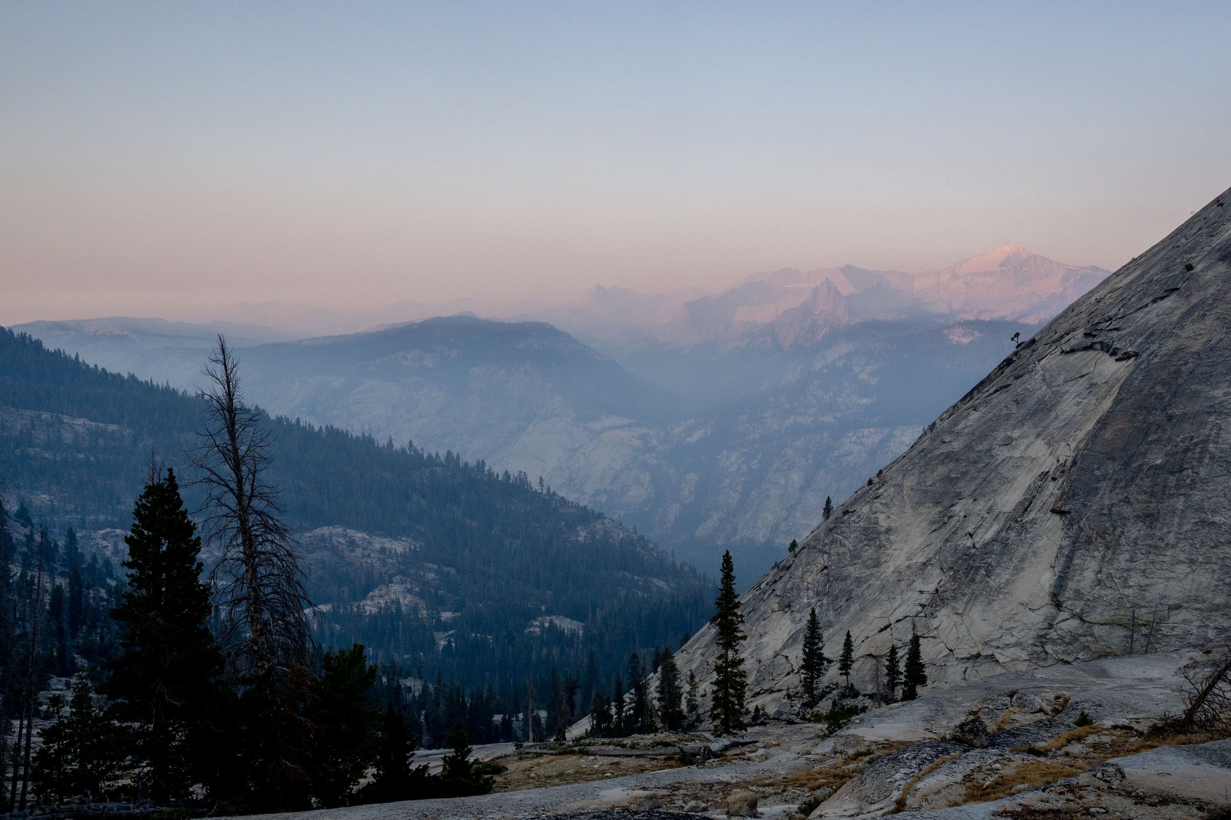
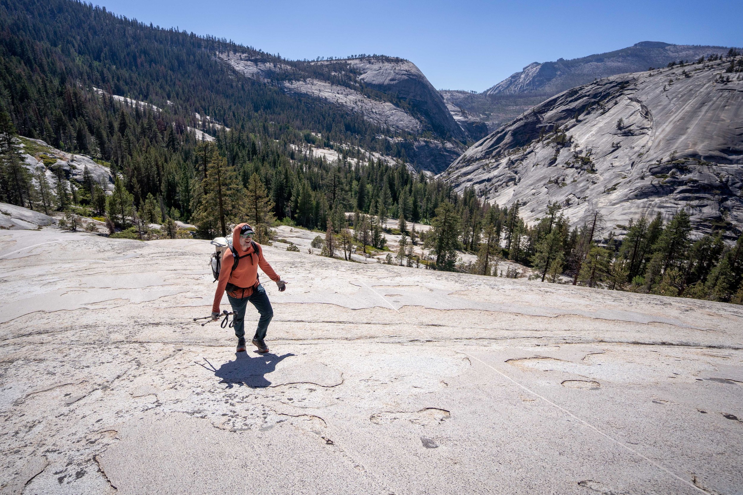
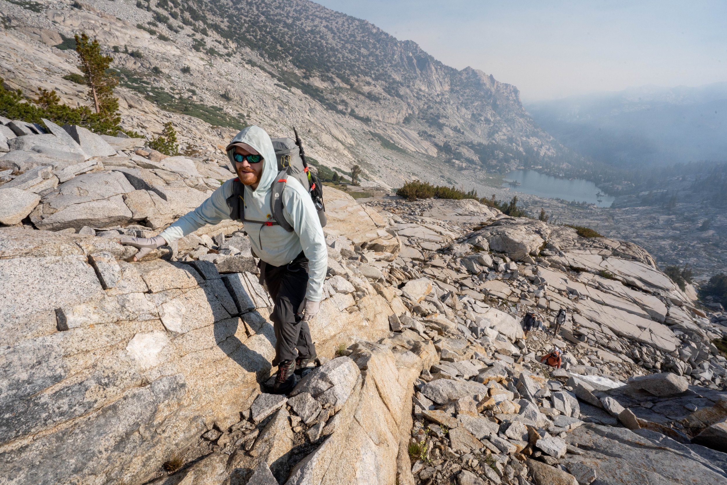
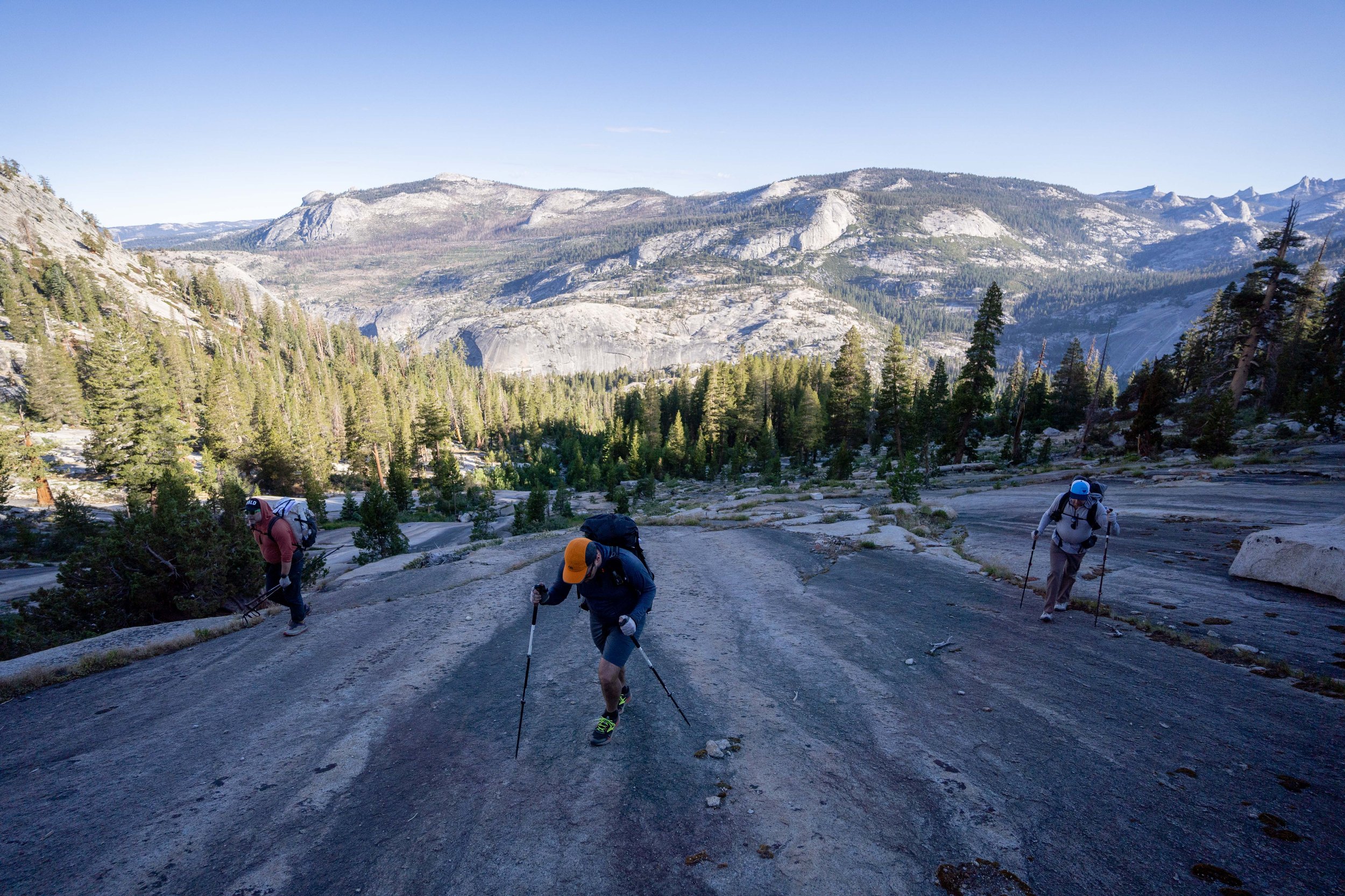
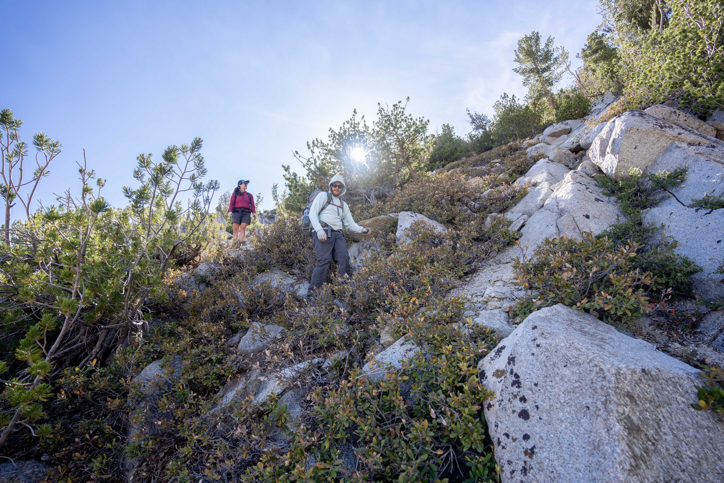
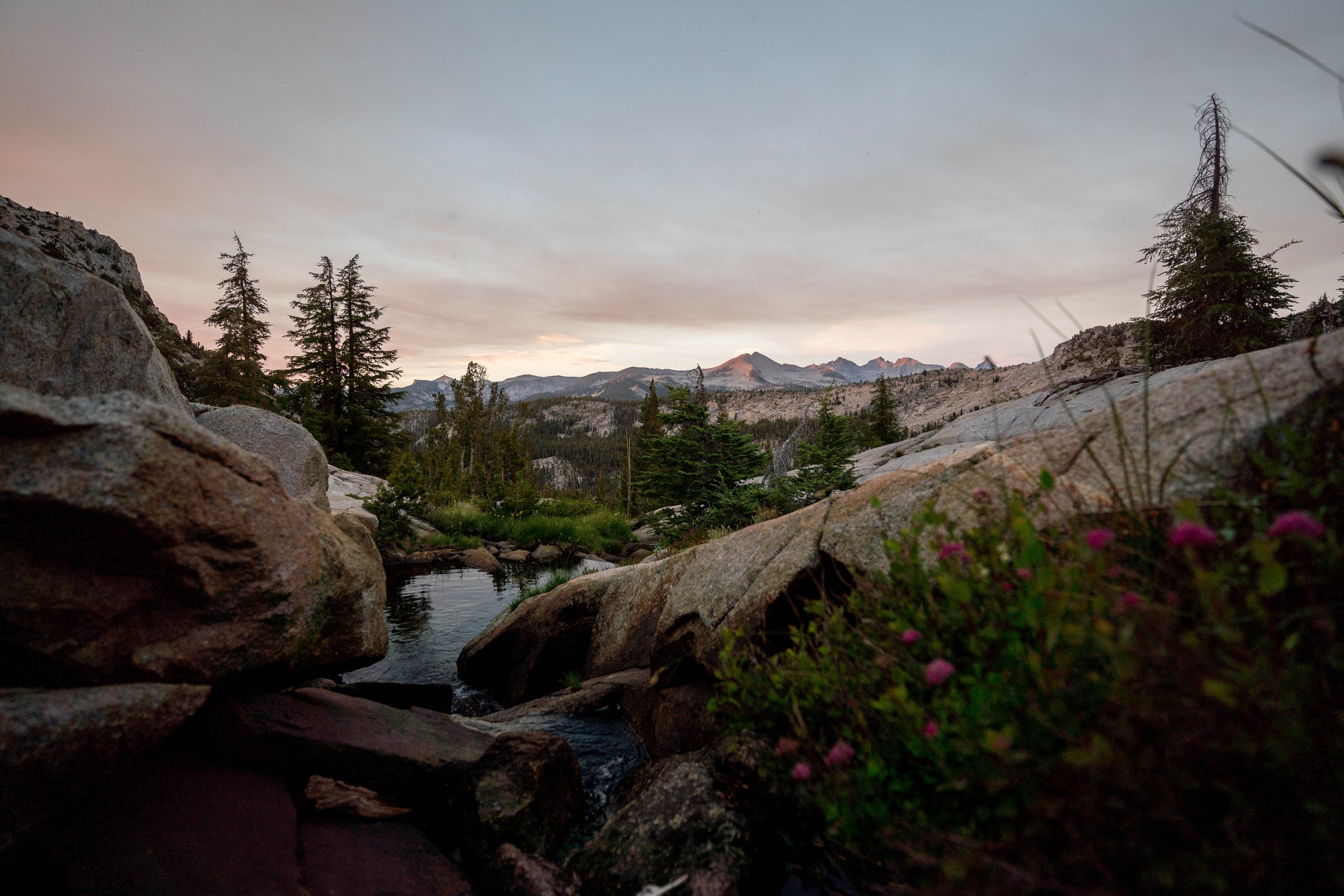
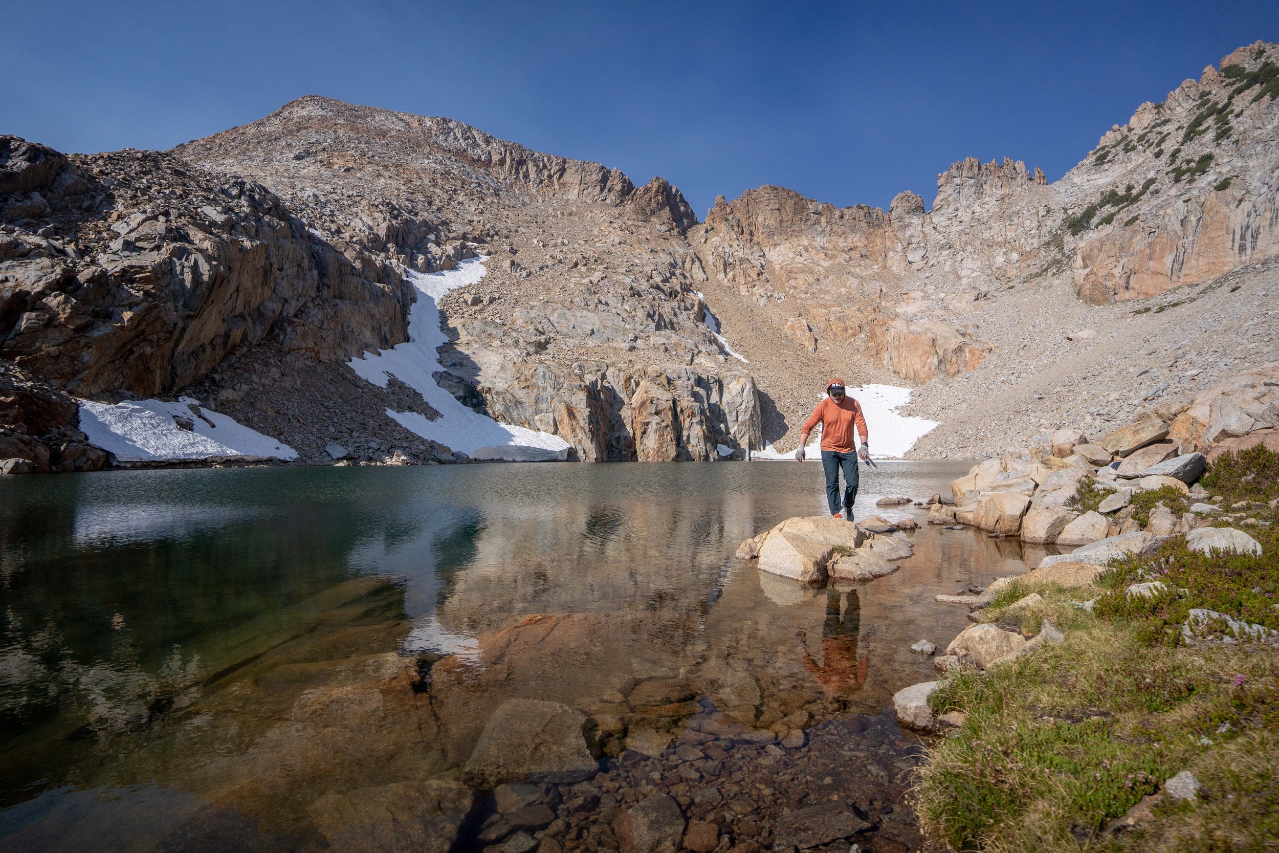
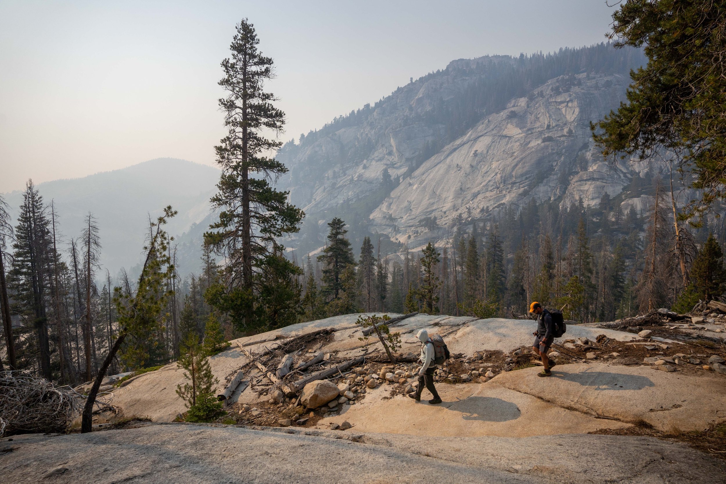
Trip Report - Guiding 6 days on the Southern Yosemite High Route with Andrew Skurka Adventures
After years of reading Andrew Skurka’s blog and making attempts on his high routes, I’m now one of his guides. This was my first trip, and while wildfire smoke forced us to bail off the route early, I had a wonderful time out.
Here are some of my favorite shots from the trip.
Trip Report - Complete Exum Ridge on Grand Teton - 7/2-4/22

Climbing The Grand by the numbers
~7,500’ of gain
around 16 miles traveled
13 pitches of climbing
50 hours spent in the park
30 hours spent moving
Big takeaways from the trip
If the entire party isn’t certain they want to continue, bail! (We had a pretty easy time with our decision to bail, but we watched another group get pretty ugly about it. Not what climbing is supposed to be about.)
Traveling with a party of three is wonderful when everyone’s skillsets complement. I was super thankful to be up there with Zac and Kika, I would have had a very rough time on the crux pitch of the Lower Exum.
Sufferfests don’t have to be bad when everyone keeps laughing the whole way through!
The Trip
On the Friday before the 4th, the forecast showed thunderstorms across all of Montana, Idaho and Washington so Zac, Kika and I decided at 5 pm to drive down to the Tetons and see if we could get a permit for the Grand. 12 hours later we were on our way.
After a six hours drive, we were lucky enough to pull a permit (though I couldn’t find parking at the ranger station). We headed up to Moraine Camp, where we got hit by a thunderstorm thankfully just after getting our pyramid set up.

Slogging up with heavy packs

Kika tries to figure out how to make her cheesy tuna
On Sunday morning, we got moving at 4 am and scrambled up to the base of the Lower Exum.

Trying to figure out exactly where the route is, just as the sun is beginning to come up.
The winds were whipping, but at belays we hunkered down in little nooks until the sun finally got high enough to warm us up.

Zac leading pitch 1
The Lower Exum was burly and definitely took us more time than we’d expected, especially trying to crawl through chimneys and up offwidths with packs full of crampons and ice axes, which we’d been told we would need for the descent.

If you look closely, you can see Zac leading on the left.

Chilly belays even in the sun


Kika leading just right of center!
Once we were on the Upper Exum, the climbing got a lot easier, but we ran into a ton of other parties and got slowed down pretty badly. We scrambled everything we could and roped up for ~6 pitches. I was stoked to lead the Friction Pitch and V-Pitch, both of which were super fun.

The Golden Staircase

Scrambling through the Wind Tunnel

Looking back down the route from just below the V-Pitch
After finishing all the climbing, we made the decision to bail about 100’ short of the summit to make sure we’d have time to descend safely.


We made it back to the lower saddle by sunset and were starting to relax (only had 800’ more to descend) when we saw a sign from the guides saying “a massive landslide took out the standard descent” and that they had put in a separate rappel.
We found the new rappel and lowered onto steep snow in the dark. It would have been a manageable situation with just our group, but three other groups were trying to descend too. We wrangled a mega-rappel (tying multiple ropes together with loops to help pass the knots) and it took 2 hours to get five of us down with all the shenanigans. Shoutout to Kyle and Alexa though for keeping things fun!
Ended up leaving our setup for the next groups to descend and retrieved it the next morning.
With all the nonsense, we got back to camp at just after midnight - 20 hours after beginning. A very long day.

Looking back up at Exum Ridge (the center-right skyline).

Rapping into the dark.

Standing on a snow ledge for hours.
On our third day, we relaxed a bit before hiking out and heading back home! It was hard to leave such a beautiful place after just three days, but I’m so glad we went.


View of the Tetons on the skyline two hours into the drive home!
Trip Report - El Capitan of the Bitterroot - 6/30/22

After learning about Jonathan Marquis’ glacier drawing project - he’s working on visiting and drawing the 60 glaciers of Montana - I knew I wanted to meet him. After contacting him on Instagram, we met up for beers in MIssoula last week and decided to start scheming on trips together. A week later, we were waking up at 4:30 am at a trailhead.
El Capitan of the Bitterroot is an incredible mountain, and one of my favorites that I’ve climbed in Montana so far. 20 miles, 6500’ gain, and a lot of scrappy schwacking/snow/talus travel = everything I like. And I was so thankful to be out with Jonathan - it was fascinating to see how he works and how thoughtfully he portrays scenes. I hope we can get out more.
Trip Report:
After I groggily struggled out of my sleeping bag at 4:30 am, we set off up the trail just after dawn and found a ton of deadfall and trail flooding. We pushed through and made good time up to Little Rock Creek Lake, where I got my first glimpse of El Capitan - an intimidating cliff-covered face with a few snow-filled couloirs on the left flank.

We climbed the leftmost couloir.
We traveled offtrail up to the bench beneath El Capitan, and the couloirs kept looking increasingly intimidating. We headed up to suss things out and the snow was perfect for kicking steps, so we pushed up to the ridge.


From the ridge, we wandered up 1,700’ of talus and snow to the summit tower, which we accessed via a few high exposure moves.


The weather on the summit was perfect, and we hung up there for an hour. Jonathan worked on a sketch and I tried to grapple with the enormity of the view - mountains in all directions, some over one hundred miles away.


Soon enough it was time to descend and we headed back down (without my phone, which I seem to have left on the summit, and didn’t notice till several miles away). Downclimbing the couloir was pretty spicy but once down, we were rewarded with spectacular views and an icy swim in an iceberg-filled alpine lake.

Then we slogged all the way out before crushing a few beers at the trailhead. Another perfect day out.
Trip Report - North Ridge of Canyon Peak (MT) - 6/26/22

There’s not enough out there about this route, it deserves a lot more attention!
I drove out of Missoula early with Zac and Kika on what turned out to be a perfect summer day. Despite a mixup on who was bringing what, we turned out to have enough gear to give it a go.

After a long approach up to Canyon Lake, we got our first big views of Canyon Peak. It looks far away from the dam, but we skirted the north side of the lake and got up to the col, where we transitioned to scrambling gear.

Some unnecessary but aesthetic scrambling.

Getting up there!

The climb itself is straightforward, though it helps if both your partners are super strong climbers. We scrambled up the first few hundred feet on class 3 and 4 terrain before roping up on a doubled up twin and leading two pitches that probably went at 5.4 or so. The route stays near the true north ridge, but wanders left occasionally.

Starting to be pretty airy.

It’s steeper on the other side…
We crested a false summit and unroped, traversing to the summit with huge dropoffs. On the summit, we found a ton of ladybugs up there - there must have been thousands, swarming in piles. I’d never seen anything like it.
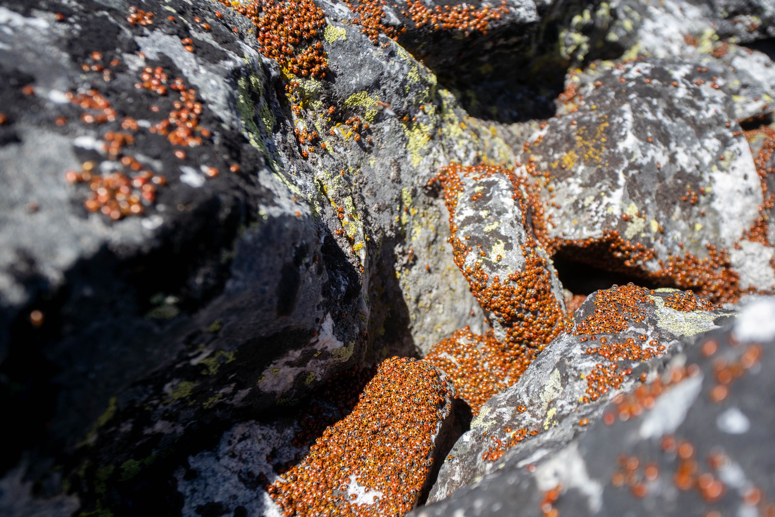
Ladybugs literally everywhere on the summit. Kinda gross honestly.
After an involved rappel/steep snow experience on the south face, we popped through a weakness in the southeast ridge and looped back to Canyon Lake, where we took a dip in the refreshingly chilly water before slogging back out to the car.

A perfect (but very long) day!
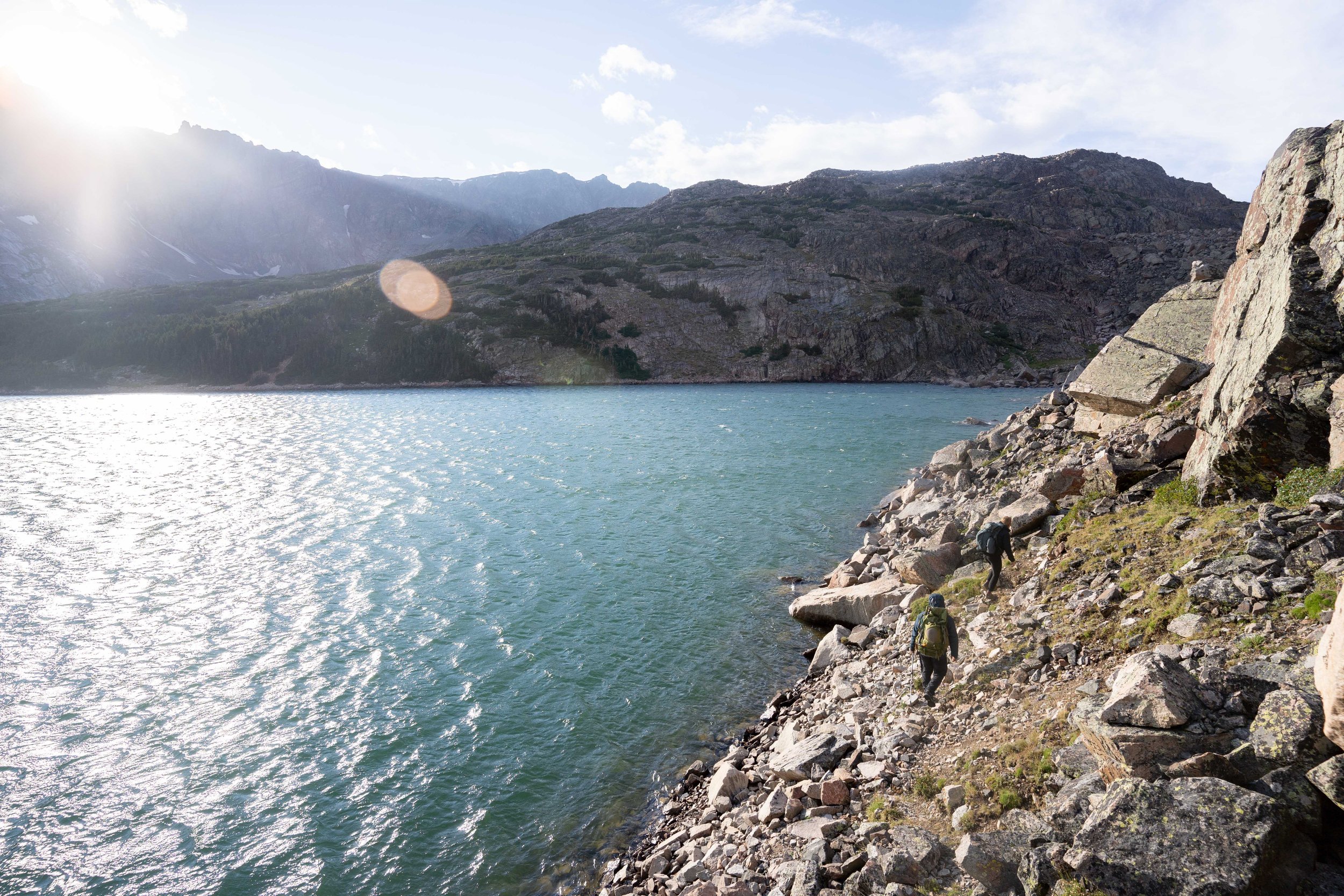
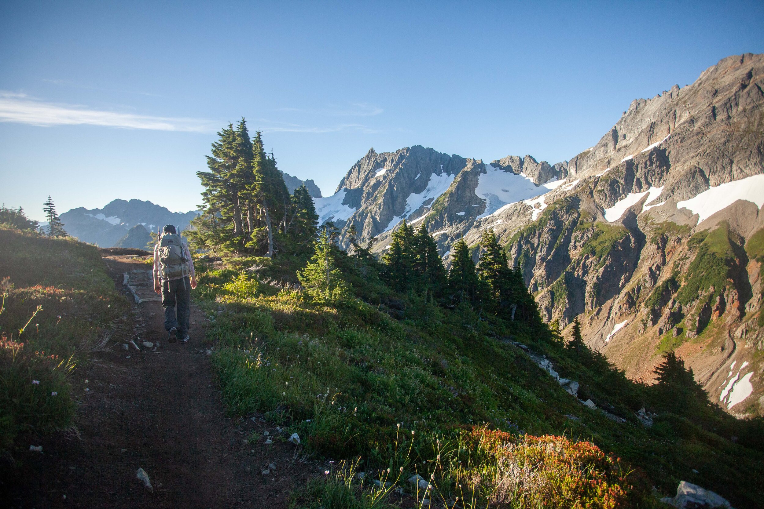
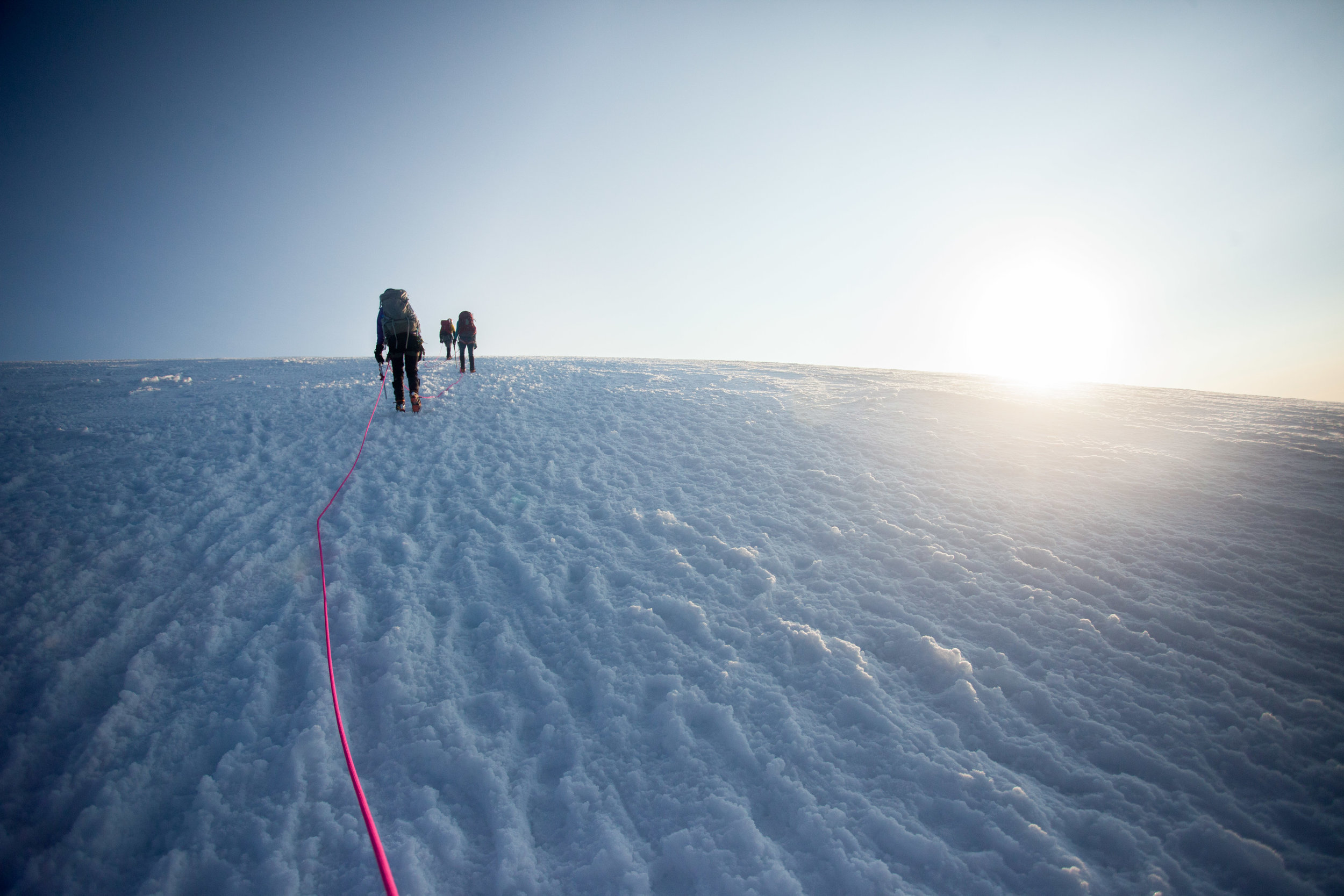
Trip Report - Royal Basin Ski Trip - 5/29/21 - 6/1/21

Skiing Surprise Basin
Robby and I had spent months planning to ski the classic Isolation Traverse in late May, but a single storm dumped 1.5” of water equivalent just a day before we were planning to begin. After many many hours of deliberation, we bailed on that plan and found ourselves in Royal Basin on the Olympic Peninsula. It ended up being an incredible trip, despite having been pretty slapdash.
Over 5 days, we
stayed a night at Robby’s family cabin on the east side of the Olympics
lugged our gear up to Royal Basin
skied the steep Northeast Couloir of Mount Deception
skied Surprise Basin beneath the Needles
skied an unnamed 7,000’ peak
ate a bunch of freeze-dried chocolate cheesecake
I’m not going to write up a full report on the trip, but I wanted to post some photos, as well as a short photostory. First, the photostory -
Skiing the Northeast Couloir of Mount Deception
Robby and I have skied some bigger lines together, but the Northeast Couloir of Mount Deception turned out to be the steepest and gnarliest that either of us have skied so far and the crusty/heavy snow didn’t help. Here’s a small collection of photos showing how that went.
Looking up at the line from camp the evening before our attempt.
Hoping the line gets less steep as we get closer (it doesn’t).
Alpenglow on the line (the narrow couloir up to the right)
Midway up.
Topping out the line
Dropping in
Very wet + catchy snow made the descent a bit sketchy
Rocketing out of the sluff-scarred couloir and onto the lower slopes
Some good turns on sluff bed-surface
All smiles after skiing the line
A couple more photos from the trip:
Full pack fear
And finally, a few photos from Robby’s cabin:
Vibrant colors on the Olympic Peninsula (minimally edited, it’s just remarkably vivid out there)
Power Pose
Reflecting on my 2020 Elevation Goals

Descending down to the still-frozen Yang Yang Lakes on day 1 of the Ptarmigan Traverse
In late December 2019, I found myself looking over my exercise/outdoor statistics. In May 2019, I’d gotten a Garmin fitness watch, and for the first time ever, I could really quantify my outdoor time. I could see, for instance, that in 2019 (from May to December), I had covered 1,100 miles (many of these bike commuting), spent 422 hours exercising, and had climbed up 160,000 ft.
After years of having trouble being deliberate about exercising, I’d finally done some serious work in 2019. To motivate myself to keep training, I set a goal.
I wanted to climb at least 365,000’ during 2020, averaging 1,000’ per day.
I wasn’t sure this goal was possible, but I figured I’d see what happened.
Why did I choose elevation as my primary goal? I love climbing up mountains, whether it’s trail running, mountaineering, rock climbing, or anything else. I love getting to the top of things. And I had some big goals for 2020. I wanted to summit Mount Rainier for the first time, and I ideally wanted to finish climbing the five volcanoes in Washington State. By the end of 2019, I’d already climbed Mt. St. Helens (in winter via Worm Flows) and Mt. Baker (via Easton), but the remaining three (Rainier, Glacier, and Adams) seemed like a huge push to finish in a season, considering it’d taken me years to do the first two. So I set my elevation goal, assuming that if I was on track to climb 365,000’ in a year, I’d probably be fit enough to get the volcanoes done. All I’d have to worry about was having the gear, partners, and the know-how.

2020 WA Heatmap. Lots of running in the Seattle area, lots of trips in the I-90 Corridor
Winter 2020
So on January 1st, I began meticulously logging my exercise. Every week, I logged my weekly hours exercised (by activity), my miles, and my elevation.
The year started out slowly, and for the first few weeks I was only logging a few thousand ft per week - nothing compared to the 7,000’ per week I’d need. But by the end of January and through February, I was skiing and trail running enough to hit my numbers. I even got to ski some couloirs I’d never imagined were possible for me. Becky and I also climbed Mt St Helens for my second time (12 miles, 5,800’).
From the alpine (Mt St Helens)
to endless stair walks around Seattle
Then COVID-19 hit, Seattle instituted a shelter-in-place, and all the public lands in Washington State closed. I could no longer go out and easily do a 4,000’ trail run. Instead, I could only run circles around my neighborhood. On these runs, I remembered that Seattle is super hilly, and I could link up staircases to get in big days of vert. Becky, Marc, and I did 3 big loops over the next few weeks (Queen Anne Loop - 18.4 miles and 4500’ of gain; Madrona Leschi Loop - 17.7 miles and 4,200’ of gain; and the Fremont Loop - 11.2 miles and 1,700’ of gain). But even these trips didn’t have enough gain to keep me on track unless I did them multiple times, which I wasn’t willing to do - too much pavement made my feet and knees hurt.
Spring
In late April, for my birthday, I decided to do a fitness benchmark, and planned a day where I’d lap the same hill in a Discovery Park (a nearby city park) until I’d climbed 10,000’. It took 11:55 hrs, and I was joined by Marc for the full thing, and Robby and Becky for smaller portions of the trip. This got my confidence up - I could already do a 10,000’ day if I was willing to slog it out. I figured this meant I could probably summit the volcanoes with a standard pack. Now all I needed to do was keep my strength up and wait for the shelter-in-place to end.

Look at all those laps - we did 33 laps on a half-mile long hill climb

Marc and I refuelling midway through the long ridiculous day
In early May, the restrictions began to ease, and I began getting out a lot more. Becky and I did a ridiculously windy two-night snow camping trip with unbelievable views.

I was trail running at least once a week, and climbing peaks almost every weekend. I churned through objectives, from skiing Lichtenberg Peak with Marc, to finally climbing the Brothers with Marc (a prominent peak on the western skyline from Seattle), to climbing Flyboys again with Marc (a 5.9 18 pitch sport climbing route). In mid-June, I benchmarked my fitness again by climbing two I-90 peaks - Granite and McClellan Butte - back to back, for a total of 19.8 miles, 8,200’ of gain, finished up in 8 hours. I knew I was fitter than I’d ever been, but I was still 3 weeks behind my elevation goal for the year, and I wasn’t sure it was going to be possible.

About to ski Lichtenberg

Descending off the Brothers
Summer
Then the glorious summer of 2020 truly began. I realize that summer 2020 was difficult for everyone - myself included, as I was laid off from my long-time job at REI in mid-July - and I don’t mean to minimize any of the difficulties that anyone faced. But as an alpinist, I had a perfect summer. For 14 weeks straight, I averaged 12,000’ per week. One week I even did 17,000’, thanks to Glacier Peak + Forbidden. And while my body felt somewhat beat up all the time, I didn’t have any injuries, which feels pretty incredible.
Some of the highlights:
Week 24 - Skied the SW Chutes of Adams with Marc on the Summer Solstice in a day (8,500’ of gain, 1 day)
Week 25 - Completed the Ptarmigan Traverse with Robby over 4 days and almost summited Dome Peak before we were weathered off (44 miles, 14,000’ over 4 days)
Week 26 - Solo trail-running linkup of Mt Hinman and Mt Daniel via the Waptus Lake, base camping with Deb (27 miles, 9,500’ of gain, 1 day)
Week 28/29 - Climbed Mount Rainier via the Kautz route and descended the Disappointment Cleaver route (18.5 miles, 9,800’ of gain, 3 days)
Week 30 - Climbed Mount Rainier via the Emmons route(20 miles, 10,800’ of gain, 3 days)
Week 31 - Climbed the NW Corner of North Early Winter Spire - trad 5.9, 4 pitches (5.5 miles, 2,100, 1 day)
Week 33 - Solo trail ran the Devil’s Dome Loop in a day (42.6 miles, 11,000’ of gain, 1 day)
Also Week 33 - Climbed Mount Sahale with Becky (14 miles, 5,200’, 1 day)
Week 35 - Climbed Glacier Peak in one day and bivvied on the summit of my final WA volcano, then descended the next day (37 miles, 11,800’, 2 days)
Also Week 35 - Climbed Mount Forbidden via the 5.7 West Ridge (8.5 miles, 5,500', 2 days)
Week 36 - Partially off-trail backpacking trip to Butterfly Cirque, Louis Creek Valley, and Spider Gap (52 miles, 15,000’ of gain, 4 days)
Fall
Before I knew it, it was mid-September. The summer was done. Becky and I made plans to go east for part of the fall, and visited Yellowstone and the Tetons on the drive out, where we hiked Paintbrush to Cascade Canyon Loop in the Tetons (20.4 miles, 4,700’).

Becky descending from Paintbrush Pass
When Becky and I arrived in Maine, the fall was well on its way, and we lived in a beautiful cabin by a lake for a month.
While we were there, we were able to do some gnarly trips in the White Mountains:
Hiked Pemi Loop in a Day w/ Becky (30.5 miles, 10,600’) - Week 40
Hiked Northern Presidentials Loop w/ Becky (17.6 miles, 7,900’) - Week 42
Hiked a snowy Southern Presidentials Loop w/ Becky, Toby, and Smythe (10.2 miles, 4000’) - Week 43
Then we headed back west to Seattle when tragedy struck and my poor car blew a headgasket. We managed to limp home, but we had no way to get to the mountains. So I spent several weeks trying to get any gains at all in the city. Becky and I got out twice, borrowed Marc’s car, and climbed Mount Dickerman (8 miles, 3,900’) and Mount Hood via the Old Chute (7 miles, 5,300’) but otherwise, those weeks were pretty slow. I resorted to running stairs again to try to meet my weekly goals.
Descending off Dickerman
Climbing up the Hogsback on Hood
Back to Winter
The end of the year was creeping up, and I was around 10,000’ short. So in Week 52, only days before the end of the year, I borrowed another car and headed out to do the Issy 50k - an informal 50k that summits four peaks in the North Bend area and runs the trails between them, climbing 13,500’ over 13:55 hrs. I surpassed 365,000’ for the year a third of the way through the route, and ended up well over my goal. Suddenly I was done!

View from the summit of Teneriffe (the second of four summits of the day) with Rainier visible on the horizon
Final Stats of 2020
1,421 miles hiked, run, or skied
731:52 hours of exercise
380,620’ of gain
Exercised 241/365 days
Longest Distance in a Day = 42.6 miles on Solo Devil’s Dome Loop (11,000’ of gain, 14hrs55m)
Most Gain in a Day = 13,500’ on the Issy Alps 50k (32.83 miles, 13h56m)
Most Hours Moving Consecutively = 19h55m on Pemi Loop in a Day w/ Becky (30.5 miles, 10,600’ of gain)
Elevation per month (Blue line = 2019, Black Line = 2020, Green Line = 2021)
Partners
This goal wouldn’t have been possible without my spectacular partners! This year wasn’t a year to find new partners, but I was lucky enough to already have a solid group of people who were willing to go on ridiculous trips. I’m counting a partner as anyone who did an exercise with me that gained more than a few hundred feet.
Here are the partners I got out with 5 or more times:

Becky - 45 days out
I’m endlessly impressed by Becky’s stoke and ability to pick up new skills so quickly. And I’m somewhat bewildered about why she’s still willing to go on trips with me when so many turn into sufferfests. But I’m also so grateful that she’s willing, because this year, we got out on so many incredible trips, including 5 nights spent winter camping, summiting Rainier via the Emmons, climbing Sahale, and a series of ridiculous trips in the Whites including one 19h55m day of hiking, plus many more. (For those who don’t know us, Becky is my outdoors and romantic partner).

Cooking a feast before attempting Adams the next day
Marc - 17 days out
This number feels low to me, but since our trips were almost always heinously intense long days out, I think that accounts for the disparity. Marc is the reason why I’m a mountaineer - when I moved to Seattle, he first opened my eyes to mountaineering, climbed my first volcano w/ me (Helens), and since then, has been a wonderful adventure partner. We’ve workshopped so many skills together and I am hugely grateful to him. This year we skied Adams, climbed the Brothers, Rainier, and Glacier, did Flyboys, and ticked off so many of my bucket-list trips.

In the horribly brushy Bachelor Creek drainage
Robby - 9 days out
One of Robby and my first days out together was in October 2011, when he told me he could teach me to lead sport. Halfway up the pitch, as he yelled confusing instructions, I realized he was not a good teacher. But I survived, and we’ve been pushing the boundaries of what a “fun trip” is ever since. From floating on pool-toys down rivers in Utah to a 28 day Grand Canyon trip, we’ve spent a lot of incredible time adventuring together. This summer, we completed the Ptarmigan Traverse and climbed Forbidden via the West Ridge, both of which were big objectives that we couldn’t have done even a few years ago. I’m really thankful that we’ve been able to keep improving our skills and getting out together for so many years!

Deb and her adventure van Wes
Mommabear/Deb - 7 days out
My mother is the reason I love the outdoors. Ever since I was born, we’ve been going on hikes, then escalating to backpacking, then climbing trips, and now she’s even been on a few alpine trips! I’m hugely inspired by her independence and willingness to push herself in the outdoors, and I was fortunate enough to be able to go on some short trips with her this year, including a beautiful trip out to Waptus Lake.

Toby, looking a little rowdy after having been up for an ungodly number of hours
Toby - 5 days out
When in 2018, Marc first told me we were going to go skiing with his brother-in-law, I assumed Toby would be a gumbie. Which he was, because he was splitboarding at that time (though he’s since reformed). And to be clear, I shouldn’t have been judging, because I was also a gumbie back then. But since that first trip, I quickly realized that Toby is a phenomenal partner whose capacity for happy suffering is as high as my own. He moved to Germany a few years ago, and now lives in the Northeast, but happened to be in Seattle for a week this summer, so Becky and I managed to summit Rainier via the Emmons route with him! Who knows when or what we’ll climb together next, but I’m looking forward to it!
My sun+wind-blasted face after 4 days on the Ptarmigan looking vaguely sad/worried about how tired I am
Did I learn anything from this ridiculous goal?
Having a goal definitely inspired me to exercise more regularly than I’ve ever exercised before.
While I worked as an Americorps member for much of the year, I only worked 4 days a week during that time, which gave me 3 days a week to go on adventures. And being laid off by REI in July gave me even more free time. I wish that my finances had been a bit more secure, but I’m so thankful that I was able to do so much this year.
My biggest issue through the summer was a lack of solid nutrition - I didn’t know how to get enough food in my body to fuel how hard I was going. I was burning thousands of calories per day, and I’m still not totally sure how to fuel for that.
I also could have been more proactive with preventative strengthening in the spring, though I was lucky enough to avoid any real injuries. I’m currently working on preventative strengthening for 2021.
Vertical gain is an illusion.
Goals for 2021
Try to do more vert than last year.
Do a 60+ mile day. Ideally 100 miles, though this might be dumb.
Do more than 20,000’ of gain in a single push (it’s ok if it takes more than 24 hrs).

Shark Fin Camp on Rainier
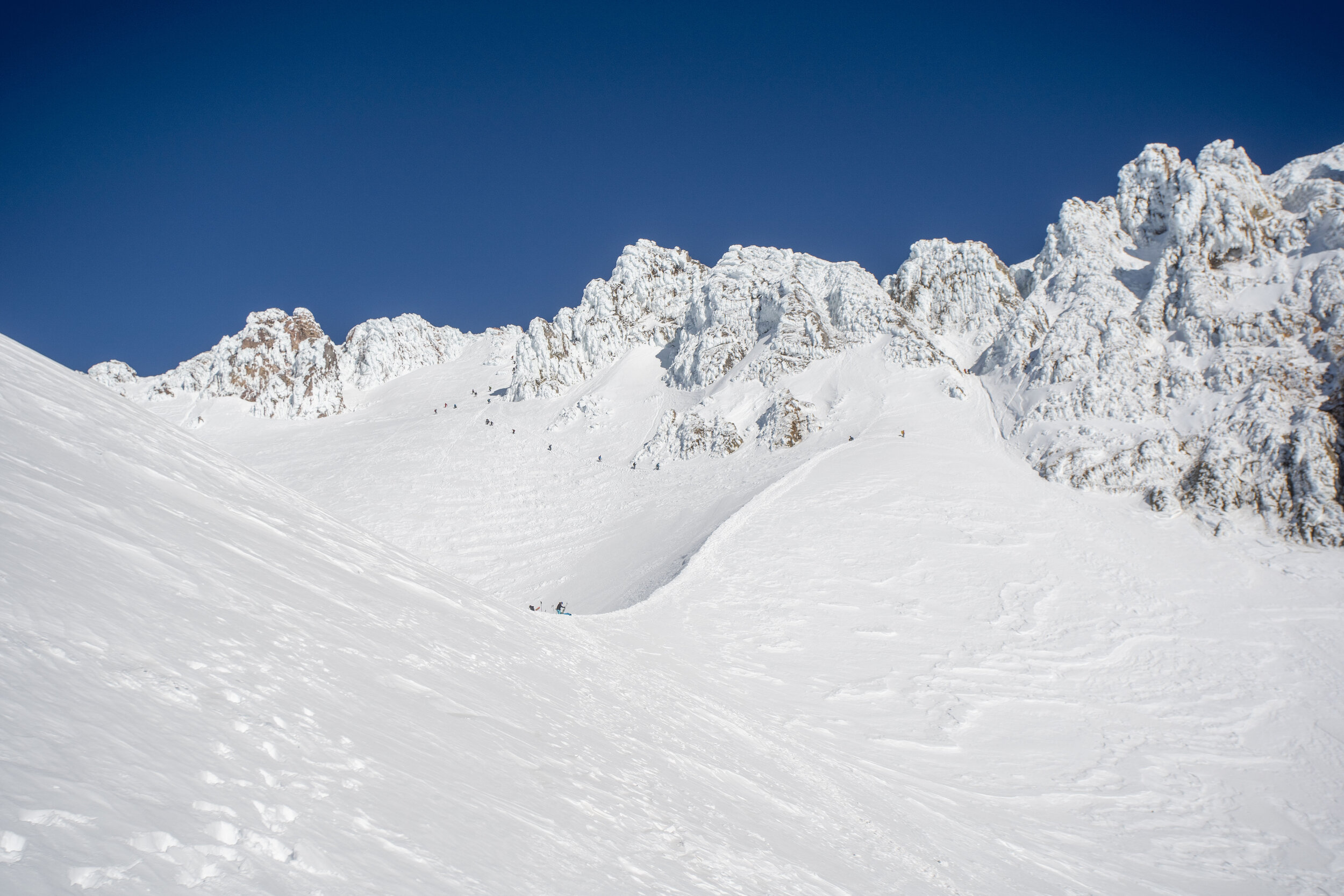
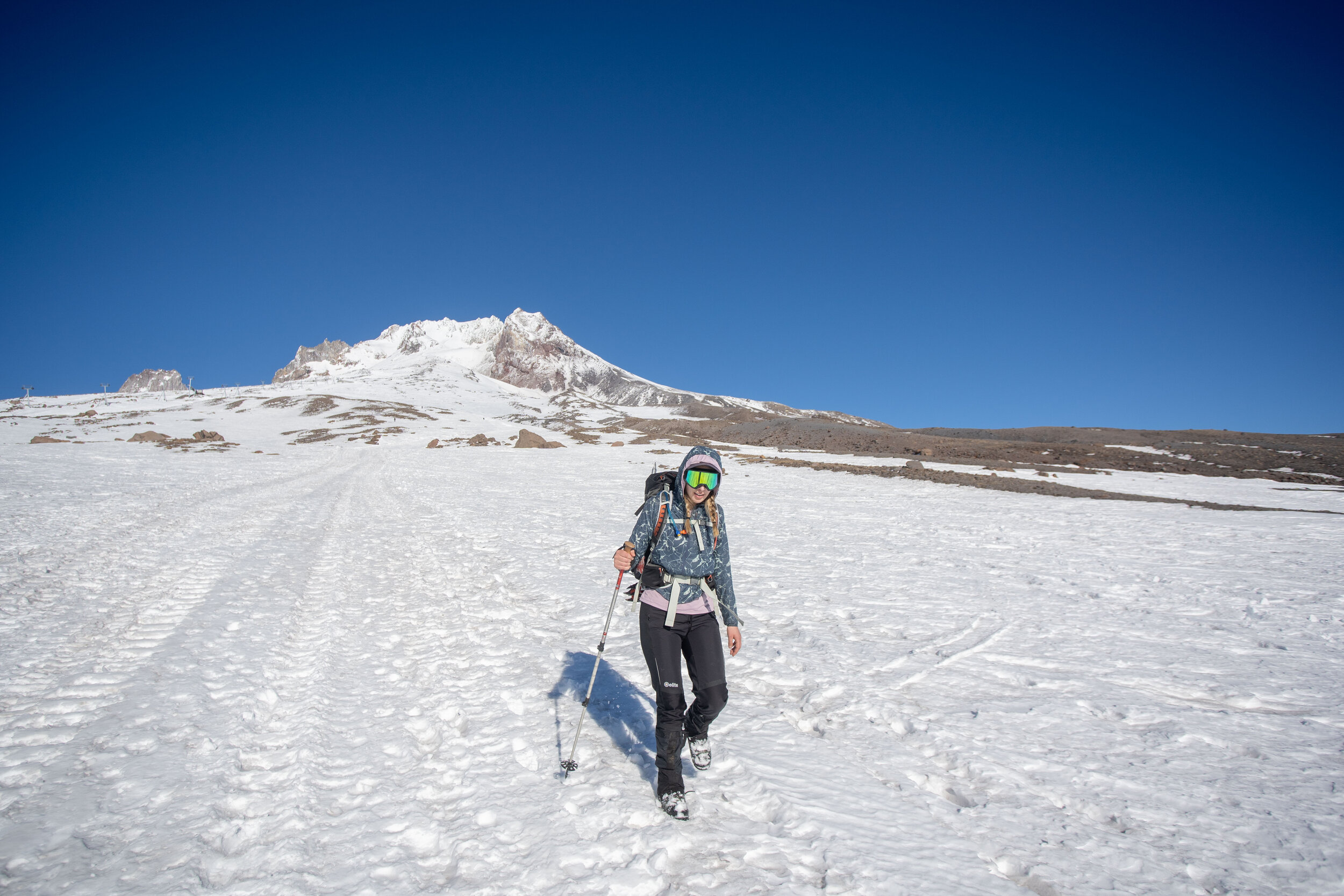
Trip Report - Mt Hood via Old Chute - 12/5/20

Looking up the Hogsback shortly after dawn
I’m pretty sure Mt Hood is the first volcano I ever saw in person. When I was 12, I flew into Portland with my family to visit my aunt, and saw Hood from the city. During that trip, we went backpacking in the Three Sisters Wilderness, and I summited South Sister (after an epically long slog). I remember falling in love with the mountains during that trip. So it was great to do the drive down from Seattle and finally get on Mount Hood.
Roundtrip Stats = 7 miles, 5,300’ of gain, 9.5 hrs
The trip was relatively straightforward - Becky and I slept in the parking lot, got up at 3 am and were heading up the mountain at 3:45 am. It was surprisingly gusty (out of the NW), and we slogged up to the top of the Palmer lift, when it finally started getting light. We reached the Hogsback shortly after dawn, and were treated with some beautiful alpenglow. We took a short break on the Hogsback before traversing over to the Old Chute. It was pretty sugary snow, so it was difficult to feel confident with our axe placements, but it wasn’t steep enough to be too troubling.
When we hit the ridge, we got great views of the inversion, with clouds spread out before us to the north and east. The final ridge traverse was pretty icy but wasn’t too sketchy.
For the descent, Becky and I were both happy to each have two tools, and we downclimbed a few hundred feet before turning around and plunge-stepping the rest of the way down to the car!
All in all, a great day out - thanks again to Marc for letting us borrow his car for the trip!
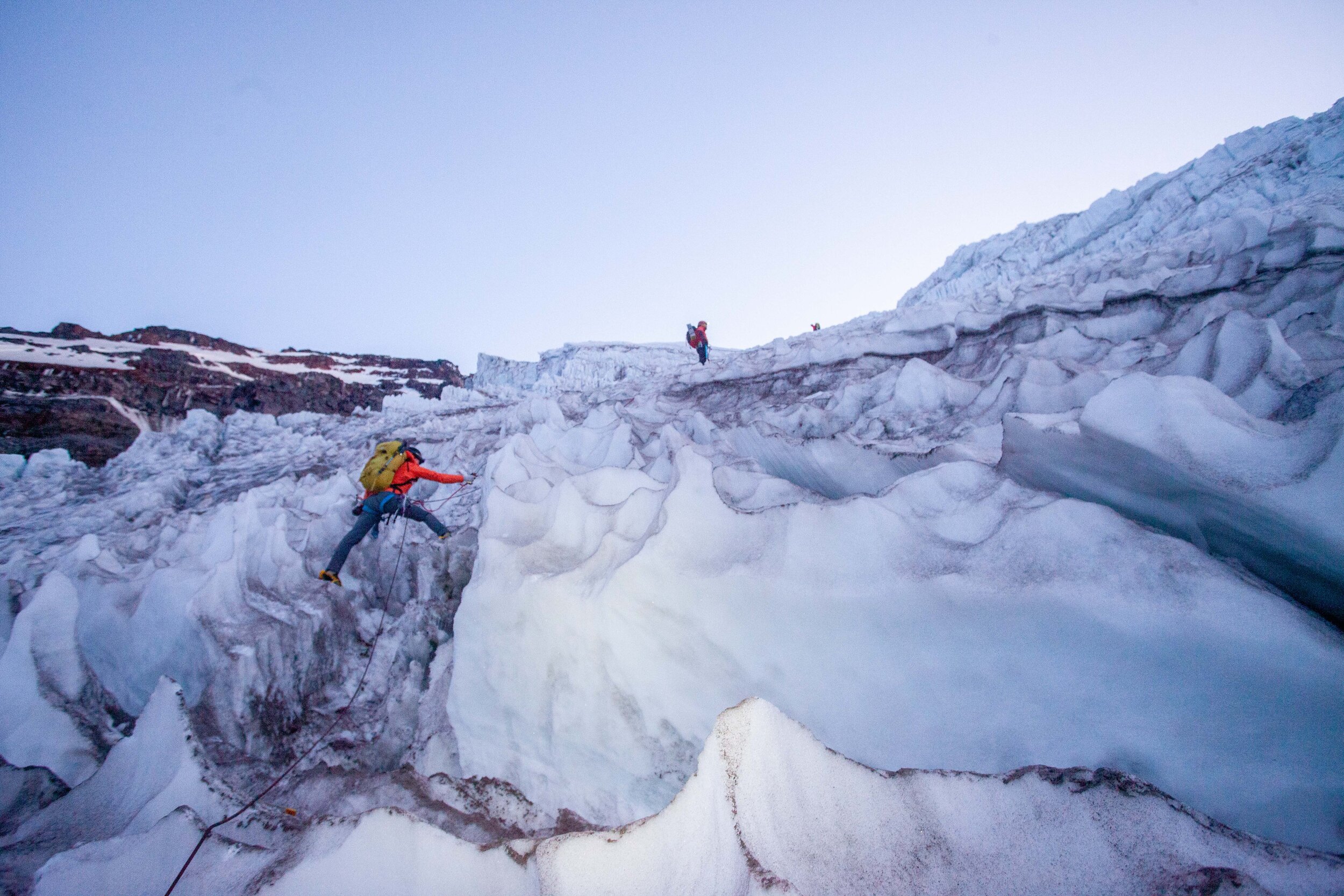
Trip Report - Mount Rainier via Emmons - August 1st - 3rd 2020
Well, I went up Rainier again - second time in two weeks - via the Emmons. This time I went with Becky and Toby, who happened to be in town for the weekend! We again got perfect weather and managed to pull off another great trip.
Roundtrip Stats
20 miles and 10,855’ of gain
24 hours of total travel time (3 days)

Roughly our route, hit me up if you want a gpx
Specifics
Interglacier is starting to break up, with some cracks and holes above 8k’. We roped up on the way up and down to be careful, though the cracks are all pretty obvious.
Ascending or descending the Prow sucks with full packs, unless you really enjoy choss. There’s probably a good line off it but we couldn’t find it.
Camp Schurman has running water on the glacier just above camp (between Schurman and Emmons Flats) as long as it’s sunny and warm.
The Corridor is in solid shape, with lots of small things opening up, but nothing too concerning.
There’s a beautiful crossing under/through a serac at 11,500’ that’s still in good shape.
At ~11,800’ the main bootpack used a bridge that is now gone. Currently (as of 8/2/20 @11 am), there’s a shitty bridge still hanging on, but this bridge has cracks on both sides, and I can’t imagine it’s going to last too much longer. See pics below for details.
Above 11,800' and the bridge, everything is smooth sailing. The route heads almost all the way to Liberty Saddle before pushing up to the summit.
There’s a lot of penitentes on the last 600’ to the summit, which are both beautiful and super frustrating to walk through.
Photo Story
Day 1 - from White River Trailhead to Camp Schurman
We hiked up on Friday afternoon.

Glacier Basin is beautiful, and all the wildflowers are out!

The snow on the Interglacier starts at ~7k’

There are cracks and holes opening up on the Interglacier above 8k’

Climbing down the Prow to get to Schurman takes a long time

Still climbing down the Prow
Day 2 - Chilling in camp
We spent day 2 hanging out in camp, drinking a ton of water, eating a ton of food, and practicing rescue skills, before heading to bed at 5 pm.

There’s running water above camp at Schurman (between Schurman and Emmons Flats) if it’s sunny and warm out. Thanks to Mia for teaching me the ice screw trick a few weeks ago!

Rest days are all about hydration

Beautiful camp, with some deep cracks opening up near the tents
Day 3 - Schurman to Summit to Schurman to White River Trailhead
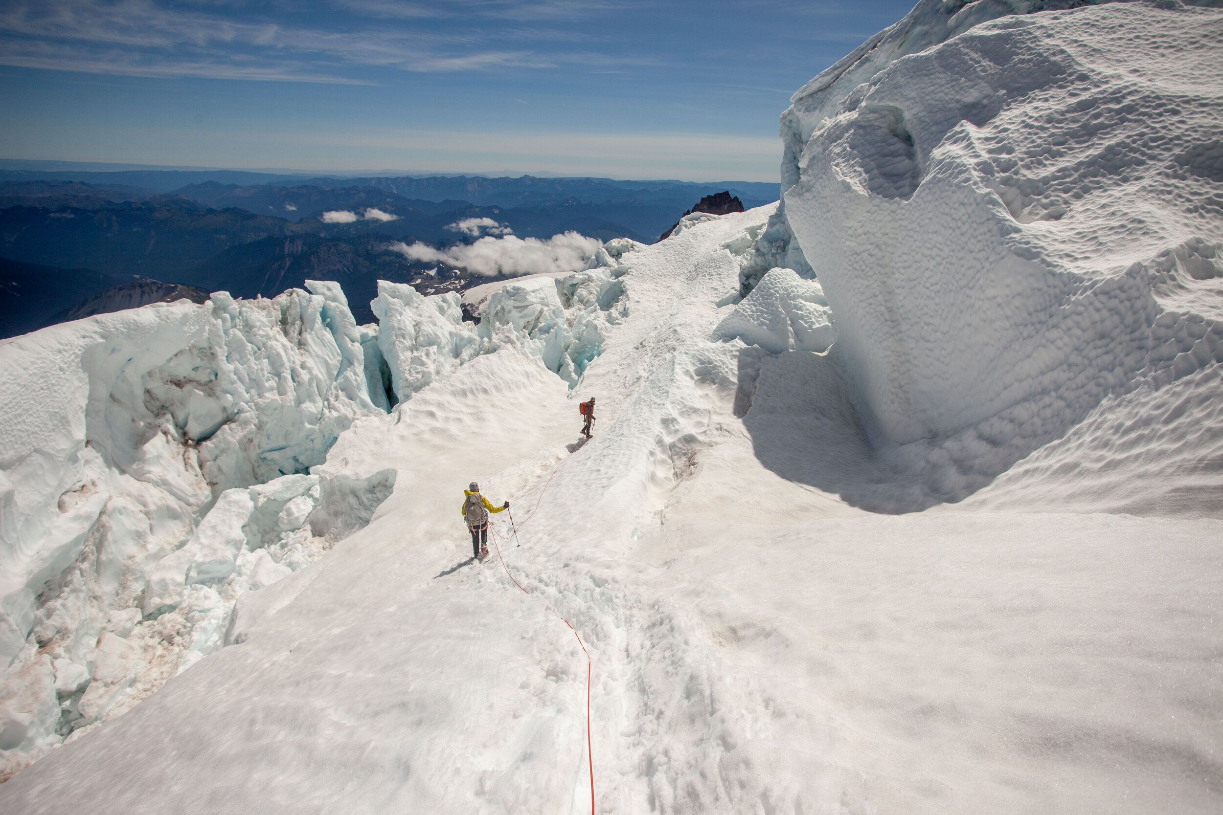
We left camp at 12:30 am and headed up the Corridor, which was all solid, though there were definitely some smaller cracks opening up both across and parallel to the bootpack.
At 11.5k’ we topped out the Corridor and went right, through some beautiful seracs. We moved quickly through this section, but it was spectacular.

Here’s a photo of the 11.5’ serac crossing (on our way down)
“The Crux” at 11,800’
We’d gotten some beta that at 11,800’ the main bootpack led to a now-fallen snowbridge, so we went left following some faint tracks (right where the standard bootpack goes straight up a 50 degree slope and into a crevasse) and found this skinny bridge. There may be other ways across this big crack, but this is the one that everyone used on 8/2. We belayed across it on the way up and the way down.
On the way up, there was one crack (at the higher side of the bridge), and on the way down there were cracks on both sides of the bridge.
How long will the bridge last? Who knows? Is there another way around? Probably, but no one we talked to found one.
Since this is the crux of the route currently, here’s some detailed photos:

Looking back across it at 4 am

Here’s me above the bridge, putting in a picket on the way down to get a little security. If you look closely you can see cracks beneath the bridge, as well as across the bridge at both sides.
PC Becky Hunter

And here’s me building an anchor on the far side to belay my rope team across.
PC Becky Hunter
Once we were across the bridge, it was smooth sailling the rest of the way. We followed the main bootpack up and trending right toward Liberty Saddle.

Curtis Ridge in the pre-dawn light

I’d read about how the alpenglow lights up the mountain for 5 minutes at dawn, but it was truly spectacular to experience it.

Cracks near Liberty Saddle

Penitentes and the final push to the summit (big snow mound)
We summited in gusting 30ish mph winds and took shelter by the register till we were ready to descend. The descent was straightforward, and we got down in 3 hrs, including belaying the 11.8k’ bridge.
Once we were back at camp, we celebrated with some snacks and red wine, then broke camp and headed out.

Celebratory wine once we got back to camp!
On the way out, we took the lower Emmons Glacier, which was very straightforward and led right to Camp Curtis.
Looking back up across the Emmons Glacier from Camp Curtis
At the bottom of the Interglacier, we threw our 4 season boots on our packs and headed down in trail runners.

Looking up at the Interglacier as we walked out past all the wildflowers.
Hiking out took forever with our heavy packs and our tired feet, but we made it down to the car and drank trailhead beers to celebrate.
Thanks to my fantastic partners for the great trip
and to Rainier for the perfect conditions and weather!

Becky, looking cheerful after 17 hrs of being up and moving
Here’s Toby, looking excited about his 50+ lb pack.
Trip Report - Mount Rainier Carryover - up the Kautz and down the DC - June 18th through 20th 2020

I’ve been on the Muir Snowfield many times, and I’ve daydreamed about summitting many times. This photo marks the first time I’ve been able to look up at the upper mountain and know what it feels like to be up there.

Trip Stats
3 days w/ 25 hrs of travel
18.5 miles 9,900’ gain
Trip Background + Map
I visited Seattle in March of 2017, and, for some reason, biked by myself across the 90 bridge. On the bridge, I got my first full view of Rainier, and wondered (in one of the first posts of this journal) what it would require to climb it. I had no idea.
Now it’s over three years later, and Rainier was the main goal for this summer. I’ve been training since January, and ticking off other bucket list trips - Ptarmigan Traverse and the Hinman to Daniel traverse - but in the back of my mind I kept wondering whether I would get a chance to try Rainier. In mid-July, I got a call from my buddy Marc asking if I wanted to join a climb via the Kautz route, and suddenly, I was in.
I researched the route obsessively, made a spreadsheet to make sure I didn’t forget anything, and watched the weather, which looked like it was going to be perfect. On Saturday morning, I drove down to the park w/ Marc and met up with Mia and Jake. We’d opted for a slow three day trip, with a big carry-over on the last day, and we got our final group gear ready in the Paradise parking lot.
Day 1 - Paradise to Shark Fin Camp (7,600’)

You can see what’s left of the Fan on the far left side of the photo
We headed up from Paradise to Glacier Vista, then dropped off the edge down to the Lower Nisqually Glacier. The Fan looked narrow and manky, so we opted to head around to where the Wilson Glacier joins the Nisqually. There were some awkward crevasses to navigate, but it wasn’t too bad. Once we were up at Wilson Bench, we decided to head up to “Shark Fin Camp”, which doesn’t get used much, but provides a great lower camp for the route. We got to camp early - around 3:30 pm, so we took it easy.

Shark Fin Camp is spectacular

The team stands around at camp in the absurdly nice weather
Jake’s heavy and heroic group contribution.

It wouldn’t be a trip if I didn’t take a photo of Marc making/eating food

If you look closely on the right side of this photo, you can see the shadow of Rainier in the hazy air
Day 2 - Shark Fin Camp to Camp Hazard
Marc on the Turtle
This is one of the most relaxed days I’ve had on a big mountain. We woke up late to perfect weather, took forever to get out of camp, and moseyed our way up the Turtle snowfield to Camp Hazard. It was absurdly hot and still, with almost no breeze.
We set up camp at Camp Hazard right near the rock step, and walked over to check out the Kautz in the late afternoon. It looked pretty intimidating, but still in good shape.

View from the top of the rock step
We spent the evening eating and packing and feeling the altitude. My head felt terrible, and I was worried about how I’d feel the next day, but I still enjoyed the absurdly beautiful views.

Day 3 - Camp Hazard to the Summit, then down the DC to Paradise
We broke camp and headed out at 3:45 am, bags fully packed. The rock step was awkward, but there was enough snow in the second half to make it feel pretty reasonable.
Mia watches Jake downclimb the step
Then we swung over onto the Kautz, and simul-ed up the first ice step, stepping over and through broken crevasses and penitentes. This is some of the coolest snow climbing I’ve ever done.

Everyone in their own pools of light

Mia taking a hero step over a crevasse filled with icicles
Soon we were at the base of the second step, and we pitched it out. Jake took the lead, and Mia, Marc, and I tried to stay warm while dodging the falling ice that rained down from Jake’s tools.

Jake on the sharp end
Mia and Marc looking warmer than we felt
Mia following the first pitch

Marc topping out the technical bit

Jake heads up towards the Wapowety Cleaver

Mia jumps a crevasse

Upper mountain crevasses
We made it up to the summit, after crossing some pretty enormous snow bridges.
Everyone layering up on the summit
Once we got down to the summit register there was no wind, and it felt like it was 70 degrees. We all de-layered to our sunhoodies, took a short break, and then headed down the DC.

After the summit, Marc crosses the crater

Big crevasses on the DC

Looking back up at the upper DC
Finally done with the Cleaver and down at Ingraham Flats
Looking back up at the mountain from Pebble Creek

Finally back at the car!
Mia and I run to the car

Time to drink a beer
We finished back at the cars, 16 hours after leaving Camp Hazard. A long and phenomenal day out.
Only one more volcano in Washington to go - Glacier Peak - with this cold hero. We’re hoping to give it a try this summer!

This is the cold face
Trip Report - Waptus Lake + Second Half of Alpine Lakes Crest Traverse (Hinman to Daniel) - July 3rd through 5th, 2020
Hinman Tarns - the heart of the traverse
Well, I figured the Ptarmigan would be the last big trip for a bit, but I finished up a project midweek and realized I had three days off in a row, and my mom wanted to go on a chill backpacking trip. I checked the weather, and realized it was going to be perfect. I did some thinking, and realized I could get on (part of) another traverse this summer - Kyle McCrohan’s “Alpine Lakes Crest Traverse”.
When I first moved out here, my friend Robby suggested a similar-ish linkup from Snoqualmie Pass to Steven’s that he’d mapped out on Caltopo, following the Cascade Crest, but I didn’t think it would go, nor did I have the time or the skills. In the years that followed, I spent a lot more time in the Alpine Lakes Wilderness, slowly expanding my distances, and falling in love with the area.
I attempted Daniel (half-heartedly) a few years ago, with my partner Becky, when we headed up to Dip Top Pass. We approached via the East side of the Daniel Massif, and thought about tagging the summit, but ran short on time and ended up traversing to Pea Soup and then doing the horrible scramble over the side of Lynch, getting to Dip Top Pass right at sunset. So It was good we hadn’t tried. But I stared at Daniel all evening, and all the next morning, and knew I needed to come back. On other trips, I stared at the Chimney/Overcoat system, and committed to getting to that area as well.
One day, a year ago, when Kyle published his route on his blog, it all came together - a well-described, well-photographed route that seemed almost doable, with the right timing and commitment. But it was still intimidating, so I put the route on the backburner - one of those routes maybe I’ll get to someday (like Frostbite Ridge, or Kyle’s Dakobed Traverse, or Luna Peak).
Completing the Ptarmigan last weekend really unlocked this trip. I was confident in my fast snow travel, and knew I could handle the distances. I still didn’t have a partner, but knew how filled in the glaciers were on the Ptarmigan, and knew that the Foss Glacier (on Hinman) and the Lynch (on Daniel) wouldn’t have opened up yet.
I knew I didn’t have time (or interest) in doing the whole traverse solo, but I figured I could do the second half in a day, from Waptus Lake, so I set out to try.
Planning + Route
Loop Distance and Vert (as recorded on Saturday) = 27.5 miles and 9500’ of gain

I couldn’t get all the labels to come through - so the Blue route is the climb route, the Green route is the potential descent, and the Orange (w/ red line) route is my actual descent. The line from Hinman/Daniel col to Venus Col is a tentative bail, I never sorted out whether it would actually go.
I had planned a few different routes based on beta from Kyle and Seeking Ultra’s circumnavigation, which had also inspired me a few years ago. The biggest question was how I was going to get back to Waptus from the summit. Could I drop straight south from the summit to Venus, then to Spade, then to Waptus? Or would I have to descend east, and then take the PCT the long way round? Kyle suggested that the Venus descent would go, but he didn’t have too many specifics, and I couldn’t find many photos taken from Venus looking north. I assumed I’d figure out it once I was out there - the point of this traverse is that it’s an adventure.
Day 1 - To Waptus Lake
My mother (an accomplished solo backpacker herself) and I headed in to Waptus in the mid-afternoon, past beautiful swimming holes and wildflowers and horrific bugs. I’d never been to Waptus, and didn’t know how many campsites there would be, but felt confident we’d find something. We did, but there were a ton of people out there and it took us wandering until the very NW side of the lake before we finally found something. We camped and I went to sleep excited and nervous.

View down to Waptus Lake from climb to Lake Ivanhoe
Day 2 - The Traverse
I got out of camp at 5:30 am. I wasn’t sure how long the traverse would take - I expected somewhere between 9 and 12 hours depending on how sloppy the snow was - so I wanted an early start to give myself a good chance of completing it.
I headed west along Waptus, and made good time up to Lake Ivanhoe, where the troubles began.

Ivanhoe looks melted out, but the trail on the N side was infuriating.
Kyle did this route almost exactly a year ago, but the melt happened way faster last year, so I knew I’d have more snow than he did. I’d expected this would slow me down somewhat on the climbs, but would make me feel safer on the glaciers. What I hadn’t thought about it was the miles of bullshit punchy icy snow on the trails from Ivanhoe over Dutch Miller Pass to Williams Lake. This slowed me down quite badly and wasted a fair amount of strength.

Dutch Miller Gap was all snow, but it became intermittent as I dropped toward the turnoff to Williams
Looking back over Williams Lake toward the Middle Fork of the Snoqualmie (with the evocative mining rails in the foreground)

Finally, consistent snow! Time to put the crampons on and go
Once I finally got up to the bench above Williams, I was good to go. I wandered past the Chain Lakes, got up to La Bohn Lake area, then finally headed east up Hinman. The weather looked terrible to the West, but I rationalized it away by knowing that I was east of the crest, where the weather never comes!
I did lose visibility on Hinman multiple times, but the route was easy to follow - stay climber’s left of the ridge, and I figured that once I was up there, I could decide whether I felt good about the rest of the traverse.
After cutting our trip short on the Extended Ptarmigan due to low vis, I was bumming pretty hard about dealing with this bullshit again.
I summited Hinman, and waited for a bit to see what the weather would do. When the clouds suddenly cleared and the weather looked like it might hold, I went for it - bootskiing down the Foss Glacier on perfect snow and descending the 2000 ft from Hinman summit to the base of the Pea Soup waterfalls in 40 minutes. I wanted to linger and enjoy the tarns, but they were barely melted out, and I felt like the visibility wouldn’t last long, so I pressed on.

Foss Glacier - it’s a dream to descend. I felt really powerfully about this glacier - it’s sublime and remote.

Looking up to the Hinman Daniel Col (about to get into the “bowling alley”)
I sped through Kyle’s “bowling alley”, which was filled with bowling ball rocks and knocked over pins, as well as cornice chunks and wet loose slides, before getting to the Pea Soup waterfalls. I climbed the snow and slabs up to the outlet, and took a break while looking at the Lynch Glacier. This was my last possiblity to bail - I could head over to Dip Top, though getting all the way to Waptus would have been hellish. I saw a bootpack on the W Glacier, and the weather looked good, so I stopped thinking and went for it.

Pea Soup Lake, Dip Top Peak, Dip Top Pass, and Lynch Peak

Looking back down the boot pack towards the outlet and Dip Top Peak
I followed another soloist’s footprints up to the main glacier, where the visibility dropped again.

Follow the footprings and the gps track…
Finally, I scrambled to the summit, where the views were clear to the east and south, and totally socked in to the north and west.
Rainier in the distance, looming over all (Spade Lake in the bottom left)
Suddenly, I had done the meat of the traverse. I sat on the summit and enjoyed the evershifting views before beginning to think about the descent. After 20 minutes, I knew I had to get going, so I headed east, enjoying the ease of following a cattlepath.
I was not sure where to drop down to Venus, but I had planned (and mapped) the ridge that leads from Daniel to the Citadel, then dropping down to the Venus outlet. On Google Earth and Caltopo, it had looked traversable, but in person it seemed a knife edge. I could have dropped down to Circle on snow, then climbed the 700 odd feet to cross east across the ridge, then descended to Venus, but after over 8000’ of climbing, I was tired. I chose to descend the eastern bowl of Daniel then to descend the PCT.
Looking at the ridge I’d hoped to traverse (over toward Citadel, with Circle Lake frozen in the bottom left).
Bootskiing the eastern bowl was perfection, and I was down at Peggy’s Pond in no time. All that remained was the endless switchbacking of the PCT back to Waptus. I thumped my way down trail, enjoying the afternoon as it turned to evening.
Peggy’s Pond, still melting out beneath Cathedral Rock

Deep Lake is spectacular from all angles

The meadows by the Deep Lake Outlet, with Cathedral Rock to the right and the eastern Daniel Massif to the left

Wildflowers on the cliffs over Spinola Creek
I finally got back to camp at 8:30, after 15 hours of travel. I ate dinner, drank a beer (cooled in a creek), and slept hard.
Day 3 - Hiking Out
My mother and I hiked out the next day, taking a leisurely pace. I was sore, but not wrecked. We swam in the Cooper River by the trailhead, and then headed back to Seattle. A phenomenal and unexpected trip!

Leaving Waptus (and Summit Chief in the distance)
Closing Thoughts
I’d highly recommend this loop, though I’m still not sure I’m happy that I soloed the Lynch Glacier. It felt fine at the time (though the whiteout rattled me a bit), but I don’t think I’d recommend it to anyone else, not because it’s an objectively bad idea, but because no one should ever recommend soloing anything. And personally, I think I’m going to take a break from soloing any more glaciers.
Regarding gear:
I did this trip in my stiffest low tops - my Sportiva TX3 approach shoes - which aren’t waterproof, but did perfectly in all other ways. I used them last year when I climbed Colchuck Glacier to Pandora’s Box + Dragontail, then did the thru-hike to Snow Lake trailhead, so I knew they could handle steep snow, crampons, and miles of dirt walking. Someday I’ll get a pair of high-top waterproof trailrunners?
I was also happy to have a hiking pole, an ultralight axe, and ultralight crampons. I probably could have done it with microspikes, but I wouldn’t have felt as stable, so it wouldn’t have been worth it to me.

I realize that this setup looks ratchet as shit, but it actually climbs great - I had no footwear issues or blisters despite the 15 hrs of travel, 27 miles, and 9500’ of gain…
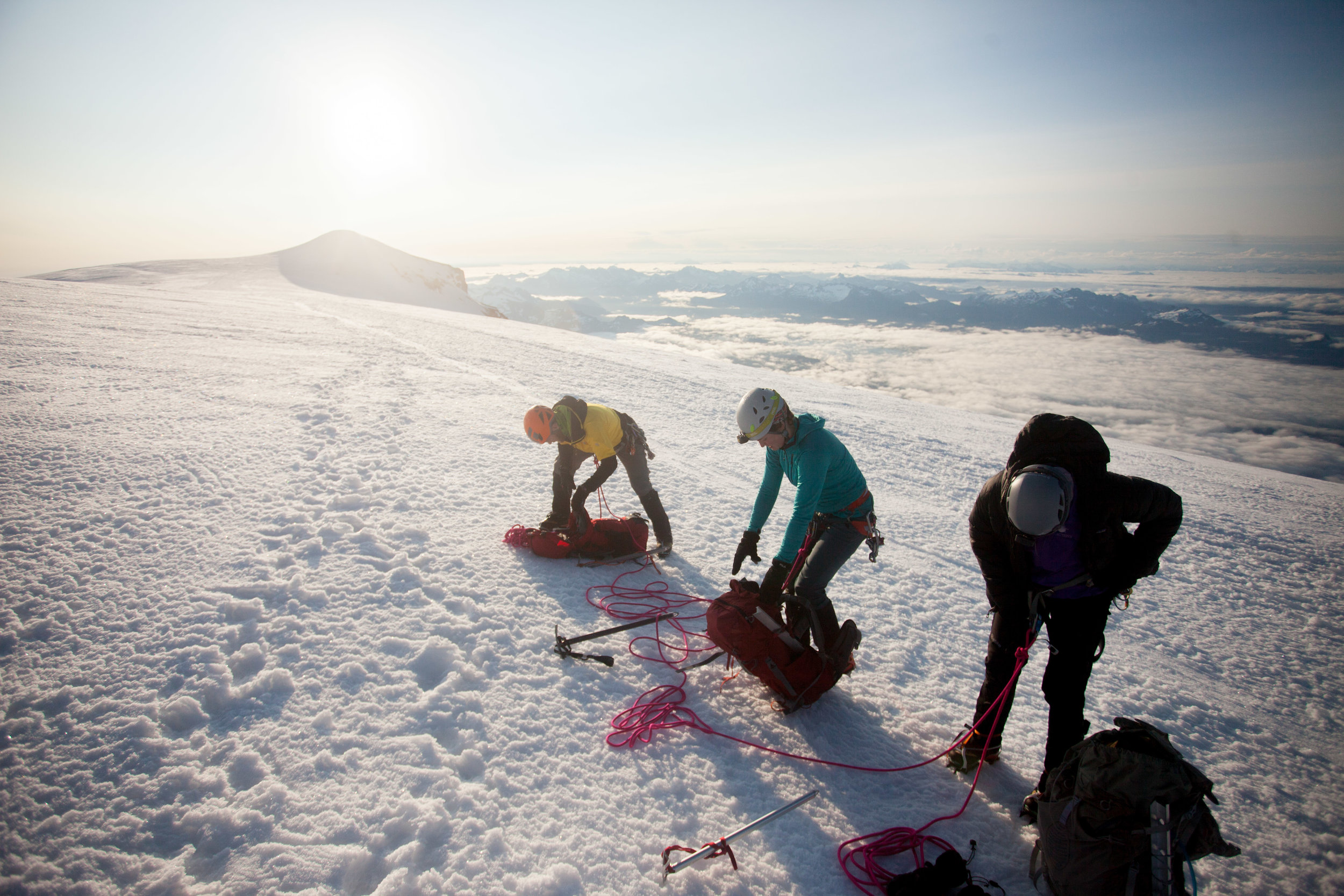
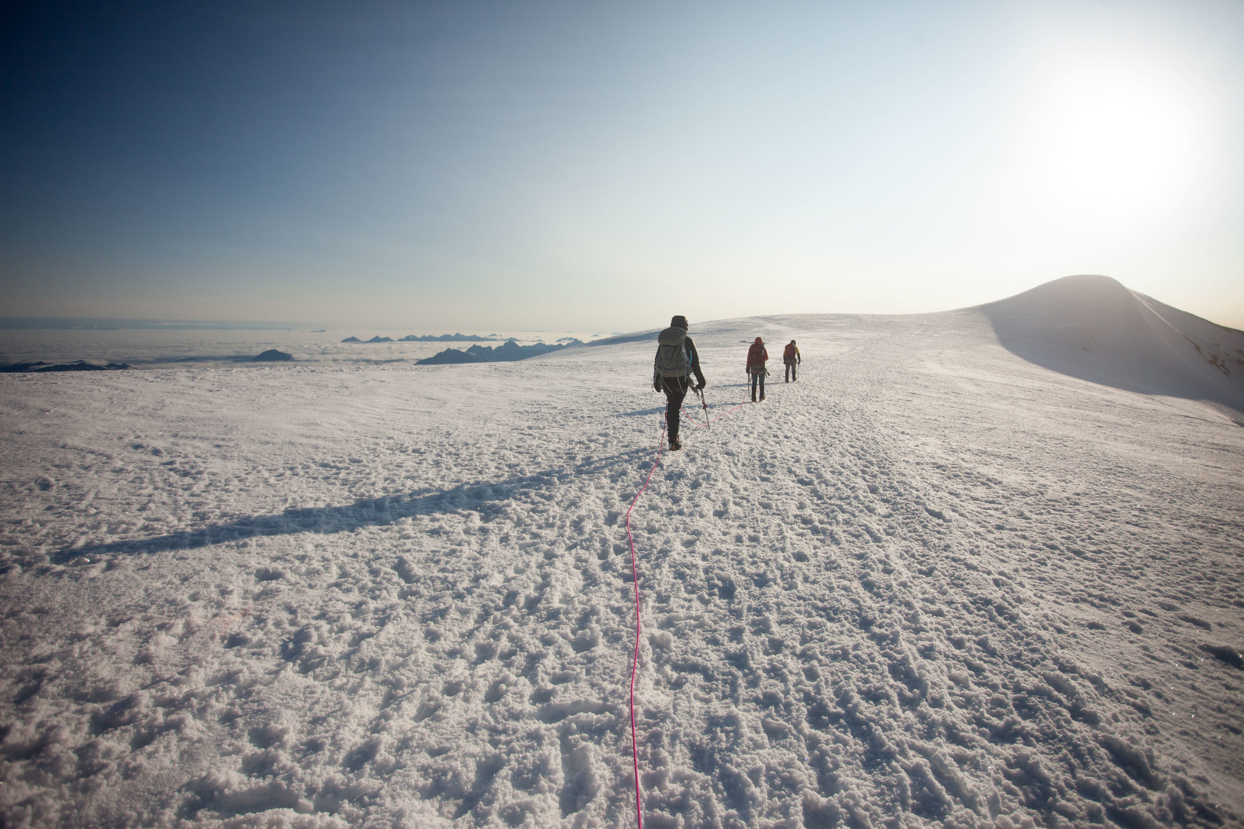
Trip Report - Ptarmigan Traverse - June 25th through 28th, 2020

View south toward Dome/Dana/Spire from White Rock Lakes
Well, after years of thinking about this traverse, I finally had the gear, partner, weather window, and time off, so my buddy Robby and I gave it a go.
Our original plan was to follow Kyle McCrohan’s Extended Ptarmigan Traverse, though we were thwarted by bad weather on the third day (and threatened by a worse forecast on the 4th). More on that later…
We dropped cars for the shuttle (~5 hrs of driving from Seattle) and slept 2 miles short of Cascade Pass due to the closure (which ended up being caused a totally manageable pile of snow).
Basic Stats:
4 days/3 nights - this felt good and doable, though with Kyle’s extension that day 4 would have been burly
our route had 14,000’ of gain and 44.5 miles traveled
Basic Takeaways (photos below):
this trip felt very early season, with a ton of snow and few patches of bare ground
the benefit of this is that descents went fast, though the sloppy snow slowed down our climbing pretty badly
there’s lots of flowing water, even though there’s so much snow. we never had to melt snow.
we didn’t have to cross or come near any big crevasses
we saw evidence of a lot of big cornice fails (saw one come off the N face of Formidable) and set a few small loose wet slides (D 0.5 at most) but generally felt pretty avy-safe
Specifics:
Cache Glacier to Cache Col is chill, though there’s still a gnarly overhanging snow/cornice thing hanging on a rock that Kyle McCrohan documented a few days ago. When that breaks, it’ll be bad for anyone underneath
Koolaid is still all snow
Red Ledges are snow up to the ledge, with intermittent steep snow traversing required. With soft snow it was fine, though exposed and unprotectable
Yang Yang Lakes is still snow camping, though it’ll be melted out sometime soon
White Rock Lakes has good dry dirt bivies
Itswoot Ridge is just a huge cornice
Cub Lake is still frozen (and the climb up to the Cub/Bachelors divide is pretty horrendous
the descent through the slide paths of Bachelor’s Creek was, to quote Jake Walker, “a human car wash” of brush and schwacking. in other words, it sucks.
Photo Story
Day 1
Despite all the posts I’ve read about the Cascade Pass switchbacks, we were up them pretty quickly, where we put on crampons (which we would have on more or less continuously.

Climbing up to Cache Col, with the view of Sahale behind us
View from descent from Cache Col down toward Koolaid Lake (invisible in this photo due to snow) and Red Ledges, with Mt. Formidable dominating the upper right of the frame

Closer to Red Ledges
The climb up Red Ledges really wasn’t that bad. Just some steepish snow climbing, which was helpfully soft, followed by alternating traversing on scree held together with red mud, and traversing more steep snow…

Almost finished
View from Spider Formidable Col toward the rest of the traverse, with the loose wet slide in the foreground
Day 2

Yang Yang Lakes -there’s no sites melted out yet, so we camped on snow here, though there’s a ton of easy access water (obviously)

We took the “snow finger” as described by Volken/McBrian out of Yang Yang Lakes area, which was the steepest snow on the traverse at probably around 45 degrees. This cut off an annoying looking spur that kept you on lower angle terrain but required more gain and distance

South Cascade Glacier and the weather begins to blow in from the northwest

Climbing down to White Rock Lakes was surprisingly steep, but with the soft snow felt very chill

Current state of White Rock Lakes - not really melted out at all…

Solid camp site w/ at least 3 good sites, though this was definitely the best
It rained and gusted all evening, so we spent about 12 hours in the tent, playing cribbage and eating all our food.
Day 3 - Here’s where we left the standard Ptarmigan…
We headed across the huge cirque, from White Rock Lakes over to Dana Glacier, then headed up southeast to the upper eastern Dome/Dana Col.
About to cross onto the Dana Glacier, looking over at Dome as it hides in the clouds
Once we were on the Dana Glacier, we lost visibility. We couldn’t see more than 40 ft, sometimes even less. I had the routes on my phone and my watch, so we just followed the lines, watched for crevasses, and waited for the col to reveal itself. It happened eventually.
Then we crossed onto the Dome Glacier, still hoping for a break in the weather, which was feeling less and less likely.

Somewhere on the Dome Glacier
We got up to 8600’ and the Dome/Chikamin Col, where we pretty quickly realized that we weren’t going any further. We wanted to summit Dome, but couldn’t even see where to start in the mist. And when we looked toward the Chikamin, we could see there was a massive drop into a yawning bergshrund, but we couldn’t even tell where the snow ended, nor whether the bergshrund spanned the entire slope.
So we sadly bailed back toward Dome Glacier and Cub Lake.

Just before we headed down, we got this view of what I think is Dome (or Dome’s false summit?) which was quickly obscured again
We didn’t regain visibility till around 6800’, when we were dropping from Dome/Dana Col southwest toward Itswoot Ridge.

Robby crossing the southern slopes of the Spire Dome ridge towards Itswoot Ridge
Here’s Robby, my heroic and indefatigable partner, looking chiq with an unnamed glacier broken up behind him

We crossed over Itswoot Ridge (still totally snowy) and then dropped down into the (also still snowy) Cub Lake Basin

Cub Lake is in the upper right third
Cub really isn’t melted out much at all

Climbing out of Cub sucked - 600 ft up 35 degree frozen avy debris with a huge slide down to the lake
We dropped northwest down the headwaters of the Bachelor Creek drainage, and then suddenly were done with snow. We wandered our way down the intermittent trail, through slide paths and alders, till we found a small site at 6200’ (wouldn’t recommend sleeping here till it melts out more)

Day 4 - back to the car!
I apologize to all of the trip reports that I may have maligned on our way down to Bachelor Creek. You were right. This section sucks.


More suck…
Finally, around 3200’ the trail become consistent enough to follow without thinking too hard. We got down to Downey and then crushed out the last 6 miles, which ended up being some beautiful (if soggy) trail.

We stashed our bags in the bushes next to the Downey Creek Trailhead and finished our trip with a 2 mile run in crocs to the Suiattle River Trailhead, where we’d left our car.
All in all, this was a phenomenal traverse. I’m sure it’s going to melt out quickly, but hopefully this trip report helps anyone trying to do it soon…
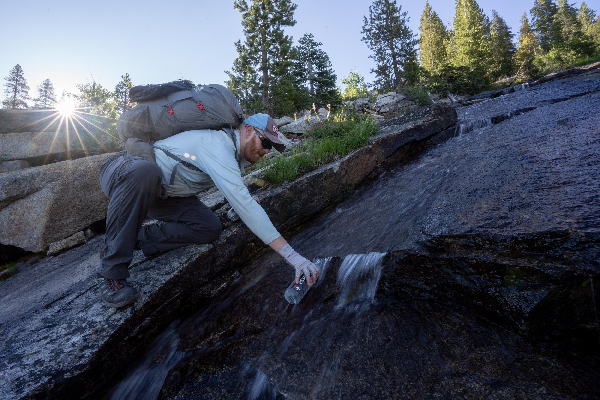
Trip Report - 8/10-12/19 - Backpacking Tapto Lakes & Copper Ridge
Overall trip - 44 miles, 12,700 ft of gain, and 24 hrs of hiking (in 2.5 days).
Just finished a 3 day backpacking trip to Tapto Lakes, Whatcom Pass, and Copper Ridge. The clouds hung low during the entire trip, so views were sparse, but Marc and I pushed hard on the mileage and did some big days. Hopefully I can get back out here someday and see some of the peaks!

The bases of Whatcom Peak and Challenger in the clouds

Tapto Lakes!

Hiking through the clouds

Finally some sun!

Copper Lake

Hiking Copper Ridge in the clouds
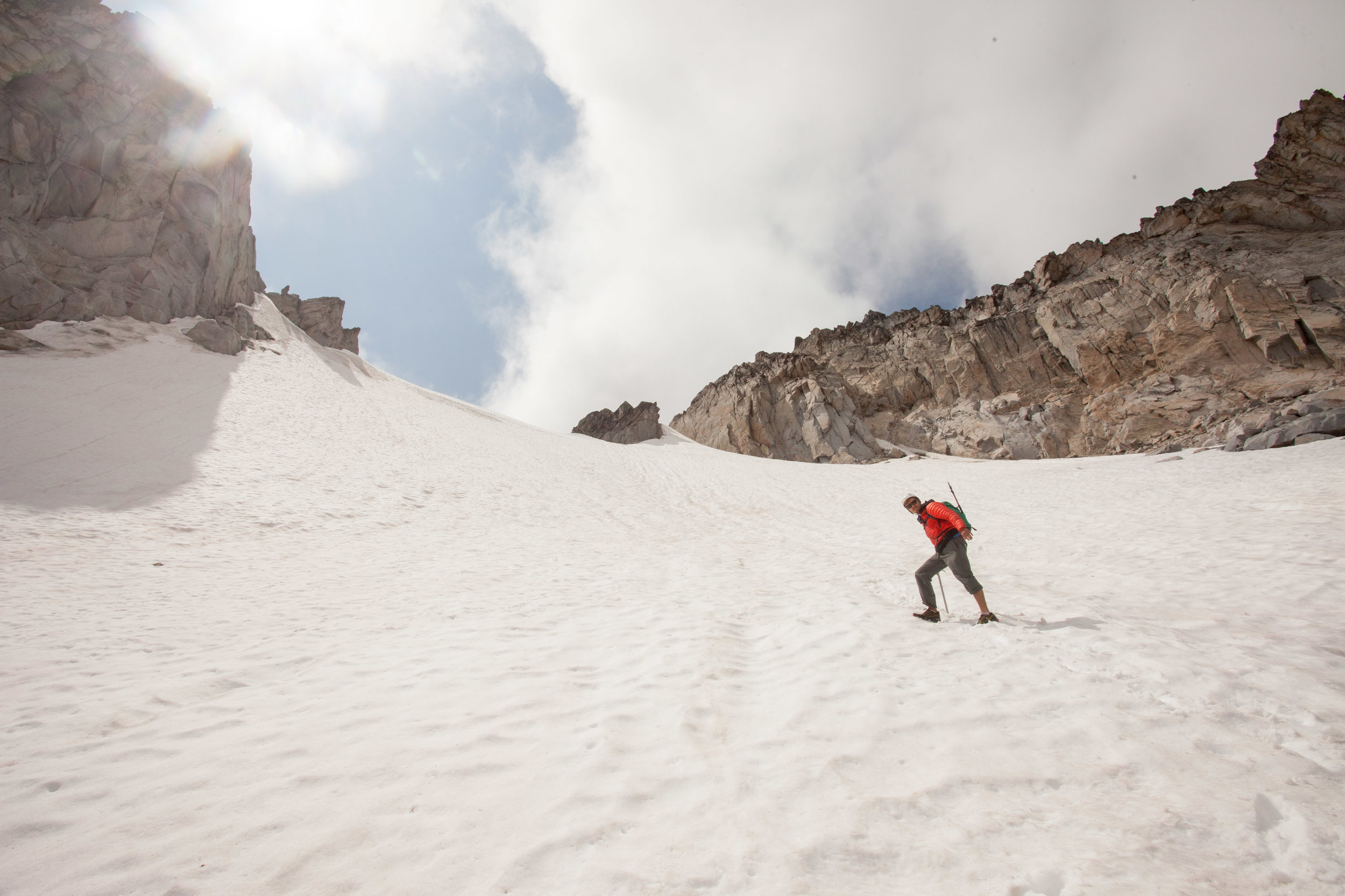
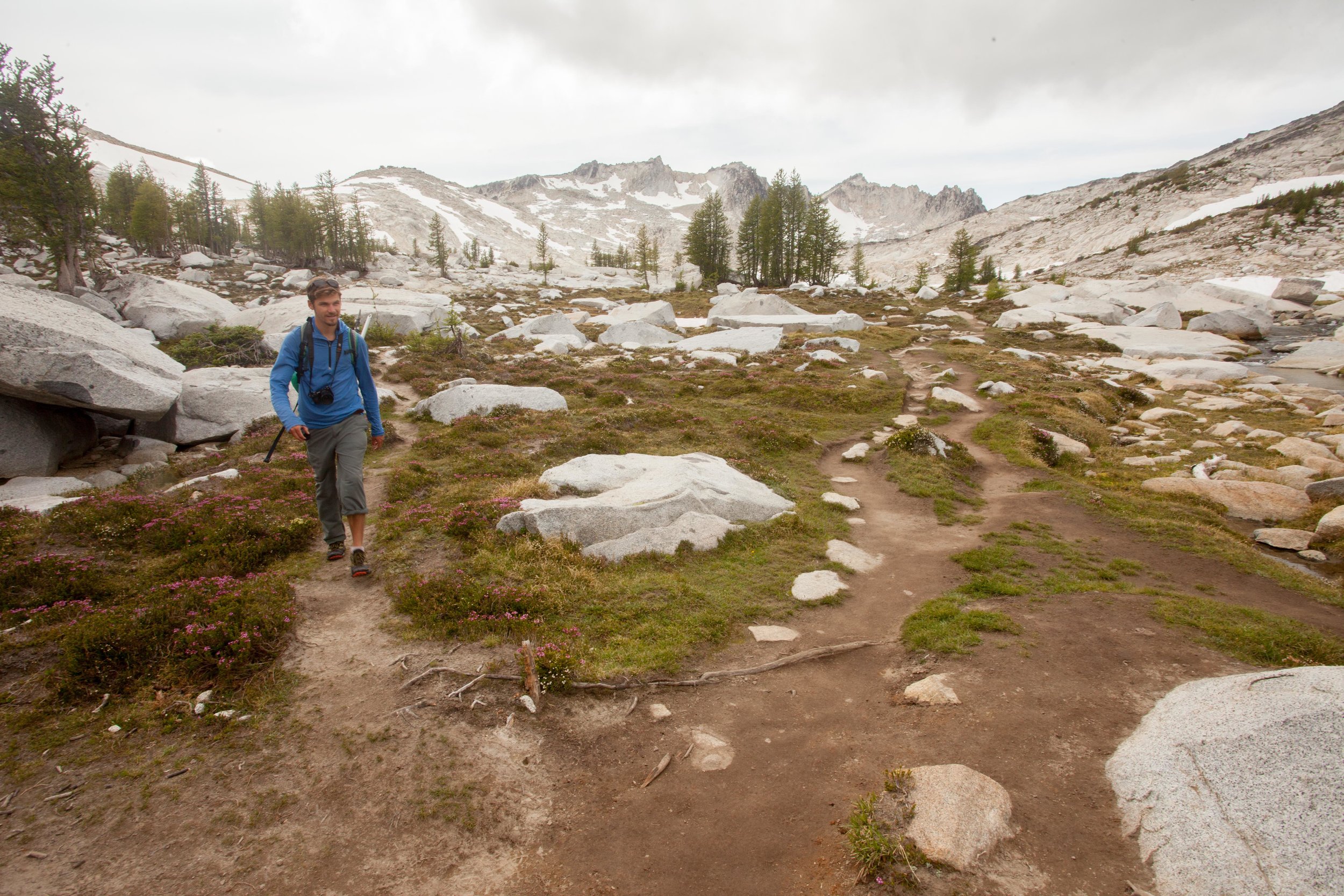
Trip Report - Dragontail Peak via Colchuck Glacier + Pandora's Box, then through the Enchantments

Had a big day on Friday with my good friend Pete. No idea on mileage (somewhere around 20 miles?) with almost 6k’ gain and 7k’ descent, all in a long 15.5 hours.
We set out from Stuart Lake TH at 5 am. Once we got up to Colchuck Lake, we could see the Colchuck Glacier looked to be in pretty bad shape, but we thought we’d go suss it out.

Once we got closer, we saw that there was a large band of blue ice across almost the entire snowfield, but there was still a small continuous snow finger on the right. So we climbed it. This was definitely the crux of the route, and it was pretty hairy. We could kick solid steps into most of the section, but there were a few points where blue ice lay only a cm beneath the snow, which made things sketchy.

Once we were through that section, the rest of the day was pretty cruiser. We got up to Colchuck Col, then scrambled some minimal class 3 terrain up to Pandora’s Box. We were worried about snow the eastern descent off the Box notch, but there was an easy path around it.
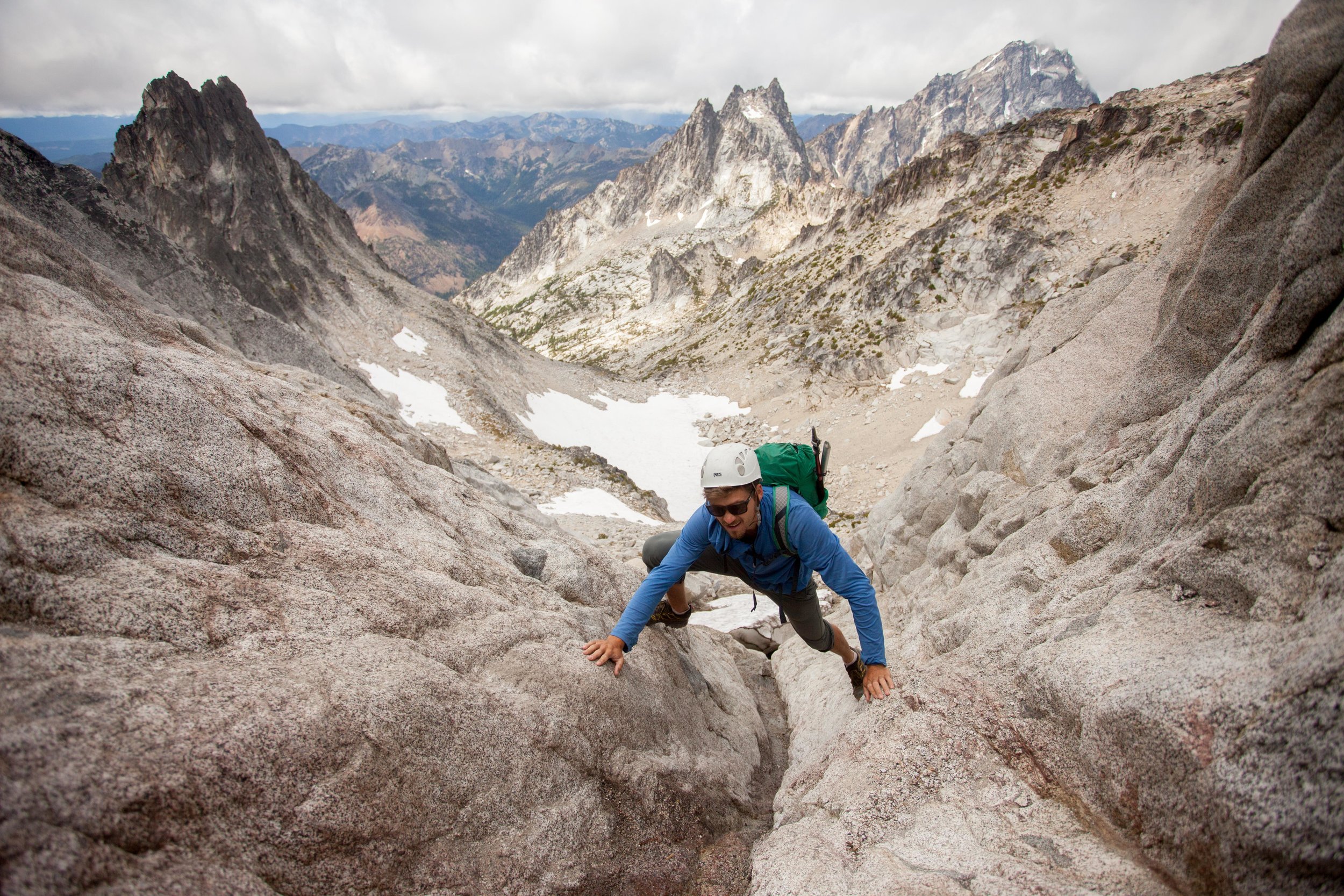


Then we climbed up Dragontail and enjoyed views of the Stuart Range and the Enchantments high country.
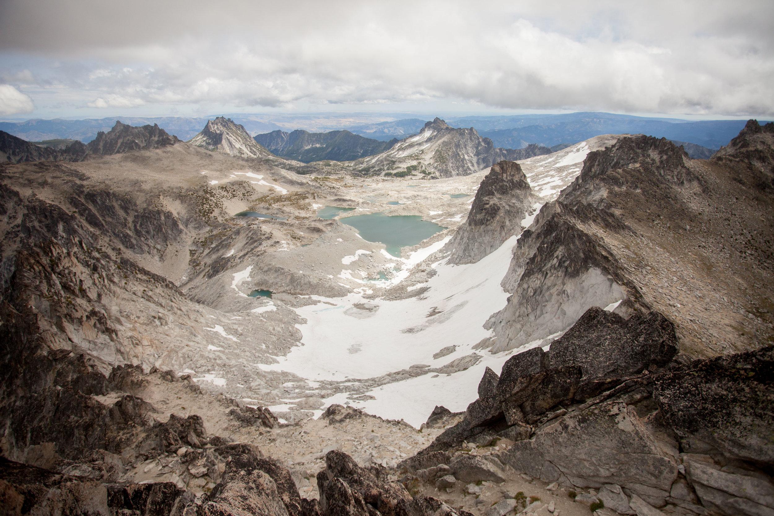
After enjoying the summit, we descended toward Asgard Pass. There’s still a lot of snow on Snow Creek Glacier, but there’s a solid bootpack up it.
Once we got down to Asgard Pass, we decided to descend through the Enchantments proper, so we slogged out the supposedly 12 miles (though it felt much longer once we’d gotten down to Snow Lake). The Enchantments were as beautiful as always!
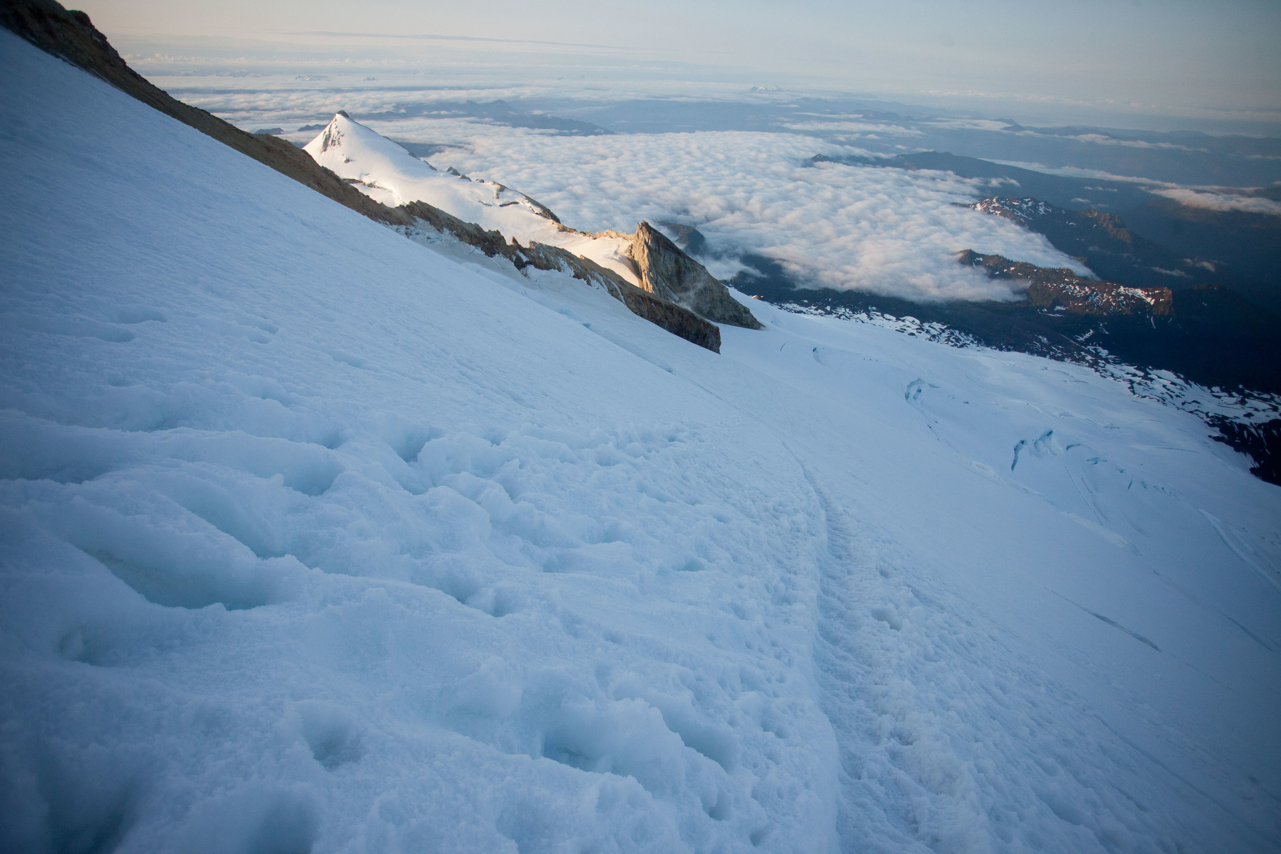
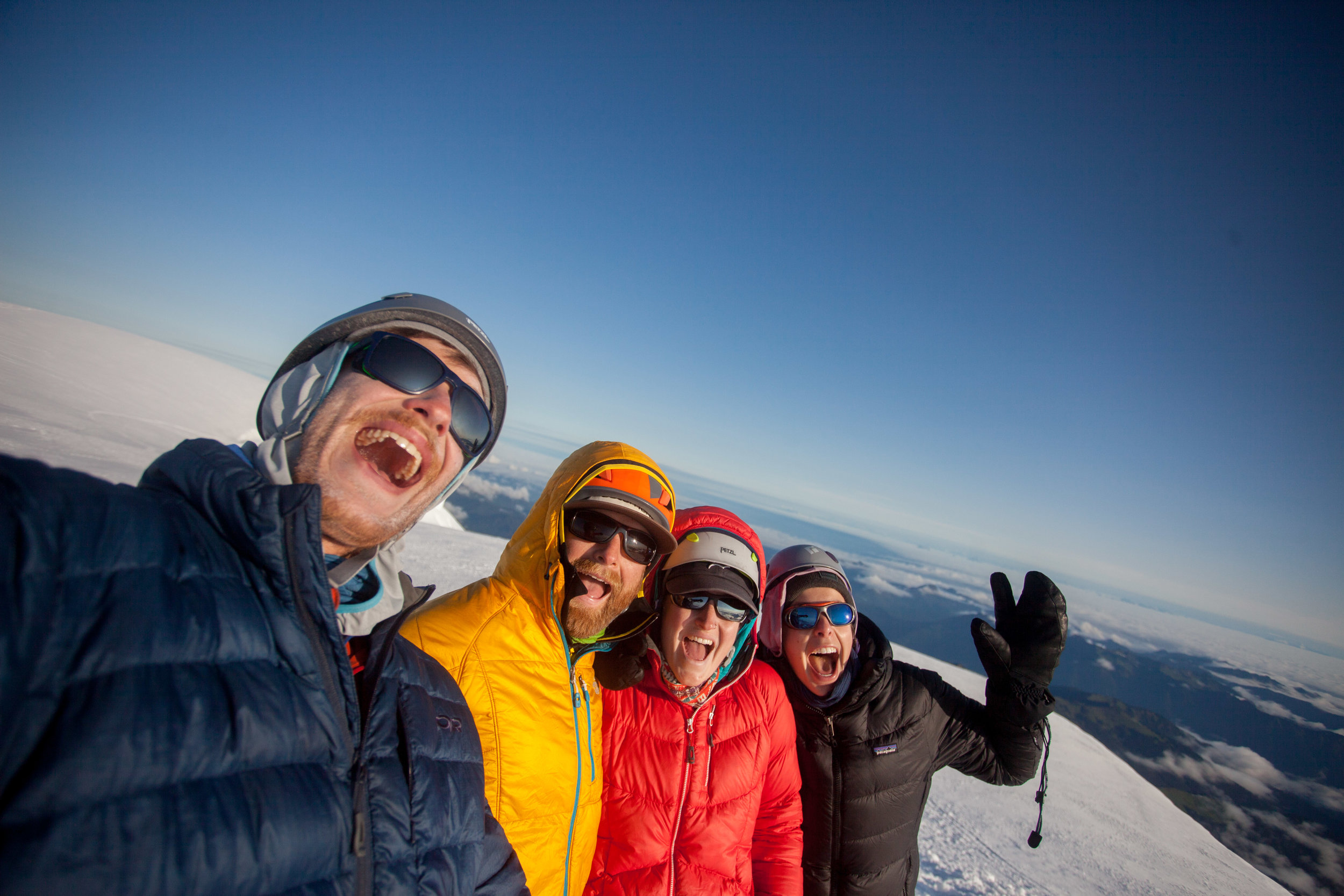
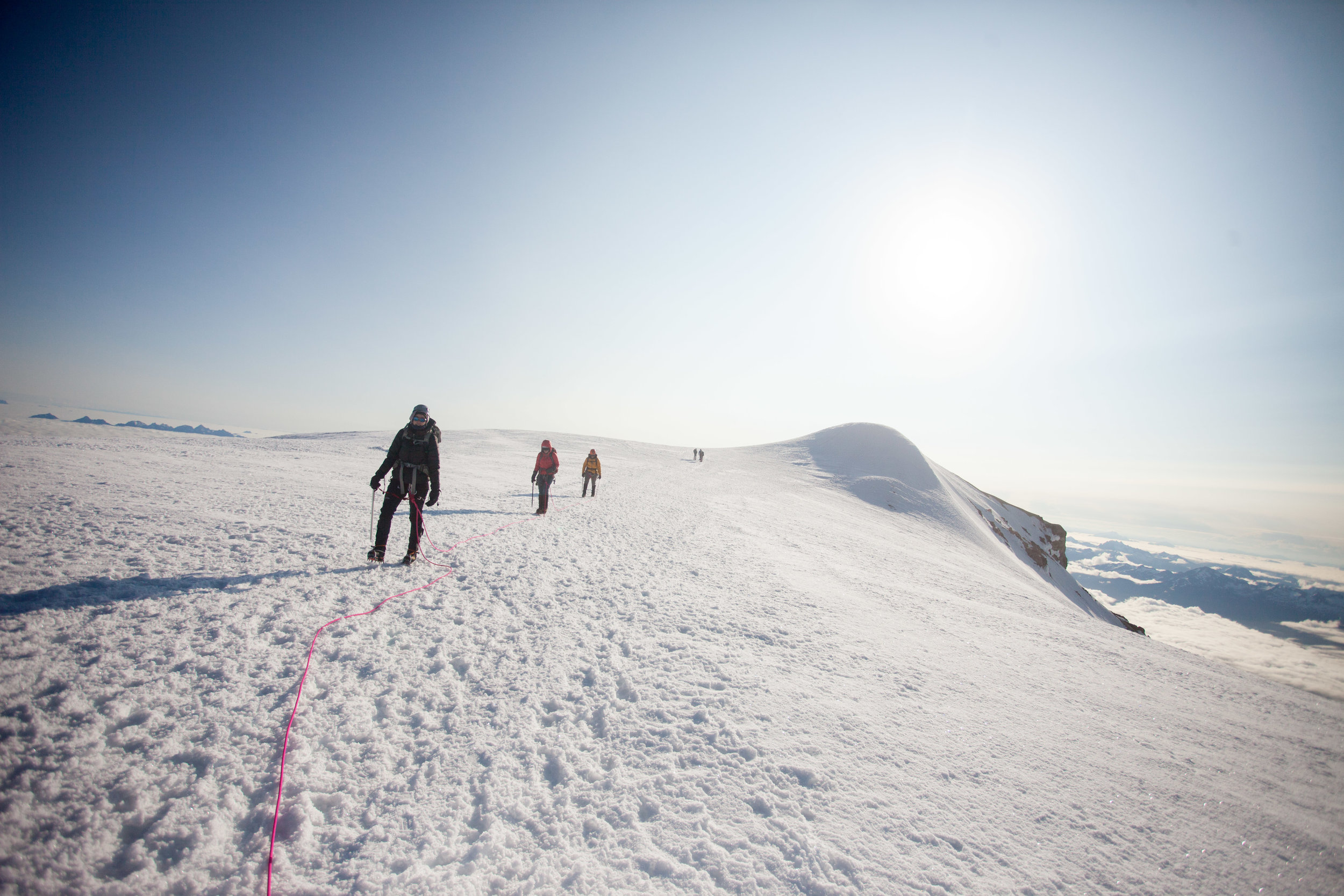
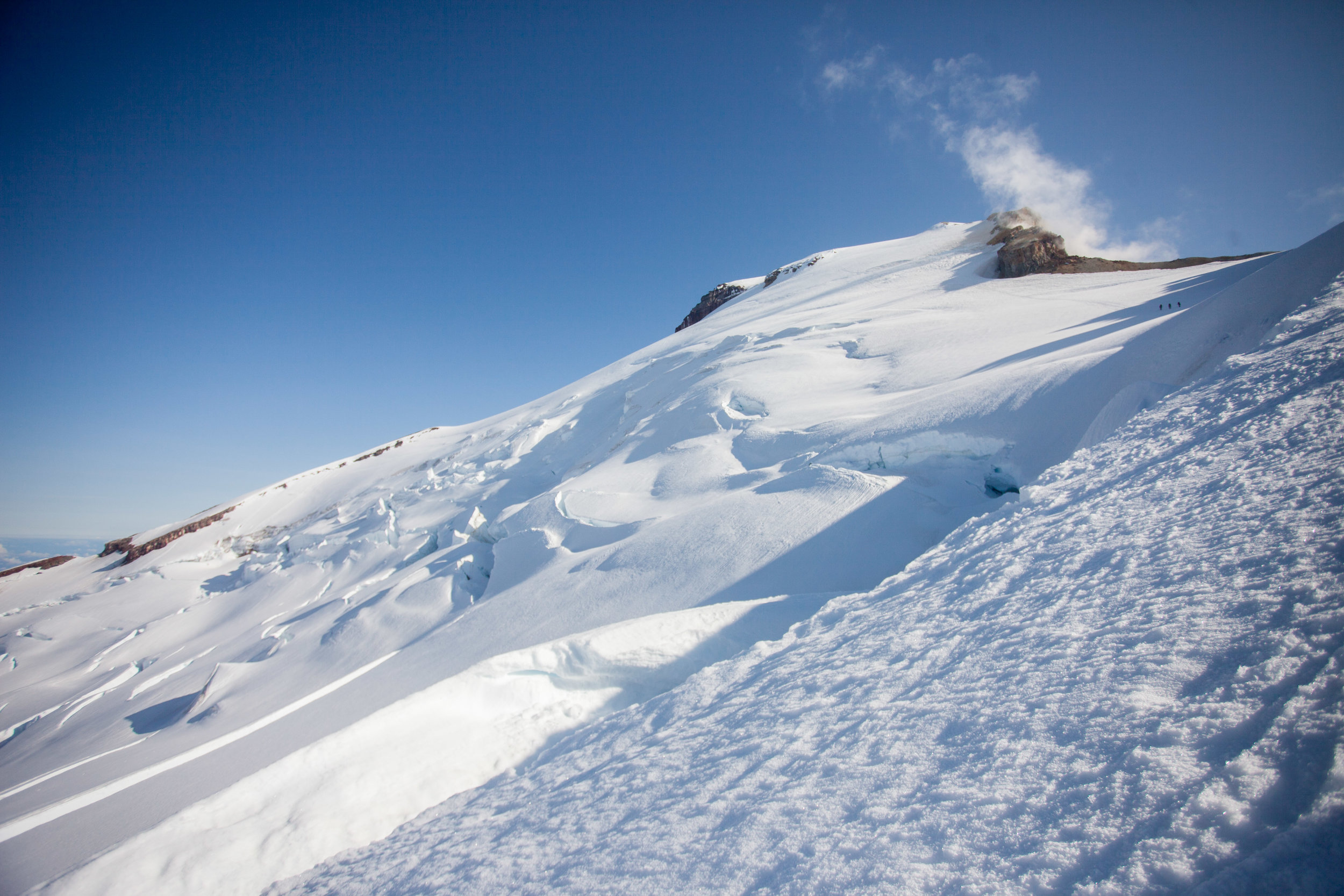
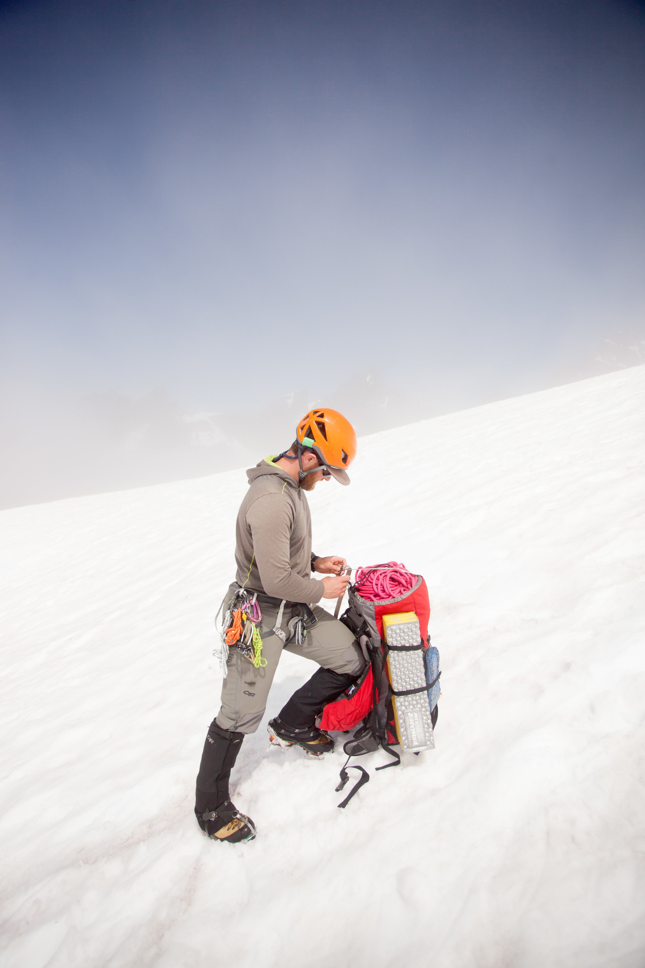
Trip Report - Mt. Baker (Easton Route) - 7/7-8/19
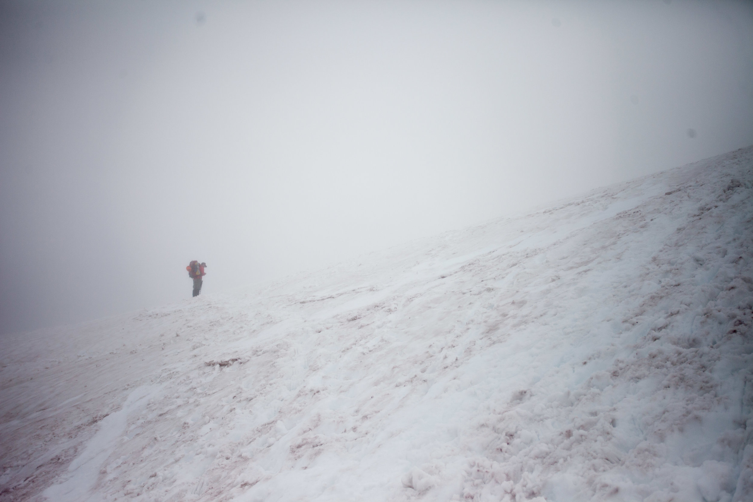
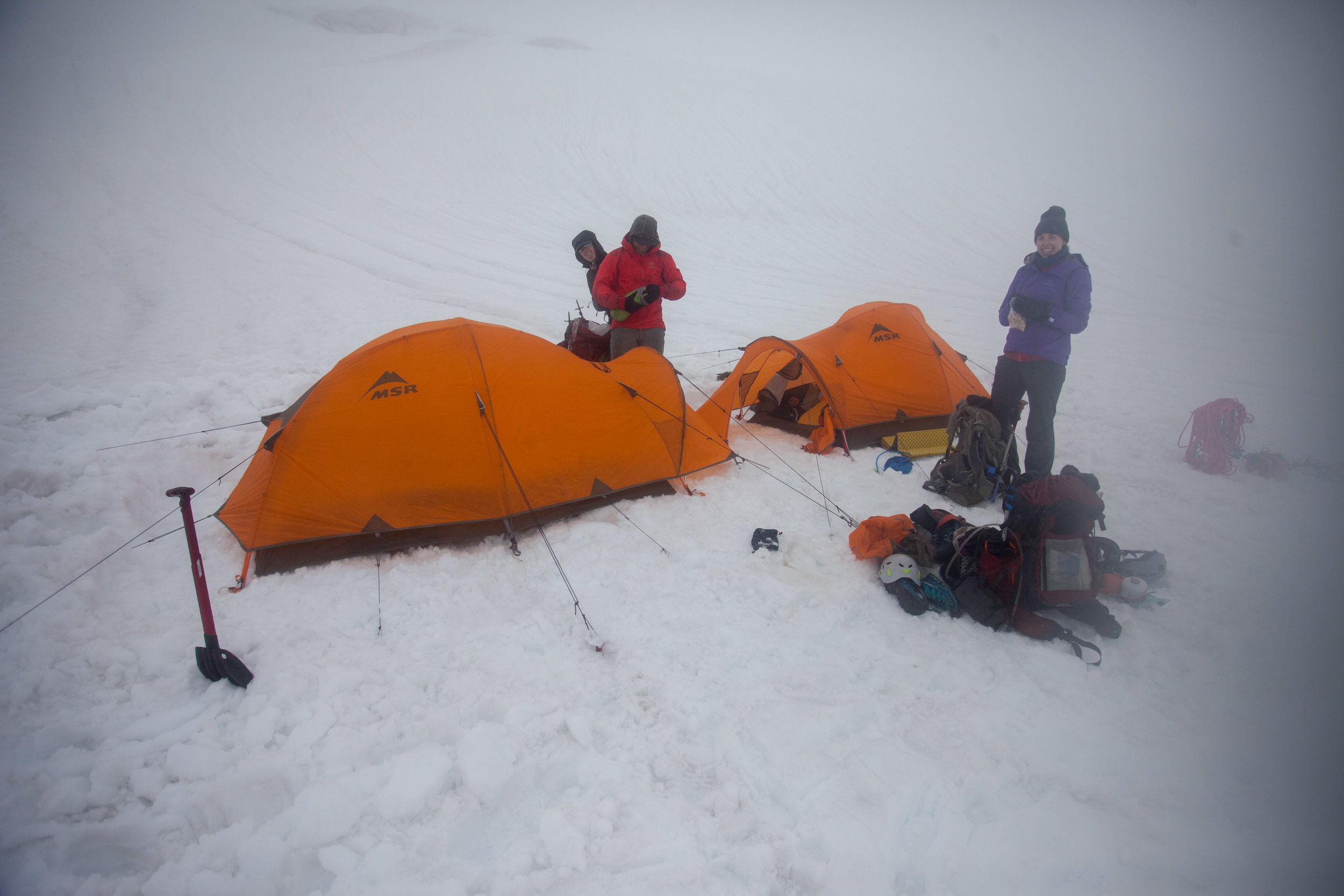
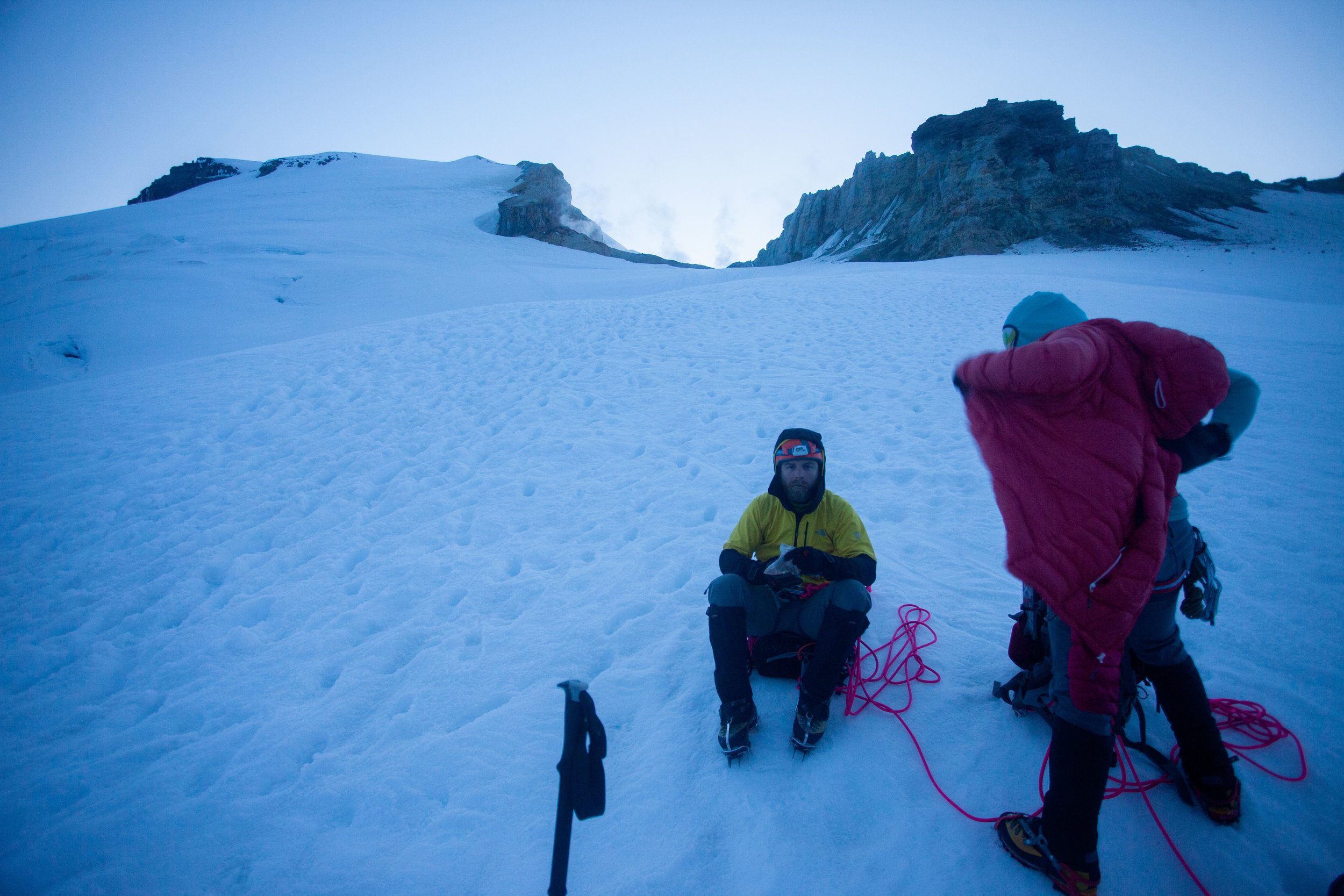
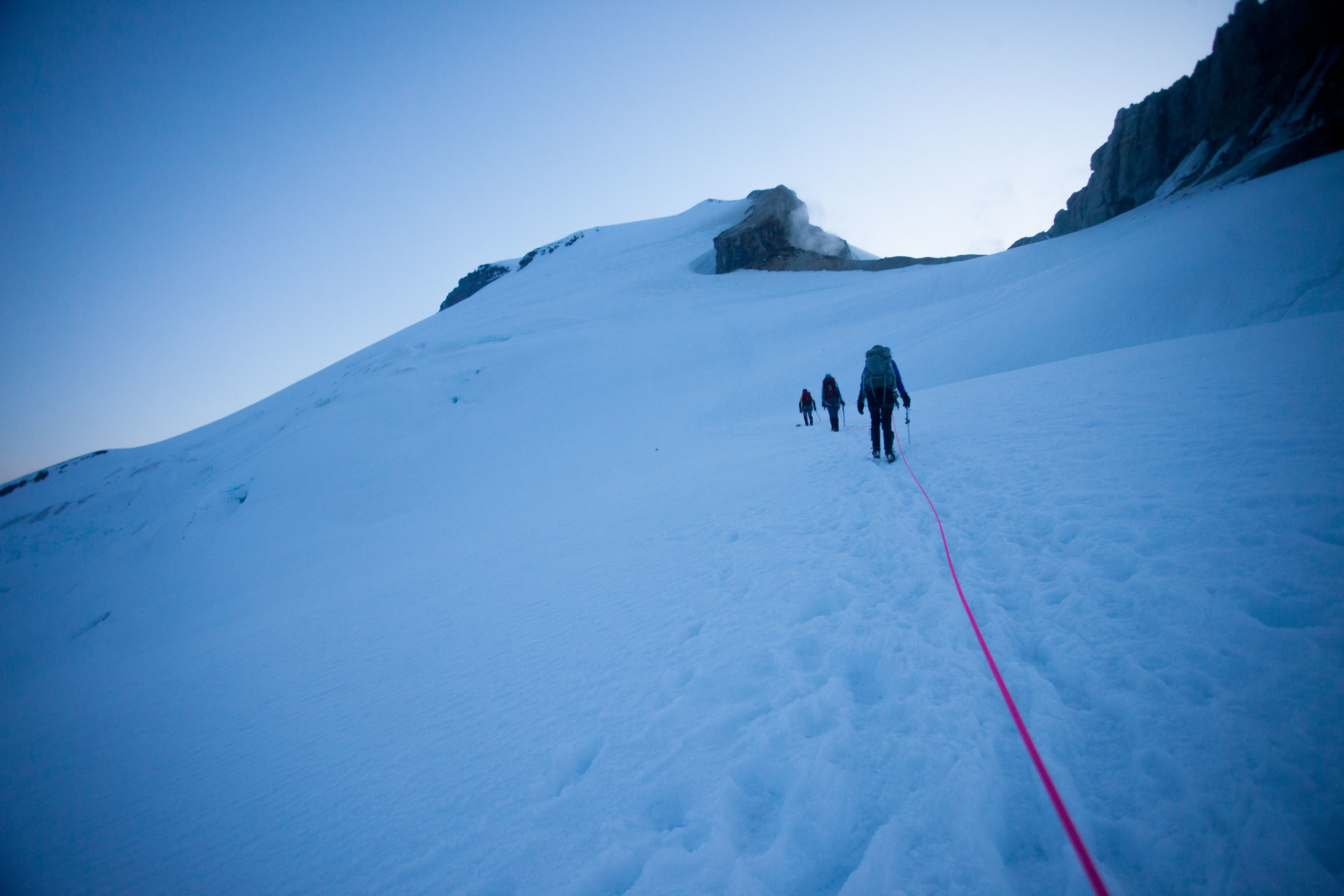
After years of dreaming about the big Washington volcanoes, I finally felt like I had the experience to make an attempt on Mt. Baker. And early on Monday morning, we were the first party to reach the summit. We got super lucky on the weather, and I feel really grateful to my amazing team (Becky, Marc, and Kate) for how well it all went. Here are some photos!
Trip Report - Trapper's Peak - 6/1/19
10.8 miles, ~3,500 ft of gain, 7.5 hrs
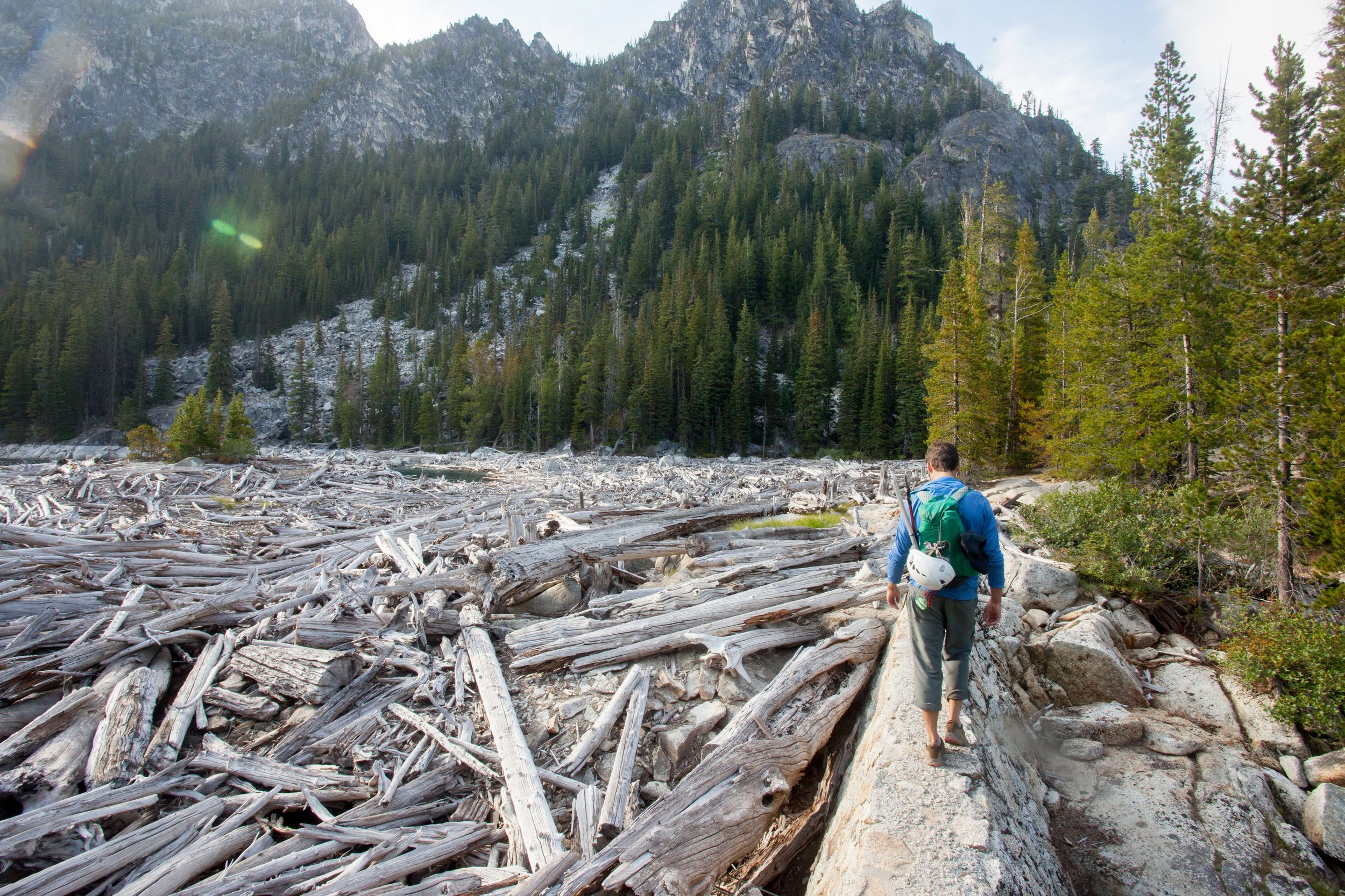
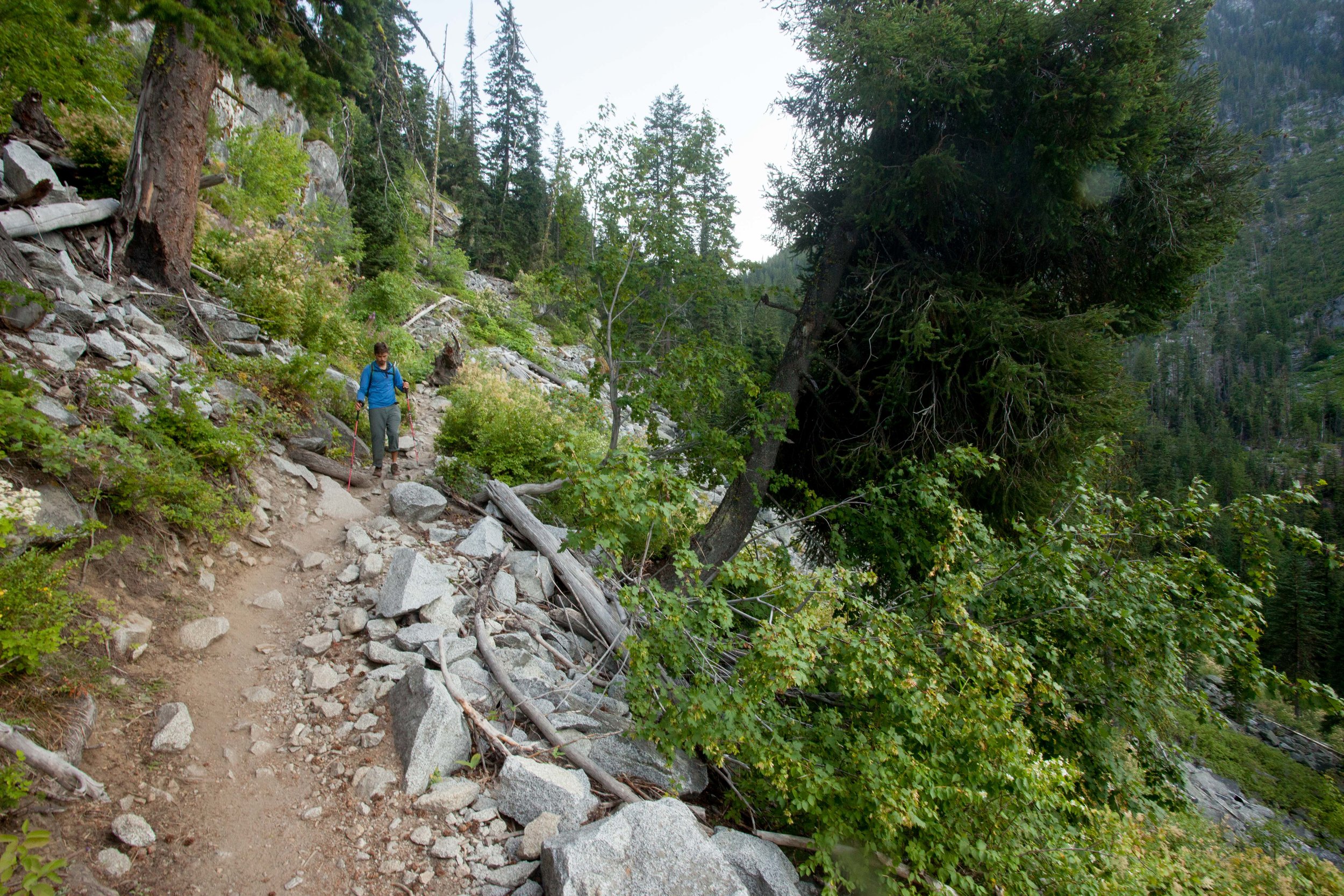
I’ve had Trapper’s Peak on my list for years, mainly so I could get a view of the Picket Range up close (which was absolutely worth it). But the climb was beautiful by itself too - a wonderful ramble through the forest up to the Thornton Lake notch, then up along the ridge to the summit knob. There was intermittent snow, starting around 3.5 miles in, and the ridge alternated between snow-covered and fully melted out. For the final push up to the summit, we had the option between chossy looking rock + heather and steep snow, so we chose the snow and then enjoyed the view!
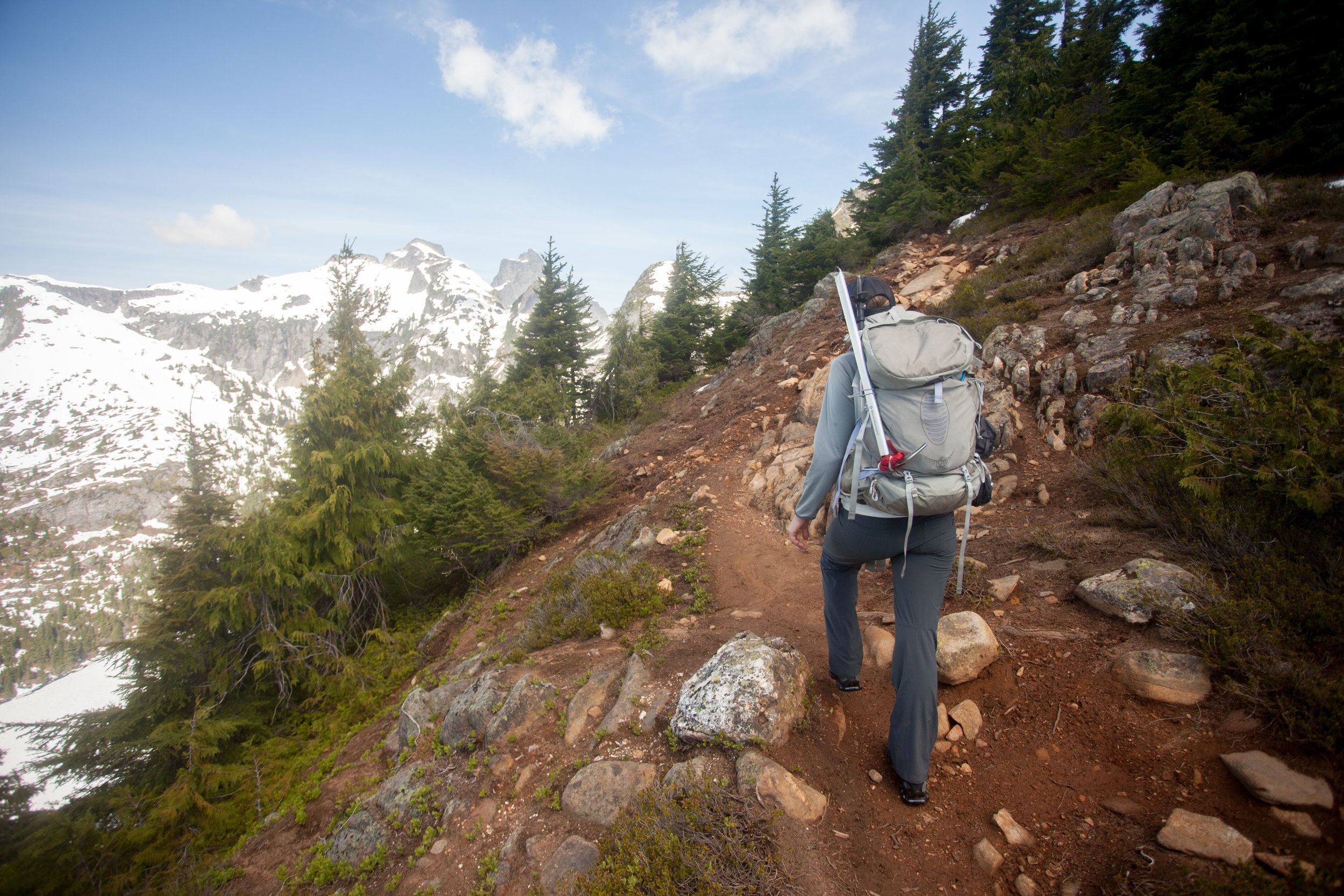
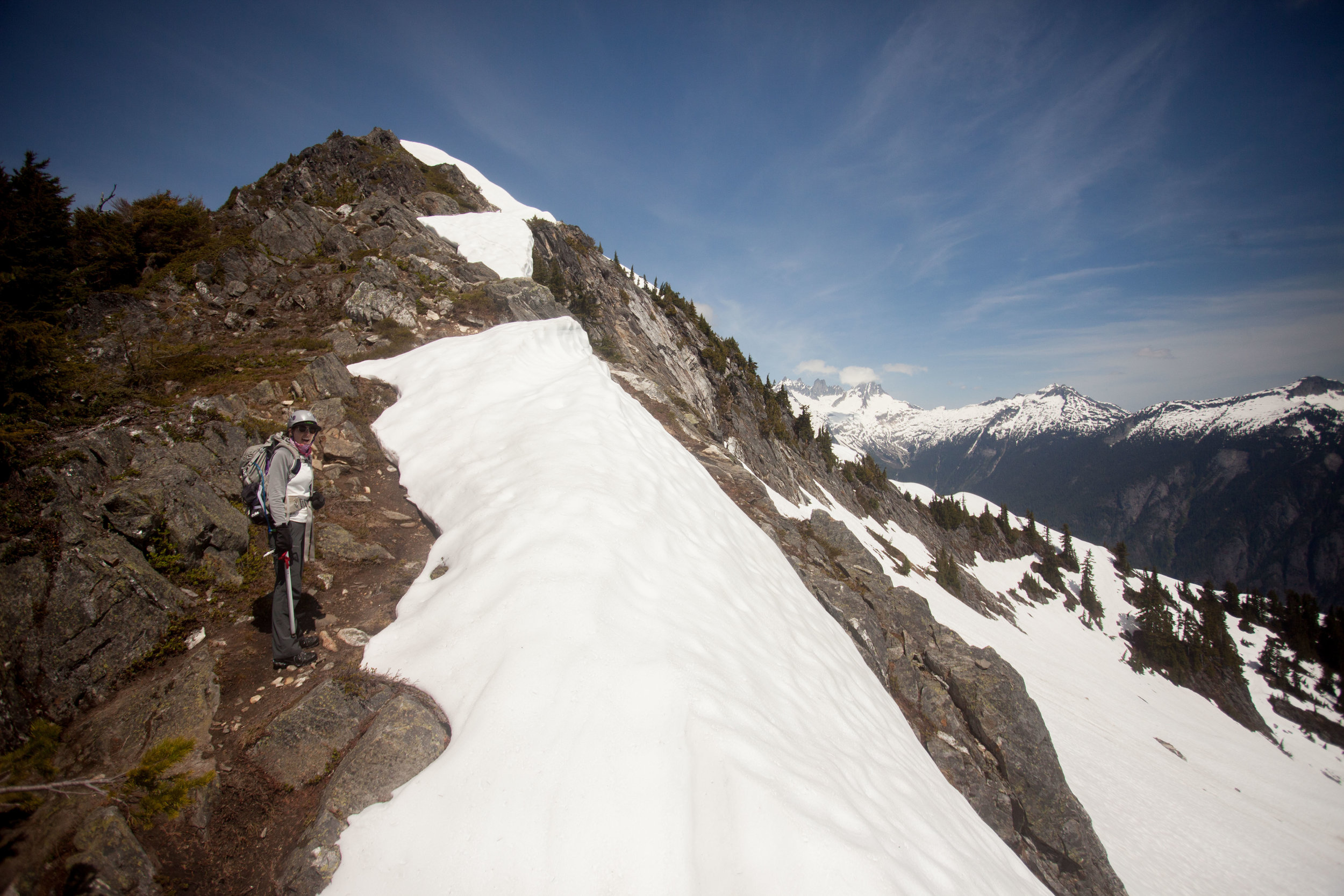
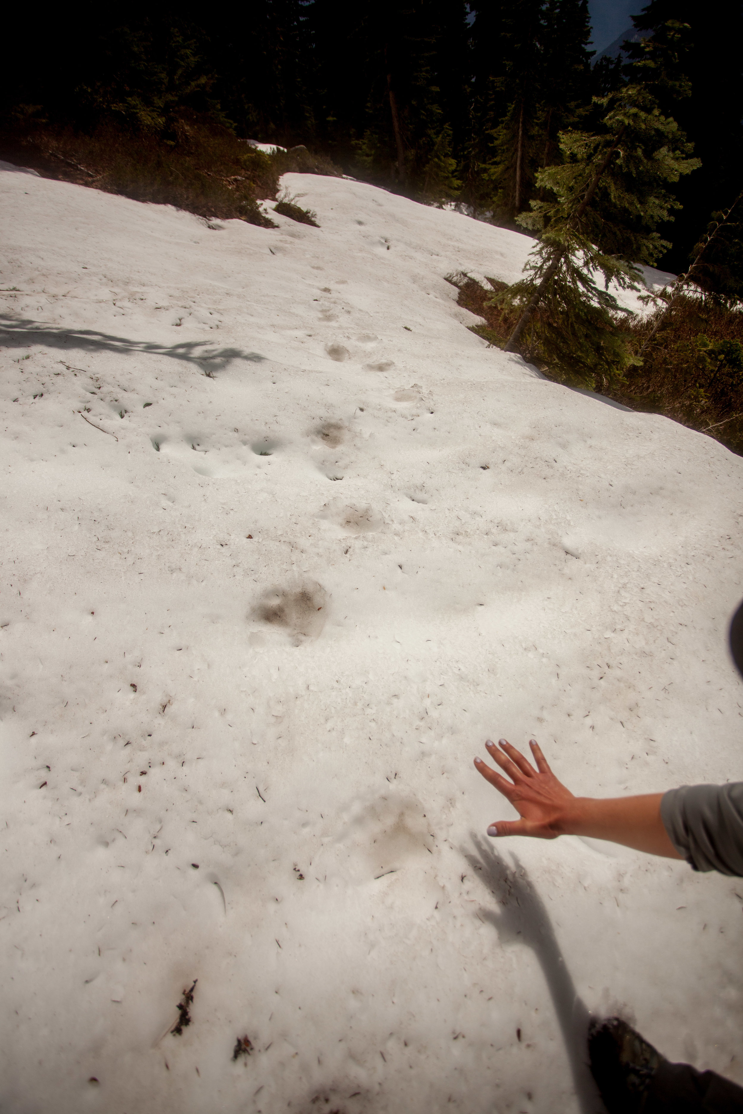
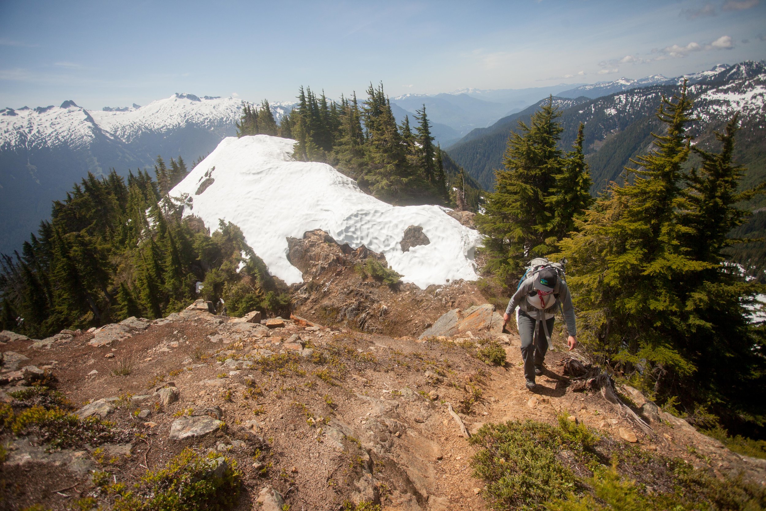
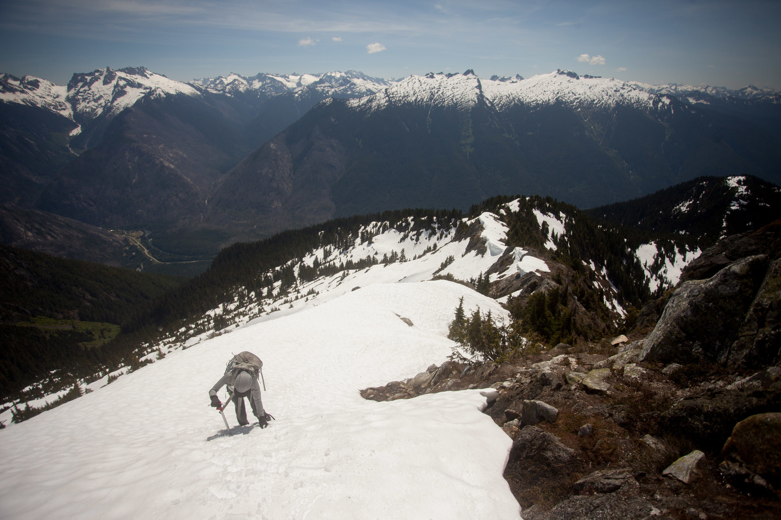
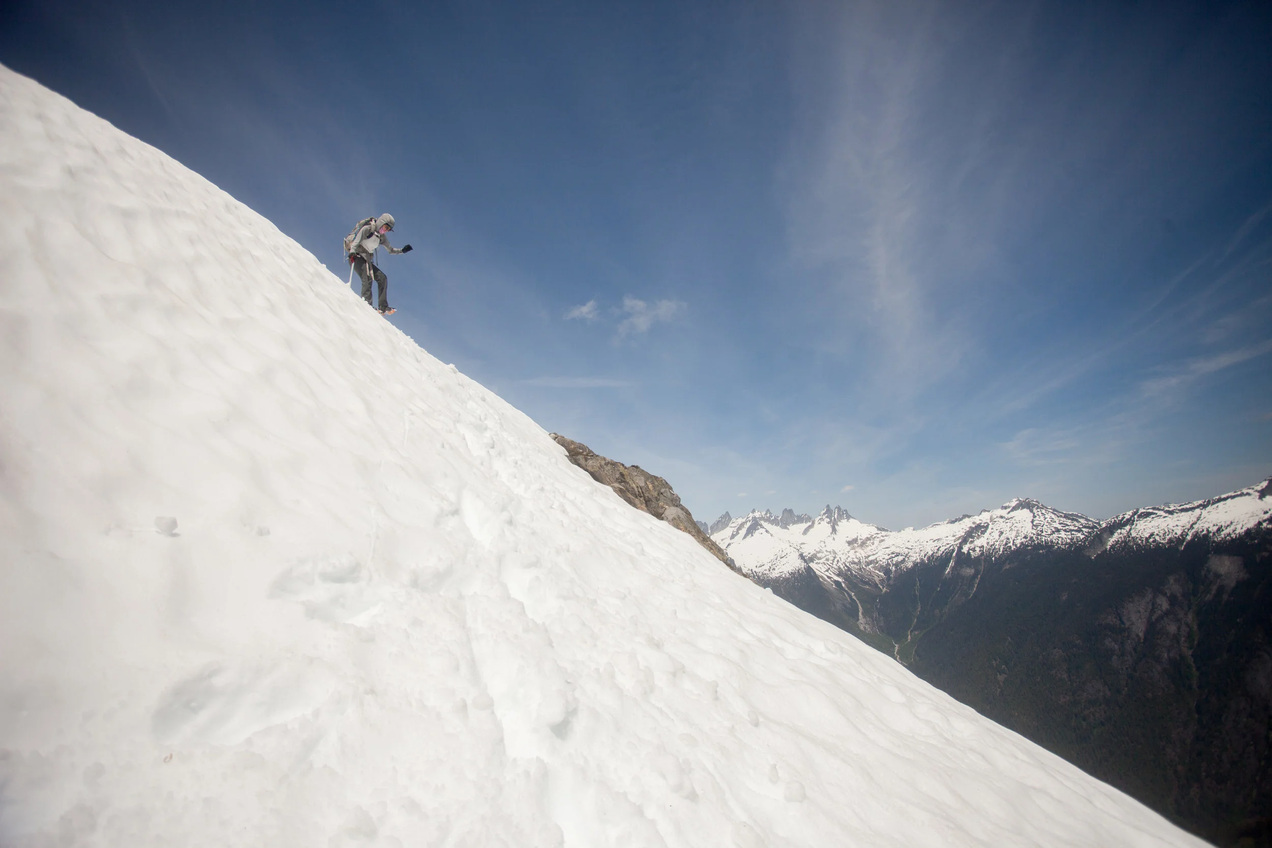
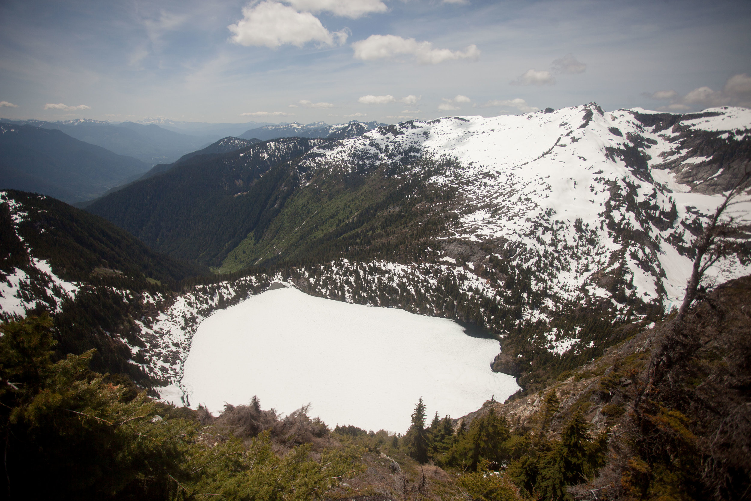
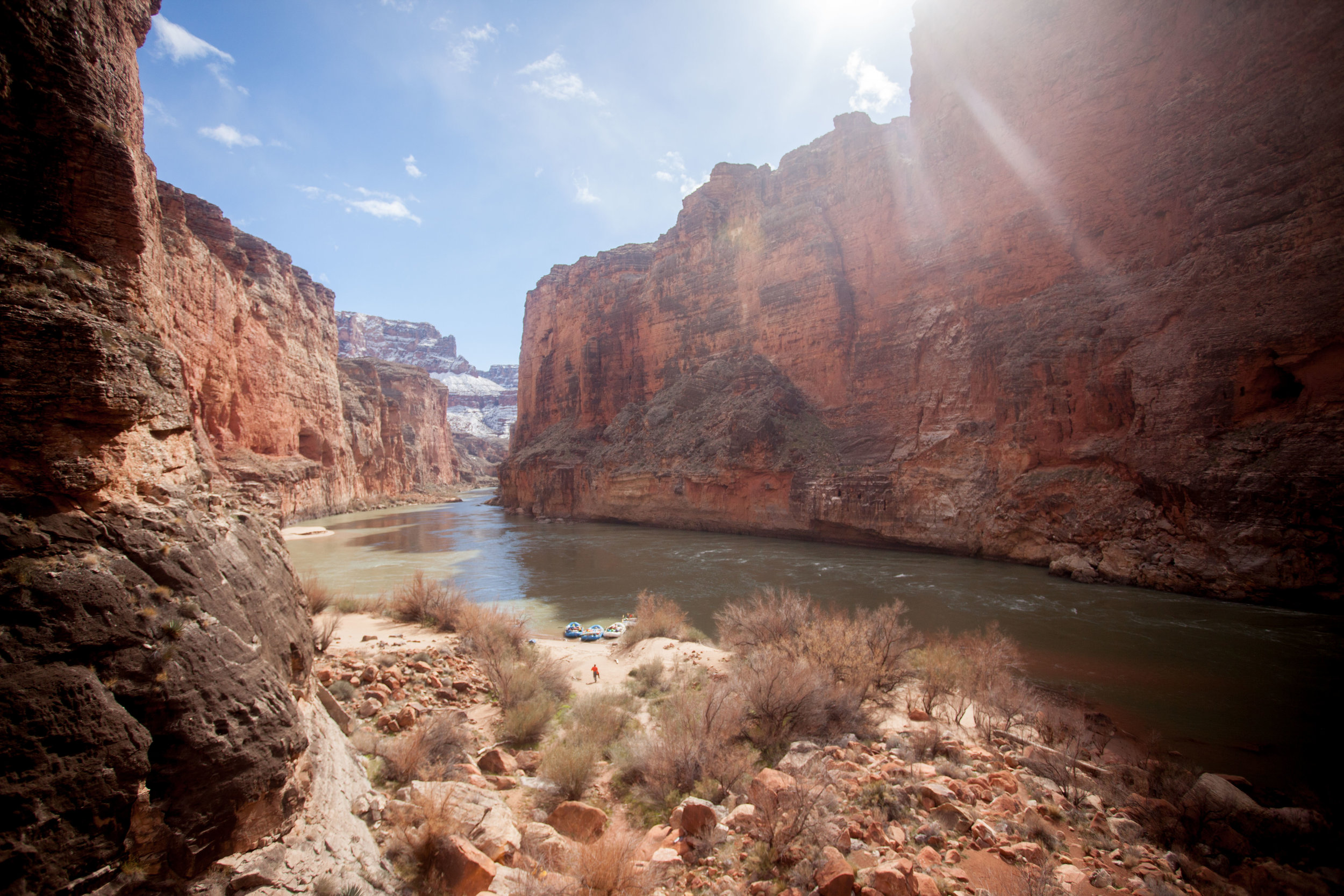
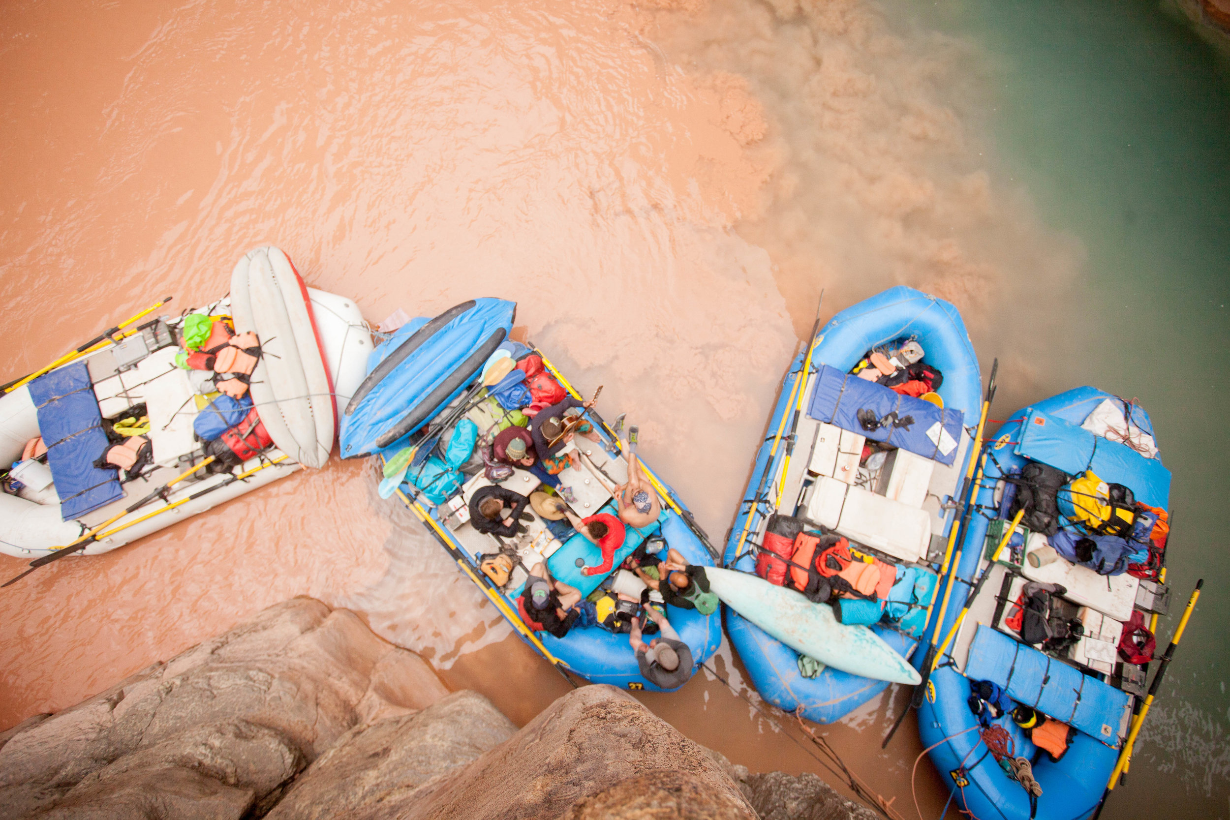
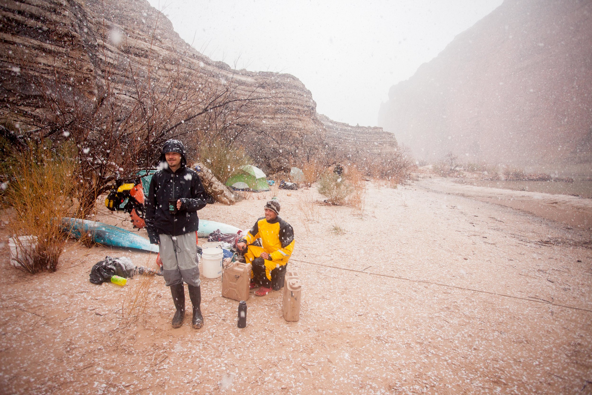
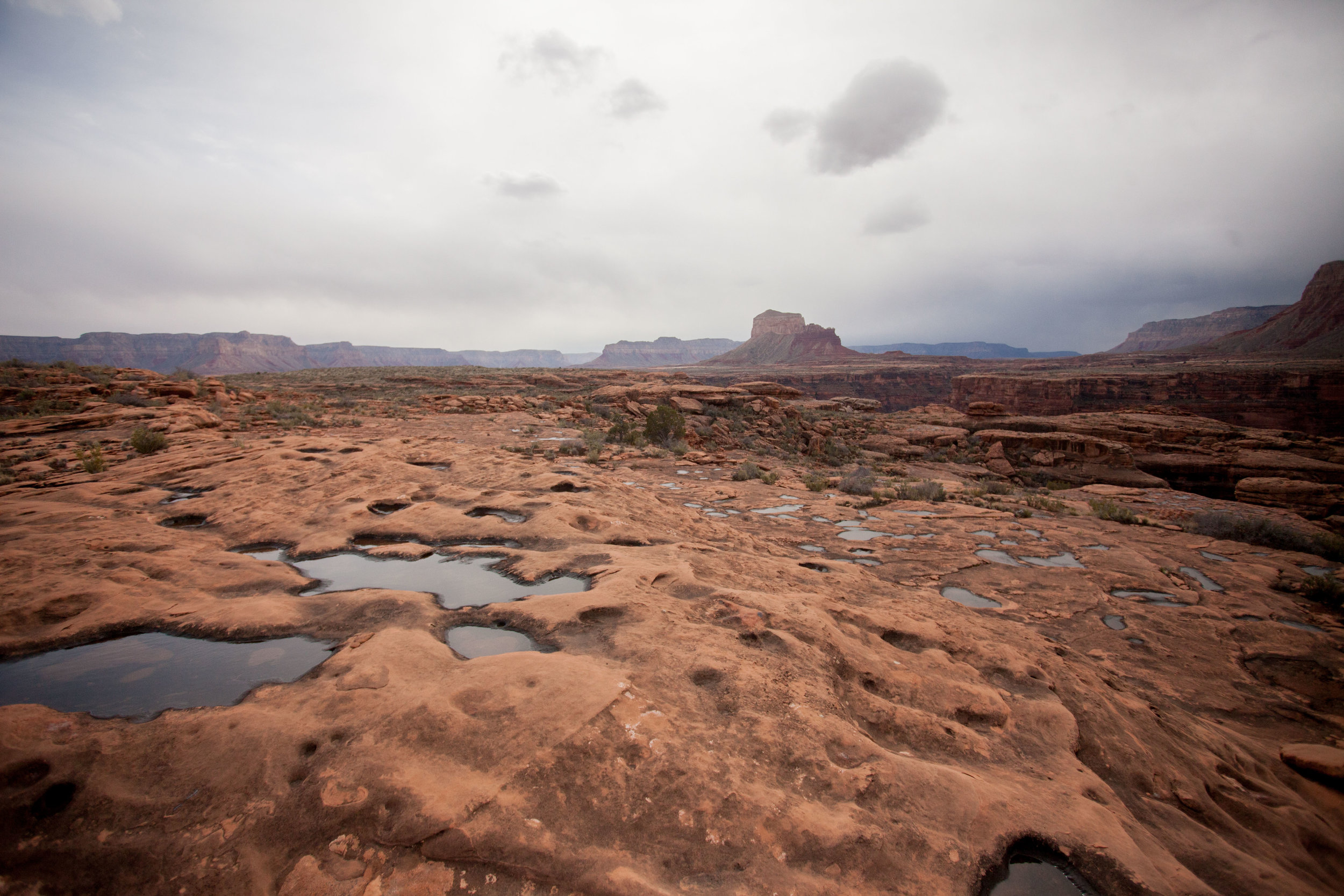
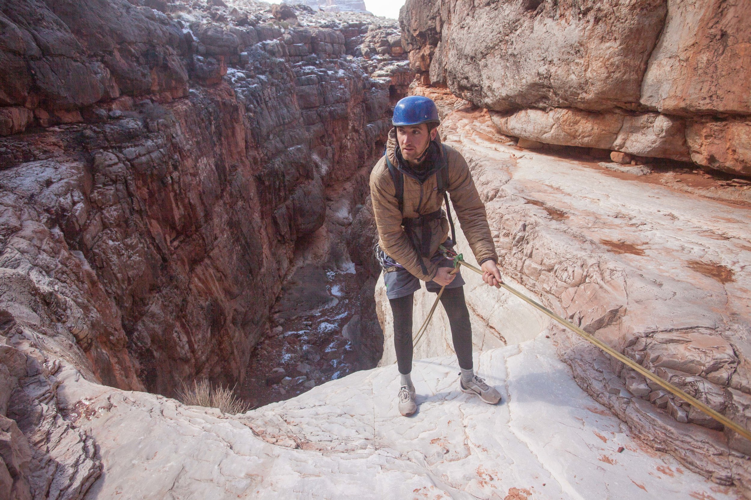
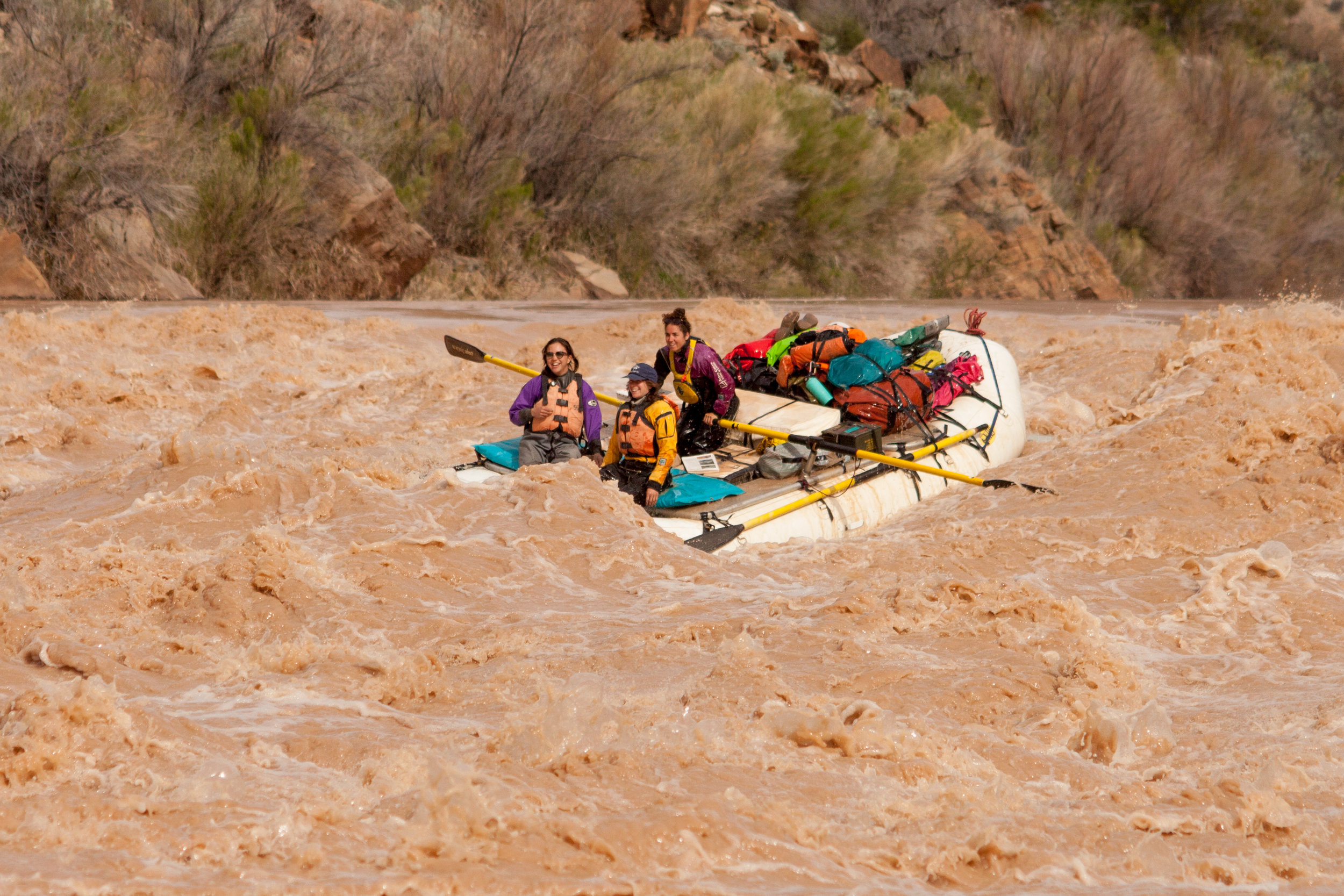
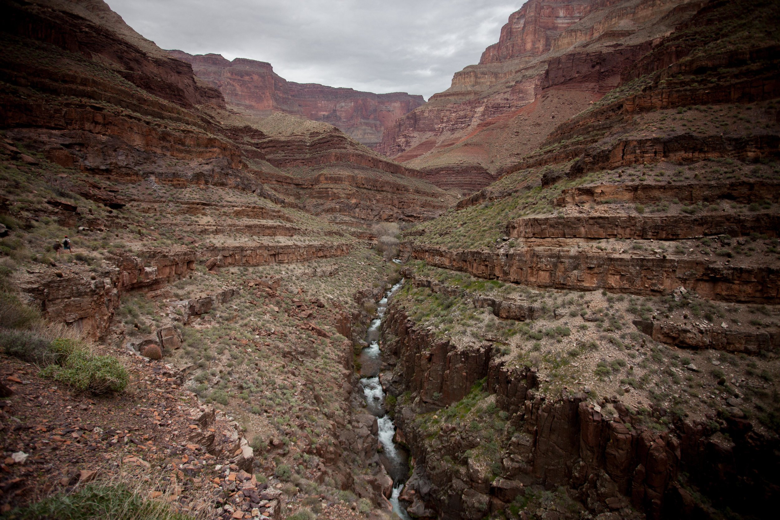
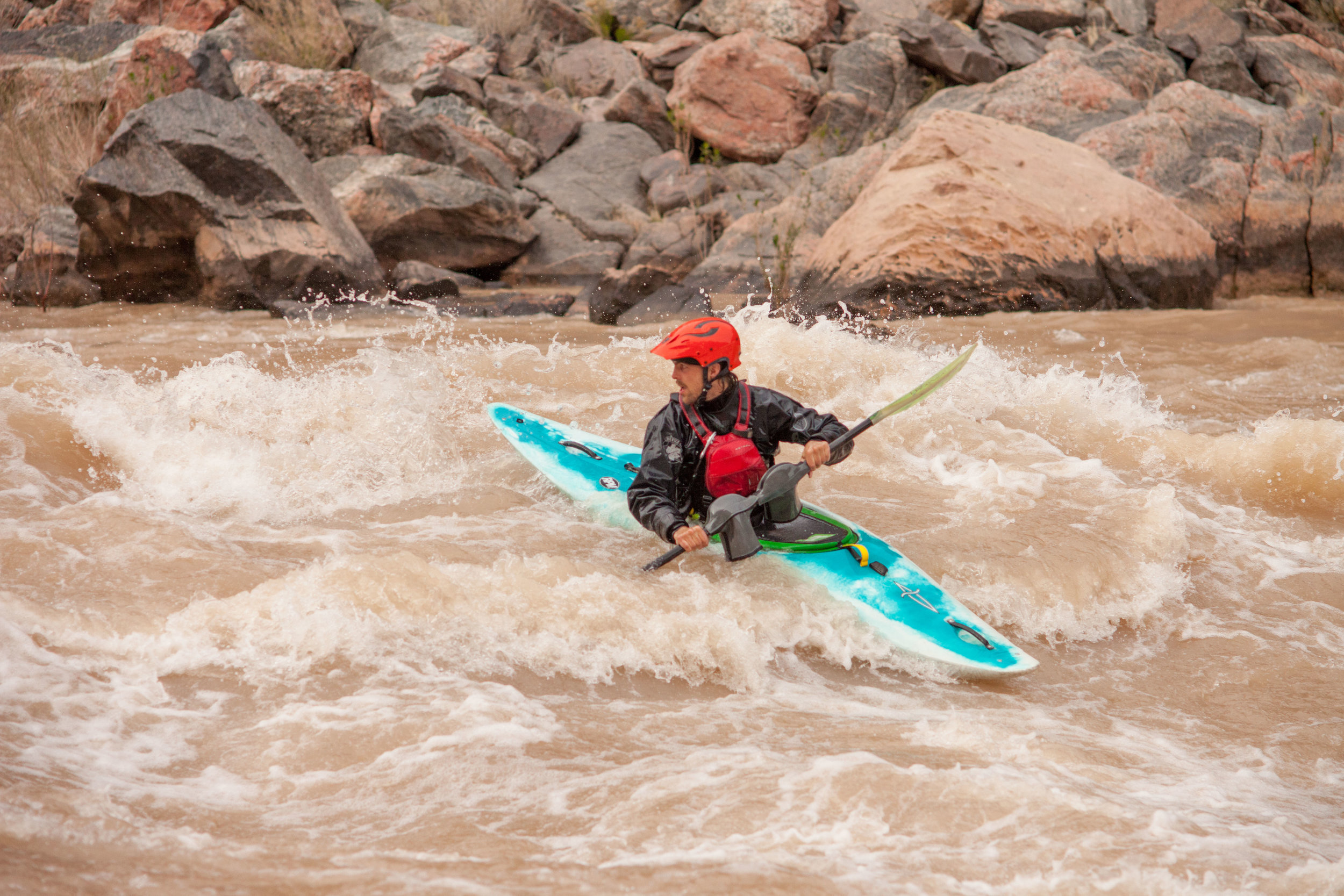
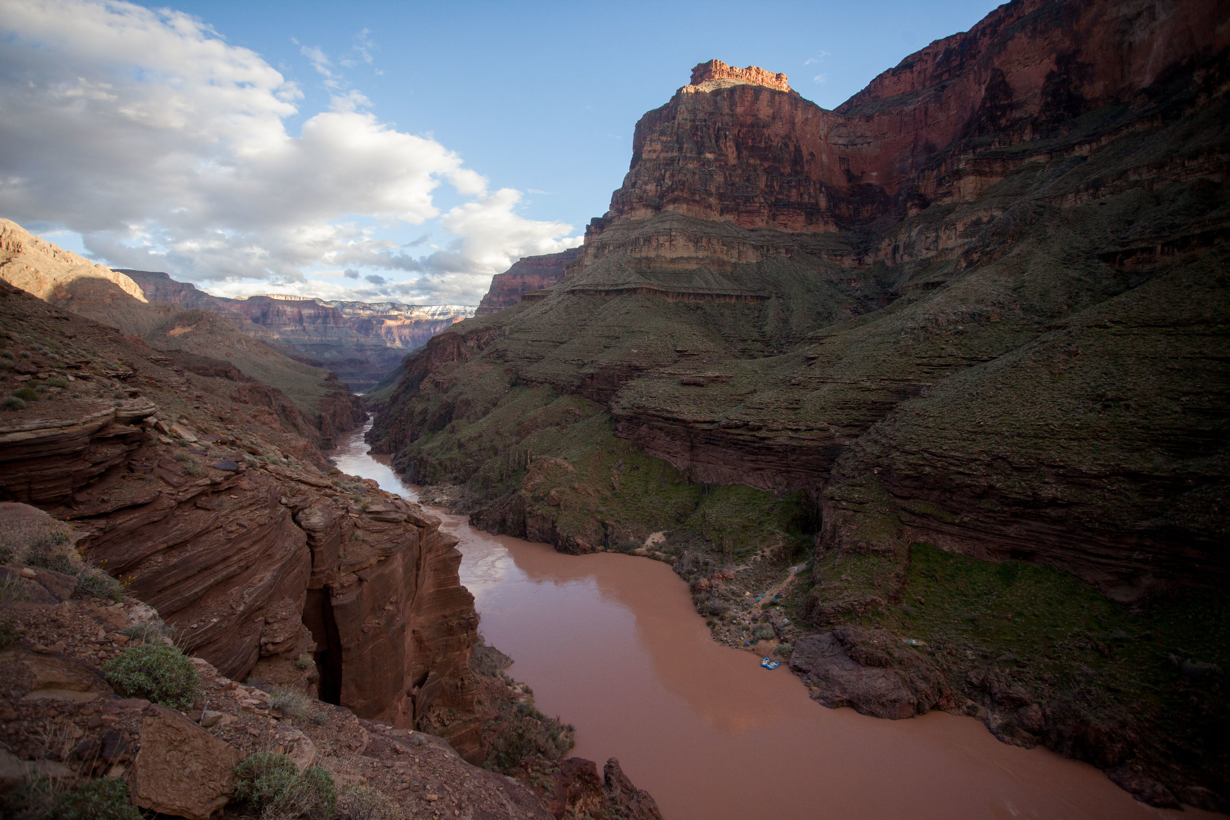
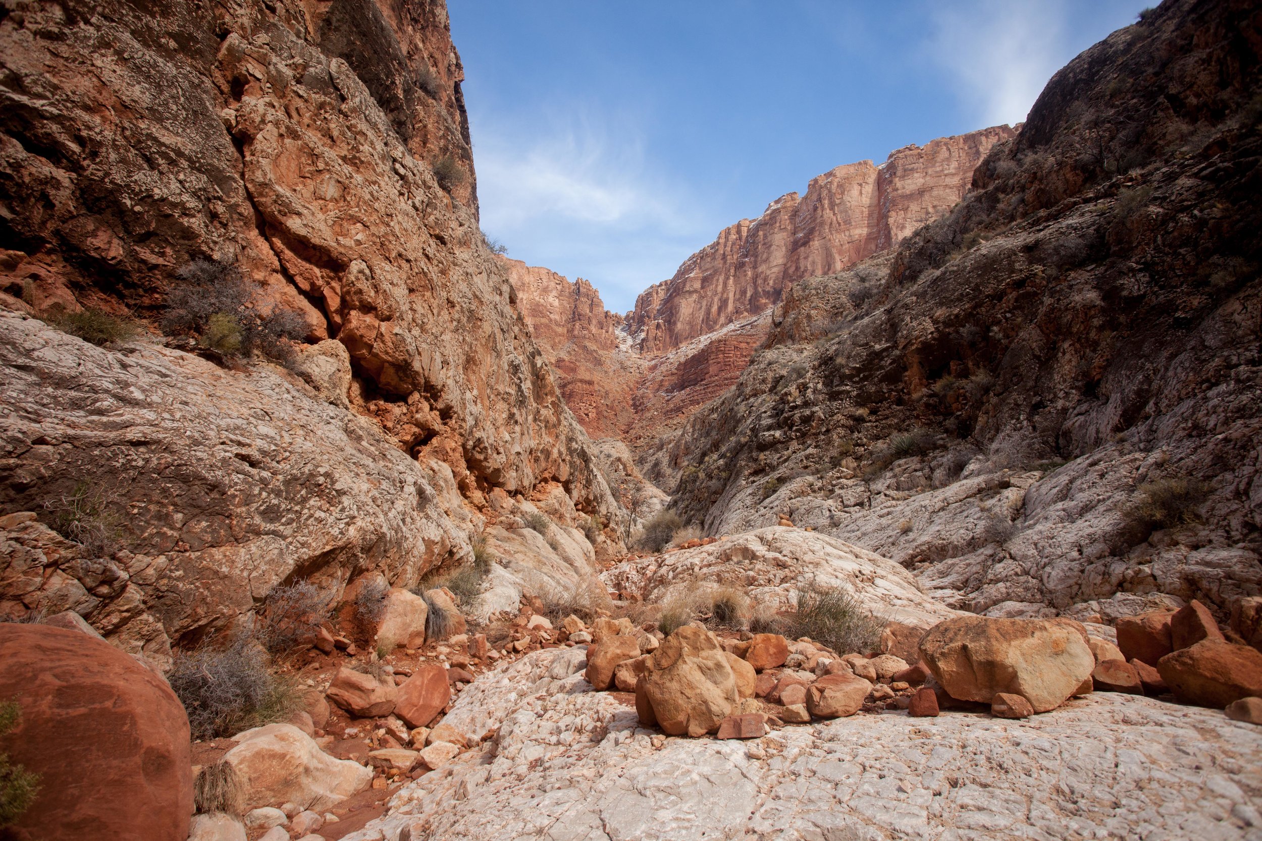
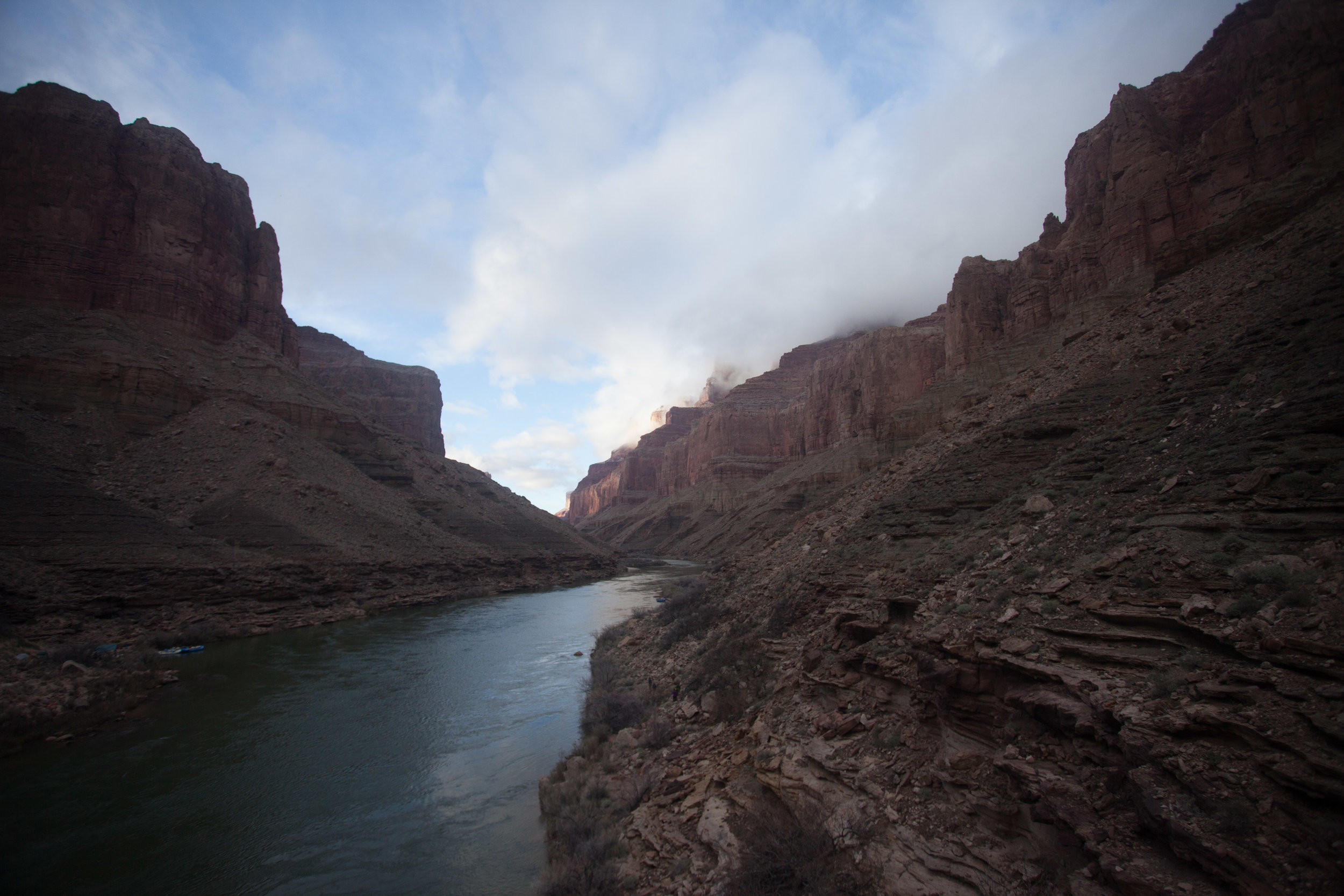
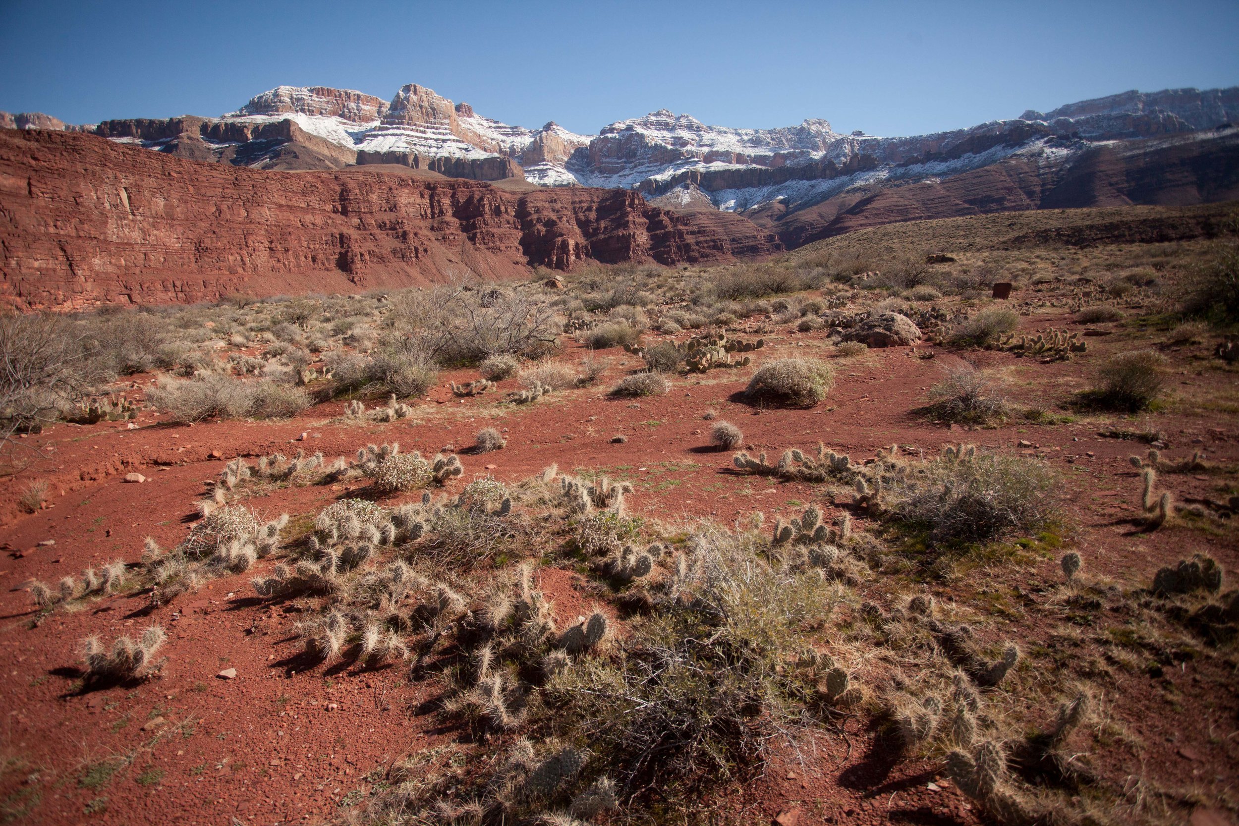
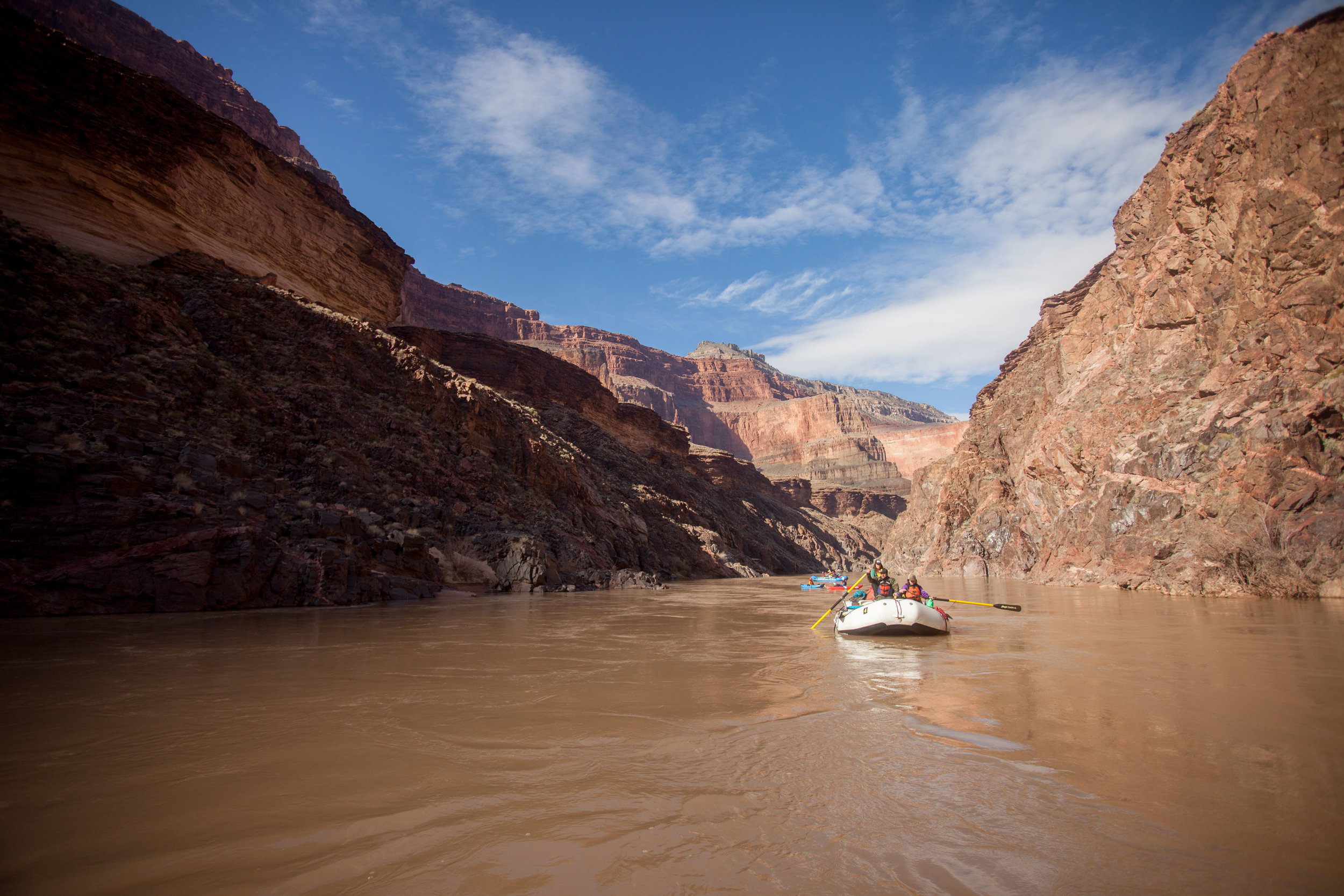
Photo Essay - 27 Days Rafting the Grand Canyon - February + March 2019
I’m still processing this trip, but here are some photos from one of the most incredible months of my life!