
Trip Report - Ptarmigan Traverse - June 25th through 28th, 2020

View south toward Dome/Dana/Spire from White Rock Lakes
Well, after years of thinking about this traverse, I finally had the gear, partner, weather window, and time off, so my buddy Robby and I gave it a go.
Our original plan was to follow Kyle McCrohan’s Extended Ptarmigan Traverse, though we were thwarted by bad weather on the third day (and threatened by a worse forecast on the 4th). More on that later…
We dropped cars for the shuttle (~5 hrs of driving from Seattle) and slept 2 miles short of Cascade Pass due to the closure (which ended up being caused a totally manageable pile of snow).
Basic Stats:
4 days/3 nights - this felt good and doable, though with Kyle’s extension that day 4 would have been burly
our route had 14,000’ of gain and 44.5 miles traveled
Basic Takeaways (photos below):
this trip felt very early season, with a ton of snow and few patches of bare ground
the benefit of this is that descents went fast, though the sloppy snow slowed down our climbing pretty badly
there’s lots of flowing water, even though there’s so much snow. we never had to melt snow.
we didn’t have to cross or come near any big crevasses
we saw evidence of a lot of big cornice fails (saw one come off the N face of Formidable) and set a few small loose wet slides (D 0.5 at most) but generally felt pretty avy-safe
Specifics:
Cache Glacier to Cache Col is chill, though there’s still a gnarly overhanging snow/cornice thing hanging on a rock that Kyle McCrohan documented a few days ago. When that breaks, it’ll be bad for anyone underneath
Koolaid is still all snow
Red Ledges are snow up to the ledge, with intermittent steep snow traversing required. With soft snow it was fine, though exposed and unprotectable
Yang Yang Lakes is still snow camping, though it’ll be melted out sometime soon
White Rock Lakes has good dry dirt bivies
Itswoot Ridge is just a huge cornice
Cub Lake is still frozen (and the climb up to the Cub/Bachelors divide is pretty horrendous
the descent through the slide paths of Bachelor’s Creek was, to quote Jake Walker, “a human car wash” of brush and schwacking. in other words, it sucks.
Photo Story
Day 1
Despite all the posts I’ve read about the Cascade Pass switchbacks, we were up them pretty quickly, where we put on crampons (which we would have on more or less continuously.
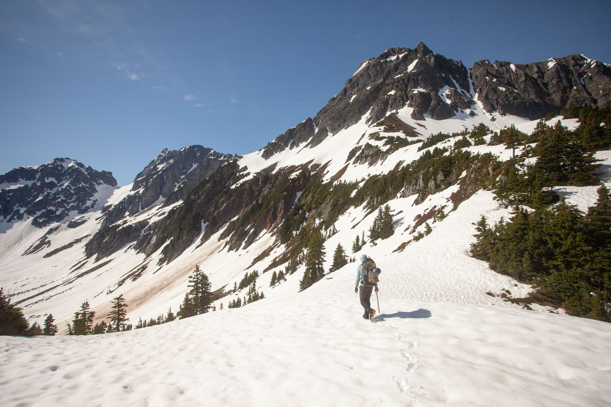

Climbing up to Cache Col, with the view of Sahale behind us
View from descent from Cache Col down toward Koolaid Lake (invisible in this photo due to snow) and Red Ledges, with Mt. Formidable dominating the upper right of the frame

Closer to Red Ledges
The climb up Red Ledges really wasn’t that bad. Just some steepish snow climbing, which was helpfully soft, followed by alternating traversing on scree held together with red mud, and traversing more steep snow…

Almost finished
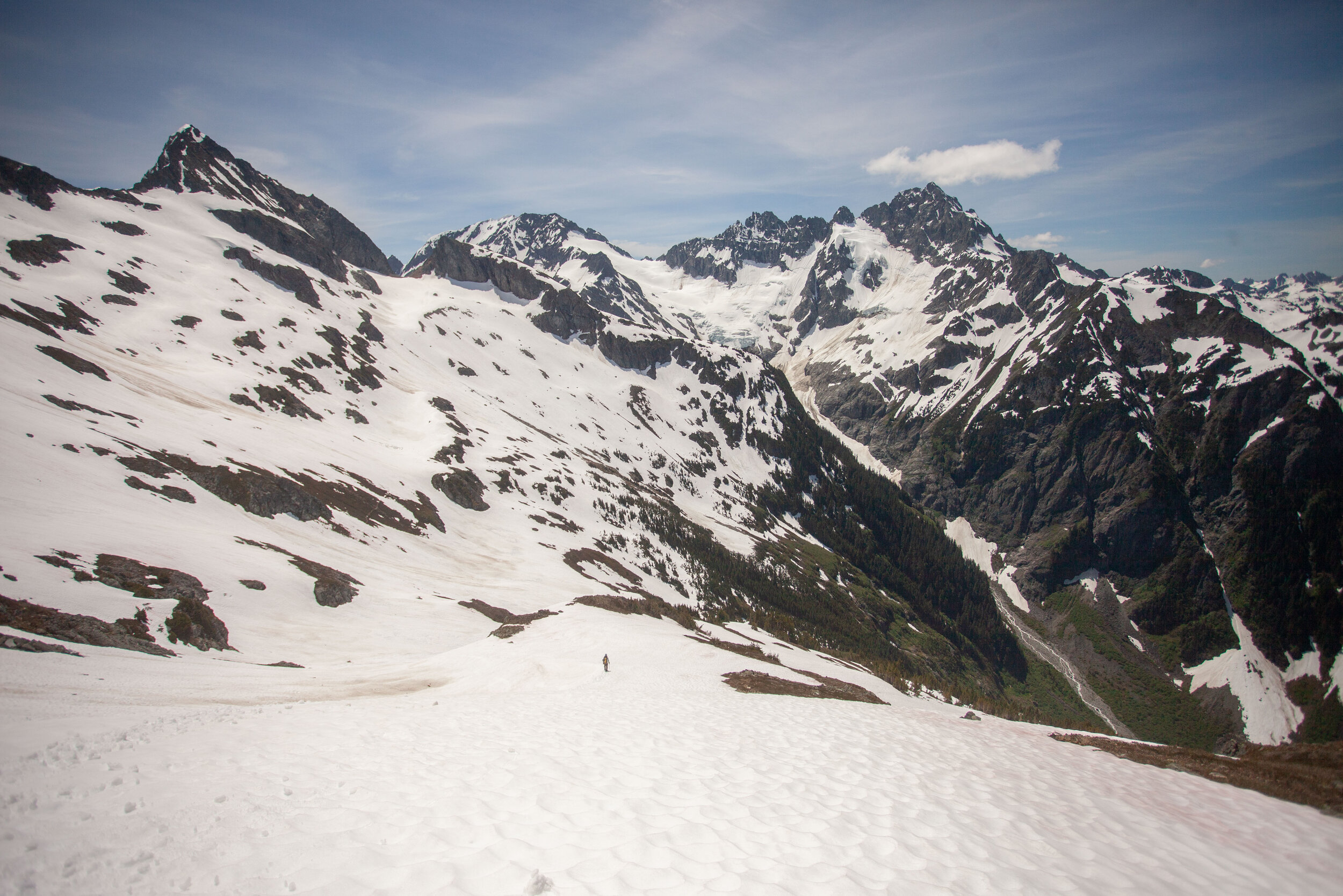
View from Spider Formidable Col toward the rest of the traverse, with the loose wet slide in the foreground
Day 2

Yang Yang Lakes -there’s no sites melted out yet, so we camped on snow here, though there’s a ton of easy access water (obviously)

We took the “snow finger” as described by Volken/McBrian out of Yang Yang Lakes area, which was the steepest snow on the traverse at probably around 45 degrees. This cut off an annoying looking spur that kept you on lower angle terrain but required more gain and distance

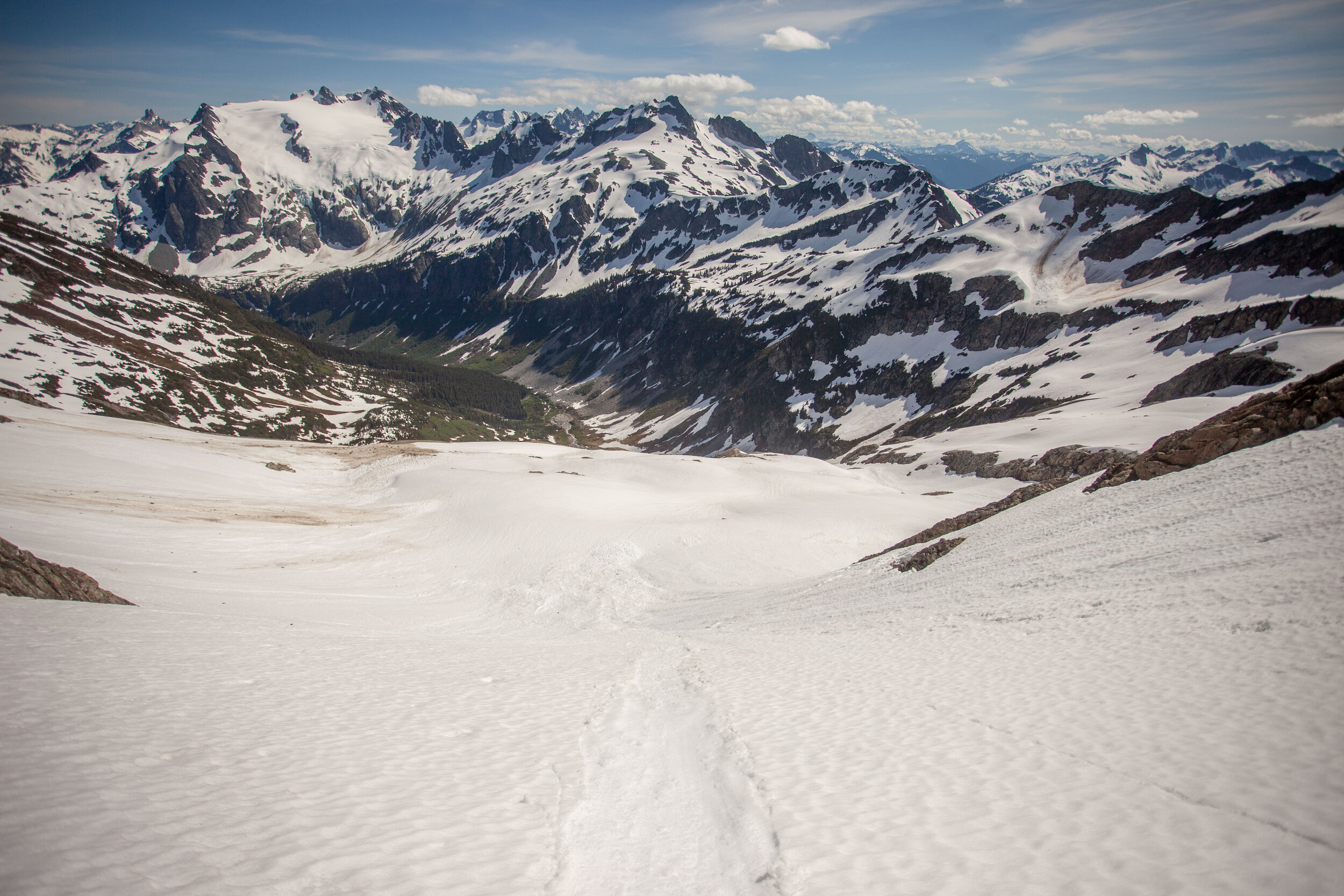
South Cascade Glacier and the weather begins to blow in from the northwest

Climbing down to White Rock Lakes was surprisingly steep, but with the soft snow felt very chill

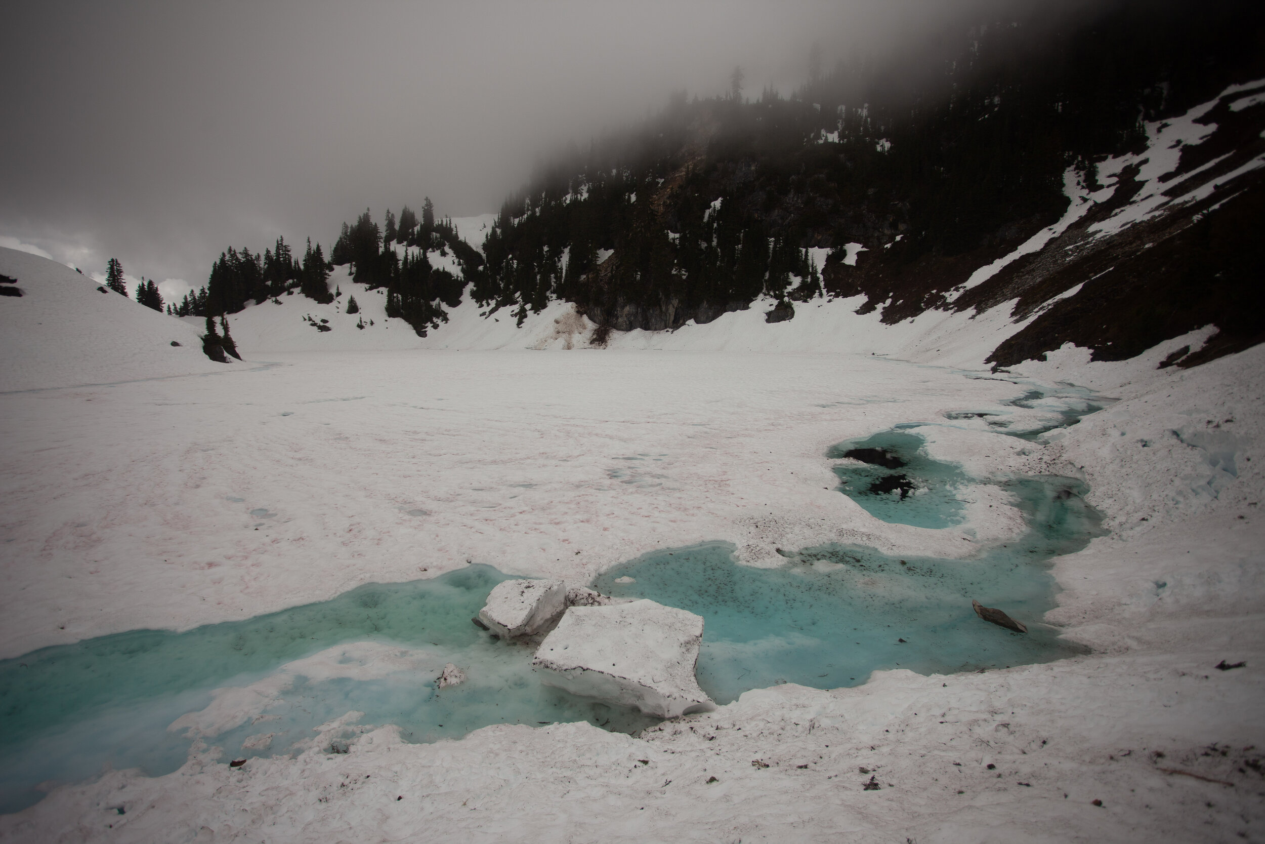
Current state of White Rock Lakes - not really melted out at all…

Solid camp site w/ at least 3 good sites, though this was definitely the best
It rained and gusted all evening, so we spent about 12 hours in the tent, playing cribbage and eating all our food.
Day 3 - Here’s where we left the standard Ptarmigan…
We headed across the huge cirque, from White Rock Lakes over to Dana Glacier, then headed up southeast to the upper eastern Dome/Dana Col.
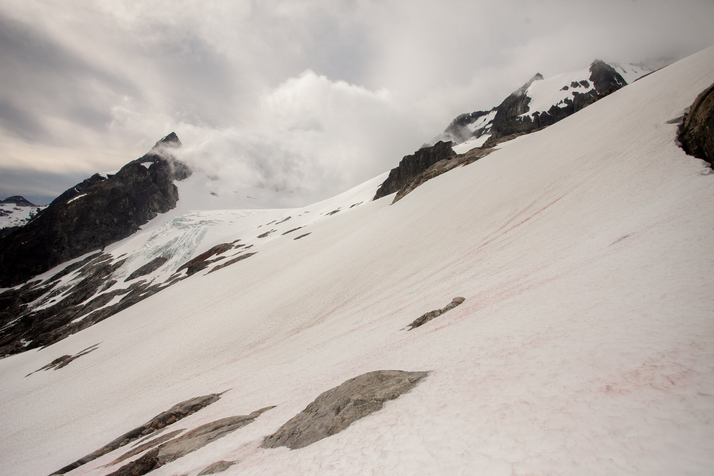
About to cross onto the Dana Glacier, looking over at Dome as it hides in the clouds
Once we were on the Dana Glacier, we lost visibility. We couldn’t see more than 40 ft, sometimes even less. I had the routes on my phone and my watch, so we just followed the lines, watched for crevasses, and waited for the col to reveal itself. It happened eventually.
Then we crossed onto the Dome Glacier, still hoping for a break in the weather, which was feeling less and less likely.

Somewhere on the Dome Glacier
We got up to 8600’ and the Dome/Chikamin Col, where we pretty quickly realized that we weren’t going any further. We wanted to summit Dome, but couldn’t even see where to start in the mist. And when we looked toward the Chikamin, we could see there was a massive drop into a yawning bergshrund, but we couldn’t even tell where the snow ended, nor whether the bergshrund spanned the entire slope.
So we sadly bailed back toward Dome Glacier and Cub Lake.

Just before we headed down, we got this view of what I think is Dome (or Dome’s false summit?) which was quickly obscured again
We didn’t regain visibility till around 6800’, when we were dropping from Dome/Dana Col southwest toward Itswoot Ridge.

Robby crossing the southern slopes of the Spire Dome ridge towards Itswoot Ridge
Here’s Robby, my heroic and indefatigable partner, looking chiq with an unnamed glacier broken up behind him

We crossed over Itswoot Ridge (still totally snowy) and then dropped down into the (also still snowy) Cub Lake Basin

Cub Lake is in the upper right third
Cub really isn’t melted out much at all

Climbing out of Cub sucked - 600 ft up 35 degree frozen avy debris with a huge slide down to the lake
We dropped northwest down the headwaters of the Bachelor Creek drainage, and then suddenly were done with snow. We wandered our way down the intermittent trail, through slide paths and alders, till we found a small site at 6200’ (wouldn’t recommend sleeping here till it melts out more)

Day 4 - back to the car!
I apologize to all of the trip reports that I may have maligned on our way down to Bachelor Creek. You were right. This section sucks.


More suck…
Finally, around 3200’ the trail become consistent enough to follow without thinking too hard. We got down to Downey and then crushed out the last 6 miles, which ended up being some beautiful (if soggy) trail.

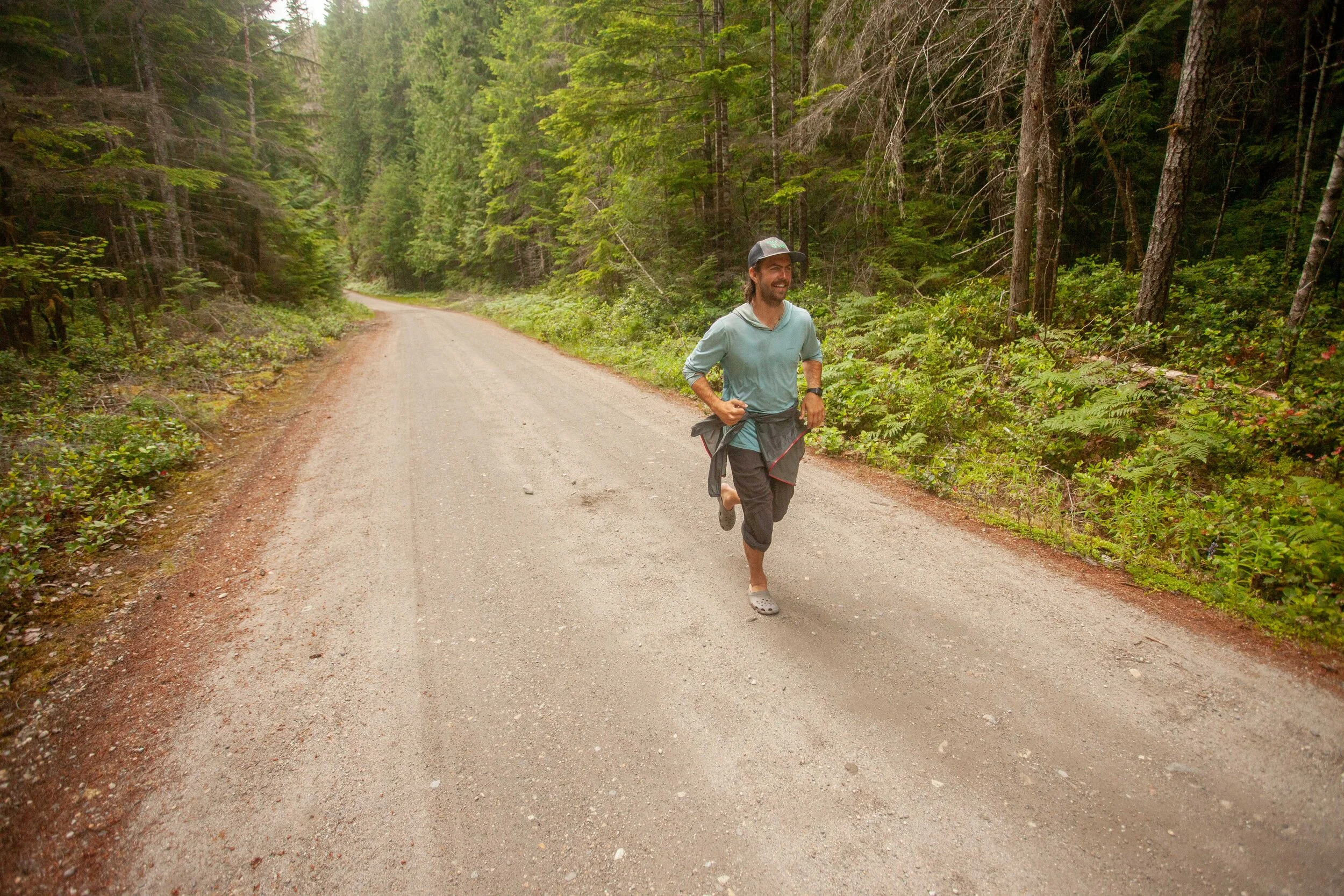
We stashed our bags in the bushes next to the Downey Creek Trailhead and finished our trip with a 2 mile run in crocs to the Suiattle River Trailhead, where we’d left our car.
All in all, this was a phenomenal traverse. I’m sure it’s going to melt out quickly, but hopefully this trip report helps anyone trying to do it soon…