
Trip Report - Waptus Lake + Second Half of Alpine Lakes Crest Traverse (Hinman to Daniel) - July 3rd through 5th, 2020
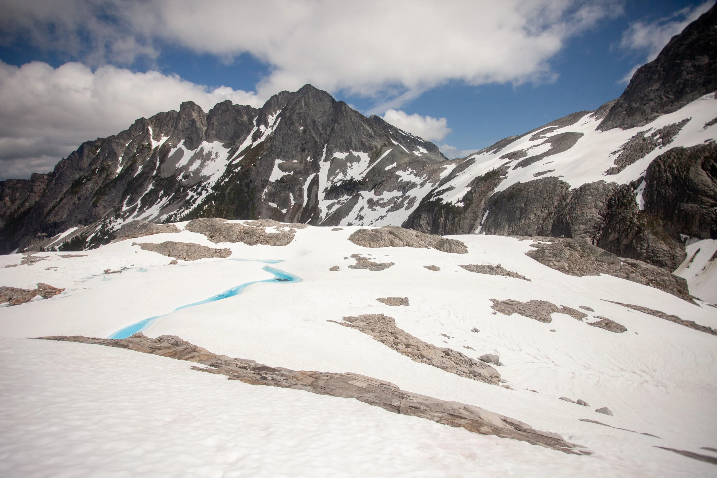
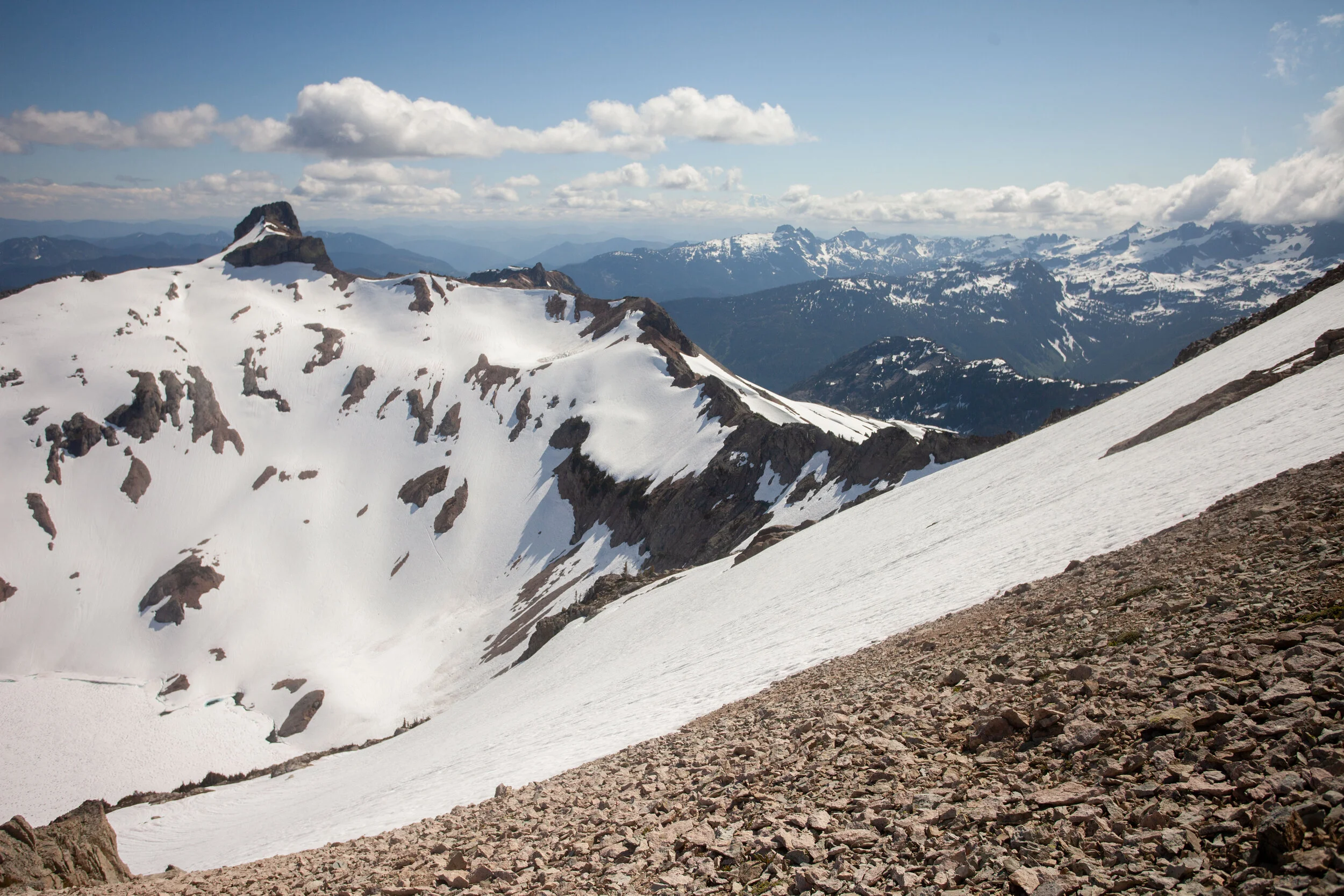
Hinman Tarns - the heart of the traverse
Well, I figured the Ptarmigan would be the last big trip for a bit, but I finished up a project midweek and realized I had three days off in a row, and my mom wanted to go on a chill backpacking trip. I checked the weather, and realized it was going to be perfect. I did some thinking, and realized I could get on (part of) another traverse this summer - Kyle McCrohan’s “Alpine Lakes Crest Traverse”.
When I first moved out here, my friend Robby suggested a similar-ish linkup from Snoqualmie Pass to Steven’s that he’d mapped out on Caltopo, following the Cascade Crest, but I didn’t think it would go, nor did I have the time or the skills. In the years that followed, I spent a lot more time in the Alpine Lakes Wilderness, slowly expanding my distances, and falling in love with the area.
I attempted Daniel (half-heartedly) a few years ago, with my partner Becky, when we headed up to Dip Top Pass. We approached via the East side of the Daniel Massif, and thought about tagging the summit, but ran short on time and ended up traversing to Pea Soup and then doing the horrible scramble over the side of Lynch, getting to Dip Top Pass right at sunset. So It was good we hadn’t tried. But I stared at Daniel all evening, and all the next morning, and knew I needed to come back. On other trips, I stared at the Chimney/Overcoat system, and committed to getting to that area as well.
One day, a year ago, when Kyle published his route on his blog, it all came together - a well-described, well-photographed route that seemed almost doable, with the right timing and commitment. But it was still intimidating, so I put the route on the backburner - one of those routes maybe I’ll get to someday (like Frostbite Ridge, or Kyle’s Dakobed Traverse, or Luna Peak).
Completing the Ptarmigan last weekend really unlocked this trip. I was confident in my fast snow travel, and knew I could handle the distances. I still didn’t have a partner, but knew how filled in the glaciers were on the Ptarmigan, and knew that the Foss Glacier (on Hinman) and the Lynch (on Daniel) wouldn’t have opened up yet.
I knew I didn’t have time (or interest) in doing the whole traverse solo, but I figured I could do the second half in a day, from Waptus Lake, so I set out to try.
Planning + Route
Loop Distance and Vert (as recorded on Saturday) = 27.5 miles and 9500’ of gain

I couldn’t get all the labels to come through - so the Blue route is the climb route, the Green route is the potential descent, and the Orange (w/ red line) route is my actual descent. The line from Hinman/Daniel col to Venus Col is a tentative bail, I never sorted out whether it would actually go.
I had planned a few different routes based on beta from Kyle and Seeking Ultra’s circumnavigation, which had also inspired me a few years ago. The biggest question was how I was going to get back to Waptus from the summit. Could I drop straight south from the summit to Venus, then to Spade, then to Waptus? Or would I have to descend east, and then take the PCT the long way round? Kyle suggested that the Venus descent would go, but he didn’t have too many specifics, and I couldn’t find many photos taken from Venus looking north. I assumed I’d figure out it once I was out there - the point of this traverse is that it’s an adventure.
Day 1 - To Waptus Lake
My mother (an accomplished solo backpacker herself) and I headed in to Waptus in the mid-afternoon, past beautiful swimming holes and wildflowers and horrific bugs. I’d never been to Waptus, and didn’t know how many campsites there would be, but felt confident we’d find something. We did, but there were a ton of people out there and it took us wandering until the very NW side of the lake before we finally found something. We camped and I went to sleep excited and nervous.

View down to Waptus Lake from climb to Lake Ivanhoe
Day 2 - The Traverse
I got out of camp at 5:30 am. I wasn’t sure how long the traverse would take - I expected somewhere between 9 and 12 hours depending on how sloppy the snow was - so I wanted an early start to give myself a good chance of completing it.
I headed west along Waptus, and made good time up to Lake Ivanhoe, where the troubles began.

Ivanhoe looks melted out, but the trail on the N side was infuriating.
Kyle did this route almost exactly a year ago, but the melt happened way faster last year, so I knew I’d have more snow than he did. I’d expected this would slow me down somewhat on the climbs, but would make me feel safer on the glaciers. What I hadn’t thought about it was the miles of bullshit punchy icy snow on the trails from Ivanhoe over Dutch Miller Pass to Williams Lake. This slowed me down quite badly and wasted a fair amount of strength.

Dutch Miller Gap was all snow, but it became intermittent as I dropped toward the turnoff to Williams
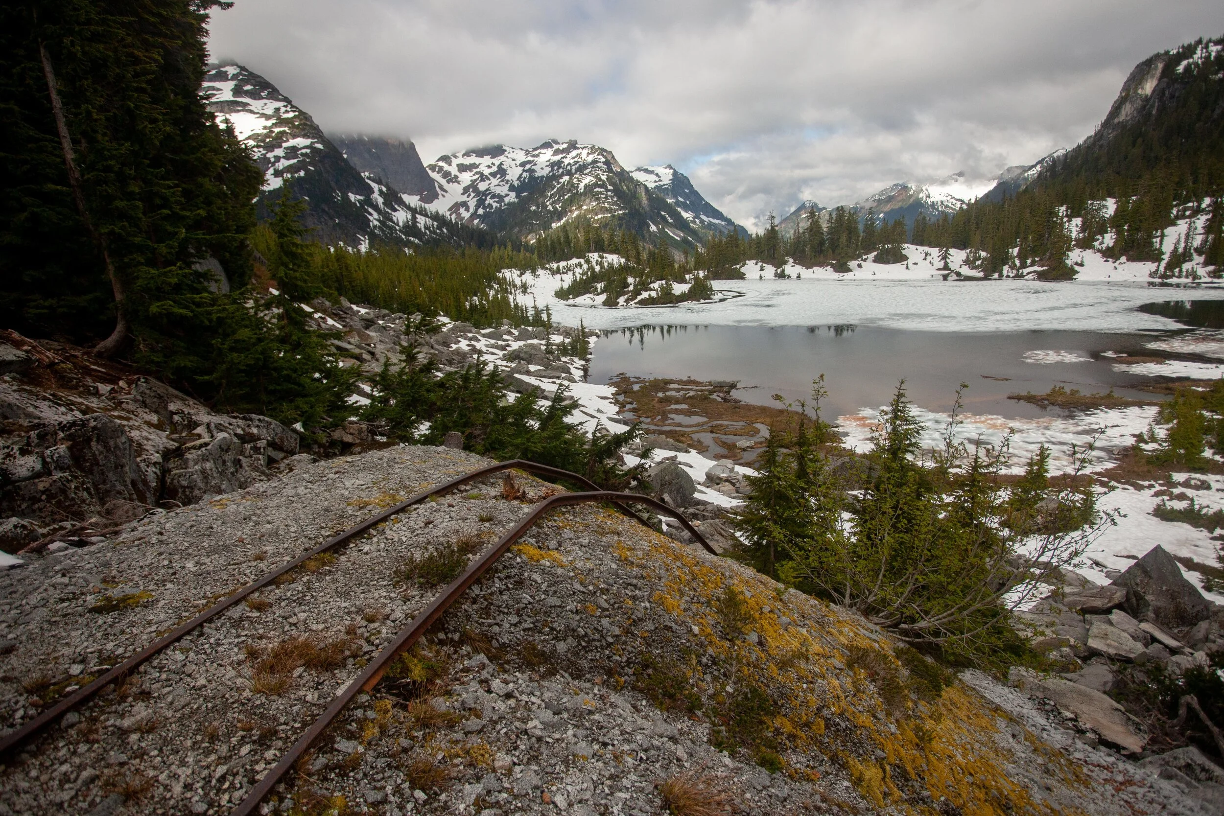
Looking back over Williams Lake toward the Middle Fork of the Snoqualmie (with the evocative mining rails in the foreground)

Finally, consistent snow! Time to put the crampons on and go
Once I finally got up to the bench above Williams, I was good to go. I wandered past the Chain Lakes, got up to La Bohn Lake area, then finally headed east up Hinman. The weather looked terrible to the West, but I rationalized it away by knowing that I was east of the crest, where the weather never comes!
I did lose visibility on Hinman multiple times, but the route was easy to follow - stay climber’s left of the ridge, and I figured that once I was up there, I could decide whether I felt good about the rest of the traverse.
After cutting our trip short on the Extended Ptarmigan due to low vis, I was bumming pretty hard about dealing with this bullshit again.
I summited Hinman, and waited for a bit to see what the weather would do. When the clouds suddenly cleared and the weather looked like it might hold, I went for it - bootskiing down the Foss Glacier on perfect snow and descending the 2000 ft from Hinman summit to the base of the Pea Soup waterfalls in 40 minutes. I wanted to linger and enjoy the tarns, but they were barely melted out, and I felt like the visibility wouldn’t last long, so I pressed on.

Foss Glacier - it’s a dream to descend. I felt really powerfully about this glacier - it’s sublime and remote.

Looking up to the Hinman Daniel Col (about to get into the “bowling alley”)
I sped through Kyle’s “bowling alley”, which was filled with bowling ball rocks and knocked over pins, as well as cornice chunks and wet loose slides, before getting to the Pea Soup waterfalls. I climbed the snow and slabs up to the outlet, and took a break while looking at the Lynch Glacier. This was my last possiblity to bail - I could head over to Dip Top, though getting all the way to Waptus would have been hellish. I saw a bootpack on the W Glacier, and the weather looked good, so I stopped thinking and went for it.

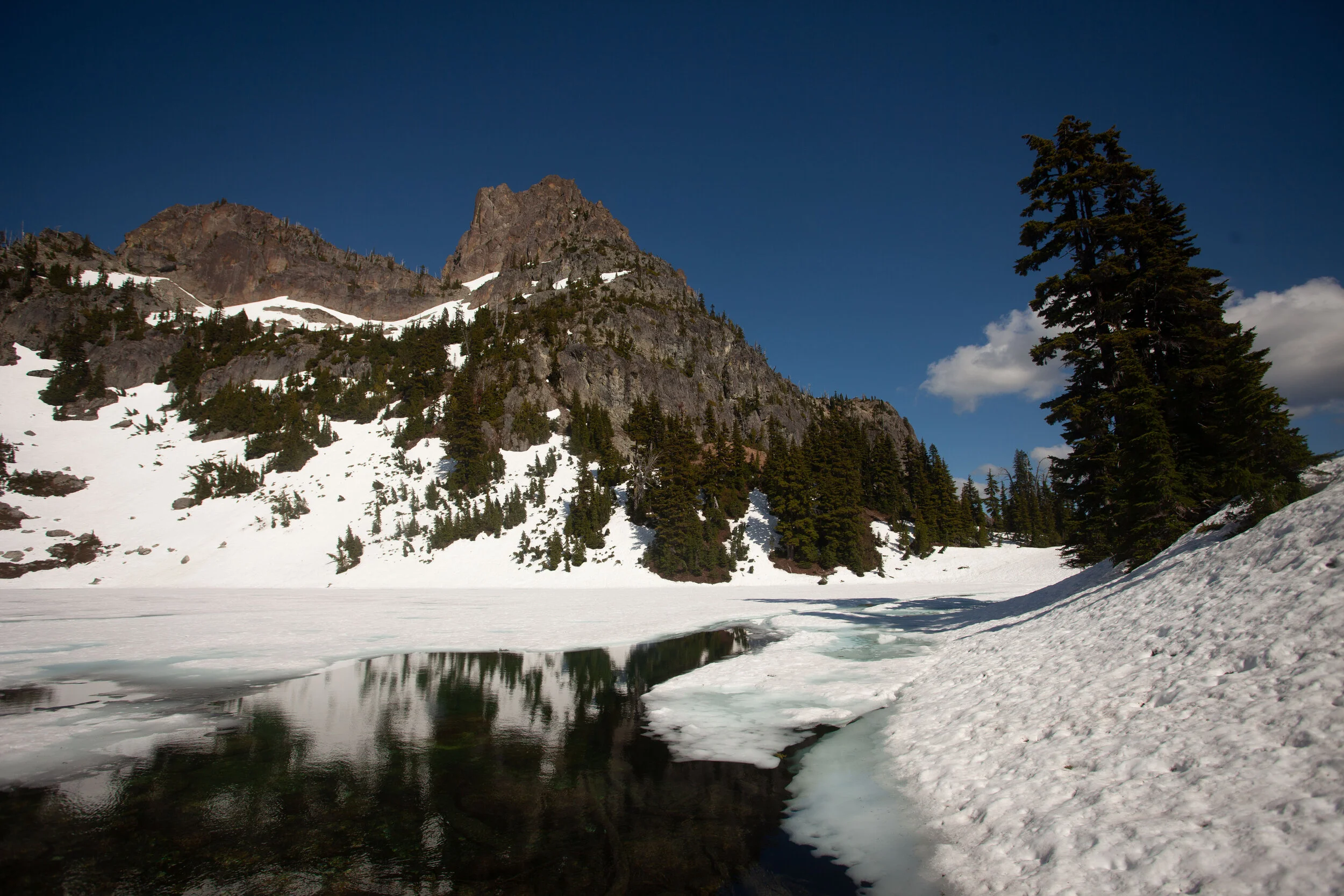
Pea Soup Lake, Dip Top Peak, Dip Top Pass, and Lynch Peak

Looking back down the boot pack towards the outlet and Dip Top Peak
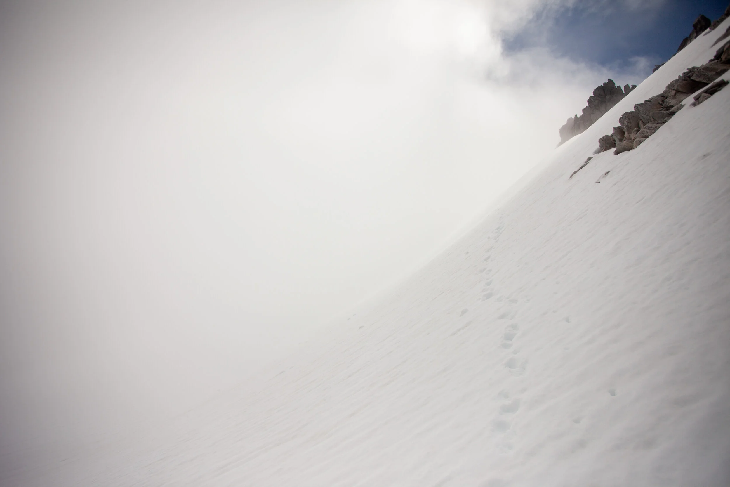
I followed another soloist’s footprints up to the main glacier, where the visibility dropped again.

Follow the footprings and the gps track…
Finally, I scrambled to the summit, where the views were clear to the east and south, and totally socked in to the north and west.
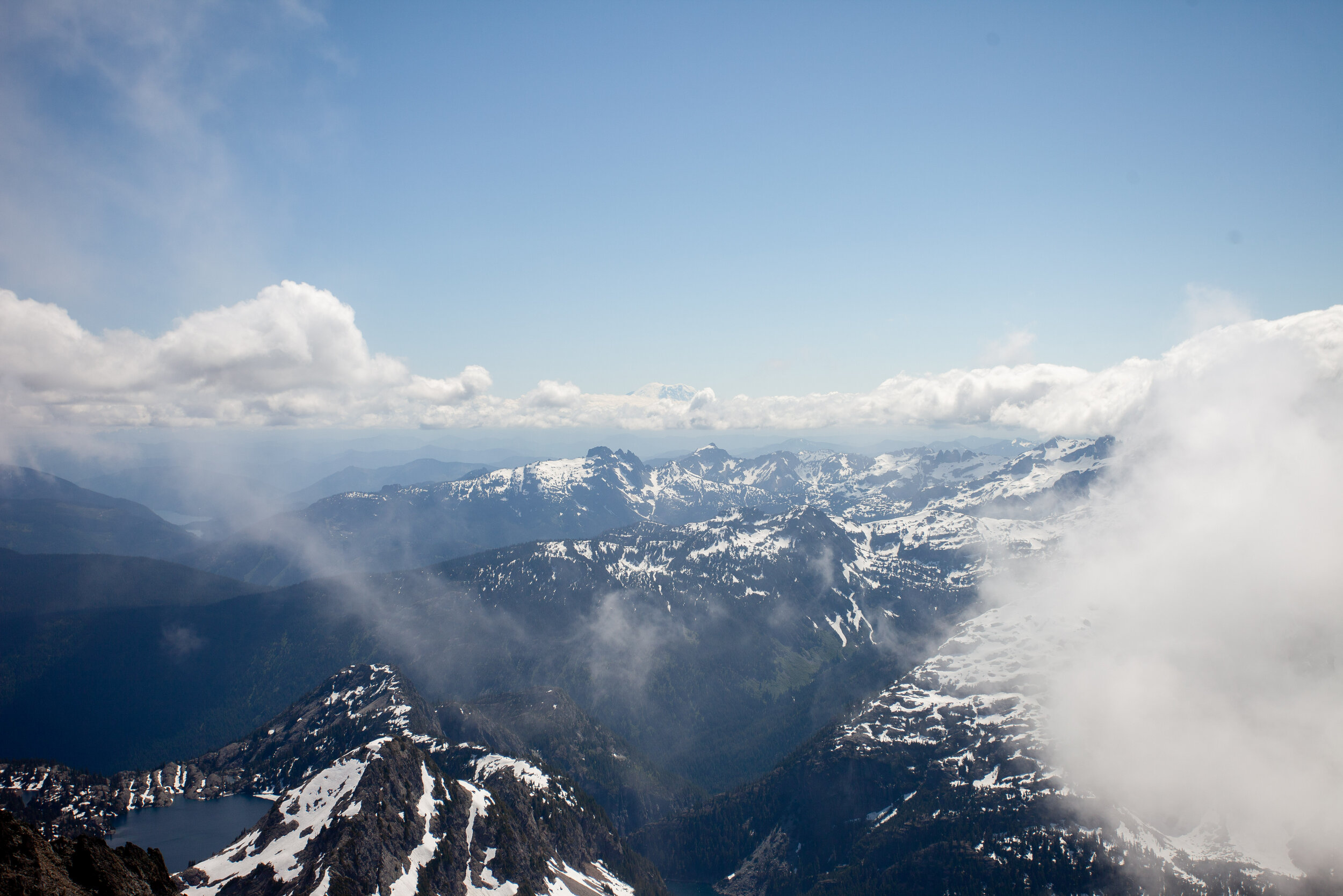
Rainier in the distance, looming over all (Spade Lake in the bottom left)
Suddenly, I had done the meat of the traverse. I sat on the summit and enjoyed the evershifting views before beginning to think about the descent. After 20 minutes, I knew I had to get going, so I headed east, enjoying the ease of following a cattlepath.
I was not sure where to drop down to Venus, but I had planned (and mapped) the ridge that leads from Daniel to the Citadel, then dropping down to the Venus outlet. On Google Earth and Caltopo, it had looked traversable, but in person it seemed a knife edge. I could have dropped down to Circle on snow, then climbed the 700 odd feet to cross east across the ridge, then descended to Venus, but after over 8000’ of climbing, I was tired. I chose to descend the eastern bowl of Daniel then to descend the PCT.
Looking at the ridge I’d hoped to traverse (over toward Citadel, with Circle Lake frozen in the bottom left).
Bootskiing the eastern bowl was perfection, and I was down at Peggy’s Pond in no time. All that remained was the endless switchbacking of the PCT back to Waptus. I thumped my way down trail, enjoying the afternoon as it turned to evening.
Peggy’s Pond, still melting out beneath Cathedral Rock

Deep Lake is spectacular from all angles

The meadows by the Deep Lake Outlet, with Cathedral Rock to the right and the eastern Daniel Massif to the left

Wildflowers on the cliffs over Spinola Creek
I finally got back to camp at 8:30, after 15 hours of travel. I ate dinner, drank a beer (cooled in a creek), and slept hard.
Day 3 - Hiking Out
My mother and I hiked out the next day, taking a leisurely pace. I was sore, but not wrecked. We swam in the Cooper River by the trailhead, and then headed back to Seattle. A phenomenal and unexpected trip!

Leaving Waptus (and Summit Chief in the distance)
Closing Thoughts
I’d highly recommend this loop, though I’m still not sure I’m happy that I soloed the Lynch Glacier. It felt fine at the time (though the whiteout rattled me a bit), but I don’t think I’d recommend it to anyone else, not because it’s an objectively bad idea, but because no one should ever recommend soloing anything. And personally, I think I’m going to take a break from soloing any more glaciers.
Regarding gear:
I did this trip in my stiffest low tops - my Sportiva TX3 approach shoes - which aren’t waterproof, but did perfectly in all other ways. I used them last year when I climbed Colchuck Glacier to Pandora’s Box + Dragontail, then did the thru-hike to Snow Lake trailhead, so I knew they could handle steep snow, crampons, and miles of dirt walking. Someday I’ll get a pair of high-top waterproof trailrunners?
I was also happy to have a hiking pole, an ultralight axe, and ultralight crampons. I probably could have done it with microspikes, but I wouldn’t have felt as stable, so it wouldn’t have been worth it to me.

I realize that this setup looks ratchet as shit, but it actually climbs great - I had no footwear issues or blisters despite the 15 hrs of travel, 27 miles, and 9500’ of gain…