
Trip Log
Index
-
2024
- Oct 10, 2024 Trip Report - Guiding in Yellowstone - September 2024 Oct 10, 2024
- Aug 20, 2024 Trip Report - My Second Summer Guiding in Gates of the Arctic - Alaska - June/July 2024 Aug 20, 2024
- Jan 2, 2024 The Lessons of 2023: On Goals, Bucketlist Lines, Failures and Overuse Injuries Jan 2, 2024
-
2023
- Oct 31, 2023 Trip Report - Guiding in Olympic National Park in WA - 9/5/23 - 9/22/23 Oct 31, 2023
- Jul 14, 2023 Trip Report - Guiding in Gates of the Arctic National Park in AK - 6/29/23 - 7/9/23 Jul 14, 2023
-
2022
- Oct 6, 2022 Trip Report - Granite Peak, MT - 8/26-28/22 Oct 6, 2022
- Aug 2, 2022 Trip Report - Guiding 6 days on the Southern Yosemite High Route with Andrew Skurka Adventures Aug 2, 2022
- Jul 6, 2022 Trip Report - Complete Exum Ridge on Grand Teton - 7/2-4/22 Jul 6, 2022
- Jul 1, 2022 Trip Report - El Capitan of the Bitterroot - 6/30/22 Jul 1, 2022
- Jun 26, 2022 Trip Report - North Ridge of Canyon Peak (MT) - 6/26/22 Jun 26, 2022
-
2021
- Jun 30, 2021 Trip Report - Royal Basin Ski Trip - 5/29/21 - 6/1/21 Jun 30, 2021
- Jan 28, 2021 Reflecting on my 2020 Elevation Goals Jan 28, 2021
-
2020
- Dec 6, 2020 Trip Report - Mt Hood via Old Chute - 12/5/20 Dec 6, 2020
- Aug 3, 2020 Trip Report - Mount Rainier via Emmons - August 1st - 3rd 2020 Aug 3, 2020
- Jul 23, 2020 Trip Report - Mount Rainier Carryover - up the Kautz and down the DC - June 18th through 20th 2020 Jul 23, 2020
- Jul 6, 2020 Trip Report - Waptus Lake + Second Half of Alpine Lakes Crest Traverse (Hinman to Daniel) - July 3rd through 5th, 2020 Jul 6, 2020
- Jun 30, 2020 Trip Report - Ptarmigan Traverse - June 25th through 28th, 2020 Jun 30, 2020
-
2019
- Aug 14, 2019 Trip Report - 8/10-12/19 - Backpacking Tapto Lakes & Copper Ridge Aug 14, 2019
- Aug 5, 2019 Trip Report - Dragontail Peak via Colchuck Glacier + Pandora's Box, then through the Enchantments Aug 5, 2019
- Jul 13, 2019 Trip Report - Mt. Baker (Easton Route) - 7/7-8/19 Jul 13, 2019
- Jun 3, 2019 Trip Report - Trapper's Peak - 6/1/19 Jun 3, 2019
- May 6, 2019 Photo Essay - 27 Days Rafting the Grand Canyon - February + March 2019 May 6, 2019
-
2018
- Aug 28, 2018 TR - Twin Sisters Traverse - 8/27/18 Aug 28, 2018
- Mar 11, 2018 TRIP REPORT - Mount St. Helens - 3/11/18 Mar 11, 2018
- Mar 3, 2018 TRIP REPORT - Tye Peak Attempt - 3/3/18 Mar 3, 2018
- Feb 13, 2018 TRIP REPORT - West Granite Mountain (and attempted traverse) - 2/12/18 Feb 13, 2018
- Feb 2, 2018 TRIP REPORT - Hyak Mountain Dawn Patrol - 2/1/18 Feb 2, 2018
- Jan 31, 2018 TRIP REPORT - Hex Mountain - 1/29/18 Jan 31, 2018
- Jan 25, 2018 TRIP REPORT - Keith's Hut - 1/20 through 1/22 Jan 25, 2018
-
2017
- Dec 24, 2017 TRIP REPORT - Skiing Great Scott Bowl - Snoqualmie Pass Dec 24, 2017
- Dec 12, 2017 TRIP REPORT - Snowshoeing Camp Muir Dec 12, 2017
- Jul 24, 2017 TRIP REPORT - Pasayten Wilderness - 50 miles Jul 24, 2017
- Mar 16, 2017 Too Few Days in Red Rocks Mar 16, 2017
- Mar 5, 2017 The Warren G Hardings! Mar 5, 2017
- Mar 3, 2017 Settling Down? Mar 3, 2017
- Mar 1, 2017 Only a few days away from a stable life? Mar 1, 2017
- Feb 14, 2017 Life on the Road Feb 14, 2017
TR - Twin Sisters Traverse - 8/27/18
I've got a huge backlog of trips to write reports on, but here's one from yesterday! Here's just a bunch of photos, I put together a full TR on Cascade Climbers.
Overview
16.2 miles, ~7000 ft of elevation, and an incredible amount of scrambling

Maps

Detail Maps

Photos


TRIP REPORT - Mount St. Helens - 3/11/18
Today, we took advantage of the beautiful weather and decent snow conditions and headed up Mt St Helens. There's a bunch of information out about the Worm Flows route so I'm not going to go into too much detail, but here's a basic trip report:
Mt St Helens
~5,800 ft of elevation in ~12 miles
Timing:
6:20 am - leave car
7:40 am - pass treeline and start up steeper slopes
8:40 am - bootpack up ridge
11:30 am - reach crater rim
12:00 - summit
1:45 pm - back at the parking lot after a pretty relaxed descent
We slept in Olympia, and tried to get an early start, but apparently daylight savings skips from 2 am to 3 am, so none of our phones' alarms worked. We woke up 45 minutes late, drove down, and left the car at 6:20 am. After gently climbing through the dark forest for 2 miles (along a trenched trail), we started leaving the trees behind, just as dawn hit the mountain. The trail is impossible to miss, as hundreds of boot/snowshoe prints mark the way.
While it didn't get below freezing at the lower elevations, the snow above treeline was bullet proof, and we had a lot of slips and slides on our skis. If you've got ski crampons, definitely bring them. We ended up bootpacking up the middle, as all the tracks made it difficult to get traction. We chose not to bring crampons or ice axes, but they wouldn't have been a bad idea.
After that, it was just a long slog to the top as the snow slowly warmed up. Once you get to the crater rim, the true summit is a bit of a hike to the west. It only looked like two or three folks got up there before us, but it seems like most people just stop at the rim. Be careful of the cornice, we saw a bunch of people standing on the edge for photos.
The true summit from the ridge to the east (with Isaiah for scale)
The top was pretty windswept and chilly, and we drank a quick summit beer before bailing off to find warmer temperatures. Once we transitioned, it was a beautiful slushy run all the way to the base.
All the dots on the left are people headed up
Once we got back down to treeline, we cruised along the trenched trail back to the car, and in the slush it wasn't even so bad.

Once we got down, we crashed in the parking lot until we could rally enough for the drive home.
crashing
TRIP REPORT - Tye Peak Attempt - 3/3/18

Skinning across Skyline Lake
There were three more deaths in the mountains today and I don't feel right writing up a whole trip report, but here's a brief overview, some photos, and a map, because I couldn't find a detailed route description with a map.
Even before we got back and learned about what had happened, today was about conservative calls. Even though the avalanche danger was "only" moderate, there was a persistent slab issue lurking 3 to 5 feet down in the snowpack, so we made a conservative trip choice and then chose to stick to low angle terrain and ridges. Our plan was to summit Tye Peak via its south ridge, but once we reached the saddle below the peak, we took stock. Warming temperatures and direct sunlight were causing loose wet slough and roller balls, and cornices hung along the ridge towards the summit. So we bailed and lapped the north-facing slopes, where shaded powder gave us great turns. It was a beautiful day.
Tye Peak Attempt
7.7 miles total and ~3,600 ft of overall elevation

The red and yellow show slope angle - the darker the color, the steeper the terrain (up to 60 degrees). The most dangerous avalanche terrain between 30 to 45 degrees (orange and red), and we tried to stay off it as much as possible.

Pinwheels and roller balls made it obvious how much things were warming up.

North face of the first ridge we crossed, where we lapped the low angle powder
TRIP REPORT - West Granite Mountain (and attempted traverse) - 2/12/18
After a few weeks of rain, warm temperatures, and high avalanche dangers, a cold snap finally rolled in and the clouds were swept away. The avalanche conditions dropped to low and we did our typical Sunday planning scramble. Late Sunday, we decided to snowshoe West Granite Mountain (also called "Tusk O'Granite" on some maps), with the option to traverse across to Granite if conditions were good.
West Granite Mountain
Trail Stats - 6.5 miles and 3,700' of gain - though there are multiple options
Rough and steep approach with no trail (that we found), but heavily treed enough that it would be relatively safe in higher avy danger
We got the West Granite/Granite trailhead early, strapped our snowshoes to our packs, and headed up in the glorious sunshine.
We took a left at the Pratt Lake trail and crossed a few icy creeks before striking up into the undergrowth. There are a few options (as far as I can tell) for getting to West Granite.
- Option 1 (which we took) - head upslope shortly after turning onto the Pratt Lakes trail, and head through the forest and undergrowth, before gaining the SW ridge of West Granite. Top out Granita, and then continue to the summit.
- Option 2 - Take the Pratt Lakes trail around West Granite until just north of Ollalie Lake, then take the W Ridge to the summit.
I'd read several trip reports that stated the top section of this ridge was extremely steep, so we chose to take option 1. However, we met a group descending from Granita that had used option 2, so it looks like either one works. There might be less bushwhacking on option 2, but I don't know.
After hiking through a pleasantly spacious old-growth forest, things got steeper, snowier (snow line is ~4,000'), and brushier. We spent a lot of time pushing through bushes and trying not to slip down the hill. We ultimately put our snowshoes on, which increased traction but made us even more ungainly.
Fighting through the brush
Once we got out into the open, things got way more pleasant. We'd been roughly following a single snowshoe track, and we came upon a far more trampled path as we approached Granita, which may be a better path than we took. We didn't follow it down, and so have no idea where it goes.
Finally some space to breathe
After summiting Granita, we followed the ridge line up West Granite mountain. At the top, we got some of the best views I've had this winter.

View north off West Granite - Kaleetan looks especially gnarly
We still wanted to go for the traverse to Granite, so we set off east along another snowshoe track. Most of the tracks curved south at the saddle, but we kept following one crampon track, until we got to the exposed ridgeline.
Granite from the west, descending the ridge to the saddle
The icy Granite ridge up close (from near the saddle), right before bailing
While we'd both been stoked on traversing to Granite, the W ridge made things obvious - we'd have to bail. The snow was barely corning up, our snowshoes weren't penetrating at all, and without crampons or ice axes we were looking at a sketchy climb with a big slide if we made any mistakes. We headed back to the saddle and then down the valley.

We ate a slow lunch in the warm sun and then started on the long way down. Instead of traversing back to the ridge, we followed tracks down the open slopes, glissading where we could.
Eventually, the trees closed back in, and we slid/fell our way through hundreds of feet of steep ice and slick roots.
This is the last photo from the trip because I was falling so much I put the camera away
We finally got back to the trail just as night fell (at 6 pm, at least the days are getting longer!) and slogged back to the car. Another glorious Monday!
Feel free to use our GPX if it helps
but I don't know if either of our routes through the "schwak zone" are worth following. They're not very pleasant.
TRIP REPORT - Hyak Mountain Dawn Patrol - 2/1/18
We never saw dawn, it just became light out at some point...
A last minute plan led to Robby, Zach, Lars (dog), and I heading out of Seattle at 6 am for a dawn patrol. They close the East side of the Hyak resort during the week, which means it's a great place to get some easy turns in.
I was impressed - there were at least 4 cars up there when we arrived, which meant we didn't get fresh tracks on the few inches of powder that had fallen overnight, but we also didn't have to break trail.
One lap is around 1,000' and a little bit over a mile.
It's not a trip report unless there's a Caltopo map. But this one is small cause I can't imagine it's helpful
It's pretty low-angle terrain, which makes it perfect in moderate avy conditions after a few inches of snow. We got in 2 laps before heading back down to work.
It was lightly snowing while we were up there, but it warmed up shortly after we left, and looks like it'll be raining on the Pass all weekend. Glad we got in a few turns before the rain set in!

Lars bravely breaking trail
Robby shredding the low light
TRIP REPORT - Hex Mountain - 1/29/18
It's always worth it to get out, even if the forecast looks gross
"The Bottom Line: Travel in avalanche terrain is not recommended as very large and destructive avalanches are expected. Rain falling on previously dry snow will lead to dangerous conditions on Monday. Identify and avoid traveling through areas with avalanche paths overhead." - NWAC, the night before
With NWAC forecasting high avalanche danger for all of Washington, heavy rainfall predicted for the entire state, and generally sloppy conditions expected, Becky and I did our now-familiar Sunday night scramble: "Where exactly are we going?"
We wanted to avoid the rain (as much as possible), avoid avalanche terrain, and stand on top of something (if at all possible). Hex Mountain looked perfect (and it was).
Hex Mountain
Trail stats - 8.2 miles and 2775' of elevation
- great option for a first snowshoeing peak or in high avalanche danger
The yellow, red, and purple shading show the slope angle (and specifically avalanche terrain). GPX available at the bottom of the report
We drove through the Seattle morning traffic, crossed Snoqualmie Pass through low-hanging clouds and dropped down to Cle Elum lake and the trailhead (which is across the road from the fire station and unmarked).
Getting geared up at the road
We walked alongside the road for a few hundred feet before coming to the turnoff and putting our snowshoes on. The snow was so wet and heavy (and the trail was relatively well packed) that we didn't necessarily need them, but they definitely helped with traction and we were happy to have them on the whole time.
We began in the fog and clouds, but slowly the sun began to shine through, and we had a few hours of unexpected sunshine and views, even as we could see the storm hanging over the Cascade Crest.
The joys of being east of the crest (look at that dark cloud on the right)
Much of the trail goes through a burn zone, which was eerie in the quiet as the ash stained the snow beneath our snowshoes.
Burnt trees tower over the final slope to the summit
After winding our way along forest service roads (which were totally snowed over), we followed the corniced ridge to the summit, where we could just see Stuart and the Enchantments peeking through the clouds. No views of Rainier, but we hadn't expected any views.
Stoked on the summit!
Just after leaving the summit, it began to rain. I dug a snowpit to check on the snowpack, and the rain gradually picked up.
Compression test!
The way down ended up being pretty uncomfortable, as the rain gradually turned into a deluge. The snow underfoot turned into sloppy concrete, and we tripped and slipped our way back down.
Smiling through the pouring rain
On our way back down the ridge, we passed a slide, where it looked like the cornice had fallen and triggered a wet slab. We were happy not to be on any avy terrain.
Wet slide
We got back to the car soaking wet and huddled in the car before driving home slowly back through the storm. It was a great day out, and the few hours of sun and views were an unexpected bonus!
GPX track + waypoints
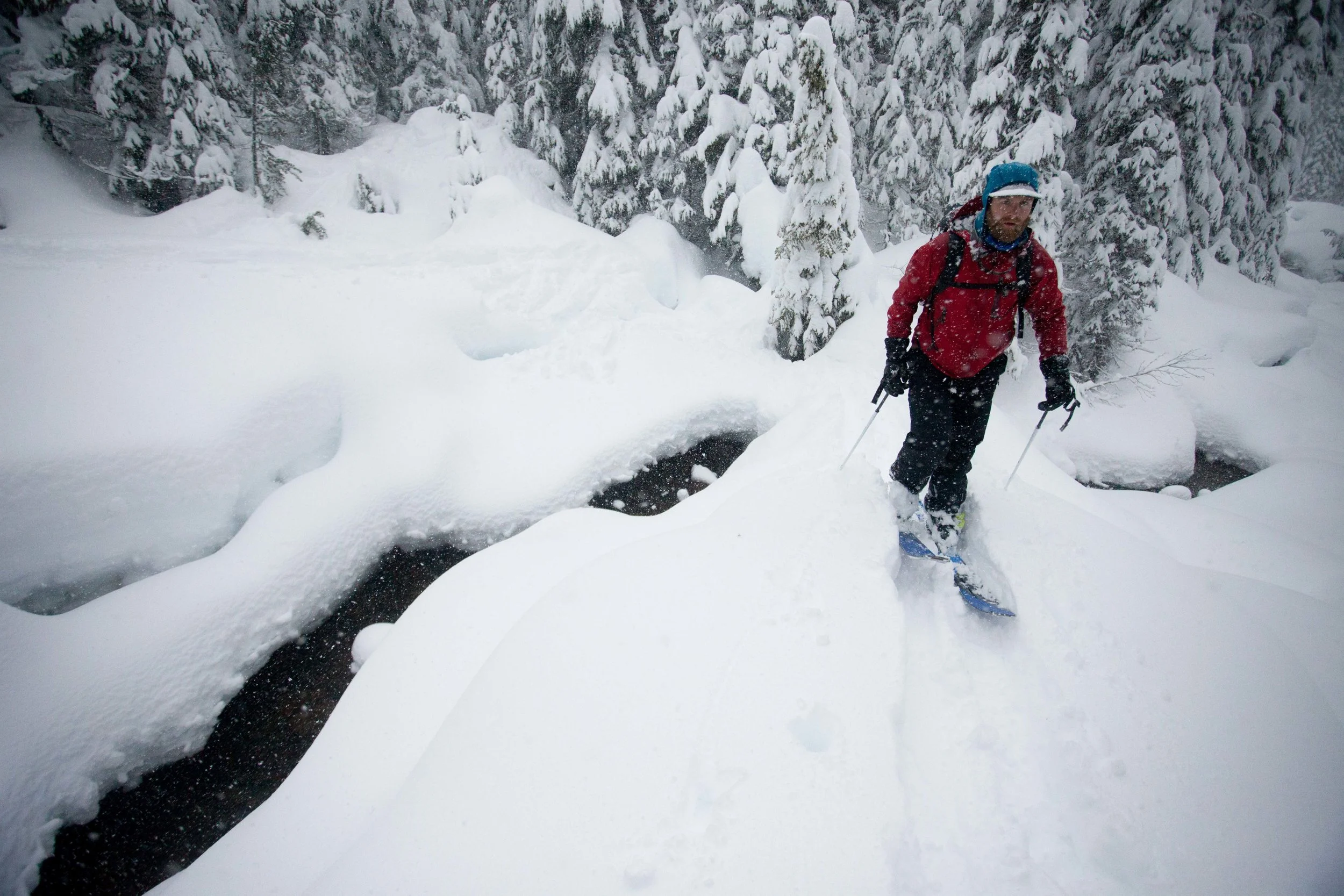
TRIP REPORT - Keith's Hut - 1/20 through 1/22
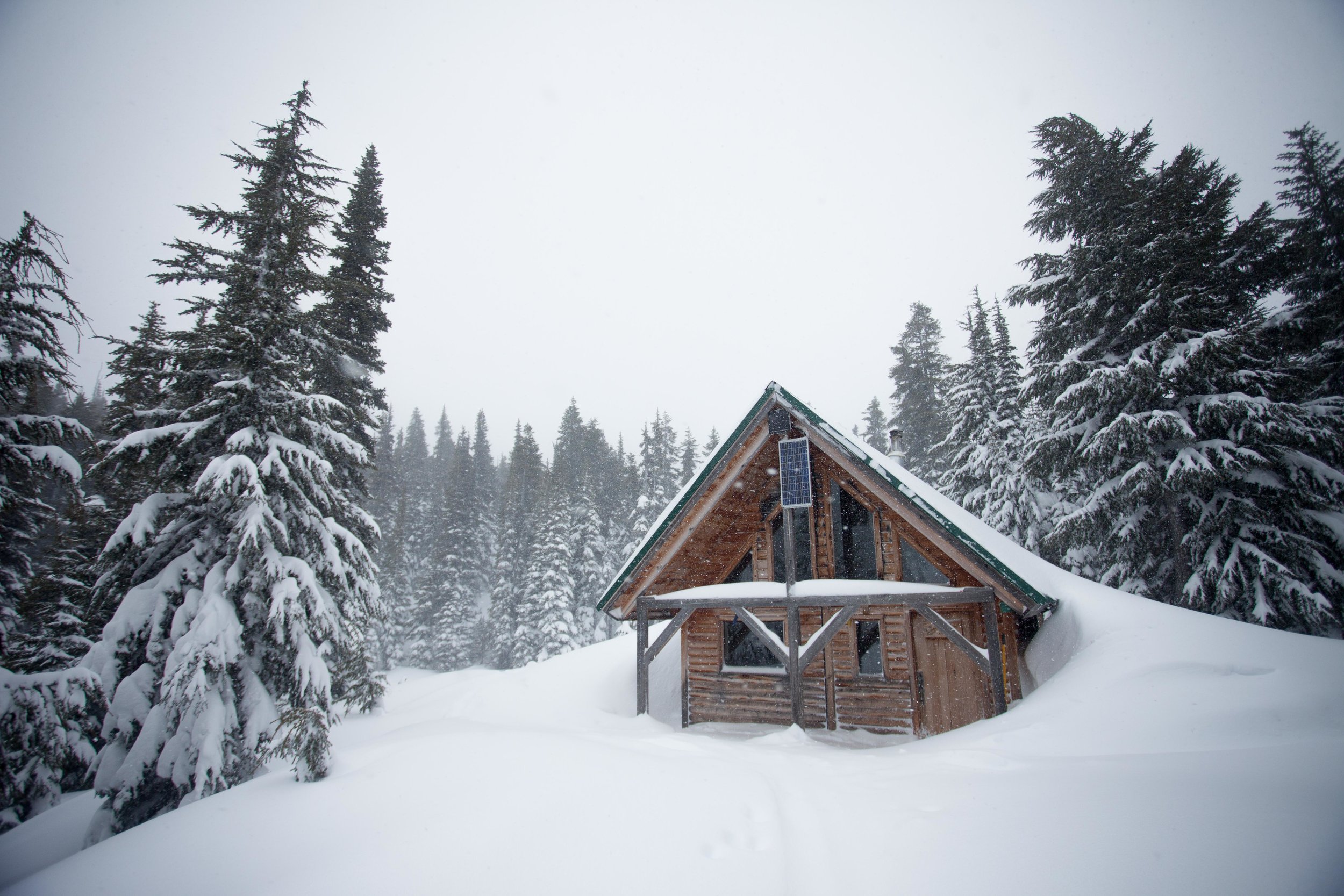
We had three days off and the avalanche danger kept stacking up in Washington. Marc and I had been planning on heading up to the North Cascades, but the hut we wanted to use required skinning up an avalanche chute, which seemed like a bad idea with the forecast. We spent a few days frantically researching alternatives before calling our friend Katrina, who sorted us out. New objective: Keith's Hut in BC. She even gave us a guidebook.
Keith's hut has it all - big objectives (Vantage Peak, Joffre Peak and Matier Mountain) for good conditions, and solid low-angle tree skiing (lower Vantage trees, Joffre Arm, east bowl of Chief Pascal) for bad. If you're planning a trip up here, I included a .kmz file at the end with our tracks and beta.
Depending on the source, there's room in the hut for 10 to 20 people. We were worried there wouldn't be room, so we woke up at midnight and left at 2 am from Seattle. 6 hours (and one Tim Horton's breakfast stop in Squamish) later, we were at the trailhead, watching the sun come up.
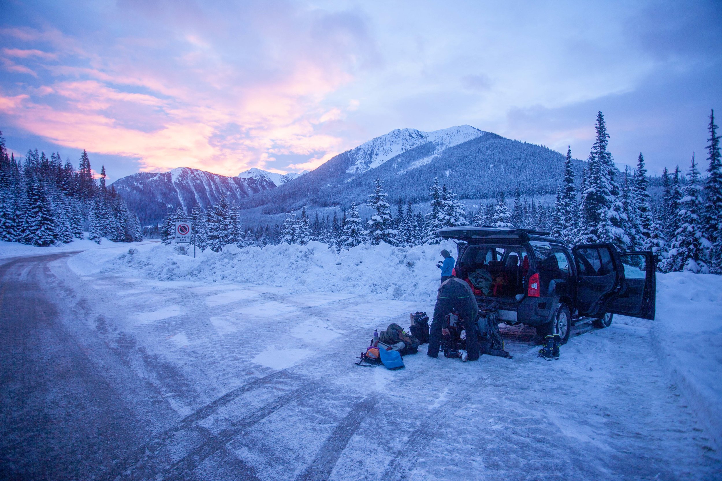
We brought tents in case there wasn't room in the hut, but decided not to bring them when we only saw a few cars parked at the trailhead.
Marc wishing he'd gotten less sleep
The skin up to the hut starts with a spicy creek crossing across a log. It's not as bad as it looks...
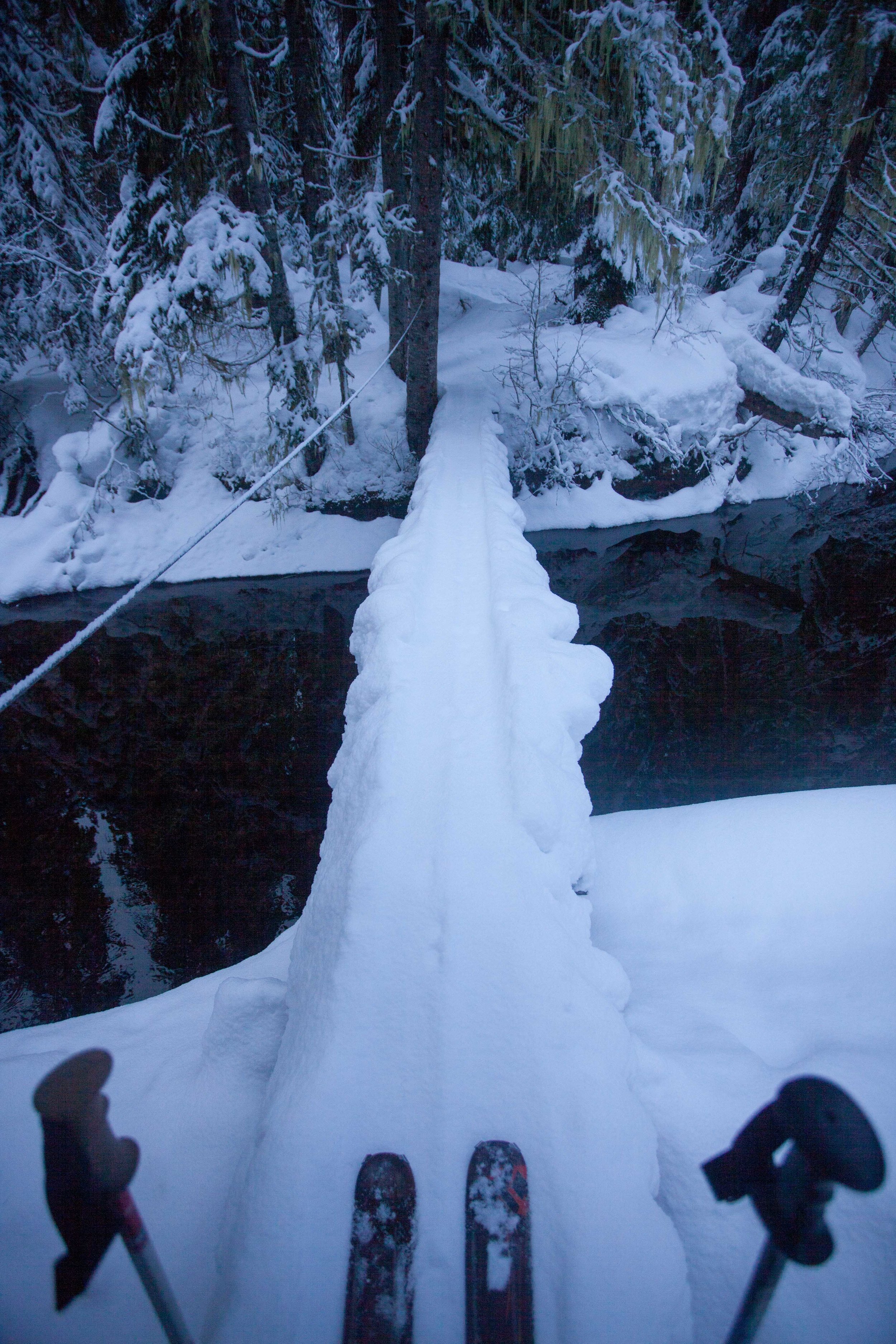
Once we were across the log, it was only 3.5 miles up to the hut. The track changes depending on avy and snow conditions, but it's well-traveled enough to be pretty obvious. If it's totally gone, break your own trail - I've included our gpx track below. It's a casual skin up, and ends up being pretty safe in high avalanche danger. A few miles in, you'll cross the bottom of huge slide path off Vantage Ridge but it wasn't fully filled in when we passed through.
Overview from above the trailhead, looking south
Near the top of the valley (once we saw the terminal and lateral moraines) we swung right and contoured along the terminal moraine, gained the ridge, and reached the hut.
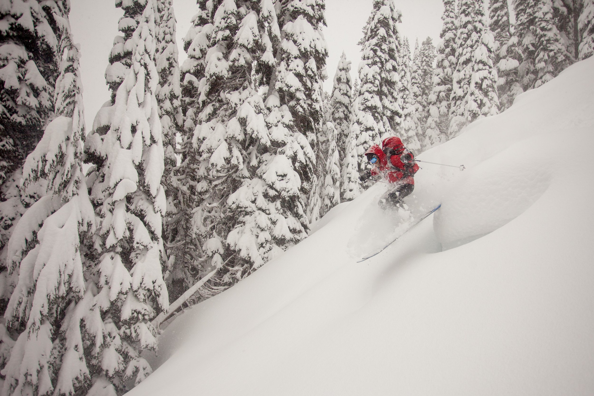
There were 11 sleeping bags upstairs when we arrived, and it was pretty close quarters after we'd added our 3. After lunch and a taste of whiskey, we headed out to ski Joffre Arm, which stretches north from Joffre Peak. It's a quick 20 minute skin to a knob on Joffre Arm, from which there are a lot of options.
View from above the hut, looking NE
You can either head back down to the hut (which is 300 vertical feet through low-angle trees) or drop off the backside (~1,200 ft of skiing) which offers open skiing for good avy conditions and nicely spaced trees when it's dangerous. We skied two laps off the hut-side and then headed back to the hut.

Marc on top of Joffre Arm
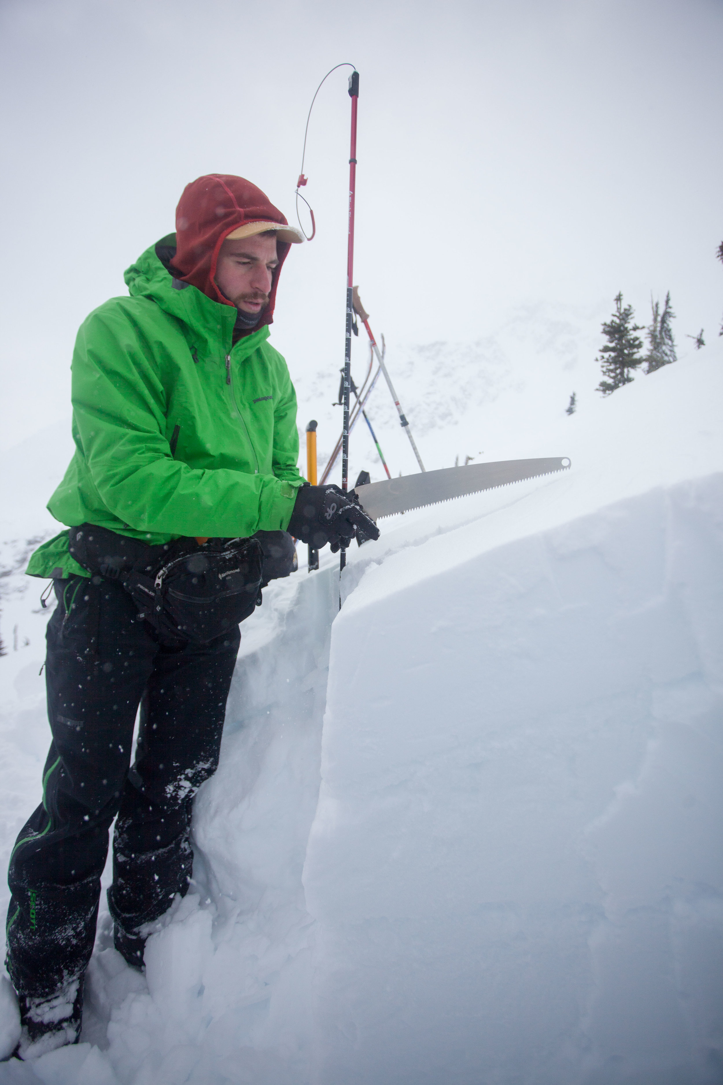
Toby cutting a column test - if you look closely you can see the two rain/warm weather crusts, with over a foot of storm slab on top...
Toby shredding down the low angle trees off Joffre Arm (hut-side)
Depending on who's in the hut, things can get pretty rowdy. I definitely drank more than I'd expected to, but it was a Saturday night, so...

The aftermath (midway through the cleanup, and without most of the empties)...
It'd been dumping all night and we woke to however many inches of new snow (at least a foot, and it showed no signs of stopping). Everyone headed their separate ways, with most people skiing different parts of Joffre Arm (though lower Vantage Peak apparently offered some good options). Toby, Marc, and I decided to head off the backside of Joffre Arm and tried to stick to the trees. Almost immediately, we remote-triggered a small avalanche on a slightly open slope, so we chose even tighter trees for the rest of the run (which kept things interesting with the tree wells). Once at the bottom of the run, we had some trouble getting back to the hut skin track, as Cerise Creek is just wide enough to make crossing difficult. After following some stray skin tracks (one of which turned out to have been the faster way back up to the hut - marked in the gpx) we found a snow bridge.
Crossing Cerise Creek could get pretty frustrating
We got back on the hut skin track and the wind and snow had almost entirely obscured our tracks from the day before.

You can just see Toby through the blowing snow

Marc gesturing at something
Once back at the hut, we ate a quick lunch before heading up for two more conservative laps off the hut-side of Joffre Arm. The snow was piling up, and another snowpit showed that things were looking pretty delicate.
Digging a late afternoon snowpit
Let's keep it low-angle for the rest of the day...
Everyone else left, so the three of us settled into the cabin for a night of sobriety and casual cards. The next day, we woke up to even more snow.

We packed up and again headed off the backside of Joffre Arm, this time starting lower to avoid where we'd had the slide (the day before). The lower trees were perfectly spaced, and we found our best turns of the trip there.


Once we were down, we headed towards the east side of Chief Pascal, where there was supposed to be some more tree skiing (it's also on the way out). We pretty quickly found ourselves traversing some pretty unpleasant slopes. Don't try to skin up the south eastern part of the ridge.

Marc does not like my skintrack (which to be fair involved some balancing on logs)
After we found the proper way to skin up, we battled through feet of powder through old growth forest (and Toby's skins failed).

Skin failure isn't a big deal when you've got 10 ski straps
NW View of low angle Chief Pascal skiing
But once we finally gained some elevation, we found some pretty sweet lines - still in the trees and low angle enough to feel good about.

By the time we finally got back to the car, we had just enough energy to dig the car out before heading home.

Toby is way too excited to be shoveling
All in all, it was a perfect trip, though we're already planning to head back when there's clearer skies and safer avalanche conditions.